“A dog is the only thing on earth that loves you more than he loves himself.”
Dog is the best friend of humankind. One dog in Japan proved his undying loyalty, waiting for his master’s return in the same location every single day for 10 years after his master’s death. It was Hachiko!
Hachikō (ハチ公), November 10, 1923 – March 8, 1935) was an Akita dog born on a farm near the city of Ōdate, Akita Prefecture, Japan. He is remembered for his remarkable loyalty to his owner, which continued for more than nine years after his owner’s death. Hachikō is known in Japanese as chūken Hachikō (忠犬ハチ公) “faithful dog Hachikō”, hachi meaning “eight” and kō meaning “affection.” During his lifetime, the dog was held up in Japanese culture as an example of loyalty and fidelity. Well after his death, he continues to be remembered in worldwide popular culture, with statues, movies, books, and appearances in various media.
In 1924, Hidesaburō Ueno, a professor in the agriculture department at the University of Tokyo, took Hachikō, a golden brown Akita, as a pet. Ueno would commute daily to work, and Hachikō would leave the house to greet him at the end of each day at the nearby Shibuya Station. The pair continued the daily routine until May 1925, when Ueno did not return. The professor had suffered a cerebral hemorrhage, while he was giving a lecture, and died without ever returning to the train station in which Hachikō would wait.
Each day, for the next nine years, nine months and fifteen days, Hachikō awaited Ueno’s return, appearing precisely when the train was due at the station.
Hachikō attracted the attention of other commuters. Many of the people who frequented the Shibuya train station had seen Hachikō and Professor Ueno together each day. Initial reactions from the people, especially from those working at the station, were not necessarily friendly. However, after the first appearance of the article about him on October 4, 1932 in Asahi Shimbun, people started to bring Hachikō treats and food to nourish him during his wait.
Hachikō died on March 8, 1935 at the age of 11 based on his date of birth. He was found on a street in Shibuya. In March 2011, scientists finally settled the cause of death of Hachikō: the dog had both terminal cancer and a filaria infection. There were also four yakitori skewers in Hachikō’s stomach, but the skewers did not damage his stomach or cause his death.
In April 1934, a bronze statue in his likeness was erected at Shibuya Station (35°39′32.6″N 139°42′2.1″E), and Hachikō himself was present at its unveiling. The statue was recycled for the war effort during World War II. In 1948, the Society for Recreating the Hachikō Statue commissioned Takeshi Ando, son of the original artist, to make a second statue. When the new statue appeared, a dedication ceremony occurred. The new statue, which was erected in August 1948, still stands and is a popular meeting spot. The station entrance near this statue is named “Hachikō-guchi”, meaning “The Hachikō Entrance/Exit”, and is one of Shibuya Station’s five exits.
The Japan Times played an April Fools’ joke on readers by reporting that the bronze statue was stolen a little before 2:00 AM on April 1, 2007, by “suspected metal thieves”. The false story told a very detailed account of an elaborate theft by men wearing khaki workers’ uniforms who secured the area with orange safety cones and obscured the theft with blue vinyl tarps. The “crime” was allegedly recorded on security cameras.
A similar statue stands in Hachikō’s hometown, in front of Ōdate Station. In 2004, a new statue of Hachikō was erected on the original stone pedestal from Shibuya in front of the Akita Dog Museum in Odate.
After the release of the American movie Hachi: A Dog’s Tale (2009) filmed in Woonsocket, Rhode Island, the Japanese Consulate in US helped the Blackstone Valley Tourism Council and the city of Woonsocket to unveil an identical statue of Hachiko at the Woonsocket Depot Square, which was the location of the “Bedridge” train station featured in the movie.
Each year on March 8, Hachikō’s devotion is honored with a solemn ceremony of remembrance at Tokyo’s Shibuya railroad station. Hundreds of dog lovers often turn out to honor his memory and loyalty.
In 1994, the Nippon Cultural Broadcasting in Japan was able to lift a recording of Hachikō barking from an old record that had been broken into several pieces. A huge advertising campaign ensued and on Saturday, May 28, 1994, 59 years after his death, millions of radio listeners tuned in to hear Hachikō bark.
@¶OÌn`öiHc¢¦ïñj
In July 2012, an exhibition containing rare photos from Hachiko’s life were shown at the Shibuya Folk and Literary Shirane Memorial Museum in Shibuya ward as part of the “Shin Shuzo Shiryoten” (Exhibition of newly stored materials). In November 2015, a previously undiscovered photograph of Hachikō was published for the first time. The image, which was captured in 1934 by a Tokyo bank employee, shows the dog relaxing in front of Shibuya Station.
“Never mind, said Hachiko each day. Here I wait, for my friend who’s late. I will stay, just to walk beside you for one more day.”
“Great people are not born great, they grow great”
Wednesday, 7 January 1987, a new star appeared in the sky. The big boy, 4.9-kilo weight, came to the life to conquer the world. “I gave birth to elephant!” says my beloved mother. I am the only son in my family, with two elder sisters, and my little sister. The great attention was directed towards me, as I was a stubborn son, the one who is the future breadwinner of the family. I had almost everything I wanted because I came from economically well-developed family. Not a single child could have many toys as I had. I will never forget that my father bought me a 2 years old horse for my 12th birthday. My parents, however, were still strict to me. Every day, early in the morning, my father woke me up, brought me to the stadium, jogging with me and teaching me how to play football. This extraordinary experience gave birth to my future football career. Later in my life, 1992, I made my first step in the local school named Tesha Saydaliev in my hometown Termez city, Surkhandarya region, Republic of Uzbekistan. I was a math prodigy, eager to know, industrious and neat. These were simply the result of my upbringing. I was averse to waste my priceless time, and had a great determination to do things on time.
I have never had a dream but target, in my point of view, dream is just a imagination. Therefore, I usually set some targets in front of me, and move forward towards whatever I have aimed to reach. Being football player was my childhood target. In fact, I can recall those uncomfortable moments in the experimental tests in the local junior football club named “Spartak”. When I would pause to glance around the stadium, my parents and other youngsters who had same aim to play in that club, realizing that even though I might still have a young boy’s body but I had an old man’s heart. Frankly speaking, that was when I felt my heart trip, losing its cadence. Thinking football was the wave of the future. After all, I have accepted as a midfielder/playmaker because I was tall enough and had a good passes. It was the best experience one could ever have. My father brought me to neighboring county to buy football stuff for me. Words cannot express how I was happy. Training sessions have begun. Learning something new can be a scary experience, but I had a strong desire not to shame my parents, therefore, i showed my best strength. I knew there was nothing that I could not manage. I fought for my family’s honor, and always wanted to make my family proud of me. I believed, someday hard work would pay off. Ultimately, in 1998, i became champion between junior football teams throughout the country; it was the time to rise the championship cup over our heads, shielding my eyes from the tremendous glare that reflected off the cup. I did my family credit.
Nevertheless, my happiness did not last long, one day I was eavesdropping on my parent’s conversation. The atmosphere was not good in that small talk. My father told that we are in big trouble. His business was bankrupted. I had no idea what was the reason. There was no answer; there was no clean diagram of point A leading smoothly to the point Z. The delicate treatment did not work, though, there was an eagerly awaited announcement to know the details, or I assumed it was a hatched plot to cheat my father out for his business. My father was a big gun in the city. He had brought a super star, top singer in the county, to my circumcision. After that, people started to dish the dirt on him, even on my family. Playing in the world’s top football clubs, like Barcelona, Real Madrid, Manchester United, being a well-educated lawyer, travelling throughout world had turned into something impossible that I could never get as if it were something written in the stars. Needless to say, my dreams crushed. This “punch” brought new direction to my life and was a huge turning point for me. The black clouds were over my head, dark days started…
Later as an adolescent, I had to work that I had never used to. My father left the city, went to overseas in the purpose of earning money. The young man became a breadwinner of the family. I had to rethink my strategies. I was devastated that I could not pursue my dreams of obtaining the college and bachelor degree, or continuing my football career in top clubs that I had always desired.
One thing led to another, after while my mother got high blood pressure and spent more than a month in the hospital. At that time, my sisters were students in local university, my little sister was still in the school like me. There was no income at all. I left football. I understood that even though this particular option was no longer open to me. I had to work, had to feed my family, buy medicines for my mother. I got a job in a computer game club as an administrator. I need much money and had to get it as quickly as possible, hence, I worked 24 hours a day. I ate, slept; shortly, I lived in the work place. It was a huge room filled with 10 computers. It was very cold inside. Every day, I tucked the earned money away. Twice, sometimes one a week, I came back home, bring a food, money for living and for medicine. When I visited my mother at hospital, just could bring two apples, I saw her and I could not hold my tears. We stood huddled together for a moment, my bottom lip quivered while tears were coming out of my eyes and even from the deep of my heart. They were tears of sorrow, for sure… I was in utter shock that not a single person, any relatives, any friends gave their hands to my family or to me in this unbearable time. I had no one to share my feelings, problems.. no one, no one at all, even God, but I still kept being practicing Muslim. I hold my beloved mother so hard, and I said, “Mum, I love you so much, much ever. I am ready to give my life for you.” We sat on the floor in front of the window in the big hall. It was about 1 am. We were goggled of doctors and other patients. I nestled my head against her shoulder and felt into gentle slumber; I did not sleep for days hence I was completely spaced out. I reeled out the hospital with gloomy face. This way of life, caused a great deal of stress for stunning me for long time. It is impossible to forget such horrific experience – they linger in the memory forever. Despite these occasional setbacks, I continued, headstrong, to pursue my passion for all things early modern. I did believe that the sorrows of my earlier years would give way to joy in later life. I got big ideas. I swore that I will not ask for help from anybody in any case in this world, I will make them ashamed who dished the dirt, who look at me as a piece of rubbish. Therefore, I took advantage of standing on my feet by myself.
Right after high school, I entered Tashkent Law College in capital city of Uzbekistan. I continued to come across many obstacles while I was a college student or even at university. After graduating my college, I took an entering exam at Tashkent Law University but I have failed. Another event, which shifted my life forever, that I have applied document for Uzbek State World Languages University. Being a lawyer was not a dream anymore. Not because of I could not pass the exam at Law University but I thought rational for a while. It is better to learn language and travel around the world, take my mother to overseas, to see the masterpieces of the modern or even ancient architecture rather than become a prosecutor and sentence people, make mothers suffer. It was outstanding decision I suppose. This was tremendous breakthrough in my life. In the nutshell, I have succeeded. In 2006, I became a student of Uzbek State World Languages University. My undergraduate curriculum consisted mainly of English classes. My student period was full of challenges in terms of economic circumstances and academic difficulties. I lodged with my friend when I came to capital city for the first time. I have faced an independent but tough life as I was living far from my family. Knowledge and gaining bachelor degree have now become more important than they had ever been before. I was doing well at University, after the first year my GPA was 3.7 out of 4 but in the following year I got in trouble with my main English teacher because of I was used to find his mistakes and got in discussions beyond the topic which was being taught but still in academic sphere. He has stopped paying attention to me, stopped answering my question, started getting bad grades from him even though I was one of the most active students in the class, though; my grades from other subjects were high. I was hunger of knowledge. Seeing no other alternatives, I continued to learn English at home, it turned into self-study. On the other hand, I was suffering economically as well. A friend, whom I was used to stay together, has transferred his study to the city where his family works. Alone at home. Nothing to eat. There were my relatives in the same city where I studied. I had no option visiting them for dinner or asking money for daily expenditures but feeling of shame push me back. I have already had my word that I will not ask for help from anybody else as they did not do when I was in need. I will never ever forget that once I opened a refrigerator and I saw a pair of carrot but they were uneatable… Carrots kept me alive for another bad day.. Twice I have lost myself, first one was at the bus stop, and another one has occurred in the bus, on the way to University. I became “skin and bone.” Saturdays and Sundays my schedule was not full, so I found myself with extra time on my hands. I joined my acquaintance to work at reconstructing buildings. It was wintertime. We were making a roof for crockery factory, suddenly I stepped on the nail. I did not feel pain because I have already got my leg frozen. Snow turned into red; it was as if roof has already painted into red if one looked at it from the front of the building.
General speaking, I swore vengeance on everybody who put us in trouble, dishing dirt on us but without a force rather with “brain” as my mother always teaches me “..never hurt people, even though you are hurt, let it flow, the day will come, the sun will shine between clouds again then they will regret. Just be patient.” Nothing could have been further from the truth. June 2010, I was defending my final research paper for gaining bachelor degree. Defending time has already come. We were in the diploma defense hall. There were approximately 20 students, professors and the teacher who hated me a lot. I did all as I could. It was time to announce the final grades. Exciting moments. They called my name, I went in front of the hall and the dean started to speak.. “the best speaker in this year with the best result 88 points out of 100 is Jakhongir Shaturaev!” The claps for the accomplishment evoked me someone special whom I was not patient to tell what has happened just now. I am calling my mother. “hello, mother it is me. I have failed in the exam.”“Really?” she chimed in. I could feel nuance of her, however, I just wanted to startle her. She was expecting an inordinate result from me but she was still in the line while crying and I continued my speech “I am always ready to give a sacrifice for those I love. I am the best speaker and graduated with the highest score in my faculty. Your sacrifices for me have paid off” tears of sadness turned into tears of joy. Then I got a job in one of the top engineering company as a junior manager and English translator. The economic problem in my family stared to wear off and it was recovering gradually.
The atmosphere became “fresh” again in my family as the wounds were gradually healing up. My mother has been promoted, and she was risen from an ordinary teacher into the position of deputy dean at the University where she works. Despite my future visions and good intentions to pursue post-secondary studies, bachelor degree, many decisions, and circumstances influenced my path but nothing would stand in the way of achieving my goals. In 2011, i got to my target what I fought for throughout of my life. I got a full scholarship for Master Degree in Indonesia. That year was the beginning of the new era for my family and for me as well. My two elder sisters finished their master degree, my little sister entered to Tashkent State Medical University. 10 July 2014, I graduated my master degree with the GPA 3.8 out of 4. At the moment, I am working as a regional manager in Samsung Company, furthermore, still willing to gain PhD in these coming years. In addition, I am reading books, those suits my sophisticated taste and playing table tennis in my spare time.
Different events in my life have directed my life path depending on the circumstances I found myself in. Free feeling when I achieve the goals I have set for myself because my goal keeps me moving forward as I know if I fall seven times, I stand up eight times. The life taught me a lot and it still does. If you work hard, it will pay off for sure. Just have a little faith, hard work and be patient. On the way to reach your target you shoot for the moon, even if you miss, you will land amongst the stars. I found throughout my small life experience that in this living world impossible is nothing!
“There is a foolish corner in the brain of the wisest man.”- Aristotle
What Is Left Brain – Right Brain Theory?
According to the theory of left-brain or right-brain dominance, each side of the brain controls different types of thinking. Additionally, people are said to prefer one type of thinking over the other. For example, a person who is “left-brained” is often said to be more logical, analytical, and objective, while a person who is “right-brained” is said to be more intuitive, thoughtful, and subjective. In psychology, the theory is based on what is known as the lateralization of brain function. So does one side of the brain really control specific functions? Are people either left-brained or right-brained? Like many popular psychology myths, this one grew out of observations about the human brain that were then dramatically distorted and exaggerated. The right brain-left brain theory originated in the work of Roger W. Sperry, who was awarded the Nobel Prize in 1981. While studying the effects of epilepsy, Sperry discovered that cutting the corpus collosum (the structure that connects the two hemispheres of the brain) could reduce or eliminate seizures. However, these patients also experienced other symptoms after the communication pathway between the two sides of the brain was cut. For example, many split-brain patients found themselves unable to name objects that were processed by the right side of the brain, but were able to name objects that were processed by the left-side of the brain. Based on this information, Sperry suggested that language was controlled by the left-side of the brain. Later research has shown that the brain is not nearly as dichotomous as once thought. For example, recent research has shown that abilities in subjects such as math are actually strongest when both halves of the brain work together. Today, neuroscientists know that the two sides of the brain work together to perform a wide variety of tasks and that the two hemispheres communicate through the corpus coliseum. “No matter how lateralized the brain can get, though, the two sides still work together,” science writer Carl Zimmer explained in an article for Discover magazine. “The pop psychology notion of a left brain and a right brain doesn’t capture their intimate working relationship. The left hemisphere specializes in picking out the sounds that form words and working out the syntax of the words, for example, but it does not have a monopoly on language processing. The right hemisphere is actually more sensitive to the emotional features of language, tuning in to the slow rhythms of speech that carry intonation and stress.”
In one study by researchers at the University of Utah, more 1,000 participants had their brains analyzed in order to determine if they preferred using one side over the other. The study revealed that while activity was sometimes higher in certain important regions, both sides of the brain were essentially equal in their activity on average. “It’s absolutely true that some brain functions occur in one or the other side of the brain. Language tends to be on the left, attention more on the right. But people don’t tend to have a stronger left- or right-sided brain network. It seems to be determined more connection by connection,” explained the study’s lead author Dr. Jeff Anderson.
The Right Brain
According to the left-brain, right-brain dominance theory, the right side of the brain is best at expressive and creative tasks. Some of the abilities that are popularly associated with the right side of the brain include:
Recognizing faces
Expressing emotions
Music
Reading emotions
Color
Images
Intuition
Creativity
The Left Brain
The left-side of the brain is considered to be adept at tasks that involve logic, language and analytical thinking. The left-brain is often described as being better at:
Language
Logic
Critical thinking
Numbers
Reasoning
Researchers have demonstrated that right-brain/left-brain theory is a myth, yet its popularity persists. Why? Unfortunately many people are likely unaware that the theory is outdated. Today, students might continue to learn about the theory as a point of historical interest – to understand how our ideas about how the brain works have evolved and changed over time as researchers have learned more about how the brain operates. While over-generalized and overstated by popular psychology and self-help texts, understanding your strengths and weaknesses in certain areas can help you develop better ways to learn and study. For example, students who have a difficult time following verbal instructions (often cited as a right-brain characteristic) might benefit from writing down directions and developing better organizational skills. The important thing to remember if you take one of the many left brain/right brain quizzes that you will likely encounter online is that they are entirely for fun and you shouldn’t place much stock in your results. In general, the left and right hemispheres of our brain process information in different ways. While we have a natural tendency towards one way of thinking, the two sides of our brain work together in our everyday lives. The right brain of the brain focuses on the visual, and processes information in an intuitive and simultaneous way, looking first at the whole picture then the details. The focus of the left brain is verbal, processing information in an analytical and sequential way, looking first at the pieces then putting them together to get the whole.
Left brain thinking is verbal and analytical. Right brain is non-verbal and intuitive, using pictures rather than words. The best illustration of this is to listen to people give directions. The left brain person will say something like “From here, go west three blocks and turn north on Vine Street. Go three or four miles and then turn east onto Broad Street.” The right brain person will sound something like this: “Turn right (pointing right), by the church over there (pointing again). Then you will pass a McDonalds and a Walmart. At the next light, turn right toward the Esso station.” Though right-brain or non-verbal thinking is often regarded as more ‘creative’, there is no right or wrong here; it is merely two different ways of thinking. One is not better than the other, just as being right-handed is not ‘superior’ to being left-handed. What is important is to be aware that there are different ways of thinking, and by knowing what your natural preference is, you can pay attention to your less dominant side to improve the same.
By learning abacus through the systematic training approach at UCMAS, children can fully realize their potential by activating both sides of their brain. By consciously using the right side of our brain, we can be more creative. More so , because left brain strategies are the ones used most often in the classroom, right brain students sometimes feel neglected. By activating the power of both hemispheres, a child will be able to retain knowledge better and become proficient in any subject, especially math.
SO WHAT IS THE DIFFERENCE BETWEEN THE RIGHT AND LEFT SIDE OF THE BRAIN?
Certain bodily functions are assigned to either the right or left side of the brain. The brain’s right hemisphere controls the muscles on the left side of the body, while the left hemisphere controls the muscles on the right side of the body. In general, the left hemisphere is dominant in language: processing what you hear and handling most of the duties of speaking. It’s also in charge of carrying out logic and exact mathematical computations. When you need to retrieve a fact, your left brain pulls it from your memory. The right hemisphere is mainly in charge of spatial abilities, face recognition and processing music. It performs some maths, but only rough estimations and comparisons. The brain’s right side also helps us to comprehend visual imagery and make sense of what we see. It plays a role in language, particularly in interpreting context and a person’s tone.
The Right Brain
Sees, thinks and processes information in whole, concrete images, therefore, it does not use a step-by-step method to reach a conclusion.
Has difficulty understanding the parts of whole images without the whole object present. For example if a teacher is using an orange cut up into pieces to demonstrate fractions there should also be a whole orange in view of the student to keep the “whole” picture in their minds.
Has difficulty thinking in sequences and has to be trained in sequencing skills, using concrete materials and visual aids. Examples of aids are: blocks with letters or numbers, flashcards, multiplication tables, coins for understanding money, clock faces with removable numbers, etc.
The right brain is reality-based because it thinks in whole, concrete images; that is, it thinks in whole pictures and does not think in the abstract or parts. Therefore, it cannot work easily with abstract symbols like words and numbers.
Thinks multi-dimensionally, or comprehending a subject on many different analytical levels. Therefore a right-brained person will not fully understand a concept until all aspects of the subject are put together to form the whole image or conclusion.
Has difficulty focusing on and organizing a large body of information such as a school project with written material, drawings, photos, references, etc. This is because a right-brained person is always using a multi-dimensional thinking process and can get confused where to start on a project and how to put it together in a logical, step-by-step format.
Thinks emotionally, intuitively, creatively, globally and analytically
May have difficulty with the verbal or language arts skills of hand printing, phonics, spelling, reading, writing sentences and paragraphs
May also have difficulty understanding and working with mathematical concepts of time, measurements, size and weights, money, fractions, number facts, word problems, algebra and geometry
May not be able to follow oral and written instructions without a visual demonstration. Needs all three senses involved: listening, seeing and touching.
Reacts best to visual images, oral discussions and handling objects
May excel in music, art, drawing, athletics and coordinated physical movement.
May be naturally mechanically-minded always taking things apart, repairing or improving them without instruction or even coming up with new inventions.
Remembers faces, places and events very well but not the names.
May have a photographic memory for images, reading selections, oral discussions, places visited and musical works.
The Left Brain
Thinks in abstract letters, numbers, written words and formulas
Excels in mathematics, reading, spelling, writing, sequencing and the use of verbal and written language
Is strongly verbal and reacts best to verbal input
Responds well to phonics when learning to spell and read
Handles sequencing of numbers, letters, words, sentences and ideas easily
Does not need to visualize in whole, concrete images to understand ideas, both concrete and abstract
Sees the parts within the whole first, then arrives at the whole concept of a given idea.
Look at the picture below for about 30 seconds and have a think about what you see. Then read below to evaluate the results of what you saw and find out if you are left or right brain orientated.
If you see the lady turning clockwise you are using your right brain
If you see the lady turning anti-clockwise you are using your left brain
Some people do see both ways, but most people see it only one way. See if you can make her go one way and then the other by shifting the brain’s current. BOTH DIRECTIONS CAN BE SEEN. If you look away, she may switch from one direction to the other. We find that if you just look at her feet or relax and look at the floor where the reflection shows, she will switch direction! Experimentation has shown that the two different sides, or hemispheres, of the brain are responsible for different manners of thinking.
Differences between the Left & Right Brain
Left Brain Right Brain
Logical Intuitive
Sequential Random
Analytical Holistic
Rational Synthesizing
Objective Subjective
Looks at part Looks at whole
Most individuals have a distinct preference for one of these styles of thinking. Some, however, are more whole-brained and equally adept at both modes. In general, schools tend to favor left-brain modes of thinking, while downplaying the right-brain activities. Left-brain scholastic subjects focus on logical thinking, analysis, and accuracy. Right-brained subjects, on the other hand, focus on aesthetics, feeling, and creativity.
SEVEN CAUSES OF DYSLEXIA
First Cause:
Difficulty understanding any concept without starting with the “whole picture”. The right brain learner thinks and understands the world in whole concrete images. If the whole concrete image has not been presented first and is available when the student is starting to learn the parts, the parts will not make any sense and the brain will discard them. The right brain needs to start with and see whole images and whole concepts, not the separated parts.
Second Cause:
Difficulty with understanding the parts separate from the whole image of the word. If these students cannot see the parts within the whole and the whole image at the same time, they cannot make sense out of pieces or parts of information. For example, demonstrating fractions. Use two oranges, keep one whole, cut the other up first into halves then into quarters, but always have the visual image of the whole orange present. The student must understand that the word fraction stands for the equal parts you have created from the whole.
Third Cause:
Difficulty with the skills of hand printing, spelling, reading and composing sentences correctly. This usually means that the right brain cannot transfer its concrete images adequately to the left brain which works with abstracts and uses the language of words and numbers. The right-brain thinker cannot learn, analyze or work with what they do not understand or can process. This is a strong indication that although the students are taking in information and attempting to store it in whole concrete images, they are not using it for thinking or learning that requires abstract processing. Instead they are memorizing the image of the information and giving it back verbatim in their answers.
They can do this easily if they are expected to give one word answers or complete a sentence, but thinking out cause and effect is next to impossible because it is an abstract task that means nothing to them and requires proper training to cope with it.
Fourth Cause:
Difficulty with sequencing (put in a logical order) numbers, letters, words, sentences, ideas, thoughts. If the students can neither see the “parts within the whole” in their correct sequence, they cannot spell, read, write sentences and paragraphs, nor do mathematical calculations.
Fifth Cause:
Difficulty understanding the abstract. The right-brain learner does not always understand the abstract words, thoughts and ideas they hear or read as they cannot easily turn them into whole concrete images they can visualize. If the dyslexic student cannot complete a thought in a visual image, they will have problems saving it and storing it in long term memory because it does not make sense. The right-brain thinker attempts to understand what is being read or spoken by catching the concrete nouns and active verbs, or by using intuition to fill in the blanks or reason it out.
Sixth Cause:
Difficulty with building a memorized word list.It is very important for all students, including dyslexics, to have a memorized sight list of words that is appropriate to their grade level. These words must be memorized beforehand so the brain does not have to lose time during reading figuring out how the word is decoded, what it sounds like or means. If the student spends too much time in decoding and recognizing the individual words, comprehension of the story is lost.
The student is forced to reread the passage over and over to understand what they have just read. Their short-term memory can consequently dump the information when the right-brain has struggled too long to decode the words and find context in what they are reading. Therefore, the student will not be able to answer any questions about their reading assignment because the student has not processed the information correctly or stored it in long-term memory.
Seventh Cause:
Difficulty in following instructions. Dyslexic students need very specific and complete instructions on how to do an assignment, project, test or complete a lesson. Again this is about the necessity to see the whole picture. They need to understand how the assignment starts and ends. They need to know: where to put their name, date and title; what kind of paper to use; pen, pencil or computer; the date to hand it in; how the answers should look (for example: one word answers, a paragraph or a page); and any other issues that may be of concern for the student. Once the student has all the information they require they have the “whole picture” of what to do and can now see the parts so they are ready to start the assignment. Also the entire lesson or explanation must be given at one time on the same day. If this does not happen, the students will forget everything they should have learned to be able to work on and complete the assignment. Dyslexic students should always be allowed and encouraged to ask questions to fill in any gaps they have in understanding what they are required to do.
A WORKOUT FOR THE BRAIN
The right and left hemisphere of the brain develop differently and have complementary strengths. The average person only uses around 10% of their brain, as most routine tasks carried out during work or learning predominantly use the left hemisphere. As a result, we do not make sufficiently balanced use of both hemispheres when thinking and learning. The effects of this have a major impact on every individual and on society as a whole. We are barely aware of what we could achieve if we were to think and learn using both hemispheres to their full potential – we are leaving tremendous possibilities and abilities untapped. Many problems in our education systems, in business and in our personal lives can be traced back to this.
Brain training: What effect can it have?
Truly successful learning can only occur when the two hemispheres of the brain, with their different ways of thinking, are used in full conjunction with each other. The bridge of neural fibers that makes this interhemispheric communication possible is the corpus callosum. With targeted training, both hemispheres can work together more effectively, improving the brain’s ability to learn and take in new information. Here are some of the ways you could benefit from this kind of training in your professional and everyday life:
Remember where you put things and remember names more easily
Learn new things more quickly
Retain what you have learned and be able to recall it more quickly
Work more productively
Improve your concentration
Improve your ability to multitask
Understand other people’s emotions better
Improve your creativity when tackling new challenges
Get better at doing sums in your head
Therefore, to improve your quality of life and professional success, it is worth investing a little time to train your brain to use both hemispheres together more effectively. Three 10-minute sessions a week is all it takes – you should begin to notice the results after 2-3 months. In fact, after completing a 10-minute training unit, you will already feel the benefit after just an hour of work. As formal schooling focuses heavily on left-brain skills, the games lend themselves to use by school pupils who want to maintain a good hemispheric balance. The games will also be suitable for use by older people who want to stay mentally sharp. At the end of every week of training, the user will be shown a personal Connectedness Index (CI) that indicates how strong the collaboration between the two hemispheres of their brain is.
What does intelligence have to do with the size of the brain?
Gregor Brand writes: “Intelligence is a collective term for cognitive ability. It is often erroneously correlated with the size of the brain. ‘Intelligence’ describes how clever, learned or shrewd someone is. Factors primarily associated with the left hemisphere are commonly linked to intelligence. The reason for the belief that intelligence is linked to the size of the brain is obvious. The brain is the organ that controls functions like language and conscious thought, closely associated with intelligence. Ever since this has been common knowledge, people have speculated whether having a larger brain leads to greater intelligence. Nevertheless, this notion is unfounded. Regardless of whether and how the size and weight of the brain are related to intelligence, it is agreed that no direct correlation to individual intelligence can be derived. This is because the brain is not only responsible for the types of functions measured by intelligence tests, it also interacts constantly with the body in a variety of ways.”
Can intelligence be measured by intelligence tests?
Yes. However, “intelligence” is such a loose term, encompassing all kinds of different fields of human achievement, that a strict definition will never be possible.
What is an intelligence test?
An intelligence test aims to measure someone’s intelligence by testing various areas of the brain. It takes gender differences and the different strengths of the two hemispheres into account, and its result thus provides an overall impression of cognitive ability.
What effect can brain training have?
Brain training is an attempt to train and strengthen mental skills. It can take the form of IQ training or more generalized intelligence training. Different parts of the brain can be trained individually, or the whole brain at once. Unlike our brain test, brain training aims to boost cognitive skills by stimulating the gray matter and improving performance on a systematic basis.
Memory training: what is that all about?
Memory training focuses on training and optimizing the brain and its recall ability. To achieve the best results, you need a good understanding of how your brain and memory work, including whether you are more of a left-brain or right-brain thinker. Knowing this allows for targeted memory training that can help you remember things better and work more productively.
Do video games negatively affect mental performance?
On the contrary – a recent study by the Max Planck Institute for Human Development and the Charité University Psychiatric Clinic at St. Hedwig Hospital, Berlin, suggests that playing video games enlarges areas of the brain important for spatial orientation, memory formation, strategic thinking and fine motor skills, and that the beneficial effects of playing computer games can also help in the treatment of mental illnesses. To find out the effect of video games on the brain, the scientists had a group of adults play the game ‘Super Mario 64’ for 30 minutes a day for two months,” explains the Max Planck Institute’s press release on the study, “while a control group was not allowed to play the game. Participants’ brains were then measured using magnetic resonance tomography (MRT). Compared to the control group, the game-players had increased grey matter – the part of the brain containing neural cell bodies. Enlargement was seen in the right hippocampus, prefrontal cortex and parts of the cerebellum. These areas of the brain are of central importance in spatial orientation, memory formation, strategic thinking and digital fine motor skills. Interestingly, the enlargement was greater in the test subjects who most enjoyed playing the game.”
Personality tests: why are they so popular?
Personality is important to all of us – people everywhere are keen to develop skills and build on their strengths. Personality tests are available in countless numbers online and are a regular feature in women’s magazines. People always want to know: what am I doing right? What are my weaknesses? What are my strengths, and how strong are they? How can I improve my personality, and which aspects in particular? Ultimately, the key questions to ask yourself are: how much am I prepared to change, and what is my personal motivation to do so? It’s a topic that fascinates people, and the media always finds new ways to appeal to this foible by creating personality tests to attract and hopefully retain interest.
How do I find the right job? Can the brain test help me find a position that suits me?
The brain and its hemispheric balance undoubtedly have an effect on the jobs people are happiest in. However, the position you hold and are able to rise to in your chosen field also plays an important role in how strong each hemisphere can become. In turn, training the hemispheres to work together more effectively is sure to improve work performance and thus career prospects.
Click start to check out which side of your brain is dominant
Kingdom Tower (Arabic: برجالمملكة Burj al Mamlakah), and initially proposed as the Mile-High Tower, (Arabic: برجالميل), is a skyscraper currently under construction in Jeddah, Saudi Arabia, at a preliminary cost of SR4.6 billion (US$1.23 billion). It will be the centrepiece and first phase of a SR75 billion (US$20 billion) proposed development known as Kingdom City that will be located along the Red Sea on the north side of Jeddah. If completed as planned, the tower will reach unprecedented heights, becoming the tallest building in the world, as well as the first structure to reach the one-kilometre-high mark. The tower was initially planned to be 1.6 kilometres (1 mi) high; however, the geology of the area proved unsuitable for a tower of that height. The design, created by American architect Adrian Smith, who also designed Burj Khalifa, incorporates many unique structural and aesthetic features. The creator and leader of the project is Saudi Arabian Prince Al-Waleed bin Talal, the wealthiest Arab in the Middle East, and nephew of King Abdullah. Al-Waleed is the chairman of Kingdom Holding Company (KHC), the largest company in Saudi Arabia, which is a partner in Jeddah Economic Company (JEC), which was formed in 2009 for the development of Kingdom Tower and City. Reception of the proposal has been highly polarized, receiving high praise from some as a culturally significant icon that will symbolize the nation’s wealth and power, while others question its socioeconomic motives, and forecast that it will have negative financial consequences. At over 1,000 meters (3,280 feet) and a total construction area of 530,000 square meters (5.7 million square feet), Expected to cost $1.2 billion to construct, Kingdom Tower will be a mixed-use building featuring a luxury hotel, office space, serviced apartments, luxury condominiums and the world’s highest observatory. Kingdom Tower’s height will be at least 173 meters (568 feet) taller than Burj Khalifa, which was designed by Adrian Smith while at Skidmore, Owings & Merrill.
Overview
The building has been scaled down from its initial 1.6 km (about one mile) proposal, which was never fully designed, to a height of at least 1,000 metres (3,281 ft) (the exact height is being kept private while in development, similar to the Burj Khalifa), which, at about one kilometre, would still make it by far the tallest building or structure in the world to date, standing at least 173 m (568 ft) taller than the Burj Khalifa in Dubai, United Arab Emirates. The tower and its 50-hectare (120-acre) plot, which will include other buildings, will be the first phase of the Kingdom City development, a three-phase project proposed for a large area of undeveloped waterfront land with an area of 5.2 km2 (2.0 sq mi). It was originally planned to cover 23 km2 (8.9 sq mi) and cost SR100 billion. The area is located roughly 20 km (12 mi) north of the port city of Jeddah. Kingdom City was designed by HOK Architects, and is estimated to cost at least US$20 billion (SR75 billion) and take around ten years to build.[8] It will essentially become a new district of Jeddah. The second phase of the project will be the infrastructure development needed to support the city, and the third phase has not yet been disclosed. The focal point of the development, Kingdom Tower’s primary purpose will be to house a Four Seasons hotel, Four Seasons serviced apartments, Class A office space, and luxury condominiums; it will also have the world’s highest observatory. Although the Kingdom City plot is nearly isolated from the current urban core of Jeddah, northward is generally considered the direction in which the city will spread in the future: however, no land tracts of such size were available closer to the city. The tower is being designed primarily by Chicago-based architect Adrian Smith of Adrian Smith + Gordon Gill Architecture (AS + GG), the same architect who designed the Burj Khalifa while he was working for Skidmore, Owings & Merill (SOM), for which he worked almost 40 years. AS + GG was formed in 2006 by Adrian Smith, Gordon Gill, and Robert Forest. The development of the tower is being managed by Emaar Properties PJSC. Thornton Tomasetti has been selected as the structural engineering firm, and Environmental Systems Design, Inc. (ESD) is a part of the AS + GG design team that serves as the building services engineering consultants.
Timeline
In May 2008, soil testing in the area cast doubt over whether the proposed location could support a skyscraper of the proposed one mile height, and MEED reported that the project had been scaled back, making it “up to 500 metres (1,640 ft) shorter.”Reports in 2009 suggested that the project had been put on hold due to the global economic crisis and that Bechtel (the former engineering firm) was “in the process of ending its involvement with the project.” Kingdom Holding Company quickly criticized the news reports, insisting that the project had not been shelved. In March 2010, Adrian Smith of Adrian Smith + Gordon Gill Architecture (AS + GG) was selected as the preliminary architect (though they deny involvement in the earlier, mile-high designs). Later, when the proposal was more serious, they won a design competition between eight leading architectural firms including Kohn Pedersen Fox, Pickard Chilton, Pelli Clarke Pelli, and Foster + Partners, as well as the firm Smith formerly worked for, Skidmore, Owings and Merrill, which was the final competitor in the competition before AS + GG was chosen. In addition to Burj Khalifa, Adrian Smith has designed several other recent supertall towers; the Zifeng Tower in Nanjing, China, the Trump International Hotel & Tower in Chicago, and the Jin Mao Tower in Shanghai, as well as the Pearl River Tower in Guangzhou, China. The four buildings are all among the top eleven tallest in the world, and the Pearl River Tower is a unique tower that uses zero net energy as it gets all its power from wind, sunlight, and geothermal mass. In October 2010, the owners (Kingdom Holding Company) signed a development agreement with Emaar Properties PJSC. The final height of the building was questionable, but it was still listed to be over 1 kilometre. Kingdom Holding said construction was progressing. In March and April 2011, several news agencies reported that the Mile-High Tower design had been approved at that height and that the building would cost almost US$30 billion (SR112.5 billion). This design was going to be drastically larger than the current design, with a floor area of 3,530,316 m2 (38,000,000 sq ft) and would have utilized futuristic wind aversion and energy producing technology for sustainability. It and the surrounding City would have had the ability to accommodate 80,000 residents and one million visitors, according to RIA Novosti. Many things were rumored about the mile-high designs, such as that it would be so high the top would freeze at night, helicopters would be used for construction, parachutes would be part of the fire escape plan, and that an elevator ride to the top would take 12 minutes (multiple transfers would be required) in a typical elevator and five minutes in a high-speed elevator. Adrian Smith denied that he was a part of any of the earlier designs, which had been purported in the media. One source even corrected its article and clarified the misunderstanding. In early August 2011, the Binladin Group was chosen as the main construction contractor with the signing of a SR4.6 billion (US$1.23 billion) contract, which is less than it cost to build the Burj Khalifa (US$1.5 billion). New renderings were revealed and on 2 August it was widely reported that the project was a go at the 1,000 m (3,281 ft) height with a building area of 530,000 square metres (5,704,873 sq ft), and will take 63 months to complete. Announcement of the main construction contract signing caused Kingdom Holding Company’s stock to jump 3.2% in one day, in addition to KHC already having reported a 21% rise in second quarter net profit. Also, for the first time, architects Gordon Gill and Adrian Smith officially announced their involvement in the project. On 21 September 2012, it was announced that financing for the Kingdom Tower was complete. Talal Al Maiman, chief executive officer and managing director of Kingdom Real Estate Development Co. said in an interview “We have all the investors, all the finance, all the money we need,” Al Maiman said. “It took us beyond 20 months to convince investors, working every detail and aspect of financing.” On 10 October 2012, Kingdom Holding awarded contracts totaling $98 million. Kingdom Holding Co. has signed a deal with Subul Development Company for the sale of land in the Kingdom Riyadh Land project for $66.5 million. The Kingdom Riyadh Land project, a mixed-use commercial and residential development, will generate more than $5.33 billion of total investment and will house up to 75,000 people. The final master plan contract was awarded to Omrania & Associates and Barton Willmore. Bauer, a German Foundations equipment manufacturer and contractor was awarded a US$32 million contract to support the initial phases of construction of the Kingdom Tower. This includes the installation of 270 bored piles with diameters of 1.5 meters and 1.8 meters. The enabling works are expected to begin before the end of 2012 and take about 10 months to complete. Construction started on April 1, 2013. Piling was completed in December 2013.
Design
The triangular footprint and sloped exterior of Kingdom Tower is designed to reduce wind loads; its high surface area also makes it ideal for residential units. The overall design of the tower, which will be located near both the Red Sea and the mouth of the Obhur Creek (Sharm Ob’hur) where it widens as it meets the Red Sea, as well as having frontage on a man-made waterway and harbor that will be built around it, is intended to look like a desert plant shooting upwards as a symbol of Saudi Arabia’s growth and future, as well as to add prominence to Jeddah’s status as the gateway into the holy city of Mecca. The designer’s vision was “one that represents the new spirit in Saudi Arabia”. The 23 hectare (57 acre) area around Kingdom Tower will contain public space and a shopping mall, as well as other residential and commercial developments, and be known as the Kingdom Tower Water Front District, of which, the tower’s site alone will take up 500,000 m2 (5,381,955 sq ft). As with many other very tall skyscrapers, including the Kingdom Centre in Riyadh, which is generally considered to have sparked the recent significant commercial developments around it in the district of Olaya, much of the intention of Kingdom Tower is to be symbolic as well as to raise the surrounding land value rather than its own profitability. To that effect, the tower’s architect, Adrian Smith, said that the tower “evokes a bundle of leaves shooting up from the ground–a burst of new life that heralds more growth all around it”. Smith states that the tower will create a landmark in which it and the surrounding Kingdom City are interdependent. Talal Al Maiman, a board member of Jeddah Economic Company, said, “Kingdom Tower will be a landmark structure that will greatly increase the value of the hundreds of other properties around it in Kingdom City and indeed throughout North Jeddah.” The concept of profitability derived from building high density developments and malls around such a landmark was taken from the Burj Khalifa, where it has proven successful, as its surrounding malls, hotels and condominiums in the area known as Downtown Dubai have generated the most considerable revenue out of that project as a whole, while the Burj Khalifa itself made little or no profit. A rendering showing the bottom of the unique, glass-floored, circular sky terrace that will overlook the Red Sea from over 610 metres (2,000 ft). The large, outdoor sky terrace will overlook the Red Sea and have an area of over 697 square metres (7,500 sq ft)
The building will have a total of 59 elevators, five of which will be double-deck elevators, as well as 12 escalators. It will also have the highest observation deck in the world, to which high speed elevators will travel at up to 10 metres (33 feet) per second (slightly over 35 km/h (22 mph)) in both directions. The elevators cannot go faster because the rapid change in air pressure over that much distance would be nauseating; at 914 m (3,000 ft), the air pressure is over 10 kPa (1.5 psi) lower than at ground level (about 10% less air pressure). They must also be efficient so the cables are not unbearably heavy. Kingdom Tower will have three sky lobbies where elevator transfers can be made, and no elevator will go from the bottom to the highest occupied floor. No official floor count has been given, however Smith stated in a television interview that it will be about 50 floors more than the Burj Khalifa, which has 163 occupied floors, leading to the inference that Kingdom Tower will have over 200 floors. The tower will also feature a large, roughly 30 m (98 ft) diameter outdoor balcony, known as the sky terrace, on one side of the building for private use by the penthouse floor at level 157; it is not the observation deck. It was originally intended to be a helipad, but it was revealed to be an unsuitable landing environment by helicopter pilots. The building’s large notches will also serve as shaded terraces for other areas of the tower and the exterior of the building will use low-conductivity glass to save on cooling costs by reducing thermal loads. In addition, the lower air density, exacerbated by the thin desert atmosphere, will cause the outdoor air temperature towards the top of the tower to be lower than the ground level air, which will provide natural cooling. There is also significantly more air flow (wind) at heights, which is very strong at one kilometre and had a large impact on the structural design of the tower. The Burj Khalifa actually takes in the cooler, cleaner air from the top floors and uses it to air condition the building. Kingdom Tower will be oriented such that no façade directly faces the sun; it will also use the condensate water from the air conditioning system for irrigation and other purposes throughout the building. Chicago-based Environmental Systems Design, Inc. will provide mechanical, plumbing, electrical and fire protection engineering, as well as tele-data, audio/visual, security systems and acoustics. Langan International will be responsible for geotechnical engineering as well as some ground level site work such as transportation engineering and parking, including the design of the proposed 3,000–4,700 car underground parking garage that will be located near, but not under the tower for terrorism reasons. Langan also designed the tower’s foundation, which has to be able to support the tower despite the less than optimal subsurface conditions, such as soft rock and permeable coral, which could cause the piles to settle. Thornton Tomasetti has provided the structural engineering for two of the previous world’s tallest building title holders, the Petronas Towers in Kuala Lumpur, and the Taipei 101 in Taiwan, as well as the under construction Ping An Finance Centre in Shenzhen, which will be the tallest building in China after completion. Saudi Binladin Group is the largest construction firm in the Middle East, with over 35,000 workers and hundreds of projects. They recently constructed the topped-out 601 m (1,972 ft) Abraj Al-Bait Clock Tower in Mecca, which is the tallest building in Saudi Arabia and second tallest in the world, as well as the largest skyscraper in the world by floor area and volume. Aside from buildings, the firm has also constructed many major infrastructure projects, such as the King Abdulaziz (Jeddah) International Airport expansion and the 775 km (482 mi) six lane Al Qassim Expressway through Saudi Arabia. Saudi Binladin Group is owned by the family of the late al-Qaeda leader Osama bin Ladin, whom the family disavowed long before his death. Nonetheless, it has sparked some minor media buzz. When asked his thoughts about this in an interview, Adrian Smith simply stated that they are the largest construction firm in the Middle East, most significant work in Saudi Arabia was done by them, and that it is a very large family that shouldn’t be stereotyped by one of its members. Furthermore, in January 2012, New York City judge George B. Daniels ruled that no charges could be filed against SBG to repay the victims of 9/11 as there is no evidence of the construction firm financially supporting bin Laden after he was removed as a shareholder following the 1993 World Trade Center bombing.
In addition to its primary functions, the building is slated to include a significant amount of retail as well as a wide variety of other unique amenities with the intention that it functions as a nearly self-sustaining entity, approaching the concept of a “vertical city”. The building’s design has been applauded as simplistic and buildable, yet bold, brilliantly sculpted, and high-tech, with AS + GG describing it as “an elegant, cost-efficient and highly constructible design.” The estimated construction cost of US$1.23 billion, which is less than that of the Burj Khalifa (US$1.5 billion), can be attributed to cheap labor in the Middle East, particularly Saudi Arabia, and that three shifts will work around the clock to expedite the process. Construction costs have also declined since the global financial crisis.
In July 2011, a report by consultancy EC Harris found that Saudi Arabia is the cheapest country in the Middle East to build in, half as expensive as Bahrain, and 34% cheaper than the United Arab Emirates, where Burj Khalifa is located. The future towers’ site is located in very close proximity to King Abdulaziz (Jeddah) International Airport, whose runways nearly align with the towers’ site, which will have an effect on the airspace. While skyscraper experts have stated that towers well over one kilometre, even two kilometres (6,562 feet) high, are technically buildable, physical sustainability and practicality issues come into play in towers of this height. From a real estate perspective, it is considered virtually impossible to create enough demand to justify such a tower, but that at some point someone with a great excess of money will likely do it anyway. As for physical restraints, Bart Leclercq, head of structures for WSP Middle East recently said, “I truly believe that 1 mile—1.6 kilometres—is within range. Over that, it may be possible if there are improvements in concrete quality. But 2km is too big a figure –it’s just a step too far at the moment.” Sustainability of such a tall building would include issues such as vertical transportation limitations, with elevators only being able to go so far, building sway, caused by wind, and super column settling, which occurs because concrete tends to shrink as it hydrates and settles under load, whereas steel is dimensionally stable, thereby causing the floors to become unleveled. Additionally, a very large core size is required in very tall buildings to support the structure as well as to house the large number of elevators needed. The core size consumes a significant amount of the space on the lower and middle floors. One of the ways Kingdom Tower attempts to overcome these issues is with its smooth, sloped-exterior design, which, although more expensive to build, offers superior aerodynamic performance over “stepped” designs such as the Burj Khalifa, allowing it to have a more conservative core overall. This was determined by wind tunnel tests performed at Burj Khalifa. Kingdom Tower will also utilize copious stiffening materials to prevent the excessive sway that would otherwise make the occupants of upper floors nauseous on windy days, including very high strength concrete that will be up to several metres thick in certain parts of the core. This, along with the highly integrated steel frame and shear walls, is also intended to prevent catastrophic failure of the structure in the event of a terrorist attack. Traditionally, these physical constraints, namely the space consumed by elevators, were considered to make a building become increasingly less profitable past 80 floors or so. More recently, it has been the advent of truly mixed-use design such as Shanghai Tower and Burj Khalifa, as well as improved building technology, that have outdated this rule of thumb, which generally applied to single use buildings. Both towers share a similar three-petal triangular footprint for stability and a tapering form, with sheer height and wind being the biggest structural design challenge. The smooth, sloped façade of Kingdom Tower particularly induces a beneficial phenomenon known as “wind vortex shedding,”[66] whereas normally when wind swirls around the leeward side of a building, rushing in from both sides to fill the low pressure zone, it would create tornado-like vortices, which would rock the building from side to side due to variations in pressure, direction, and velocity, the dynamic façade of Kingdom Tower creates an infinite timing differential (whereas Burj Khalifa is limited by the number of steps) in air pressure exertion in any one particular direction, thus creating a more stable structure, as there is no broad area of outstanding pressure or depression at any given time. Put simply, a smooth taper is more aerodynamic than an irregular or jagged taper, while both are advantageous over rectangular geometries. At Kingdom Tower’s height, it is considered essentially unfeasible to use a traditional square design.
To overcome elevator issues, the tower will use its large number of efficient elevators as well as its three sky lobbies, which allows transfers to be made between elevators serving a specific area with no elevator being overburdened. Much was learned from Burj Khalifa that helped with the design of Kingdom Tower not only structurally, but in methods for designing practical mechanical, electrical, and plumbing (MEP) systems, as well as adhering to local regulations and international building codes. Despite all the physical challenges, Adrian Smith states that practicality is still the greater challenge over structural durability, even in such super-tall designs, and that as with all buildings, Kingdom Tower’s form and was primarily derived respective of what the building’s uses would be, then in accordance with the structural factors that would have to be considered to deliver it. Another unique feature of the design is a sky terrace, roughly 30 meters (98 feet) in diameter, at level 157. It is an outdoor amenity space intended for use by the penthouse floor.
The Kingdom Tower Waterfront District
The area surrounding Kingdom Tower is known as the Kingdom Tower Waterfront District. Designed by AS+GG, the 23-hectare Waterfront District provides a cohesive and pedestrian-friendly setting for the magnificent Kingdom Tower while creating a pleasant neighborhood experience nestled along the Kingdom City lakefront. The Kingdom Tower Waterfront District encompasses a high-end shopping mall and additional development parcels that accommodate commercial and high-density residential uses, offices, two luxury hotels and high-quality open spaces, including the central Tower Plaza. A serene waterfront promenade connects Kingdom Tower, the various development parcels, the open space areas and the mall together. The result is an exciting mixed-use area that offers a concentrated and comprehensive experience including vibrant shopping, entertainment and open-space amenities. The Waterfront District also provides an array of connections to other areas within Kingdom City’s overall master plan, designed by HOK Architects. The Waterfront District is subdivided into 13 development parcels, the largest of which are the Kingdom Tower parcel of about 90,000 square meters and the mall parcel of about 65,000 sm. Smaller mixed-use parcels of between 5,000 sm and 10,000 sm are arranged in two development precincts, North and South, each with its own unifying palette of materials. The parcel sizes vary depending on the density of each site; the larger sites are farther away from Kingdom Tower, with the smaller sites stepping closer to the tower, creating the effect of an architectural amphitheater around the structure. Views of Kingdom Tower from throughout the District—including the sensitively designed 20- to 60-story buildings around the tower—are spectacular. The buildings closest to the tower are of lower heights, ensuring that the outer buildings also have access to views of Kingdom Tower.
Construction
While the official construction estimate is five years and three months (63 months), others calculate that it will take significantly longer, over seven years, based on the duration of Burj Khalifa’s construction, which was over six years. Geotechnical investigation (soil testing) took place in 2008. Work on the foundation was scheduled to begin towards the end of 2012. However, statements that construction will begin soon have been made since 2008, but have been postponed each time. In August 2011, the start of construction was slated as “no later than December,” with some saying “immediately,” and that construction is imminent. This meant the tower was expected to be completed in 2017, though at that time it was also possible that it could still have been completed by the date the media continued to publish, which was the prior estimate of late 2016. Only if construction had begun promptly and went smoothly could a late 2016 completion be achieved. Designs for the foundation were in place by early August 2011 and the contract for the piling was being tendered. On 16 August 2011, Langan International officially announced their involvement and that the foundation and piling had to be uniquely designed to overcome subsurface issues such as soft bedrock and porous coral rock, which normally could not support a skyscraper without settling. The foundation will be similar to that of the Burj Khalifa, but larger. It is expected to be around 60 metres (197 ft) deep with a concrete pad of around 7,500 m2 (80,729 sq ft). The concrete will have to have low permeability to keep out corrosive salt water from the Red Sea. Its depth and size is also considered to be an indicator of what the tower’s final height will be. The piles will be up to 200 metres (656 ft) deep and the pad over 90 metres (295 ft) across, yet even still the building, which will weigh over 900,000 tons, is expected to settle. The idea is that it settles evenly enough so that the building doesn’t tip or put undue stress on the superstructure. Computer modeling programs performed tests at the site to confirm that the foundation design would work. A later design for the foundation, to be constructed by Bauer in 2013, calls for 270 bored piles up to 110 metres (361 ft) deep which have to be installed into the difficult ground conditions. Some materials needed for the structure are 500,000 cubic meters of concrete and 80,000 tons of steel. Construction of the building will rely on cutting edge technology, including the high-strength reinforced concrete and the pumps used to elevate it to record heights, similar to what was used during Burj Khalifa’s construction. Bob Sinn, principal of Thornton Tomasetti states, “Concrete quality is getting better and better, as is pumping technology. There have been very strong advances in reinforced concrete over the last 20 years.” He continued, “Kingdom Tower is certainly feasible. It’s not a structural challenge. Technically I think a 2 km (6,562 ft)-tall tower could be done, but I don’t think it will be done anytime soon.
Facts
Official Name Kingdom Tower
Type building
Status Under Construction
Country Saudi Arabia
City Jeddah
Street Address Kingdom City (Map)
Building Function serviced apartments / residential / hotel / office
Structural Material concrete
Proposed 2011
Start of Construction 2013
Completion 2019
Companies Involved
Owners Jeddah Economic Company; Kingdom Holding Company
Developers Jeddah Economic Company; Kingdom Holding Company
Architects
• Design Adrian Smith + Gordon Gill Architecture
• Architect of Record Dar al-Handasah Shair & Partners
The Baduy (or Badui), tribe is a group of indigenous people in the Sundanese sub – ethnic in Lebak, are a traditional community living in the western part of the Indonesian province of Banten, near Rangkasbitung. They also have some taboos such as being photographed, especially those who belong to Badui Dalam or Inner Baduy cluster.
The term possibly the name originated from some Dutch researchers who seem to equate them with the Arabic Bedouin tribe who are known to be nomadic, another possibility because there are Baduy River and Baduy Mountain in the northern part of the region. The tribe prefers to call themselves as “urang Kanekes”, Urang – means people and Kanekes – is the name of the area where they live. Their population of 11,700 is centered in the Kendeng mountains at an elevation of 300–500 meters (975′-1,625′) above sea level. Their homeland in Banten, Java is contained in just 50 km2 (19 sq mi) of hilly forest area 120 km (75 mi) from Jakarta, Indonesia’s capital. Baduy people are divided into two groups, namely the Baduy Dalam or Inner Baduy and Baduy Luar or Outer Baduy. They split up not because of a dispute but because of beliefs and customs that apply in each group. The characteristics of the Inner Baduy among others, dressed in a white shirt called Sangsang, because it is only sangsang or attached to the body, there are no buttons nor pockets. They also wear a white headband, dark blue sarong up over the knee. All shirts are handmade, because sewing machine, or any machine for that matter, is forbidden here. The material comes from cotton thread woven using traditional looms. Similar material is used for the bottom side of their dress, which is actually a sarong with blue-black color, worn just wrapped around the waist. To prevent it from being loose and falling down, a long black piece of cloth is used to tie it as a belt. The Inner Baduys rarely speak, only as needed. But they are highly trustworthy, though strongly abide by the customary law, and is not easily affected by any outside influences.
Meanwhile, the Outer Baduy people usually dressed in black, with pockets and buttons like other people outside the Baduy area. The material is not necessarily of pure cotton yarn. They wear a dark blue batik headband and also carry a traditional plaited bags. They are allowed to travel by motor vehicles, to open a new field for farming from one place to another, and to work as farm laborer. They are easier to talk to but remain affected by the customary law because they still have to comply with and obey the law of their ancestors. There is a little leeway in the way Outer Baduy dress when compared to the Inner Baduy. It can be seen from the colors, models, motif or fashion style, showing that their lives have been influenced by foreign cultures. Clothing for men among the Baduys is very important. Another accessories is a big dagger or cleaver. Bothe the Inner or Outer Baduy man, whenever he wants to travel us cloth usually always carries a cleaver tucked in the waist and a Koja or bag made of cloth or bags on his shoulder.
Groups
Ethnically the Baduys belong to the Sundanese ethnic group. Their racial, physical and linguistic traits bear much resemblance to the rest of the Sundanese people; however, the difference is in their way of life. Baduy people resist foreign influences and vigorously preserve their ancient way of life, while modern Sundanese are more open to foreign influences and a majority are Muslims. The Baduy are divided into two sub-groups; the Baduy Dalam (Inner Baduy), and the Baduy Luar (Outer Baduy). No foreigners were allowed to meet the Inner Baduy, though the Outer Baduy do foster some limited contacts with the outside world. The origin of the word Baduy may come from the term “Bedouin”, although other sources claim the source is a name of a local river.
Language & Hood
The Baduy speak a dialect derived from archaic Sundanese. However, modern Sundanese and Javanese influences in their archaic dialect can be heard in their speech. Baduy houses are uniformly simple, constructed only of natural materials, such as bamboo and palm thatching, without windows, and are devoid of any furniture, chairs, tables or other furnishings. They use no modern utensils, mechanized equipment, or manufactured materials, such as glass or plastic, and no modern device or even domestic animal is used in their traditional Sweden rice farming techniques. Within the Baduy territory, there is no electricity or other modern conveniences, and no electronic equipment, motor vehicles or other instruments of the outside world are permitted to enter. Thus, many an anachronism in today’s rapidly industrializing Indonesia, rejecting all forms of modernization, and still following unique cultural and religious practices as defined by the Baduy adat law systems handed down by their ancestors more than four hundred years ago perceive the Baduy community.
Baduy Dalam & Baduy Luar
Inhabiting a special reserve of some 5,200 hectares set aside for the Baduy people by the Indonesian Government, the population of about 7,200 people live in two separate clans. The Inner Baduy (Baduy Dalam), numbering only 350 in three villages (kampung) in the core area, are the strictest adherents to Baduy spiritual belief, while the remaining population live in the Outer Baduy (Baduy Luar) area. The Baduy Dalam is the centre point of culture and religious following and the focus of rituals and sacred sites within the Baduy territory. Symbolically, the Baduy Dalam clan members may wear white with the black traditional clothing, while the Baduy Luar clan members are characteristically dressed in black or dark blue. The Baduy Luar serves as a buffer zone between the Baduy Dalam and the outside world with members of the outer clan acting as intermediaries for the more pure members of the inner clan.
Religion and Beliefs
The religion of the Baduy is known as Agama Sunda Wiwitan, a combination of traditional beliefs and Hinduism. However, due to lack of interaction with the outside world, their religion is more related to Kejawen Animism, though they still retain many elements of Hindu-Buddhist religion influences, like the terms they use to define things and objects, and the rituals in their religious activities.
According to kokolot (elder) of Cikeusik village, Kanekes people is not adherent of Hinduism or Buddhism, they follow animism, the belief that venerated and worshiped the spirit of ancestors. However in its development this faith is influenced and incorporated Hindu, and to some extent, Islamic elements.
A certain amount of Islamic influence has also penetrated into the religion of a few of the Baduy Luar in recent years (especially in Cicakal Girang village), with some original ideas thrown in for good measure. The ultimate authority is vested in Gusti Nu Maha Suci, who according to the Baduy sent Adam into the world to lead the life of a Baduy.
The Baduy also observe many mystical taboos. They are forbidden to kill, steal, lie, commit adultery, get drunk, eat food at night, take any form of conveyance, wear flowers or perfumes, accept gold or silver, touch money, or cut their hair. Other taboos relate to defending Baduy lands against invasion: they may not grow sawah (wet rice), use fertilizers, raise cash crops, use modern tools for working ladang soil, or keep large domestic animals.
There is evidence that they were originally influenced by Hindu, but retain much of their native animism ancestral veneration beliefs. They have adopted this many centuries before foreign influence including Arab (Islam), European (Christianity) etc.
The Baduy believe in one central deity, whom they call Batara Tunggal, and regard themselves as the descendents of seven minor deities sent to earth by Batara Tunggal at the beginning of humankind on the planet. The Baduy hold as most sacred a remote place near the centre of Baduy territory, known as Sasaka Domasa, where this event is said to have occurred and where the spirits of their ancestors are protected and revered. However, all Baduy territory is regarded as protected and sacred, particularly the most significant forest areas, which are not, permitted to be disturbed or altered. Consequently, these forests comprise a valuable environmental reserve and a perpetual resource for sustainable use by the community.
Social Classes
Generally, the Baduy are divided into two groups: The Baduy Dalam and The Baduy Luar. The community of villages in which they live are considered mandalas, derived from the Hindu/Buddhist concept but referring in the Indonesian context to places where religion is the central aspect of life. The population of about 400 Baduy Dalam consists of 40 families Kajeroan who live in the three villages of Cibeo, Cikertawana, and Cikeusik in Tanah Larangan (forbidden territory) where no stranger is permitted to spend the night. They are probably the purest Baduy stock. The Dalam follow the rigid buyut taboo system very strictly,(see Religion and Beliefs for more information about their taboos) and thus they have made very few contacts with the outside world as they are considered as “People of the sacred inner circle”. The Dalam are the only one of these two major clans that have the Pu’un, the spiritual priest of the Baduy. The Pu’un are the only people that visit the most hallowed and sacred ground of the Baduy which lies on Gunung Kendeng, in a place called Arca Domas. Unlike the Luar, the Dalams are hardly influenced by Islam.
The Baduy Luar make up the remainder of the Baduy population, living in 22 villages and acting as a barrier to stop visitors from entering the Sacred Inner circle. They do follow the rigid taboo system but not as strictly as the Dalam, and they are more willing to accept modern influence into their daily lives. For example, some Luar people now proudly sport the colorful sarongs and shirts favored by their Sundanese neighbours. In the past the Baduy Luar only wore only their homespun blue-black cloth, and were forbidden to wear trousers. Other elements of civilization (toys, money, batteries) are rapidly infiltrating especially in the villages to the north, and it is no longer unusual for an outer Baduy to make a journey to Jakarta, or even to work outside as a hired hand during the rice planting and reaping seasons. Some even work in big towns and cities like Jakarta, Bogor and Bandung. Animal meat is eaten in some of the outer villages where dogs are trained for hunting, though animal husbandry is still forbidden.
History
Some people believe that the Baduy are the descendants of the aristocracy of the Sunda Kingdom of Pajajaran who lived near Batutulis in the hills around Bogor but there is no strong evidence to support this belief yet; their domestic architecture follows most closely the traditional Sundanese architecture. Pakuwan Pajajaran port known as Sunda Kelapa, was destroyed by invading Faletehan (Fatahillah) Muslim soldiers in 1579, Dayeuh Pakuan the capital of Pajajaran, was invaded by Banten Sultanate some time later. Another theory suggests that they originate in northern Banten; pockets of people in the northern hills still speak the archaic dialect of Sunda that the Baduy use.
A most extraordinary aspect of Baduy society is the origin of this tribal group, which today remains shrouded in mystery. According to one legend, when Muslim forces began to spread the Islamic religion through western Java and other parts of the archipelago in the early part of the 16th century, an ascetic group of people said to have originated within the ancient Hindu Kingdom of Pajajaran refused to embrace the new religion. Instead, these people fled to the upper regions of a nearby mountain range (Kendeng Mountains), forming their own religious clan based on strict adherence to unique religious beliefs; perhaps influenced in some ways by the Hindu religion of the Kingdom of Pajajaran before it fell to the Muslim invaders.
Education
Formal education for the children of Baduy is against their traditional customs. They reject government proposal to build educational facilities in the villages. Even today, despite the ways that Suharto tried to force them to change their lives and build modern schools in their territory, the Baduy still strongly opposed the government. As a result, very few Baduy are able to read or write.
Baduy – 21 century
Today, the Baduy people exist as an isolated, small-scale traditional community surrounded by mainstream Indonesian society, which in western Java alone is comprised of some 40 million followers of the Islamic faith. In spite of the external forces of modernization and the pressure for this small community to assimilate within modern Indonesian society, the Baduy tribe still controls its mountain stronghold where religious and cultural practices have remained largely unchanged until very recent times.
Today, a burgeoning Baduy population and increasing contacts with the outside world, have led to the development of a more market-based village economy dependent on cash crops and sale of handicrafts. In recent years, the Baduy have placed an increasing emphasis on agro-forestry production, such as the timber plantation Albizia tree, fruit, palm sugar and other products grown almost exclusively for sale on local markets, rather than the formerly self-sustaining cultivation of hill rice (ladang).
These changes have begun to cause some cultural, social, and environmental impacts, which are most evident in the increasing use of non-traditional, western-style clothing, consumption of packaged fast foods and use of other manufactured goods that are purchased with money obtained through growing cash crops. Although prohibited by Baduy adat law, some other modern articles imported from outside the Baduy territory, such as thermos bottles, radios and even the mobile phone, are becoming increasingly commonplace in Baduy homes.
The Bajau Laut, also spelled Badjao, Bajaw, Bajao, Bajo, Badjau, or Badjaw), and also known as Sama or Samal, are a Moro indigenous ethnic group of Maritime Southeast Asia. The Bajau live a seaborne lifestyle, and use small wooden sailing vessels such as the perahu and vinta.
The Bajau are traditionally from the many islands of the Sulu Archipelago in the Philippines, as well as parts of the coastal areas of Mindanao and northern Borneo. In the last 50 years, many of the Filipino Bajau have migrated to neighbouring Malaysia and the northern islands of the Philippines, due to the conflict in the Autonomous Region in Muslim Mindanao. As of 2007, they were the second-largest ethnic group in the Malaysian state of Sabah, making up 13.4% of the total population. Groups of Bajau have also migrated to Sulawesi and North Kalimantan in Indonesia, although their exact population is unknown.
Bajau have sometimes been called the “Sea Gypsies”, a term that has also been used for non-related ethnic groups with similar traditional lifestyles, such as the Moken of the Burmese-Thai Mergui Archipelago and the Orang Laut of southeastern Sumatra and the Riau Islands of Indonesia. The modern outward spread of the Bajau from older inhabited areas seems to have been associated with the development of sea trade in sea cucumber (trepang).
Term
Like the term Kadazan-dusun, Bajau is a collective term, used to describe several closely related indigenous groups. These Bajau groups also blend culturally with the Sama groups into what is most properly called the Sama–Bajau people. Historically the term “Sama” was used to describe the more land-oriented and settled Sama–Bajau groups, while “Bajau” was used to describe the more sea-oriented, boat-dwelling, nomadic groups. Even these distinctions are fading as the majority of Bajaus have long since abandoned boat living, most for Sama–style piling houses in the coastal shallows. Today, the greatest feature distinguishing the “Bajau” from the “Sama” is their poverty. The Sama–Bajau peoples speak some ten languages of the Sama–Bajau subgroup of the Western Malayo-Polynesian language family.
Life Style
While most Bajau have begun to live in houses built on stilts in shallow water, some Bajau are boat dwellers. Among the Bajau boat dwellers, local communities consist of scattered moorage groups made up of families whose members regularly return, between intervals of fishing, to a common anchorage site. Two to six families will group together in an alliance to regularly fish and anchor together, often sharing food, nets and gear and pooling labor. The marine life exploited by the Bajau fishermen is diverse, including over 200 species of fish. Fishing activity varies with the tides, monsoonal and local winds, currents, migrations of pelagic fish and the monthly lunar cycle. During moonless nights, fishing is often done with lanterns, using spears and hand lines. Today, fishing is primarily for market sale. Most fish are preserved by salting or drying. In some cases turtles are caught and kept under the house until an appropriate feasting time (such as the marriage of a son) – to the chagrin of marine conservationists. The boats that are used as family dwellings vary in size and construction. In Indonesia and Malaysia, boats average 10 meters in length and 2 meters in width. They are plank construction with solid keel and bow sections. All are equipped with a roofed living area made of poles and straw matting and a portable earthenware hearth, usually carried near the stern, used for preparing family meals. The boat-dwelling Bajau (in contrast to their neighbors) see themselves as non-aggressive people who prefer flight to physical confrontation. As a consequence, the politically dominant groups of the region have historically viewed the Bajau with disdain as timid, unreliable subjects.
History
The exact origin of the word “Bajau” is unclear. It is generally accepted that these groups of people can be termed Bajau, though they never call themselves Bajau. Instead, they call themselves with the names of their tribes, usually the place they live or place of origin. They accept the term Bajau because they realise that they share some vocabulary and general genetic characteristic.
British administrators in Sabah classified the Sama as “Bajau” and labelled them as such in their birth certificates. During their time in Malaysia, some have started labelling themselves as their ancestors called themselves, such as Simunul. For political reasons and to ensure easy access to the special privileges granted to ethnic Malays, many have started calling themselves Malay. This is especially true for recent Moro Filipino migrants.
For most of their history, the Bajau have been a nomadic, seafaring people, living off the sea by trading and subsistence fishing. The boat dwelling Bajau see themselves as non-aggressive people. They kept close to the shore by erecting houses on stilts, and traveled using lepa-lepa, handmade boats which many lived in. Although historically originating from the southern Philippine coasts, Sabahan Sama legend narrates that they are descended from members of the royal guard of the Johor Sultanate, after the fall of the Malacca Empire, who settled along the east coast of Borneo after being driven there by storms. Another version goes that a Johorean princess was washed away by a flood. In his grief her father ordered his subjects to sea to return only when they had found his daughter.
However, there are traces that Sama people came from Riau Archipelago especially Lingga Island more than 300 years ago. It is believed by some that the migration process of Samah to North West Borneo took place more than 100 years earlier, starting from trade with the Empire of Brunei (the Johorean princess who in the origin myth was a royal bride being sent to Sulu but was kidnapped by the Prince of Brunei). With the overthrow of the legitimate Sultan of Johor by Bugis conquerors, the Sama people fled to the western coast of North Borneo, where they felt safe to live under the protection of the Brunei Sultanate. That is why native Kadazan-Dusun call Sama people as “tuhun” or “tulun Sama (“people of Sama”) in their dialects, the form of recognition before the arrival of westerners. It was believed that Sama people are not from the royalty of the Sultanate, but loyal workers, craftsmen, boat builders and farmers that fled from cruelty of ethnic cleansing in chaotic Johor during aggression of the Bugis taking over the throne of Johor.
Today the number of Bajau who are born and live primarily at sea is diminishing, partially due to hotly debated government programs which have moved Bajau on to the mainland. Currently, there exists a huge settlement of Filipino Bajau in Pulau Gaya, off the Sabah coast. Many of them are illegal immigrants on the Malaysian island. With the island as a base, they frequently enter Sabah and find jobs as manual labourers.
Discrimination of Bajau (particularly from the dominant Tausūg people, who have historically viewed them as ‘inferior’, and less specifically from the majority Christian Filipinos) and the continuing violence in Muslim Mindanao, have driven many Bajau to begging, or to emigrate. They usually resettle in Malaysia and Indonesia, where they are less discriminated against.
A large part of Bajau history and tradition is captured in their folklore. One ancient story tells of a very large man, named Bajau himself. His people used to follow him into rivers because whenever he went there the river was so overflowed by his body mass that they could easily collect dead fish! They eventually came to call on his service just to help harvest fish. Other tribes in the area soon learned of his reputation and, being envious of the advantage he bestowed on his people, plotted to kill him. But their efforts came to no avail and he survived the poisoned arrows they fired at him. His epitaph today is a stone which he carried to his own burial place — a stone that no other man could lift. Some Bajau — and other local indigenous peoples — still fear his stone and his reputation to this day.
Bajau Today
The Bajau, like any distinct group, have already lost some of their heritage as some of their stories were never re-told to the next generation. The Bajau are also beginning to lose something of their identity as they integrate with their adopted, land-based communities. Even the most traditional, seafaring Bajau are losing their boat-building craft as they replace their hand-made lipa-lipa boats with commercially built, mass-produced ones. On Sabah’s southeastern-most coast these lipa-lipa boats are a feature of the annual Semporna festival, for which the boats are colorfully decorated and raced against each other in a celebration of Bajau culture. It is uncertain how long this festival might be able to continue.
Despite these changes, the richness of Bajau heritage is starting to be recognized as worthy of preservation. In addition to anthropological works (see Books/Articles below), organizations like the Sabah Bajau Arts and Cultural Association and the Centre for Borneo Studies sponsor various events that spotlight Bajau life.
What are Bajau people’s needs?
At this time, the Bajau need infrastructure development and renovations in the areas of health and education. Medical workers, facilities and services in their communities are very inadequate. In the area of education, partially due to their nomadic lifestyle, many Bajau people are illiterate.
Demographics and religion
The various Bajau sub-groups vary culturally, linguistically, and religiously. Religion can vary from a strict adherence to Sunni Islam, forms of folk Islam, to animistic beliefs in spirits and ancestor worship. There is a small minority of Catholics.
Sub-groups
Commonly, many sub-groups of Badjao are named after the place or island they live-in for many years. Even though they are called Bajau, each sub-groups has their own unique language, cultures and tradition. However, certain sub-groups are able to understand the languages of other sub-groups. For example, some Bajau understand the Bajau Ubian language, and the Bajau Ubian and Simunul in Sabah are able to understand and speak the Tausug language called the Suluk language in Sabah. The general terms for the native languages of the Bajau is Вahasa Вajau or Sinama.
Lists of Bajau sub-groups:
1. Ubian – Originate from the island South Ubian in Tawi-Tawi, Philippines and make up the largest Bajau sub-group in Sabah. They reside in sizable minorities living around the towns of Kudat and Semporna in Sabah, Malaysia.
2.Bannaran – Another subgroup of Bajau originated from Bannaran Island in Tawi-Tawi. Mostly found in Kudat, Kunak, Semporna and Tawau.
3.Sama – Commonly known as Bajau Kota Belud, because most of them live in or near area of Kota Belud, Sabah. This is actually a misnomer as they can be found all over the west coast of the state, and not just in Kota Belud. They call themselves Sama, not Bajau and their neighbours, the Dusuns also call them Sama, not Bajau. British administrators originally defined them as Bajau.
4.Samah/Sama Sulawesi Selatan’ (Malaysia)
5.Colorful non-traditional designs on the vinta boats of the Samal people from Samal Island, Philippines. Traditionally, vintas feature distinctive vertical bands and triangles of bright colors
6.Simunul – Simunul people can be found at Kampung Bokara, Sandakan, Semporna and Lahad Datu Towns. Simunul is an island in Tawi-Tawi where many Sama Simunul are still found and are the majority there. They are known among the Bajau group for having fair skin.
7.Samal (Philippines, Malaysia) – A group native to the Philippines, a large number are now residing around the coasts of northern Sabah, though many have also migrated north to the seas around the Visayas and southern Luzon. The Samal are sometimes considered distinct from the other Bajau. They are the largest single group of Bajau.
8.Bajau Suluk – This sub-group, of mixed heritage Bajau and Tausug, live mostly in Kudat, and have origins in the Philippines, hence, although living among Malay peoples for a substantial part of their history, are also able to converse in the Tausug and Samal languages.
9.Tando’ Bas – This sub-group was rarely found in Sabah before the 1970s. They had recently migrated to Sabah from a place called Tando Bas in the Sulu Archipelago.
10.Ungus Matata – This sub-group was rarely found in Sabah before the 1970s. They had recently migrated to Sabah from a place called Ungus Matata in the Sulu Archipelago.
11.Tolen – This sub-group was found only at Bum-bum island, in Semporna, Sabah. No trace of them anywhere else even in the Sulu Archipelago.
12.Pala’u or Bajau Laut – The word Pala’u in Bajau means boat-dwelling, but is by many Bajau Laut considered derogatory, why they prefer the term Bajau Laut. This sub-group originally lived on boats all the time but almost all have taken to living on land in the Philippines. In Malaysia the boat-dwelling culture has been retained by some, but many others have built homes on land.
13.Tabawan (Sulu, Malaysia) – This sub-group was rarely found in Sabah before the 1970s. They have recently migrated to Sabah from an island called Tabawan, Tawi-tawi, Philippines. They are now numerous in Sabah.
14.Banguingui or Balangingi Samal (Philippines, Malaysia) – Native to the Philippines, where the majority still live. This sub-group was rarely found in Sabah before the 1970s. Some have recently migrated to Sabah. The Balanguingui were once slavers and pirates during the 16th to 19th centuries, capturing people from other nearby ethnic groups and often integrating them into their own culture.
15.Sikubung – People from this sub-group were rare in Sabah before the 1970s. They have recently migrated to Sabah.
The obvious migration pattern after 1970 is the obvious fallout of the armed fighting between major Moro groups and Settler militia and Philippine Navy disrupting the traditional sea routes of the sea loving Badjau.
Religion
Claims to religious piety and learning are an important source of individual prestige among the coastal Bajau. Some of the Bajau lack mosques and must rely on the shore-based communities such as those of the more Islamized or Malay peoples. The Ubian Bajau, due to their nomadic marine lifestyle, are much less adherent to orthodox Islam, and practice more of a syncretic folk hybrid, revering local sea spirits, known in Islamic terminology as Jinn. Almost all Bajau today claim to be Sunni Muslim. They believe that among their people are direct descendants of the prophet Mohammed. Yet many — predominantly the seafaring, nomadic Bajau — retain spiritually based religious practices that pre-date any major religion. In their religion designated spirit mediums communicate with the spirit world in ritual ceremonies of celebration, worship and exorcism — in which, for example, spirit boats are sailed into the open seas to cast the offending spirit away from their community. They also worship the God of the sea, Omboh Dilaut.
Culture
Many Bajaus of the east coast retain their seaborne lifestyle, together with remnants of traditional pre-Islamic beliefs. Traditional Bajau communities may have a dukun (i.e. a shaman) and may adhere to taboos concerning the treatment of the sea and other cultural aspects. An example of this is the offering of thanks to the Omboh Dilaut, the God of the Sea, whenever a particularly large catch is brought in. The east coast Sabah Bajau are also famous for the annual Semporna Regatta.
Among the boat-dwellers in particular, community spirit mediums are consulted at least once a year for a public séance and nightly trance dancing. In times of epidemics, the mediums are also called upon to remove illness causing spirits from the community. They do this by setting a “spirit boat” adrift in the open sea beyond the village or anchorage.
It has been suggested by some researchers that Bajau people’s visits to Arnhem Land gave rise to the accounts of the mysterious Baijini|Jinn people in the myths of Australia’s Yolngu Aboriginals.
Bajau fishermen make use of wooden sailing vessels known as perahu lambo for voyages as far as Timor and Arafura seas. The construction and launch of these craft are ritualized, and the vessels are believed to have a spirit (Sumanga’). Under a 1974 Memorandum of Understanding, “Indonesian traditional fishermen” are allowed to fish within the Exclusive Economic Zone of Australia, which includes traditional fishing grounds of Bajau fishers. However, illegal fishing encroachment of Corporate Sea Trawlers in these areas has led to concern about overfishing and destruction of Bajau vessels.
Bajaus are also noted for their exceptional abilities in free-diving, with physical adaptations that enable them to see better and dive longer underwater. Divers work long days with the “greatest daily apnea diving time reported in humans” of greater than 5 hours per day submerged. Some Bajau intentionally rupture their eardrums at an early age in order to facilitate diving and hunting at sea. Many older Bajau are therefore hard of hearing.
The West Coast Bajau are expert equestrians – this is their main claim to fame in Malaysia, where horse riding has never been widespread anywhere else. Bajau people are also well known for weaving and needlework skills.
Bajau have a unique type of dance called the Pangigal. It is common in wedding ceremonies for native communities throughout Malaysia and the Sulu Archipelago. This dance is most famously danced to the music Dayang-dayang. Numerous Music Videos of the Pangigal songs and dances have been produced in Malaysia and distributed throughout Sabah and in the Sulu Archipelago.
Notable Bajau
·Mat Salleh (Datu Muhammad Salleh) – Sabah warrior from Inanam during the British administration of North Borneo.
·Tun Datu Mustapha (Tun Datu Mustapha bin Datu Harun) – First Yang di-Pertua Negeri (Governor) of Sabah and third Chief Minister of Sabah.
·Tun Said Keruak (Tun Datu Mohamad Said Keruak) – Former Chief Minister of Sabah and Yang di-Pertua Negeri (Governor) of Sabah from Kota Belud.
·Datuk Seri Panglima Salleh Said Keruak (Datu Mohd Salleh bin Tun Mohd Said Keruak) – Former Chief Minister of Sabah from Kota Belud.
·Tun Sakaran Dandai – Former Chief Minister of Sabah and Yang di-Pertua Negeri (Governor) of Sabah from Semporna.
·Tun Ahmadshah Abdullah – Ninth Yang di-Pertua Negeri (Governor) of Sabah from Inanam
·Dato’ Mohd Nasir Tun Sakaran (Dato’ Mohd Nasir bin Tun Sakaran Dandai) – Sabah politician from Semporna.
·Datuk Seri Hj Mohd Shafie Bin Apdal (Dato’ Seri Hj Mohd Shafie Bin Apdal) – Malaysian minister.
·Osu Sukam (Datu Seri Panglima Osu bin Sukam) – Former Chief Minister of Sabah from Papar.
·Tan Sri Pandikar Amin Mulia – Speaker of the Dewan Rakyat, Parliament of Malaysia
·Askalani Abdul Rahim (Datuk Askalani Bin Abdul Rahim) – Former Minister of Culture, Youth and Sports Semporna.
·Adam AF2 (Aizam Mat Saman) – Malaysian singer and actor, grandson of Tun Ahmadshah Abdullah.
·Norayu (Ayu) Damit – Malaysian singer and One in a Million (Season 2) champion.
·Yanie (Siti Suriane Julkarim) – Malaysian singer in the popular TV shows of Mentor on TV3.
·Wawa Zainal Abidin – Malaysian actress.
·Matlan Marjan – Former Malaysian football player and the former Sabah FA captain
“This country, the Republic of Indonesia, does not belong to any group, nor to any religion, nor to any ethnic group, nor to any group with customs and traditions, but the property of all of us from Sabang to Merauke!” ― Sukarno, Speech in Bangkok, 24 September 1955.
EDUCATION SYSTEM OF REPUBLIC OF INDONESIA
Indonesia is an archipelago comprising approximately 17,508 islands. It encompasses 35 provinces with over 238 million people, making it the world’s fourth most populous country. Indonesia constitution (1945 constitution) assigns the government to give equal opportunities for all citizen in education Act no 20/2003 on national education system: -”every citizen has equal rights to obtain quality education” (chapter 5 article 1).
Indonesia has a 6-3-3 formal education structure. Primary school has an official entry age of seven and duration of six grades. Secondary school is divided into two cycles: lower secondary consists of grades 7 – 9, and upper secondary consists of grades 10 – 12. Basic education consists of primary and lower secondary school. In principle, public school is free and basic education is compulsory. Students sit for the lower secondary school certificate examination at the end of grade 9, and the senior secondary certificate at the end of grade 12.The academic year is broken down into two semesters and lasts approximately 38 weeks.
From the age of 2, some children in Indonesia attend pre-school playgroup, known as PAUD (Pendidikan Anak Usia Dini). From the age of 4, they attend kindergarten (Taman Kanak-Kanak). This education is not compulsory for Indonesian citizens, as it is aimed to prepare them for Primary Schooling. Of the 49,000 kindergartens in Indonesia, 99.35% of them are privately operated schools. The kindergarten years are usually divided into “Class A” and “Class B” students spending a year in each class.
Indonesians are required to attend nine years of school. They can choose between state-run, nonsectarian public schools supervised by the Ministry of National Education (Mendiknas) or private or semiprivate religious (usually Islamic) schools supervised and financed by the Ministry of Religious Affairs. However, although 86.1 percent of the Indonesian population is registered as Muslim, according to the 2000 census only 15 percent of school-age individuals attended religious schools. Overall enrollment figures are slightly higher for girls than boys and much higher in Java than the rest of Indonesia.
A central goal of the national education system is not merely to impart secular wisdom about the world but also to instruct children in the principles of participation in the modern nation-state, its bureaucracies, and its moral and ideological foundations. Beginning under Guided Democracy (1959–65) and strengthened in the New Order after 1966, a key feature of the national curriculum—as was the case for other national institutions—has been instruction in the Pancasila. Children age six and older learned by rote its five principles—belief in one God, humanitarianism, national unity, democracy, and social justice—and were instructed daily to apply the meanings of this key national symbol to their lives. But with the end of the New Order in 1998 and the beginning of the campaign to decentralize the national government, provincial and district-level administrators obtained increasing autonomy in determining the content of schooling.
Children aged 6–11 attend primary school, called Sekolah Dasar (SD). Most elementary schools are government-operated public schools, accounting for nearly 93% of all elementary schools in Indonesia (Depdiknas, 2004-2005). Students spend six years in primary school, though some schools offer an accelerated learning program in which students that perform well can complete the level in five years. Three years of middle school (Sekolah Menengah Pertama, or SMP) follow elementary school. After completion of the six-year primary-school program, three years of junior secondary school (Sekolah Menengah Pertama, or SMP), and then may be followed by three years of senior secondary school (Sekolah Menengah Atas or SMA.); or students can choose among a variety of vocational and pre-professional senior secondary schools (Sekolah Menengah Kejuruan or SMK), each level of which requires three years of study. There are academic and vocational high schools that lead to senior-level diplomas. There are also “domestic science” high schools for girls. At the senior high school level, three-year agricultural, veterinary, and forestry schools are open to students who have graduated from an academic junior high school. Students with disabilities/special needs may alternately opt to be enrolled in a separate school from the mainstream called Sekolah Luar Biasa, school for children with special needs (lit. Special Education School).
Indonesian schools (from kindergarten to university) are divided in public (negeri) and private (swasta) schools. The demand for schools is higher than the supply and the number of both types of schools has been growing rapidly in recent decades. The public schools are fully government owned, meaning the land, buildings and facilities are fully subsidized. School teachers and staff are civil servants, which gives them status, a relatively reasonable wage and a pension scheme. Like public schools, private schools receive an amount of money per student. However they do have to find their own sources of money for land, buildings, facilities and wages. Because of this, and contrary to most countries, public schools are generally of better quality. Their facilities are more complete and the teachers are of better quality. The elite schools are the oldest schools, mostly built before independence. Both public and private (often catholic) elite schools charge high fees to be able to provide high quality and status.
Basic education offered in primary schools aims to provide the ability to read, write, and do arithmetic, and to instill primary knowledge and skills that are useful for pupils in line with their development levels, as well as to prepare students to attend education in lower secondary school. Basic education is also carried out in lower secondary schools and is aimed at expanding the knowledge and improvement of skills obtained in primary schools that are useful for students to develop their lives as individuals, members of society, and citizens. Article 39, Clause 3, Law No. 2 /1989 and Article 14, Clause 2, Government Regulation No. 28 of 1990, and the February 25, 1993 decree of the Ministry of Education and Culture No. 060/U/1993 prescribe the education program for primary schools. The curriculum content of compulsory primary education consists of subject matter covering Pancasila education, religious education, citizenship education, Indonesian language, reading and writing, mathematics, introduction to science and technology, geography, national and general history, handicrafts and art, physical education and health, drawing, and the English language. And after announcing Indonesian new Curriculum 2013, there some changes have been made, such as number of subjects are reduced and the number of hours have increased.
HISTORY OF EDUCATION IN INDONESIA
During the period of the Dutch East Indies Company (VOC), the educational effort was rather minuscule. Whatever happened was done by the VOC in cooperation with the state church in agreement with the principle regnant at that time of the oneness between church and school, the unity between church and state. However, with the exception of the area of the Moluccas, in general the pupils were Dutch and Indo (children of Dutch and Indonesian parents), or non- Indonesian Asians. In this connection, Governor General Daendels who assumed office in 1807 took a beginning step. In 1808, he directed several regents in Java to organize schools for indigenous children with a curriculum, which included Javanese culture and religion so that the children would grow up to become good Javanese. He also initiated the opening of several vocational schools. This idea grew; it seems, out of the enthusiasm generated by the Enlightenment. Because of its influence in the Netherlands, people began to hear the slogan, “national education,” or “universal education”. England, which exercised temporary authority (in all of the Dutch East Indies from 1811- 1816, and in Sumatra until 1825) through Lieutenant Governor General Thomas Stamford Raffles, also exhibited the enthusiasm of the Enlightenment. These included the organization of two types of schools: one using western language (Europeesche scholen) both at the elementary and secondary levels, and the other using the regional language(inlandsche scholen) limited to the elementary level. Indigenous children from the upper classes were permitted to attend the European school.
After 1848, thanks to their efforts, the Indies government itself became more serious about offering educational opportunities to Indonesians, instead of handing schooling over to others, including missionaries. This endeavor was parallel to the Gouvernements-cultures program, or as it was more familiarly known cultuurstelsel, which needed the services of educated Indonesians. Thus after 1848, there were various new decisions to expand school opportunities for Indonesians, including organizing of teacher-training facilities.
The new policy taken in 1863 by Fransen van de Putte, the Minister for Colonies, encouraged the mobilization of government funds for education without requiring the financial support of the indigenous community, and was a reflection of the politics of liberal education. Here it was evident that the government-sponsored education was no longer directed towards the production of governmental employees, but was directed towards the aim of developing indigenous communities. Thorbecke, the Dutch prime minister in 1849-1853 and 1862-1866, first promulgated this liberal conception of education. He emphasized, “It is our task, our responsibility, to enlighten the East Indies through liberal education.” As a result of this new policy, the total number of schools increased rapidly, especially in Java. Administrative organization was also undertaken with more seriousness, for example the office of inspector for indigenous education was established, and after January 1, 1867 a Department of Education, Religion and Industry (Departement van Onderwijs, Eeredienst en Nijverheid), was also formed. However, the more important development occurred during the 1870s and was characterized by the promulgation of a whole new series of regulations.10 In these regulations were included the following: (a) Standardization of all East Indies elementary schools; (b) Utilization of the regional language or Malay as the medium of instruction; (c) Prohibition of religious instruction for Indonesians studying in government schools (both for elementary schools as well as teacher-training schools) and also in private schools subsidized by the government during curriculum hours. In other words, the government followed a policy of neutrality in religious matters; (d) Mandatory payment of tuition as an indication of participation by the local community. All of these indicated the increasing liberal influence in the educational policy of the Indies government, as made clear by Brugmans: “Liberalism, with its strong rationalistic bent, followed the slogan “knowledge is power”. Because it was evident that Europe had become great thanks to Western knowledge, there was no need in principle to raise objections to the spread of knowledge in indigenous societies. Emphasis on Dutch elements in education formed the clearest indication of this view.”
Since the establishment of the above-mentioned regulations, government schools increased rapidly at first, especially so after special schools were founded for the children of nobility (Hoofdenscholen). But after the beginning of the 1880s there was a marked slowing down in the rate of developing new government schools.
During the years 1905-1907, several officials from both the Dutch government and the colonial government of the Indies enunciated this new policy. The most important element of the new policy as included in the Staatsblad 1906, no. 241 and 242 consisted of the organizing of schools in all the villages, especially on the island of Java. According to the new regulations, the village was responsible for erecting and furnishing the school building, while the Indies government or regional government’s treasury would pay the teachers’ salaries according to the prevailing standard for village employees. In other words, the government moved towards a policy of decentralization and the cultivation of community participation. Because the main objective for village schools involved little more than the abolition of illiteracy, it was considered sufficient to teach the children reading, writing and arithmetic. This limited objective could be attained in three years. Initially, this policy resulted in a rapid increase in the number of schools. However, not all private schools founded after the 1920s were labeled ‘unauthorized’. In addition to Protestant and Catholic mission schools receiving recognition and subsidies were those sponsored by the Muhammadiyah movement. However, the Taman Siswa schools founded in 1922 by Ki Hadjar Dewantara (original name Soewardi Soerjaningrat) were originally considered unauthorized but gradually they became recognized even though the schools rejected all government subsidies. Furthermore, MULO using Javanese founded in 1939 as a Taman Siswa idea was praised by the government in 1940 as exemplary for its contribution to the educational system. Unfortunately, it never had an opportunity to provide concrete evidence of its achievement because the authority of the Dutch East Indies government ended at the beginning of 1942. From the perspective of quality, government schools, especially those organized along western lines: ELS, HIS, MULO, HBS, AMS, and vocational schools such as OSVIA, STOVIA and NIAS, produced a new ‘functional elite’.
The actual point of beginning mission schooling differed in each area, because the time of arrival of missionaries and the places of ministry of the various mission boards differed as well. For example, in the Moluccas, the NZG had an educational program since 1815, this was followed in Timor in 1819, and 1827 in Minahasa.36 After that, the Rhenish mission (RMG) founded schools in Kalimantan in 1835, and among the Bataks in 1861, and later in Nias and other islands along the west coast of Sumatera. The NZG was active in Java also since 1851 having succeeded in obtaining permission from the Dutch East Indies government.
INDONESIAN EDUCATION POLICY IN MODERN HISTORY
Suharto and his advisors recognized the importance of agricultural production, they also recognized the importance of being able to provide people with the means to obtain food. To buy food, one must have a job. Creating jobs in Indonesia started with education. As he had done in agriculture, Suharto and the Indonesian government transformed the country’s education system. The state reformed the primary and secondary education systems, providing near universal enrollment for children between 8 to 11 years old. The illiteracy rate dropped to 18.4%, lower than that of neighboring Malaysia. While Indonesia still had a long way to go in terms of educationby the end of the Suharto regime, the fact remains that a large portion of the labor force received at least some education due to the government education system, which was virtually nonexistent under Sukarno’s presidency. In the1970s, Indonesia had a national program that increased elementary school enrollment form 69 to 83 percent. The current wages to the education in the region of birth of the wage earner and concludes that one extra school per 1000 children led to an increase in wage of 1.5 to 2.7 percent. This counters the general concern that the results of increasing quantity will be offset by reduced quality. Besides the quality of education, the quantity plays an important role too.
The Indonesian school system, since the days of Soeharto, is based on the American school system. Six years of elementary school are followed by three years of junior high school, totaling nine years of compulsory education. After this, students choose a vocational school or senior high school, followed by university. There are several school standards: the national standard, national plus and international standard. The difference is in the quality and amount of English used in class.
MANAGEMENT AND FINANCE OF EDUCATION IN INDONESIA
The Ministry of Religious Affairs is responsible for the Islamic preschools, primary schools, junior secondary schools, and senior secondary schools. Provision of higher education is managed by the Ministry of National Education and Culture through the directorate general of higher education, as well as by the Military Academy and the College for Civil Servants.Technically, the government is responsible for financing education. However, costs for education carried out by the community are recognized as the responsibility of those institutions. In some cases the government funding is limited to specific elements of compulsory education. The education programs funded by the government are mainly financed through the administration’s annual budget along with a separate development budget. Other funding sources are international aid (loans and grants) and assistance from regional governments and the private sector.
Primary school is free and theoretically requires no fees. Routine assistance for financing the middle and higher levels of education is the responsibility of the family in the form of a school fee paid to the state by each school to be reallocated back to the schools through an account known as the Education Funds Support. While the government offers subsidies to universities and among the various regions, it strongly encourages the participation of the local government, community and business in educational finance. Essentially each educational institution is expected to manage its own admission process and finances.
The Ministry of Education budget has expanded continuously over time. Within the first five-year development planning period or Repelita (1969-1973) the budget was 147 billion rupiah. There was a marked increase in monies appropriated in 1973 in support of the presidential decree launching the compulsory six years of primary school education. The budget increased to 12.9 trillion rupiah during the Fifth Repelita (1989-1993), and financial allocations for the first year of the Sixth Repelita (1994-1999) expanded to 4.6 trillion rupiah. The annual percentage of MOEC budget fluctuates in close proximity to the gross domestic product (GDP).
The Ministry of Education designs most education policy (the Ministry of Religion generally copies this) and is responsible for education policy and the distribution of funds. The policy and funds trickle down from the ministry to the provinces education authorities and from there to the municipalities and regional authorities (who have the same legal status). The regional authorities and municipalities distribute the money to the schools. The Bantuan Operasional Sekolah (BOS – Operational school help) is an amount per student per year for SD and SMP students. The money is intended to finance the operational costs of the compulsory education program and provided to both public and private schools. The amount for SMP students is higher than for SD students and the amount per student is higher in the city than in the rural areas. Besides the BOS, public schools are completely financed by the government and are not allowed to charge additional fees. An exception is made for schools that offer the higher educational standard (involving a partly English curriculum). The private schools have to find other sources of money (the BOS is not enough to completely finance a school) and private SMA schools do not receive any government funds at all. Non-formal schools are taken care of by the regional authority and municipality when it concerns permits and policy, but are dependent on the Ministry in Jakarta for funds. Each year they have to file a proposal and hope they are eligible for a one year block grant.
Indonesia is currently finalizing the implementation of its nine-year compulsory free education program. The focus now is on improving equality of learning opportunities, improving the quality of research and improving management through more local autonomy and decentralized education initiatives. The goal is that Indonesian learners must be smart and competitive by 2025 (Ministry of National Education, 2008). The vision of the Indonesian Departemen Pendidikan Nasional (Ministry of Education) is: “Bringing national education system as a strong and respected social institution to empower all citizens of Indonesia to become enlightened human beings who are able to keep abreast the challenges of the time.” Its mission:
1. Expand educational access and better quality of education
2. Accommodate rights and needs of children
3. Improve accountability and professionalism of schools
4. Community participation based on decentralization.
Although the published education policy is ridden with politics and ambiguities, the accessibility and quality of education for all citizen of Indonesia clearly emerge as the main goals.
INDONESIAN EDUCATION SYSTEM IN 21 CENTURY
Republic of Indonesia, however, is running new prospective projects such as DBE (Decentralized Basic Education). This project focuses on improving the quality of basic education in primary and junior secondary schools, both public and private. The project has three main goals: (1) strengthening the capacity of local governments and communities to manage educational services (DBE1); (2) enhancing teaching and learning to improve student performance in key subjects such as science, math, and language (DBE2) and; (3) assisting Indonesian youth to gain more relevant life and work skills to better compete in a world economy (DBE3).
The DBE project was designed to be implemented in three phases or cohorts. In the first year of the project (cohort 1), DBE was to implement a project within 25 districts and 50 school clusters (there are 10 schools in a cluster), while in the second year of the program (cohort 2), DBE was to add 25 districts and 50 school clusters for a total of 50 districts and 100 clusters. Cohort 3, which was scheduled to start in late 2009, was eliminated from DBE contracts. Eventually, the DBE programs are expected to reach 9,000 public and private schools; 2.5 million students; 90,000 educators; and 1 million youth through replication. Currently, the DBE program works within 57 local district governments in seven provinces (East and Central Java, Banten, West Java, South Sulawesi, Aceh, and North Sumatra, as well as Jakarta) in three project components: district and school-based management and community participation; teacher training; and life-skills development.
As part of the Australia-Indonesia Partnership for Reconstruction and Development the Australia-Indonesia Basic Education Program (AIBEP) was founded in 2006. (AusAID. 2010) The AUD$355 million project is the largest educational partnership between Australia and Indonesia. The program supports the Indonesian government in enhancing its educational system by improving accessibility and quality of basic education services and improving the governance of basic education services in disadvantaged areas. The objectives of the program are reflected in its four pillars; improved equitable access to basic education services, improved basic education quality, and internal efficiency, improved governance of basic education services and assurance of resource mobilization in the education sector. Since April 2006, the program constructed 2,074 schools creating more than 330,000 school places. A key target of the program is enhancing gender equality in education services for girls and women. The first pillar of the program stresses the importance of equitable access to education services and thus incorporates gender in its key objective. The Australian – Indonesia Partnership aims to implement gender in education by supporting the Indonesian government in developing gender parity policies and developing infrastructure to improve gender in lagging districts. The AIBEP Independent Completion Report indicates that approximately 80% of the schools surveyed in 2009 have implemented a Gender Policy and 66% of the schools implemented an Inclusive Education Policy. (AusAID Australia – Indonesia Partnership for Basic Education, Independent Completion Report, May 2010,)
The Decentralized Basic Education Project in Indonesia achieved mixed results in its gender assessment. On one hand, it requested the inclusion in the loan agreement of gender provisions such as scholarships for girls, women’s participation in school committees, equal access to in-service training for female teachers and delivered practical benefits to women and girls. In addition, by focusing on equity for poor students from the poorest areas, the project was able to achieve a positive impact for both boys and girls. On the other hand, the assessment found that had the project developed a stronger gender strategy and engaged a gender adviser, as well as undertaking greater analysis and monitoring of the barriers facing children attempting to access quality education, it could have been more effective. Whilst this assessment identified shortcomings in the programming of the ADB in Indonesia to deal with issues of gender, it does exhibit a commitment to gender that is likely to have positive impacts in the future.
In Indonesia, the Early Childhood Education and Development (ECED) program, undertaken with the Ministry of National Education (MoNE), aims to reach 738,000 children in 50 districts over five years with the intention of improving children’s development and readiness for primary school by offering block grants to communities who decide best how to utilise them. To understand the impact of the project, MoNE is conducting an evaluation that tracks over 6,400 children aged 1 to 4 for a period of 3 years. However, in the project’s implementation status and results report there is no mention of children with disabilities. This lack of disaggregated data relating to marginalized groups neglects the needs of disabled children and continues to leave them in the margins of society.
Government of Indonesia is creating new policies and programs in Teacher Education in order to solve teacher competence and other problems. To address the poor performance of Indonesian students on international tests, the GOI enacted the Teacher Law in 2005 aimed at providing a much-needed incentive for teachers to improve their qualifications and professional skills. Essentially, the teacher law mandates a comprehensive package of reforms and applies them uniformly to the whole teaching service. Teachers are required to meet two conditions. First, all teachers are required to have a minimum qualification of at least four years of post-secondary education or a S1 degree (equivalent to a bachelor’s degree). Second, having achieved the academic qualification, in-service teachers must pass a portfolio test. Pre-service teachers have to take one or two semesters of professional training and pass a certification exam. Certified teachers receive a professional allowance that doubles their salary, and certified teachers who are assigned to remote areas receive a special allowance, which is also equal to their base salary. The Teacher Law is an ambitious effort to upgrade the quality of Indonesian teachers and provides a type of quality control for students about to become practicing teachers (pre-service training) or for upgrading (in-service training) under-qualified teachers.
Teaching-learning methods in the new curriculum (Kurikulum Berbasis Kompetensi, “Competency Based Curriculum” in 2004) emphasize active, creative, effective, and joyful processes (in Indonesia it is called PAKEM: Pembelajaran Aktif, Kreatif, Efektif, dan Menyenangkan). In this way, the teacher assesses the basic competency of his students, helps to develop other competencies, and/or increases its capacity of existing competencies. PAKEM has been conducted through the implementation of School Based Management since 1999 in collaboration between UNESCO-UNICEF and the Department of National Education Affairs. The implementation of PAKEM is conducted in the Working Club of Teachers (KKG: Kelompok Kerja Guru) and the Working Club of Head of Schools. The former helps teachers in composing and developing teaching-learning subject matters and methods.
PROBLEMS AND SOLUTIONS EDUCATION SYSTEM IN INDONESIA
Indonesia has the fourth largest education system in the world yet in a landmark education report of 50 nations Indonesia ranked last. For a country that has been experiencing a stable 5 to 6 percent annual economic growth rate and is classed as a middle-income country by the World Bank, it is sad that it’s education system and thus its youth are not benefiting.
So why did it rank so poorly?The answer, as is often the case with developing countries still finding their feet as a democracy, appears to be corruption. The funding is there but it ends up in the pockets of corrupt civil servants and not in classrooms. East 101′s recent investigation highlighted some shocking facts about the Indonesian education system including:
Only a third of Indonesian students – in a country where 57 million attend school – complete basic schooling.
Education experts say less than half of the country’s teachers possess even the minimum qualifications to teach properly and teacher absenteeism hovers at around 20 percent. Many teachers in the public school system work outside of the classroom to improve their incomes.
Indonesian Corruption Watch claims there are very few schools in the country that are clean of graft, bribery, or embezzlement – with 40 percent of their budget siphoned off before it reaches the classroom.
One of the Indonesian government’s responses to these findings has been to restructure the Indonesian curriculum, including postponing teaching science, geography and ENGLISH until students attend secondary school. For a nation economically prospering, geographically located in a region that looks set to be at the forefront of world economics and politics it seems a bemusing choice to make. Moreover, the Indonesian education system does not encourage independent, creative thought but focuses more on learning by rote. Discipline is strict, commendation little and many students are expelled for what in the western world we would consider slight misbehavior. The future success of communities and thus nations depends on today’s youth and the education they access. Nowhere is education more important than in the world’s poorest communities. Many of the above facts characterize the education system in place in the Mentawais. Often schools are closed as there are no teachers to teach. Materials and equipment are lacking or at best basic. Technology non-existent. Teachers poorly qualified. At a Liquid Future, we are working hard to change that. A communications tower is being put in at a nearby town, which will provide internet access. Providing the youth of Katiet and the surrounding villages with access to knowledge and information will empower them to play a role in the many changes their area is going to see over the coming years. The local Mentawai government has already blue-printed extensive parts of the beach area here for tourist development. It would be a win-win situation for the local community, tourists and the environment if the upcoming local generation is informed, knowledgeable leaders able to be a part of it. Government announced a new Curriculum 2013, which costs 82.9 million USD in order to improve Education System, and an access to schools will be fixed in close future.
CONCLUSION AND RECOMMENDATION
Indonesia is getting the education the lower the quality. Survey based United Nations Educational, Scientific and Cultural Organization (UNESCO), the quality of education in developing countries in Asia Pacific , Indonesia is ranked 10th out of 14 countries . As for the quality of teachers, quality located on level 14 of the 14 developing countries. There are few factors of low quality education in Indonesia: a) Fundamental Problems of Education in Indonesia b) Low Quality Physical Infrastructure c) Low Quality Teachers d) Low Teachers’ Welfare e) Low Student Achievement f) Equitable lack of education opportunities g) The low Relevance to Needs Education h) Costly Cost of Education.
To solve the problems, such as poor quality of infrastructure, poor quality of teachers , and others as described above , in general there are two solutions , namely :
Systemic Solutions , the solutions by changing the social systems that deals with the education system. As we, all know the education system is closely linked to the economic system that is applied. The education system in Indonesia today, applied in the context of the economic system of capitalism, which among other principled minimize the role and responsibilities of the state in public affairs, including education funding.
Technical solutions, regarding technical matters directly related to education. The solutions to resolve problems such as teacher quality and student achievement.
Solutions to technical problems returned to the practical efforts to improve the quality of the education system. The low quality of teachers, for example, in addition to the given solution increased prosperity, is also given a solution to the financing of teachers continue to pursue higher education, and provide training to improve the quality of teachers. The low student achievement, for example, given a solution to improve the quality and quantity of learning materials , improve the tools and the means of education , and so on. So with the solutions of education in Indonesia is expected to rise from the ground, to create new generations of high School Based Management, Pancasila and dignified personality.
Indonesian Government is paying a huge attention on Education System, in this case, new Curriculum 2013 was introduced, Teacher Certification Programs, access to knowledge in every single part of country is being fixed. Speaking of the future, Indonesia will give a good quality Education to its citizens; I do believe the Future of Indonesia is bright and it is in the hands of young generation of Indonesia.
Mentawai island is one line with Nias and located further South, near West Sumatra, and reside Pagai, Sipora, and Siberut islands. Physically they are the same as Nias people, and speak a variation of Melayu-Polinesian language. Since the location of the islands is aside from the sea traffic, actually until today the development is not significant yet. They have already learnt Christian by missionaries since 18th centuries, so until now almost 98% of them are Christian and Catholic. This culture is interesting for anthropologist to explore the simple life where nature still regulates their everyday life.
The oldest record about Mentawai population was made in 1796 recorded 11.090, in 1930 recorded 17.900 and 1966 recorded 20.000. The Mentawai consist of 4 main islands, the Siberut, Sipora, Pagai Utara and Pagai Selatan. Mentawai islands are covered by dense forest with mountain in the middle of the islands stretches from north to south as it all islands are connected. Record until 1980 still found all island had premier forest even up to the beach. All beaches covered by dense coconut trees, and no one of the village was visible from the sea or from the air. All villages are located near the river’s estuary, yet still 5kms deep in;and from the beach. Each village has an average of 150 people, while at Pagai Utara and Siberut islands can be found a village with 500 residents.
They live a semi-nomadic hunter-gatherer lifestyle in the coastal and rainforest environments of the islands. The main clothing for men is a loincloth and they are adorned with necklaces and flowers in their hair and ears. Women wear the same thing except they wear a piece of cloth wound around the waist. Women wear small sleeveless vests and they sharpen their teeth with a chisel for aesthetic reasons to make their teeth look like a shark’s. Tattooing is done with a needle and wood, which is hammered on the needle. Men hunt wild pigs, deer, and primates. Women and children gather wild yams and other wild food. Women hunt small animals. The Mentawai keep pigs, dogs, monkeys, and sometimes chickens as pets.
In the past a village was consist of one big house built on stilt and enclosed by small houses as the house of families, which were also on stilt. On the surrounding of the village was cultivated their fruits trees. They also cultivated land under big trees in the forest. The big house called Uma with the size 25 x 10 meters on strong poles 1,5m high including in all house total height can reach 10m. To reach the room is used wooden steps directly contact to from and side terrace. The terrace enclosed all Uma. The door from front area bring one to wide room with gallery to the back on which sides are smaller rooms for sleeping. Front room is considered a holy place. The function of Uma as until today still can be found is the place for organizing traditional ritual for the numbers whom still have blood relation, and at the front room are preserved various valuable traditional heirs, in anthropology known as fetish. Some materials are considered as charms beside also arms and human skeletons. This front room is also used by guest who need to overnight during their trip. According to the record this type of house with its original function has started to disappeared during 1920, especially in Pagai Selatan island, yet the Uma can still be seen in some villages, and functioned only as meeting places, school, and also ever as church. The former smaller stilt houses also become more and more disappeared or only used as meeting places. It is lucky that some of these houses can still be seen until today.
The main subsistence of the Mentawai is simple farming be clearing the land from small and medium trees, burn the cut plantation for fertilizer. The main cultivation is yam (Colocasea esculenta), Taro (dioscoren Alata), rice, banana, papaya, sugar cane, vegetable, and medicaments. The Mentawai introduces rice since around 1930s, quiet in contrary with the rest of Asian ethnics who have been cultivating rice since farming revolution. Clearing the land is the assignment of men, while for the treatment of growing is taken over by women. The exclusive work done by men is hunting of pigs, deer, birds, monkey and others using bows. It is know that before Christian religious reaching the island, youths and girls of 16-20 years among members of Uma, this ritual called Rimata. Rimata was also the 4 persons who was respected as the leader who take care of family heirs, and various social activities of an Uma. When a Mentawai is dead all his heritages were divided among his children, but if her did not have child it will be distributed for his brothers and sisters. For the women when she got married with a man and bring her children from her previous marriage, these children would not got the heritage, as they would be given by their father or mother which during the marriage was separated from husband’s wealth.
Record in 1966 mentioned that 55% Christian, 34% Catholic and 11% Moslem. Although foreign religions have been accepted in Mentawai, yet original concept of ritual is continued, until now. The Mentawai has the concept of life and after here. The spirit that bring human to alife is called “Simagere”. When human being is dead his/her spirit left the body and live around human place. This spirit is called “Sabulungan”, The spirit that make human being to be strong and powerful is called “Kere”, while the spirit that protect houses called “Kira”, Evil spirits that can trouble human being is called “Sanitu”. The Mentawai also introduce magician who was consulted for medicament called “Sikeree”.
The basic concept of Sikerei is almost the same as other ethnics of the world, that using the stranger’s soul as the cause of the disease or assumption that the patient has offended their fasting had been intimate relation, beside also girls had been in intimate relation with her youth in her village. Sometimes a girl gives birth a child without formal marriage, which then the child will be cared by her parents. A formal marriage would then be reached if the couple advised their wish to their parents. In addition, friends, and neighbor will be informed of the marriage. It was not recorded, that following a marriage if was a special ritual or traditional ceremony such as in Nias. When a couple has reached their 40s, usually the husbands build a new house to upgrade his status in the society. With his new status, he then becomes a busy man to fulfill traditional activities in the village, doing very strict fasting season, which is called “Punen”. The fasting limited man in meals, economic activities, and intimate relation. With his new status he would also add more burden to take care of his sons, daughters and even grandchildren. His new house would be completed with charms, relics, and other family heirs. In Mentawai word, this new status of a family was called to have been reaching “Lalep”. Where a husband was respected by their society.
When Christianity reached the island, changes happened and the meaning of “Penen” becomes holiday. On Siberut island until today can still be seen a ritual of initiation for children or members between 12-15 years to become full member of the Uma. This will bring the equal right and obligation for the members that got initiation ceremony. Normally the feast is big followed by skin tattoo age the leader of.
On 25 October 2010 a massive 7.2 Richter scale quake devastated the lowland of Mentawai islands namely North Pagai island, Sipora and South Pagai island. The quake triggered a 12 meters high tsunami swept some villages left only land, damaged 25.426 houses, flattened six hamlets and forced 4,500 residents to evacuate to temporary shelters, according to report until 1 November 2010 300 people died and about 100 more were missing. The quake happened at 21.00 when all people at home and some might sleep already. The tsunami came only 10 minutes after the quake. The disaster is only 1 year after the massive quake strict West Sumatra killing 1000 persons in 30 September 2009, deadly quake and tsunami of Aceh in 26 December 2004, and Nias lethal quake in 28 March 2005 killing more than 8.000 people.
Social Structure
Mentawai people are patrilineal and social life in a tribe called ‘uma’. Traditional social structures are together, they lived in a big long house called the ‘uma’ in the tribal lands. All food, forest products, and jobs are divided into a uma.
Patrilineal groups consisted of families who live in narrow places along the great rivers. Although there has been a marriage relationship between uma groups living in the same river valley, but the political units have never formed because of this incident.
The social structure was also to be egalitarian, that each member has grown in uma same position except “sikerei” (or shaman), which has precedence because it can cure disease and lead religious ceremonies.
Uma traditionally has the highest authority in Siberut. During the New Order regime uma function of social organization to function but less so since the reform era uma begin again encouraged by the formation of several Village Traditional Council. Since regional autonomy planned rolling lowest government unit “laggai”.
Traditional Culture
According to traditional religion Mentawai (Arat Sabulungan) all living things and everything in nature has a spirit or soul (simagre). Spirit can separate from the body and roaming freely. If the harmony between spirit and body are not maintained, then the spirit will leave and can cause disease. The concept of trust is valid in the daily life of people everyday activities that are inconsistent with customary and beliefs it can disrupt the balance and harmony of spirit in nature.
Religious ceremony known as punen, puliaijat or lia should be done in conjunction with human activities so as to reduce interference. The ceremony was led by the sikerei who can communicate with the spirit and souls are not visible to ordinary people. Spirit beings who are still living and the dead will be given a presentation that provided by many members of the tribe. Custom house (uma) decorated, pork is served and held dances (turuk) to please the spirit so that they will restore harmony. During the events are held, then the system is taboo or tabu (kekei) must be running and there were various restrictions on various daily activities.
Traditional beliefs and taboos in particular that is the social control of people and regulate forest use are wise and prudent in thousands of years. However, now these cultures fade away. The population grew rapidly and natural resources are exploited without regard to the traditional rules that affect the decline in carrying capacity of the environment, which was a focus for the life of the Mentawai people.
In doing hunting, making canoes, penetrated / open land to farm or build a uma ririskiky then usually performed jointly by all members of the uma and the division of labor is divided over the sexes. Each family in a uma bring food (chicken, sago, etc.) which is then collected and eaten together by all members of the uma after completed the activity / ceremony.
Food staples of the Siberut are sago (Metroxylon sago), banana, and taro. Other foods such as fruits, honey, and mixed mushrooms from the forest or planted in the fields. Protein sources such as deer, monkeys and birds obtained by using the arrows to hunt and fish fished from pond or river.
After a Mentawaian dies, the family will show tribute by carving the shape of their foot into a durian tree. The Sikeri believe that if someone were to break off the bark of the foot and bring it to the relatives’ house, that will certainly die. It is a great shame for an enemy to spoil the grave.
The Allianz Arena is a football stadium which located at the northern edge of Munich’s borough of Schwabing-Freimann on the Fröttmaning Heath, Bavaria, Germany. It is the first stadium in the world that has a full changing color outside. Near the Allianz Arena, Fröttmaning U-Bahn station, on U6 can be seen. The two professional Munich football clubs FC Bayern Munich and TSV 1860 München have played their home games at the Allianz Arena since the start of the 2005–06 season. The clubs had previously played their home games at the Munich Olympic Stadium since 1972. The Allianz Arena is the third biggest stadium in Germany behind Signal Iduna Park in Dortmund and the Olympiastadion in Berlin. TSV 1860 München previously had a 50% share in the stadium but FC Bayern Munich bought their shares out for 11 million euros in April, 2006. This still allows TSV 1860 München to play at the stadium but they own no rights to it.
The large financial services provider Allianz purchased the rights to name the stadium for 30 years. However this name cannot be used when hosting FIFA and UEFA events, since these governing bodies have policies forbidding corporate sponsorship from companies that are not official tournament partners. During the 2006 World Cup, the stadium was referred to as FIFA World Cup Stadium Munich. In UEFA club matches, it is known as Fußball Arena München and it hosted the 2012 UEFA Champions League Final. The stadium has been nicknamed “Schlauchboot” (inflatable boat). The museum of Bayern Munich, FC Bayern Erlebniswelt, is located inside the Allianz Arena.
Construction
The stadium construction began on 21 October 2002 and was officially opened on 30 May 2005. The primary designers are architects Herzog & de Meuron. The stadium is designed so that the main entrance to the stadium would be from an elevated esplanade separated from the parking space consisting of Europe’s biggest underground car park. The roof of the stadium has in-built roller blinds which may be drawn back and forth during games to provide protection from the sun.
Total concrete used during stadium construction: 120,000 m³
Total concrete used for the parking garage: 85,000 m³
Total steel used during stadium construction: 22,000 tonnes
Total steel used for the parking garage: 14,000 tonnes
Capacity
Effective with the city’s approval of modifications that was granted 16 January 2006, the legal capacity of the stadium increased from 66,000 to 69,901 spectators (including standing room). The lower tier can seat up to 20,000, the middle tier up to 24,000, and the upper tier up to 22,000. 10,400 of the seats in the lower tier corners can be converted to standing room to allow an additional 3,120 spectators. The total capacity includes 2,000 business seats, 400 seats for the press, 106 luxury boxes with seating for up to 174, and 165 berths for wheelchairs and the like. From the second half of the 2005–06 Bundesliga season, the arena is able to accommodate 69,901 spectators at league and German Cup games, but because of UEFA regulations, the capacity remained at 66,000 seats for UEFA Champions League and UEFA Cup games. Bayern Munich limited capacity during their league and cup games to 69,000. The partial roof covers all seats, although winds can still blow rain onto some of them. Prior to the 2012–13 season, Bayern Munich announced that capacity had been increased to 71,000 for domestic matches and 68,000 for UEFA matches, with the addition of 2,000 seats in the upper tier of the arena.
Allianz Arena also offers three day-care centers and a fan shop, the FC Bayern Munich Megastore. Merchandise is offered at stands all along the inside of the exterior wall inside the area behind the seats. Numerous restaurants and fast-food establishments are also located around the stadium.
There are four team locker rooms (one each for the two home teams and their respective opponents), four coaches’ locker rooms, and two locker rooms for referees. Two areas are provided where athletes can warm up (approx. 110 m² each). There are also 550 toilets and 190 monitors in the arena.
On 28 April 2013, FC Bayern announced to sell 300 more tickets in the Südkurve starting with the 2013–14 Bundesliga season.
Luminous exterior
The arena facade is constructed of 2,874 ETFE-foil air panels that are kept inflated with dry air to a differential pressure of 3.5 Pa. The panels appear white from far away but when examined closely, there are little dots on the panels. When viewed from far away, the eye combines the dots and sees white. When viewed close up however, it is possible to see through the foil. The foil has a thickness of 0.2 mm. Each panel can be independently lit with white, red, or blue light. The panels are lit for each game with the colors of the respective home team—red for Bayern Munich, blue for TSV and white for the German national football team. White is also used when the stadium is a neutral venue, like the 2012 UEFA Champions League Final. Other colours or multicolor or interchanging lighting schemes are theoretically possible, but Munich Police strongly insists on uni-color only due to several car accidents on the nearby autobahn A9 with drivers being distracted by the changing lights.
Allianz Arena’s innovative stadium-facade lighting concept has been subsequently adopted in other newly built venues, like MetLife Stadium near New York City, which lights up in blue for the NFL’s Giants, green for the Jets, and red for a concert.
With electricity costs for the light of about 50 Euros (75 USD) per hour only, the construction evolved such luminosity that in clear nights the stadium can easily be spotted even from Austrian mountain tops, e.g. from a distance of 50 miles (80 km).
Inside the Arena
6,000 m² of catering facilities devided into following sections:
28 kiosks
2 fan-restaurants (one in the north- and one in the south-stand), each with 1,000 seats
Restaurant Arena a la Carte accommodating 400 people
Press club with about 350 seats
Mixed Zone (520 m²)
Offices and conference rooms
Comfortably appointed media areas
A nursery
54 ticket counters
Shopping facilities
Changing rooms ( 4 for players: FC Bayern 2, TSV 1860 2 ; 4 for coaches ; 2 for referees)
2 warm-up rooms, each 110m²
550 WC-cubicles in the Arena
300 HD-TV Monitors in the Arena
Transport
Patrons may park their cars in Europe’s largest parking structure, comprising four four-story parking garages with 9,800 parking places. In addition, 1,200 places were built into the first two tiers of the arena, 350 places are available for buses (240 at the north end, and 110 at the south entrance), and 130 more spots are reserved for those with disabilities.
The stadium is located next to the Fröttmaning U-Bahn station. This is on the U6 line of the Munich U-Bahn.
Surroundings
From the subway station just south of the arena, visitors approach the stadium through a park that was designed to disentangle and guide them to the entrance. An esplanade rises gradually from ground level at the subway station entrance, practically building the parking garage’s cover, to the entrance level of the stadium. On the other side of the Autobahn, the Fröttmaning Hill with its windmill affords a marvellous view on the stadium. Also the Romanesque Heilig-Kreuz-Kirche, the oldest structure on the area of the City of Munich designed to serve religious purposes, is located there together with its copy, an artwork in concrete as a reminder for the village of Fröttmaning which disappeared with the construction of the Autobahn.
Owners
The arena was commissioned by the Allianz Arena München Stadion GmbH, founded in 2001, and was owned in equal parts by the two football clubs that call it home. The GmbH’s CEO was Karl-Heinz Wildmoser, Jr. until the unraveling of the stadium corruption affair (see below). Since then, Bernd Rauch, Peter Kerspe, and Walter Leidecker have led the company. In April 2006, FC Bayern Munich bought out TSV 1860 München’s 50% share in the arena for a reported 11 million Euros. 1860’s managing director Stefan Ziffzer stated that the deal prevented insolvency for the club. The terms of the agreement gave 1860 the right to buy back their 50% share of the arena for the price of sale plus interest anytime before June 2010. In November 2007, TSV 1860 München resigned that right. In advance, the income of two friendly-games both clubs shared equally instead of having that money going to Allianz Arena GmbH. Due to financial turbulences of TSV 1860 München, FC Bayern Munich took over all the shares and now owns 100% of the Allianz Arena.
Name
Allianz paid significant sums for the right to lend its name to the stadium for a duration of 30 years. However, as Allianz wasn’t a sponsor of the 2006 World Cup and is not an official UEFA sponsor, the Alllianz logo had to be removed during the World Cup and is covered during Champions League games.
Cost
The cost of the construction itself ran to €286 million but financing costs raised that figure to a total of €340 million. In addition, the city and State incurred approximately €210 million for area development and infrastructure improvements.
Reactions
On 14 November 2005 at the annual general meeting, many FC Bayern Munich club members complained about the uncomfortable draft inside the arena. As a result, closable doors were installed and spectators now enjoy watching the games in greater comfort.
The Ultras and many other fans protested at several home games against the seats and some of the rules of the arena which they perceive as “fan unfriendly”. For example, a spectator may not enter with a megaphone or a pennant that a single person cannot carry unfurled, and pennant poles with a length of over one metre are prohibited. The complaint is that these rules and the designer seats put a damper on the fan experience. The presence of a large fence and safety nets in front of the southern curve (seat bloc reserved for fans of the FC Bayern Munich) are also often criticized.
These complaints have had some success. From the 2006–07, season blocks 112 and 113 have been converted into terracing, in the usual German style so that seats can be installed for UEFA and international matches, whose regulations demand seating for all spectators.
In reaction to the heavy commercialisation that followed the rejection of the Ultra movement in the media, and some other actions of the FC Bayern Munich football club, the stadium has sometimes been dubbed Arroganz Arena (“Arrogance Arena”).
History
On 21 October 2002 voters went to the polls to determine whether a new stadium should be built in this location and whether the city of Munich should provide the necessary infrastructure. About two thirds of the voters decided in favor of the proposition. An alternative to constructing the new arena had been a major reconstruction of the Olympic Stadium but this option had been refused by its architect Günther Behnisch.
The Swiss architect firm of Herzog & de Meuron then developed the concept of the stadium with a see-through exterior made of ETFE-foil panels, that can be lit from the inside and are self-cleaning. Construction started in the autumn of 2002 and was completed by the end of April 2005.
The Fröttmaning and Marienplatz stations of the subway line U6 were expanded and improved in conjunction with the arena construction. The Fröttmaning subway station was expanded from two to four tracks, while the Marienplatz U-Bahn station was outfitted with additional pedestrian connector tunnels running parallel to the subway tracks, which lead towards the S-Bahn portion of the station, lessening congestion among passengers making connections to the Munich S-Bahn. To be able to handle the additional traffic load, the Autobahn A9 was expanded to three and four lanes going each way and another exit was added to the A99 north of the arena.
On 19 May 2012, the 2011–12 UEFA Champions League final was held at the Allianz Arena. Bayern Munich, who were drawn as home team, was set to play against Chelsea. Chelsea won on penalties after the game had tied 1–1 after regulation and extra time. Bastian Schweinsteiger’s penalty hit Petr Cech’s left post, and Didier Drogba swept home the winning penalty.
On 25 May 2012, Bayern opened a museum about its history, FC Bayern Erlebniswelt, inside the Allianz Arena.
On 29 August 2012, Bayern Munich announced that there are an additional 2,000 seats. The capacity for domestic matches increases to 71,000 and UEFA Champions League and International matches increases to 68,000.
Stadium corruption affair
Since March 2004, a corruption affair relating to the stadium has occupied the football world and German courts. On 9 March, Karl-Heinz Wildmoser, Sr., president of the TSV 1860 München, his son Karl-Heinz Wildmoser, Jr., chief executive officer of Allianz Arena München Stadion GmbH, and two others were charged with corruption in connection with the award of arena construction contracts and taken into custody. On 12 March 2004, Wildmoser, Sr. struck a plea bargain and was released. As part of the plea bargain, he relinquished the presidency of the club three days later, and on 18 May, the investigation into his conduct was closed.
His son, Karl-Heinz Wildmoser, Jr., remained in custody. At a bail hearing on 29 June, the judge refused bail on the grounds of danger of flight and obstruction of justice. The District Attorney filed charges on 23 August 2004, accusing him of fraud, corruption and tax evasion. The case was that Wildmoser, Jr. had awarded the construction contract at an inflated price, provided the Austrian builder Alpine with inside information that enabled the builder to win the contract, and in return received €2.8 million.
On 13 May 2005, Karl-Heinz Wildmoser, Jr. was convicted and sentenced by a Munich court to four and a half years in prison. He was released on bail pending his appeal. The Federal Court of Justice rejected the appeal in August 2006.
Opening day
On 30 May 2005, TSV 1860 München played an exhibition game against 1. FC Nuremberg. The next day the record German champions Bayern Munich played a game against the German national team. Both games had been sold out since early March 2005. Patrick Milchraum of TSV 1860 scored the first official goal at the stadium.
On 2 June, in response to high demand, the first “arena derby” took place between the two owners. That game was won by TSV 1860 with the help of a goal by Paul Agostino.
Prior to opening day the alumni teams of both clubs played each other in an exhibition game in front of a crowd of 30,000 where all stadium functions were thoroughly tested.
The stadium’s first goal in a competitive game went to Owen Hargreaves of FC Bayern when the home team won 3–0 in its 2005–06 Bundesliga season opener against Borussia Mönchengladbach on 5 August 2005. The first goal in an official game by a visiting team was scored by Dynamo Dresden on 9 September 2005 in the Second Bundesliga match against TSV 1860 München. That game ended in a score of 1–2 in front of a full house which included approximately 20,000 – 22,000 fans who had traveled to Munich from Dresden for the game. Dresden thus became the first visiting team to win a competitive game at Allianz Arena.
The first goal against FC Bayern Munich in a league game at Allianz Arena was scored by Miroslav Klose of SV Werder Bremen on 5 November 2005 in the first minute of play. This was to remain the visitors’ only goal that day as the game went to the FC Bayern with a final score of 3–1.
FC Bayern broke its consecutive sell-out record by selling out each of its first ten home games at Allianz Arena.
Allianz Arena is lit up in red when Bayern Munich plays, in blue when 1860 Munich plays, and in white when in use by the German national team.
Lake Kelimutu or ‘the three colored lake’ is three crater lakes of Mount Kelimutu located on Flores Island, East Nusa Tenggara, Indonesia. The three crater lakes are a haunting—and possibly haunted—sight. Considered to be the resting place for departed souls, the lakes are locally referred to as “the lake of old people,” “the lake of young men and maidens,” and “the lake of evil spirits.” Bizarrely, all three lakes change color dramatically and unpredictably, from blue or green to black or red. The exact location of this mountain village Pemo , District Flores , Ende. In administrative, Lake Flores is at 3 districts, namely District of Detsuko, District and Sub-District Wolowaru Ndona, all three are under the auspices of Ende regency, East Nusa Tenggara Province.
The lake is known as the Lake of Three Colors because it has three different colors, namely red , blue , and white. Even so, the colors are always changing over time. The first lake named Tiwu Ata Mbupu, the second lake with called Muri Koo Fai Tiwu Nuwa and the third lake called Tiwu Ata Polo.
Some people suspect, discoloration of water in the lake due to the activity of Kelimutu Volcano, refracting sunlight, the presence of micro- organisms of water, the dissolved chemical substances , as well as due to the reflection color of the walls and the bottom of the lake. A brief explanation that the water color changes to blue and white (now green) is made possible by changes in the chemical composition of the water of the crater due to changes in volcanic gases , or may be due to increased temperatures.
The locals believe that the lake is the third color change indicates that natural phenomena will arise as a volcano erupts, the presence of landslides, natural disaster or other calamity. Meanwhile, the increasing concentration of iron ( Fe ) in the fluid causes the red color to black ( dark brown now ) . The moss green moss made possible certain types of organisms. Then about a wall of separation between Tiwu nua muri ko’o fai with ata polo Tiwu given a brief explanation that the geology of the corner, the wall section of the lake is the most unstable. With the adjacent position, especially if an earthquake with large scale, it is possible to merge these two lakes. Moreover, given the Flores Island including seismic area, required studies to inform travelers on where to take cover when the location was in the vicinity of Lake Kelimutu.
The first and second lake is located very close together, while the third lake is located about 1.5 km in the west. The third broad lake was approximately 1.051 million square meters with a volume of 1292 million cubic meters of water. Boundary between of the lake with is a narrow stone wall prone to landslides. The wall is very steep with a 70-degree angle. The Wall height of the lake ranging from 50 to 150 meters. The lake has a height of 1,640 meters above sea level. Flores is a combination word of “keli” meaning mountain and the word “quality” which means to boil. According to local belief, the colors on the lake Flores has the meaning of each and have a very powerful natural forces. Lake or Tiwu Flores in the top three sections corresponding to the color – the color that is in the lake. Blue lake or ” Nuwa Muri Koo Fai Tiwu” is a gathering place for the souls of young people who have died. The lake is colored red or “Tiwu Ata Polo” is a gathering place for the souls of the dead and as long as he lived always commit a crime / magic. While the lake is white or “Tiwu Mbupu Ata” is a gathering place for the souls of parents who have died.
The color of water from three lakes are different from each other and constantly changing from time to time, especially color of the water Tiwu Nuwa Muri (twelve times change within twenty-five years). A few years ago they were white, turquoise and red. In November 2009 they were black, turquoise and coca-cola coloured. In July 2010 the smallest ,Tiwu Ata Mbupu, was clear bottle green, Tiwu Nuwa Muri Koo Fai , the largest, was turquoise from the copper below, Tiwu Ata Polo was moss green. The lakes change colour suddenly. In addition to Kelimutu volcanic activity caused by, discoloration is allegedly due to the refraction of sunlight, the water micro-biota, the dissolved chemicals, and due to the reflection color of the walls and bottom of the lake.
The third area of the lake is approximately 1,051,000 square meters with a volume of 1292 million cubic meters . Boundary between the lake was a narrow stone walls prone to landslides. This wall is very steep with a 70-degree angle . Lake wall height ranges from 50 to 150 meters.
Earlier this area was discovered by Van Such Telen, a Dutch citizen, in 1915. Beauty is widely known after Y. Bouman describes in his writings in 1929. Since then the foreign tourists started to come enjoy the lake known as anchor for the local community. Those who came not only a lover of beauty, but also researchers who want to know the nature of events that are very rare.
The natural wonders of Kelimutu Lake, providing exceptional charms. In addition to these three lakes, at Kelimutu is also has arboretum, mini forest which have an area of 4.5 hectares, where the growth of various types of trees that represent the potential biodiversity of the Kelimutu National Park. There are various types of flora whose number 78 Flora, 2 (two) of them are endemic species of Uta Onga Flores (Begonia kelimutuensis) and Turuwara (Rhondodenron renschianum) and three types of mammals, namely rats lawo (Rattushainaldi), Deke (Papagomys armandvillei), Wawi ndua (Susheureni). At the time of the flowering season between May to August this area is like a flower garden of Eden because it will give a red color on the edge lakes. There is also a type of bird species endemic to Kelimutu, Gerugiwa (Monarcha sp), endemic bird whose voice is very melodious and often called bird of the soul, because it seldom appeared and difficult to find. With the noisy chirping birds Meandering is what always welcomes your arrival in Flores each day break, a chirp with 11 different voices.
National Wildlife Conservation Area
Flores area has been determined to be the National Natural Conservation Area since February 26, 1992.
forest type
Dipterokarp Forest Hill is a forest area located at an altitude between 300-750 meters .
Forest Hill Dipterokarp 300-750 meters
Forest Dipterokarp Up altitude 750-1200 meters
Montane Forests 1.200 to 1500 meters
Forest Ericaceous > 1,500 meters
Some of the flora that can be found around the lake, among others Kesambi (Schleichera oleosa), Casuarina (Casuarina equisetifolia) and perennial flower Edelweiss. While the fauna around the lake, including deer (Cervus timorensis), wild boar (Sus sp), Jungle chicken (Gallus gallus) and the Eagle (Elanus sp).
The Dayak or Dyak or Dayuh are the native people of Borneo. It is a loose term for over 200 riverine and hill-dwelling ethnic subgroups, located principally in the interior of Borneo, each with its own dialect, customs, laws, territory and culture, although common distinguishing traits are readily identifiable. Dayak languages are categorized as part of the Austronesian languages in Asia. The Dayak were animist in belief; however many converted to Christianity, and some to Islam more recently. Estimates for the Dayak population range from 18 to 20 million. Dayak people are divided into some sub-ethnics that have different language and even different way of living. Shortly, Dayak is referred to Ngaju People or Ot Danum tribe who stays in South Borneo. While, in general, Dayak is referred to the 6 tribes of Dayak; [Kenyah-Kayan-Bahau],[Ot Danum],[Iban],[Murut],[Klemantan] and [Punan]. Those six clusters were subdivided into approximately 405 sub-clusters. Although divided into hundreds of sub-clusters, Dayak groups have similar cultural traits in particular ways. These characteristics become the deciding factor if a sub-tribe in Borneo which can be incorporated into the group of Dayak.
Dates back to the history, in the year 1977-1978, the Asian continent and the island of Borneo, which is part of the archipelago are still together, allowing the Mongoloid races of the Asian mainland to wander through and up through the mountains of Borneo to the mountains which is now called “Muller-Schwaner mountain. Dayak people was true the Borneo indigenous. However, after the Malays from Sumatra and the Malay Peninsula came, they increasingly retreated back inside. Moreovheer, arrival of the Bugis, Makasar, and the Javanese in time of Majapahit Empire. Dayak people was living scattered throughout the territory of Kalimantan in the span of time, they have spread through the rivers to downstream and then inhabit the coast of Borneo island.
It was analyzed that Dayak people had to build an empire. In the oral tradition of Dayaks, often called “Nansarunai Uak Jawa” which means, A kingdom of Dayak Nansarunai was destroyed by Majapahit. This was occurring between the years 1309-1389. The incident resulted the Dayaks get insurgency and dispersed, some of them was get into the hinterland. The next big flows occur when the influenced of Islam that originated from the kingdom of Dayak, with the influx of traders Melayu around 1608.
In the past the Dayak people were the tribe who practicing the ancient tradition of headhunting. After conversion to Islam or Christianity and anti-headhunting legislation by the colonial powers, the practice was banned and disappeared. Nevertheless, some said that Dayak people practicing cannibalism only when the war is occur and their life is in danger. In other word, practicing cannibalism is not the term of the way of living or part of the culture, but it is just the consequences that Dayak people have for someone’s disturbance within their groups.
Dayak people have various types of weapons which commonly used for hunting and war in ancient time, or for everyday use such as in the fields. For example blowpipe (sipet), saber, lonjo (spear), shield (telawang), and spurs. Originally, the main icon from Dayak weapon is Sumpitan, not Mandau. Mandau was being used to cut the enemies head in ancient time, when the war was occur. While sumpitan is still exist until present time, and there is no antidote from the poison in sumpitan. Sumpitan is such a bamboo wooden stick along the 1.9 meters to 2.1 meters. Sumpitan should be made of hard wood such as ironwood, tampang, lanan, berangbungkan, rasak, or plepek wood.
More about Dayak people, they also use tattoo in their culture. Tattoo for Dayak people is referred to religion, social status in society, as well as the appreciation for a person. Therefore, the tattoo cannot be made arbitrarily. There are certain rules in making a tattoo or Parung, good selection of pictures, the social structure of the tattooed and the tattoo placement. The belief that the meaning of making tattoo is used to be a torch when the death occurs. The more they have tattoo, the more they are lighten when they die. Still, making a tattoo cannot be made as much in vain, because it must comply with customs rules.
The main religion of Dayak people in ancient time was Kaharingan, such as animism but similar to Hindu in present time. Over the last two centuries, some Dayaks converted to Islam, abandoning certain cultural rites and practices. Christianity was introduced by European missionaries in Borneo. Religious differences between Muslim and Christian natives of Borneo has led, at various times, to communal tensions.
For everyday living, Dayak people nowadays are depended their life in agricultural things like planting the rice field, planting bananas or palm oil. Following the modernity that came up nowadays, Dayak people are more to be a modern society, bust still hold the heritage to be the real Dayak.
HISTORY
The main ethnic groups of Dayaks are the Bakumpai and Dayak Bukit of South Kalimantan, The Ngajus, Baritos, Benuaqs of East Kalimantan, the Kayan and Kenyah groups and their sub-tribes in Central Borneo and the Ibans, Embaloh (Maloh), Kayan, Kenyah, Penan, Kelabit, Lun Bawang and Taman populations in the Kapuas and Sarawak regions. Other populations include the Ahe, Jagoi, Selakau, Bidayuh, and Kutai.
The Dayak people of Borneo possess an indigenous account of their history, partly in writing in papan turai (wooden records), partly in common cultural customary practices and partly in oral literature. In addition, colonial accounts and reports of Dayak activity in Borneo detail carefully-cultivated economic and political relationships with other communities as well as an ample body of research and study considering historical Dayak migrations. In particular, the Iban or the Sea Dayak exploits in the South China Seas are documented, owing to their ferocity and aggressive culture of war against sea dwelling groups and emerging Western trade interests in the 19th and 20th centuries.
In 1838 James Brooke, a British adventurer with an inheritance and an armed sloop arrived to find the Brunei Sultanate fending off rebellion from war like inland tribes. Sarawak was in chaos, Brooke put down the rebellion and as a reward signed a treaty in 1841 was bestowed the title Governor and granted power over parts of Sarawak. He pacified the natives, suppressed headhunting, eliminated the much-feared Borneo pirates, bringing ever growing tracts of Borneo under their control. In Sarawak, the most famous Iban enemy of the Brooke was Libau “Rentap” who was only defeated at Sadok Hill after three expeditions by the Brooke who was helped by some Dayaks themselves and thus, the Brooke famously said “Only Dayaks can kill Dayaks”. Shariff Mashor was another enemy to the Brooke who was a Melanau from Mukah.
During World War II, the Japanese occupied Borneo and treated all of the indigenous peoples poorly – massacres of the Malay and Dayak peoples were common, especially among the Dayaks of the Kapit Division. Following this treatment, the Dayaks formed a special force to assist the Allied forces. Eleven United States airmen and a few dozen Australian special operatives trained a thousand Dayaks from the Kapit Division to battle the Japanese with guerrilla warfare. This army of tribesmen killed or captured some 1,500 Japanese soldiers and were able to provide the Allies with intelligence vital in securing Japanese-held oil fields.
Coastal populations in Borneo are largely Muslim in belief, however these groups (Tidung, Bulungan, Paser, Melanau, Kadayan, Bakumpai, Bisayah) are generally considered to be Islamized Dayaks, native to Borneo, and heavily influenced by the Javanese Majapahit Kingdoms and Islamic Malay Sultanates.
Other groups in coastal areas of Sabah, Sarawak and northern Kalimantan; namely the Illanun, Tausug, Sama and Bajau, although inhabiting and (in the case of the Tausug group) ruling, the northern tip of Borneo for centuries, have their origins from the southern Philippines. These groups are not Dayak, but instead are grouped under the separate umbrella term of Moro.
ETYMOLOGY
The term ” Dayak ” most commonly used to refer to the native non – Muslim , non – Malay who live on the island. This is especially true in Malaysia , because in Indonesia there Dayak tribes are Muslim but still Dayak category although some of them referred to the tribe Banjar and Kutai tribe . There are various explanations about the etymology of this term. According to Lindblad , Dayak word is derived from the power of the Kenyah language , which means upstream or inland . King , further speculate that the Dayak may also be derived from the word “aja” , a Malay word meaning native or indigenous . He also believes that the word is probably derived from a term of Central Java language that means behavior that is not appropriate or is not in place.
The term for the native tribes near Sambas and Pontianak is Power ( Kanayatn : the power = the landline ) , whereas in Banjarmasin called Biaju ( bi = from ; aju = upstream ). Thus the original term Power ( the landline ) intended to native of West Kalimantan which clumps hereinafter called Dayak Bidayuh Land Dayak are distinguished by the Sea ( clumps Iban ) . In Banjarmasin , the term Dayak started to be used in agreement with the Sultan of Banjar Dutch East Indies in 1826 , to replace the term Biaju Large ( Kahayan river area ) and Small Biaju ( Moody Kapuas river region ) , each of which was changed to Dayak Dayak Large and Small . Since then the term Dayak is also intended to Ngaju – Ot Danum clump or clumps Barito . Furthermore, the term ” Dayak ” is used to refer collectively extends to the native tribes of different local languages, especially the non – Malays or non- Muslims. At the end of the 19th century ( after the Peace tumbles Anoi ) term used in the context of population Dayak colonial rulers who took over the sovereignty of the tribes living in the hinterlands of Borneo. According to the Ministry of Education and Culture Project Assessment and Development Section Cultural Values in East Kalimantan , Dr . Kaderland August , a Dutch scientist , was the first person to use the term Dayak in the definition above in 1895 .
The meaning of the word ‘ Dayak ‘ itself is debatable . Commans ( 1987) , for example , writes that according to some authors , ‘ Dayak ‘ means man , while other authors stated that the word means inland . Commans said that the most proper sense is people living in the river upstream. In a similar name , Lahajir et al reported that people use the term Dayak Iban with a human sense , while people Benuaq Alas and interpret it as upstream. They also stated that some people claim that the term Dayak refers to certain personal characteristics that are recognized by the people of Borneo , which is strong , manly , brave and tenacious . Lahajir et al noted that there are at least four terms to the original penuduk Borneo in the literature , namely Power ‘ , Dyak , Power , and Dayak . The natives themselves are generally not familiar with these terms , but the people outside of the scope they are referred to them as ‘ Dayak ‘.
SUB-ETHNIC DIVISION
Due to the strong migration of settlers, who still retain Dayak indigenous culture ultimately chose to go into the interior. As a result, the Dayak became scattered and become its own sub-sub-ethnic. Dayak groups, divided into sub-sub-tribe numbers approximately 405 sub (by JU Lontaan, 1975). Each sub tribe Dayak in Borneo have customs and cultures are similar, refer to the sociology of community service and differences in customs, culture, or language typical. Past society now called Dayak, inhabit coastal areas and rivers in each of their settlements. Dayaks of Borneo by an anthropology JU Lontaan, 1975 in book Customary Law and Customs of West Kalimantan, consisting of six major tribes and 405 sub-tribes are small, which is spread across Borneo.
ORIGIN
In general, most people in the archipelago is the speakers. Currently the dominant theory is proposed linguists such as Peter Bellwood and Blust , namely that the place of origin is Taiwan’s Austronesian languages . Around 4000 years ago , a group of Austronesian people began migrating to the Philippines . Approximately 500 years later, no group has begun to migrate south to the islands of Indonesia now , and to the east towards the Pacific .
But this is not the Austronesian sourdough Borneo island . Between 60 000 and 70 000 years ago , when sea levels 120 or 150 meters lower than today and the Indonesian island of land ( geologists call this land ” Sunda ” ) , humans had migrated from Asia to the south and had reached the Australian continent who was not too far away from mainland Asia .
From the mountains that come across the great rivers of Borneo. It is estimated that, in the long span of time , they have to spread tracing rivers to downstream and then inhabit the coast of the island of Borneo. It turned Tahtum tells migration of local Dayak Ngaju perhuluan rivers heading downstream rivers .
In the southern area of the Dayak Kalimantan never build an empire. In the oral tradition of the Dayak in the area often referred to Usak Nansarunai Java, namely the kingdom of Dayak Maanyan Nansarunai destroyed by the Majapahit , which is expected to occur between the years 1309 to 1389. The incident resulted Dayak Maanyan urgency and scattered, partly into the hinterland to the area of the Dayak tribe Lawangan . The next big flow occurs during the Islamic influence came from the kingdom of Demak with the entry of Malay traders (circa 1520 ).
Most of the Dayak tribes in the south and east Kalimantan who embraced Islam out of the Dayak tribe and no longer recognizes him as the Dayaks , but refer to themselves as a tribe or people of Banjar and Kutai . While the Dayak people who reject Islam back down the river , into the interior , live in areas of Tangi Wood , Amuntai , Margasari , Watang Amandit , Labuan Amas and Watang Balangan . Some are kept pressed for entering the jungle . Muslims Dayaks are mostly located in the South and most Kotawaringin , one of the leaders of the famous Hindu Banjar is Gastric Mangkurat according to Dayak is a Dayak ( Ma’anyan or Ot Danum ). In East Kalimantan , the Tribe Tonyoy – Benuaq who embraced Islam calls itself a tribe Kutai. Not only of the archipelago, other nations also came to Borneo . Chinese people began to come to Kalimantan recorded during the Ming dynasty recorded in Book 323 History of the Ming Dynasty ( 1368-1643 ) . Hanzi lettered manuscript mentioned that the city was first visited Banjarmasin and mentioned that a bloody Prince Sultan Hidayatullah Biaju be a substitute for the first. The visit at the time of Sultan Hidayatullah I and his successor, Sultan Mustain Billah . Hikayat Banjar preach visit but not settled by Chinese traders and European nations jung ( called Walanda ) in South Kalimantan has occurred in the Hindu kingdom of Banjar ( XIV century ). Chinese merchants began to settle in the city of Banjarmasin at a place near the beach in 1736.
The arrival of the Chinese in southern Borneo Dayak population does not lead to the displacement and does not have a direct effect because they only trade , especially with the kingdom of Banjar Banjarmasin . They do not directly trade with the Dayaks . Remains of the Chinese nation was saved by some Dayak tribes like malawen plates, pots ( jars ) and ceramic equipment .
Since the beginning of the fifth century the Chinese nation has reached Borneo. In the fifteenth century Yongle Emperor sent a large army to the south ( including the archipelago ) under the leadership of Zheng He , and returned to China in 1407 , having previously stopped to Java , Borneo , Malacca , Manila and Solok . In 1750, Sultan Mempawah accept Chinese people (from Brunei) who were looking for gold . Chinese people are also carrying merchandise including opium, silk, glassware such as plates , cups , bowls and jars.
TRADITIONAL HEADHUNTER CULTURE
In the past, the Dayak were feared for their ancient tradition of headhunting practices. Among the Iban Dayaks, the origin of headhunting was believed to be meeting one of the mourning rules given by a spirit which is as follows:
The sacred jar is not to be opened except by a warrior who has managed to obtain a head, or by a man who can present a human head, which he obtained in a fight; or by a man who has returned from a sojourn in enemy country.
The war (ngayau) regulations among the Iban Dayaks are listed below:
If a war leader leads a party on an expedition, he must not allow his warriors to fight a guiltless tribe that has no quarrel with them.
If the enemy surrenders, he may not take their lives, lest his army be unsuccessful in future warfare and risk fighting empty-handed war raids (balang kayau).
The first time that a warrior takes a head or captures a prisoner, he must present the head or captive to the war leader in acknowledgement of the latter’s leadership.
If a warrior takes two heads or captives, or more, one of each must be given to the war leader; the remainder belongs to the killer or captor.
The war leader must be honest with his followers in order that in future wars he may not be defeated (alah bunoh).
There were various reasons for headhunting as listed below:
For soil fertility so Dayaks hunted fresh heads before paddy harvesting seasons after which head festival would be held in honor of the new heads.
To add supernatural strength which Dayaks believed to be centered in the soul and head of humans. Fresh heads can give magical powers for communal protection, bountiful paddy harvesting and disease curing.
To avenge revenge for murders based on “blood credit” principle unless “adat pati nyawa” (customary compensation token) is paid.
To pay dowry for marriages e.g. “derian palit mata” (eye blocking dowry) for Ibans once blood has been splashed prior to agreeing to marriage and of course, new fresh heads show prowess, bravery, ability and capability to protect his family, community and land.
For foundation of new buildings to be stronger and meaningful than the normal practice of not putting in human heads.
For protection against enemy attacks according to the principle of “attack first before being attacked”.
As a symbol of power and social status ranking where the more heads someone has, the respect and glory due to him. The war leader is called tuai serang (warleader) or raja berani (king of the brave) while kayau anak (small raid) leader is only called tuai kayau (raid leader) whereby adat tebalu (widower rule) after their death would be paid according to their ranking status in the community. For territorial expansion where some brave Dayaks intentionally migrated into new areas such as Mujah “Buah Raya” migrated from Skrang to Paku to Kanowit while infighting among Ibans themselves in Batang Ai caused the Ulu Ai Ibans to migrate to Batang Kanyau River in Kapuas, Kalimantan and then proceeded to Katibas and later on Ulu Rajang in Sarawak. The earlier migrations from Kapuas to Batang Ai, Batang Lupar, Batang Saribas and Batang Krian rivers were also made possible by fighting the local tribes like Bukitan.
Reasons for abandoning headhunting are:
Peacemaking agreements at Tumbang Anoi, Kalimantan in 1894 and Kapit, Sarawak in 1924. Coming of Christianity with education where Dayaks are taught that headhunting or murder is against the Christian Bible teachings for whatever reasons.
Dayaks’ own realization that headhunting was more to lose than to gain.
After mass conversions to Christianity and Islam, and anti-headhunting legislation by the colonial powers was passed, the practice was banned and appeared to have disappeared. However, the headhunting began to surface again in the mid-1940s, when the Allied Powers encouraged the practice against the Japanese. It also slightly surged in the late 1960s when the Indonesian government encouraged Dayaks to purge Chinese from interior Kalimantan who were suspected of supporting communism in mainland China and also in late 90s when the Dayak started to attack Madurese emigrants in an explosion of ethnic violence.
It should be noted headhunting or human sacrifice was also practiced by other tribes such as follows:
Toraja community in Sulawesi used adat Ma’ Barata (human sacrifice) in Rambu Solo’ ritual which is still held until the arrival of the Hindi Dutch which is a custom to honor someone with a symbol of a great warrior and bravery in a war.
In Gomo, Sumatra, there were megalithic artifacts where one of them is “batu pancung” (beheading stone) on which to tie any captive or convicted criminals for beheading.
One distinction was their ritual practice of head hunting, once prevalent among tribal warriors in Nagaland and among the Naga tribes in Myanmar. They used to take the heads of enemies to take on their power.
AGRICULTURE
Traditionally, Dayak agriculture was based on widen rice cultivation. Agricultural Land in this sense was used and defined primarily in terms of hill rice farming, ladang (garden), and hutan (forest). Dayaks organized their labour in terms of traditionally based land holding groups which determined who owned rights to land and how it was to be used. The “green revolution” in the 1950s, spurred on the planting of new varieties of wetland rice amongst Dayak tribes.
The main dependence on subsistence and mid-scale agriculture by the Dayak has made this group active in this industry. The modern day rise in large scale monocarp plantations such as palm oil and bananas, proposed for vast swathes of Dayak land held under customary rights, titles and claims in Indonesia, threaten the local political landscape in various regions in Borneo.
Further problems continue to arise in part due to the shaping of the modern Malaysian and Indonesian nation-states on post-colonial political systems and laws on land tenure. The conflict between the state and the Dayak natives on land laws and native customary rights will continue as long as the colonial model on land tenure is used against local customary law. The main precept of land use, in local customary law, is that cultivated land is owned and held in right by the native owners, and the concept of land ownership flows out of this central belief. This understanding of custom is based on the idea that land is used and held under native domain. Invariably, when colonial rule was first felt in the Kalimantan Kingdoms, conflict over the subjugation of territory erupted several times between the Dayaks and the respective authorities.
RELIGION
The Dayak indigenous religion has been given the name Kaharingan, and may be said to be a form of animism. For official purposes, it is categorized as a form of Christian in Indonesia. Nevertheless, these generalizations fail to convey the distinctiveness, meaningfulness, richness and depth of Dayak religion, myth and teachings.
Underlying the world-view is an account of the creation and re-creation of this middle-earth where the Dayak dwell, arising out of a cosmic battle in the beginning of time between a primal couple, a male and female bird/dragon (serpent). Representations of this primal couple are amongst the most pervasive motifs of Dayak art. The primal mythic conflict ended in a mutual, procreative murder, from the body parts of which the present universe arose stage by stage. This primal sacrificial creation of the universe in all its levels is the paradigm for, and is re-experienced and ultimately harmoniously brought together (according to Dayak beliefs) in the seasons of the year, the interdependence of river (up-stream and down-stream) and land, the tilling of the earth and fall of the rain, the union of male and female, the distinctions between and cooperation of social classes, the wars and trade with foreigners, indeed in all aspects of life, even including tattoos on the body, the lay-out of dwellings and the annual cycle of renewal ceremonies, funeral rites, etc.
The Iban Dayak religion can be simply referred to as the Iban religion which has been written by Benedict Sandin and others extensively. It is characterized by a supreme being in the name of Bunsu (Kree) Petara who has no parents and creates everything in this world and other worlds. Under Bunsu Petara are the seven gods whose names are: Sengalang Burong as the god of war and healing, Biku Bunsu Petara as the high priest and second in command, Menjaya as the first shaman (manang) and god of medicine, Selampandai as the god of creation, Sempulang Gana as the god of agriculture and land along with Semarugah, Ini Inda/Inee/Andan as the naturally-born doctor and god of justice and Anda Mara as the god of wealth.
The praying and propitiation to certain gods are held via four main categories of rituals and festivals (gawai). The first category is the agricultural-related festivals which are dedicated to paddy farming to honour Sempulang Gana and include Gawai Batu (Whetstone Festival), Gawai Ngalihka Tanah (Soil Reactivation Festival), Gawai Benih (Padi Seed Festival), Gawai Ngemali Umai (Farm Curing Festival), Gawai Matah (Harvest Initiation Festival) and Gawai Bersimpan (Paddy Storing Festival). The second category is the headhunting-related festivals to honour Sengalang Burong comprises Gawai Burung (Bird Festival) and Gawai Kenyalang (Hornbill Festival) which are held after other smaller rituals like bedara matak (first offering inside the family room), bedara mansau (second-in-scale offering inside the family room), sandau ari (mid-day celebration) and enchaboh arong (head-welcoming ceremony) are performed. The third category is the sickness-healing festivals to ask for curing from Menjaya or Ini Andan such as Gawai Sakit (Sickness Festival) which is held after other smaller attempts have failed to cure the sicked persons such as begama (touching), belian (various manang rituals), Besugi Sakit (to ask Keling for curing via magical power) and Berenong Sakit (to ask for curing by Sengalang Burong) in the ascending order. Gawai Burung can also be used for healing certain difficult-to-cure sickness via magical power by Sengalang Burong especially nowadays after headhunting has been stopped. Two more festivals that are related to wellness and longevity are Gawai Betambah Bulu (Hair Adding Festival) and Gawai Nanga Langit (Sky Staircasing Festival). The fourth category is the fortune-related festivals which consist of Gawai Pangkong Tiang (Post Banging Festival) after trasfering to a new longhouse, Gawai Tuah (Luck Festival) with three ascending stages to seek and to welcome lucks and Gawai Tajau (Jar Festival) to welcome newly acquired jars. The fifth category is the Soul Festival (Gawai Antu) for the souls of the deads. The seven and last category is the Gawai Mimpi (Dream Festival) which is held for any dreams experienced during sleep where good meaning dreams are purposely sought.
At the end of these festivals except Gawai Antu, the divination of the pig liver will be interpreted to forecast the outcome of the future or the luck of the individual who holds the festival.
The Iban Dayaks have several methods to receive omens where good omens are purposely sought. The first method is via dream to receive charms, amulets (pengaroh, empelias. engkerabun) or medicine (obat) and curse (sumpah) from any gods, people of Panggau Libau and Gelong and any spirits or ghosts. The second method is via animal omens (burong laba) which have long lasting effects such as from deer barking which is quite random in nature. The third method is via bird omens (burong bisa) which have short term effects that are commonly limited to a certain farming year or a certain activity at hands. The forth method is via pig liver divination after festival celebration The fifth but not the least method is via nampok or betapa (self-imposed isolation) to receive amulet, curse, medicine or healing.
There are seven omen birds under the charge of their chief Sengalang Burong at their longhouse named Tansang Kenyalang (Hornbill Abode), which are Ketupong (Jaloh or Kikeh) (Rufous Piculet) as the first in command, Beragai (Scarlet-rumped trogon), Pangkas (Maroon Woodpecker) on the righthand side of Sengalang Burong’s family room while Bejampong as the second in command, Embuas (Banded Kingfisher), Kelabu Papau (Senabong) (Diard’s Trogon) and Nendak (White-rumped shama) on the lefthand side. The calls and flights of the omen birds along with the circumstances and social status of the listeners are considered during the omen interpretations.
The prayers to gods and/or other spirits are made by giving offerings (“piring”) and animal sacrifices (“genselan”). The number (leka or turun) of each piring offering item is based on ascending odd numbers which have meanings and purposes as below:
piring 3 for piring ampun (forgiveness seeking) or seluwak (wastefulness spirit)
piring 5 for piring minta (reguest offering) or bejalai (journey)
piring 7 for piring begawai (festival) or bujang berani (brave warrior)
piring 9 for sangkong (including others) or turu (leftover included)
Piring contains offering of various traditional foods and drinks while genselan is made by sacrificing chickens and/or pigs. Bedara is commonly held for any general purposes before holding any festivals.
Any Iban Dayak will undergo some forms of simple rituals and several elaborate festivals as necessary in their lifetime from a baby, adolescent to adulthood. The longhouse where the Iban Dayaks stay is constructed in a unique way for both living or accommodation purposes and ritual or religious practices.
The shaman (manang) of the Iban Dayaks have various types of pelian (ritual healing ceremony) to be held in accordance with the types of sickness determined by him through his glassy stone to see the whereabouts of the soul of the sick person.
The best and still unsurpassed study of a traditional Dayak religion in Kalimantan is that of Hans Scharer, Ngaju Religion: The Conception of God among a South Borneo People; translated by Rodney Needham (The Hague: Martinus Nijhoff, 1963). The practice of Kaharingan differs from group to group, but shamans, specialists in ecstatic flight to other spheres, are central to Dayak religion, and serve to bring together the various realms of Heaven (Upper-world) and earth, and even Under-world, for example healing the sick by retrieving their souls which are journeying on their way to the Upper-world land of the dead, accompanying and protecting the soul of a dead person on the way to their proper place in the Upper-world, presiding over annual renewal and agricultural regeneration festivals, etc. Death rituals are most elaborate when a noble (kamang) dies. On particular religious occasions, the spirit is believed to descend to partake in celebration, a mark of honor and respect to past ancestors and blessings for a prosperous future.
Over the last two centuries, some Dayaks converted to Christianity and Islam, abandoning certain cultural rites and practices. Christianity was introduced by European missionaries in Borneo. Religious differences between Muslim and Christian natives of Borneo has led, at various times, to communal tensions. Relations, however between all religious groups are generally good.
Muslim Dayaks have however retained their original identity and kept various customary practices consistent with their religion. However many Christian Dayak has changed their name to European or English name but some minority still maintain their ancestors traditional name.
An example of common identity, over and above religious belief, is the Melanau group. Despite the small population, to the casual observer, the coastal dwelling Melanau of Sarawak, generally do not identify with one religion, as a number of them have Islamized and Christianised over a period of time. A few practise a distinct Dayak form of Kaharingan, known as Liko. Liko is the earliest surviving form of religious belief for the Melanau, predating the arrival of Islam and Christianity to Sarawak. The somewhat patchy religious divisions remain, however the common identity of the Melanau is held politically and socially. Social cohesion amongst the Melanau, despite religious differences, is markedly tight within their small community.
Despite the destruction of pagan religions in Europe by Christians, most of the people who try to conserve the Dayaks’ religion are missionaries. For example Reverend William Howell contributed numerous articles on the Iban language, lore and culture between 1909-1910 to the Sarawak Gazette. The articles were later compiled in a book in 1963 entitled, The Sea Dayaks and Other Races of Sarawak.
SOCIETY
Kinship in Dayak society is traced in both lines of genealogy (tusut). Although, in Dayak Iban society, men and women possess equal rights in status and property ownership, political office has strictly been the occupation of the traditional Iban patriarch. There is a council of elders in each longhouse.
Overall, Dayak leadership in any given region, is marked by titles, a Penghulu for instance would have invested authority on behalf of a network of Tuai Rumah’s and so on to a Pemancha, Pengarah to Temenggung in the ascending order while Panglima or Orang Kaya (Rekaya) are tittles given by Malays to some Dayaks.
Individual Dayak groups have their social and hierarchy systems defined internally, and these differ widely from Ibans to Ngajus and Benuaqs to Kayans.
In Sarawak, Temenggong Koh Anak Jubang was the first paramount chief of Dayaks in Sarawak and followed by Tun Temenggong Jugah Anak Barieng who was one of the main signatories for the formation of Federation of Malaysia between Malaya, Singapore, Sabah and Sarawak with Singapore expelled later on. He was said to be the “bridge between Malaya and East Malaysia”. The latter was fondly called “Apai” by others, which means father. Unfortunately, he had no western or formal education at all.
The most salient feature of Dayak social organisation is the practice of Longhouse domicile. This is a structure supported by hardwood posts that can be hundreds of metres long, usually located along a terraced river bank. At one side is a long communal platform, from which the individual households can be reached.
The Iban of the Kapuas and Sarawak have organized their Longhouse settlements in response to their migratory patterns. Iban longhouses vary in size, from those slightly over 100 metres in length to large settlements over 500 metres in length. Longhouses have a door and apartment for every family living in the longhouse. For example, a longhouse of 200 doors is equivalent to a settlement of 200 families.
The tuai rumah (long house chief) can be aided by a tuai burong (bird leader), tuai umai (farming leader) and a manang (shaman). Nowadays, each long house will have a Security and Development Committee and ad hoc committee will be formed as and when necessary for example during festivals such as Gawai Dayak.
The Dayaks are peace loving people who live based on customary rules or adat asal which govern each of their main activities. The adat is administered by the tuai rumah aided by the Council of Elders in the longhouse so that any dispute can be settled amicably among the dwellers themselves via berandau (discussion). If no settlement can be reached at the longhouse chief level, then the dispute will escalate to a pengulu level and so on.
Among the main sections of customary adat of the Iban Dayaks are as follows:
Adat idup di rumah panjai (Order of life in the longhouse rule)
Adat betenun, main lama, kajat ngau taboh (Weaving, past times, dance and music rule)
Adat beburong, bemimpi ngau becenaga ati babi (Bird and animal omen, dream and pig liver rule)
Adat belelang (Journey rule).
The Dayak life centres on the paddy planting activity every year. The Iban Dayak has their own yearlong calendar with 12 consecutive months which are one month later than the Roman calender. The months are named in accordance to the paddy farming activities and the activities in between. Other than paddy, also planted in the farm are vegetables like ensabi, pumpkin, round brinjal, cucumber, corn, lingkau and other food sources lik tapioca, sugarcane, sweet potatoes and finally after the paddy has been harvested, cotton is planted which takes about two months to complete its cycle. The cotton is used for weaving before commercial cotton is traded. Fresh lands cleared by each Dayak family will belong to that family and the longhouse community can also use the land with permission from the owning family. Usually, in one riverine system, a special track of land is reserved for the use by the community itself to get natural supplies of wood, rattan and other wild plants which are necessary for building houses, boats, coffins and other living purposes, and also to leave living space for wild animals which is a source of meat. Beside farming, Dayaks plant fruit trees like rambutan, langsat, durian, isu and mangosteen near their longhouse or on their land plots to amrk their ownership of the land. They also grow plants which produce dyes for colouring their cotton treads if not taken from the wild forest. Major fishing using the tuba root is normally done by the whole longhouse as the river may take sometimes to recover. Any wild meat obtained will distribute according to a certain customary law.
Headhunting was an important part of Dayak culture, in particular to the Iban and Kenyah. The origin of headhunting in Iban Dayaks can be traced to the story of a chief name Serapoh who was asked by a spirit to obtain a fresh head to open a mourning jar but unfortunately he killed a Kantu boy which he got by exchanging with a jar for this purpose for which the Kantu retaliated and thus starting the headhunting practice.[13] There used to be a tradition of retaliation for old headhunts, which kept the practice alive. External interference by the reign of the Brooke Rajahs in Sarawak via “bebanchak babi” (peacemaking) in Kapit and the Dutch in Kalimantan Borneo via peacemaking at Tumbang Anoi curtailed and limited this tradition.
Apart from massed raids, the practice of headhunting was then limited to individual retaliation attacks or the result of chance encounters. Early Brooke Government reports describe Dayak Iban and Kenyah War parties with captured enemy heads. At various times, there have been massive coordinated raids in the interior and throughout coastal Borneo before and after the arrival of the Raj during Brooke’s reign in Sarawak.
The Ibans’ journey along the coastal regions using a large boat called “bandong” with sail made of leaves or cloths may have given rise to the term, Sea Dayak, although, throughout the 19th Century, Sarawak Government raids and independent expeditions appeared to have been carried out as far as Brunei, Mindanao, East coast Malaya, Jawa and Celebes.
Tandem diplomatic relations between the Sarawak Government (Brooke Rajah) and Britain (East India Company and the Royal Navy) acted as a pivot and a deterrence to the former’s territorial ambitions, against the Dutch administration in the Kalimantan regions and client sultanates.
In the Indonesian region, toplessness was the norm among the Dayak people, Javanese, and the Balinese people of Indonesia before the introduction of Islam and contact with Western cultures. In Javanese and Balinese societies, women worked or rested comfortably topless. Among the Dayak, only big breasted women or married women with sagging breasts cover their breasts because they interfered with their work. Once marik empang (top cover over the shoulders) and later shirts are available, toplessness has been abandoned.
Metal-working is elaborately developed in making mandaus (machetes – parang in Malay and Indonesian). The blade is made of a softer iron, to prevent breakage, with a narrow strip of a harder iron wedged into a slot in the cutting edge for sharpness in a process called ngamboh (iron-smithing).
In headhunting it was necessary to able to draw the parang quickly. For this purpose, the mandau is fairly short, which also better serves the purpose of trailcutting in dense forest. It is holstered with the cutting edge facing upwards and at that side there is an upward protrusion on the handle, so it can be drawn very quickly with the side of the hand without having to reach over and grasp the handle first. The hand can then grasp the handle while it is being drawn. The combination of these three factors (short, cutting edge up and protrusion) makes for an extremely fast drawing-action.
The ceremonial mandaus used for dances are as beautifully adorned with feathers, as are the costumes. There are various terms to describe different types of Dayak blades. The Nyabor is the traditional Iban Scimitar, Parang Ilang is common to Kayan and Kenyah Swordsmiths, pedang is a sword with a metallic handle and Duku is a multipurpose farm tool and machete of sorts.
Normally, the sword is accompanied by a wooden shield called terabai which is decorated with a demon face to scare off the enemy. Another weapons are sangkoh (spear) and sumpit (blowpipe) with lethal poison at the tip of its laja. To protect the upper body during combat, a gagong (armour) which is made of animal hard skin such as leopards is worn over the shoulders via a hole made for the head to enter.
Dayaks normally build their longhouses on high posts on high ground where possible for protection. They also may build kuta (fencing) and kubau (fort) where necessary to defend against enemy attacks. Dayaks also possess some brass and cast iron weaponry such as brass cannon (bedil) and iron cast cannon meriam. Furthermore, Dayaks are experienced in setting up animal traps (peti) which can be used for attacking enemy as well. The agility and stamina of Dayaks in jungles give them advantages. However, at the end, Dayaks were defeated by handguns and disunity among themselves against the colonialists.
Most importantly, Dayaks will seek divine helps to grant them protection in the forms of good dreams or curses by spirits, charms such as pengaroh (normally ponsonous), empelias (weapon straying away) and engkerabun (hidden from normal human eyes), animal omens, bird omens, good divination in the pig liver or by purposely seeking supernatural powers via nampok or betapa or menuntut ilmu (learning knowledge) especially kebal (weapon-proof).[39] During headhunting days, those going to farms will be protected by warriors themselves and big agriculture is also carried out via labour exchange called bedurok (which means a large number of people working together) until completion of the agricultural activity. Kalingai or pantang (tattoo) is made unto bodies to protect from dangers and other signifying purposes such as traveling to certain places.
The traditional Iban Dayak male attire consists of a sirat (loincloth) attached with a small mat for sitting), lelanjang (headgear with colourful bird feathers) or a turban (a long piece of cloth wrapped around the head), marik (chain) around the neck, engkerimok (ring on thigh) and simpai (ring on the upper arms). The Iban Dayak female traditional attire comprises a short “kain tenun betating” (a woven cloth attached with coins and bells at the bottom end), a rattan or brass ring corset, selampai (long scarf) or marik empang (beaded top cover), sugu tinggi (high comb made of silver), simpai (bracelets on upper arms), tumpa (bracelets on lower arms) and buah pauh (fruits on hand).
The Dayaks especially Ibans appreciate and treasure very much the value of pua kumbu (woven or tied cloth) made by women while ceramic jars which they call tajau obtained by men. Pua kumbu has various motives for which some are considered sacred. Tajau has various types with respective monetary values. The jar is a sign of good fortune and wealth. It can also be used to pay fines if some adat is broken in lieu of money which is hard to have in the old days. Beside the jar being used to contain rice or water, it is also used in ritual ceremonies or festivals and given as baya (provision) to the dead.
The adat tebalu (widow or widower fee) for deceased women for Iban Dayaks will be paid according to her social standing and weaving skills and for the men according to his achievements in lifetime.
Dayaks being accustomed to living in jungles and hard terrains, and knowing the plants and animals are extremely good at following animals trails while hunting and of course tracking humans or enemies, thus some Dayaks became very good trackers in jungles in the military e.g. some Iban Dayaks were engaged as trackers during the anti-confrontation by Indonesia against the formation of Federation of Malaysia and anti-communism in Malaysia itself. No doubt, these survival skills are obtained while doing activities in the jungles, which are then utilized for headhunting in the old days.
DAYAK IN THE PRESENT
Today Dayak tribes are divided into six large clumps , namely : Apokayan ( Kenyah – Kayan – Bahau ) , Ot Danum – Ngaju , Iban , Murut , Klemantan and Punan . Clumps Dayak Dayak Punan is the oldest inhabited the island of Borneo , Dayak clumps while others are the result of assimilation between the clumps and Punan Dayak groups Proto Malay ( Dayak ancestors who came from Yunnan ) . Sixth clump was subdivided into approximately 405 sub – ethnic . Although divided into hundreds of sub – ethnic , all have in common Dayak ethnic cultural traits typical . These characteristics be the deciding factor whether a subsuku in Borneo can be incorporated into the Dayak groups or not . These characteristics are the length , the results of material culture such as pottery , saber , chopsticks , beliong ( ax Dayak ) , views on nature , livelihood ( farming system ) , and the art of dance . Ot Danum Dayak village clump – Ngaju usually called Lewu / dust and the other Dayak often referred banua / continent / binua / benuo . In sub-districts in Kalimantan, which is an area of the Dayak Customary led by a Chief who led one or two different Dayak tribes .
Prof . Lambut from the University of Hull Mangkurat , ( Ngaju Dayak ) rejected the notion derived from the Dayak tribe of origin , but only the collective designation of various ethnic elements , according to him are ” racial ” , the Dayak people can be grouped into :
Dayak Mongoloid
Malayunoid
Autrolo – Melanosoid
Dayak Heteronoid
However, in the international scientific world , terms like ” race Australoid ” , ” Mongoloid races and in general ” race ” is no longer considered meaningful for classify human beings because of the complex factors that make the existence of human groups.
DAYAK IN MILITARY
Two highly decorated Iban Dayak soldiers from Sarawak in Malaysia are Temenggung Datuk Kanang anak Langkau (awarded Seri Pahlawan Gagah Perkasa) and Awang Anak Rawing of Skrang (awarded a George Cross). So far, only one Dayak has reached the rank of a general in the military that is Brigadier-General Stephen Mundaw in the Malaysian Army, who was promoted on 1 November 2010.
Malaysia’s most decorated war hero is Kanang Anak Langkau due to his military services helping to liberate Malaya (and later Malaysia) from the communists. Among all the heroes were 21 holders of Panglima Gagah Berani (PGB) which is the bravery medal with 16 survivors. Of the total, there are 14 Ibans, two Chinese army officers, one Bidayuh, one Kayan and one Malay. But the majorities in the Armed Forces are Malays, according to a book – Crimson Tide over Borneo. The youngest of the PGB holder is ASP Wilfred Gomez of the Police Force.
There were six holders of Sri Pahlawan (SP) Gagah Perkasa (the Gallantry Award) from Sarawak, and with the death of Kanang Anak Langkau, there is one SP holder in the person of Sgt. Ngalinuh (an Orang Ulu).
POLITICS
Organised Dayak political representation in the Indonesian State first appeared during the Dutch administration, in the form of the Dayak Unity Party (Parti Persatuan Dayak) in the 30s and 40s. The feudal Sultanates of Kutai, Banjar and Pontianak figured prominently prior to the rise of the Dutch colonial rule.
Dayaks in Sarawak in this respect, compare very poorly with their organised brethren in the Indonesian side of Borneo, partly due to the personal fiefdom that was the Brooke Rajah dominion, and possibly to the pattern of their historical migrations from the Indonesian part to the then pristine Rajang Basin. Political circumstances aside, the Dayaks in the Indonesian side actively organised under various associations beginning with the Sarekat Dayak established in 1919, to the Parti Dayak in the 40s, and to the present day, where Dayaks occupy key positions in government.
In Sarawak, Dayak political activism had its roots in the SNAP (Sarawak National Party) and Pesaka during post-independence construction in the 1960s. These parties shaped to a certain extent Dayak politics in the State, although never enjoying the real privileges and benefits of Chief Ministerial power relative to its large electorate due to their own political disunity with some Dayaks joining various political parties instead of consolidating inside one single political party.
The first Sarawak chief minister was Datuk Stephen Kalong Ningkan who was removed as the chief minister in 1966 after court proceedings and amendments to both Sarawak state constitution and Malaysian federal constitution due to some disagreements with Malaya with regards to the 18-point Agreement as conditions for Malaysia Formation. Datuk Penghulu Tawi Sli was appointed as the second Sarawak chief minister who was a soft-spoken seat-warmer fellow and then replaced by Tuanku Abdul Rahman Ya’kub (a Melanau Muslim) as the third Sarawak chief minister in 1970 who in turn was succeeded by Abdul Taib Mahmud a (Melanau Muslim) in 1981 as fourth Sarawak chief minister.
Wave of Dayakism has surfaced at least twice among the Dayaks in Sarawak while they are on the opposition side of politics as follows:
SNAP won 18 seats (with 42.70% popular vote) out of total 48 seats in Sarawak state election, 1974 while the remaining 30 seats won by Sarawak National Front.
PBDS (Parti Bansa Dayak Sarawak), a breakaway of SNAP in Sarawak state election in 1987 won 15 seats while its partner Permas only won 5 seats. Overall, the Sarawak National Front won 28 constituencies with PBB 14; SUPP 11 and SNAP 3. In both cases, SNAP and PBDS (now both party are defunct) had joined the Malaysian National Front as the ruling coalition. Under Indonesia, Kalimantan is now divided into four self-autonomous provinces i.e. West, East, South and Middle Kalimantan.
Under Indonesia’s transmigration programme, settlers from densely populated Java and Madura were encouraged to settle in the Indonesian provinces of Borneo. The large scale transmigration projects initiated by the Dutch and continued following Indonesian independence, caused social strains.
During the killings of 1965-66 Dayaks killed up to 5,000 Chinese and forced survivors to flee to the coast and camps. Starvation killed thousands of Chinese children who were under eight years old. The Chinese refused to fight back, even though previously the Chinese had fought against the Dutch colonialist occupation of Indonesia, since they considered themselves “a guest on other people’s land” with the intention of trading only. 75,000 of the Chinese who survived were displaced, fleeing to camps where they were detained on coastal cities. The Dayak leaders were interested in cleansing the entire area of ethnic Chinese. In Pontianak, 25,000 Chinese living in dirty, filthy conditions were stranded. They had to take baths in mud. The massacres are considered a “dark chapter in recent Dayak history”.
In 2001 the Indonesian government ended the transmigration of Javanese settlement of Indonesian Borneo that began under Dutch rule in 1905.
From 1996 to 2003 there were violent attacks on Indonesian Madurese settlers, including executions of Madurese transmigrant communities. The violence included the Sampit conflict in 2001 in which more than 500 were killed in that year. Order was restored by the Indonesian Military.
BLACK MAGIC OF DAYAK
1 . Boxing Nine Doors.. Your punch so strong.. one blow could be brutal..
2 . Heavy Earth spell.. Your body weight and finally made your bones can not support the weight of your body, all the bones broken, and eventually die.
3 . Eggplant arrows.. kind of witchcraft as in Java , we sent in the evening , for anyone who got .. our bodies become purple as eggplant , within 3 days surely die if not treated quickly .
4 . Arrow Lombok .. Some kind of black magic as well .. if exposed to our body and we feel the spiciness of red .. we will continue to thirst but always spiciness .. your body will become weak over time and within a maximum period of 1 week is definitely dead .
5 . Fur Perindu .. a kind of supernatural stuff .. in use to conquer the opposite sex that we want … if there is a sale … definitely FAKE ! ! ! as in the non-tradable .. This is taken from the unseen world .
6 . Oil Star .. occult oil in use to heal bone fractures .. within a week the bone will definitely connected .. any severe fracture ..
7 . Pig Necklace .. magical items taken when we fight against the demon pigs who live in the interior of Borneo jungle . useful for the thugs because we would be immune jab , bullets and threats of any sharp objects . but we will be exposed to the side effects can be cured without phlegm .
8 . Saber Demon .. This he has most macho .. can make enemies wherever they are .. to decide the target enemy ‘s head.
9 . Balm Evil .. Balm in taro in objects that are often used by our target.. in less than 4 days would have died with the diagnosis of a heart attack ..
BORNEO LONGHOUSE
Many of the inhabitants of the Southeast Asian island of Borneo (now Kalimantan, Indonesia and States of Sarawak and Sabah, Malaysia), the Dayak, live traditionally in buildings known as a longhouse, Rumah panjang in Malay, rumah panjai in Iban. Common to most of these is that they are built raised off the ground on stilts and are divided into a more or less public area along one side and a row of private living quarters lined along the other side. This seems to have been the way of building best accustomed to life in the jungle in the past, as otherwise hardly related people have come to build their dwellings in similar ways.
One may observe similarities to South American jungle villages also living in large single structures. The design is elegant: being raised, flooding presents little inconvenience. The entry could double as a canoe dock. Being raised, cooling air could circulate as well as have the living area above ground where any breeze is more likely. Livestock could shelter below at night when their security might be a concern.
In modern times many of the older longhouses have been replaced with buildings using more modern materials but of similar design. In areas where flooding is not a problem, beneath the longhouse between the stilts, which was traditionally used for a work place for tasks such as threshing, has been converted into living accommodation or has been closed in to provide more security also in modern times long houses in Asia were made of grass and tree bark.
The layout of a traditional longhouse could be described thus:
Along the whole length of the building runs a wall placed near the middle. The one side would seem like a corridor or hall from one end to the other, while the other side is blocked from public view by the wall.
Behind this wall lay the private units, bilik, each with a single door for each family. These are usually divided from each other by walls of their own and contain the living and sleeping spaces. The kitchens, dapor, sometimes reside within this space but are quite often situated in rooms of their own, added to the back of a bilik or even in a building standing a little away from the longhouse and accessed by a small bridge due to the fear of fire, as well as reducing smoke and insects attracted to cooking from gathering in living quarters..
The corridor itself is divided into three parts.
The space in front of the door belongs to each unit and is used privately. This is where rice can be pounded or other domestic work can be done. A public corridor, a ruai, basically used like a village road, runs the whole length in the middle of the open hall. Along the outer wall is the space where guests can sleep, the pantai. On this side a large veranda, a tanju, is built in front of the building where the rice (padi) is dried and other outdoor activities can take place. Under the roof is a sort of attic, the sadau, that runs along the middle of the house under the peak of the roof. Here the padi, other food, and other things can be stored. Sometimes the sadau has a sort of gallery from which the life in the ruai can be observed. The pigs and chicken live underneath the house between the stilts.
The houses built by the different tribes and ethnic groups can differ from each other. Houses described as above may be used by the Iban Sea Dayak and Melanau Sea Dayak. Similar houses are built by the Bidayuh, Land Dayak, however with wider verandas and extra buildings for the unmarried adults and visitors. The buildings of the Kayan, Kenyah, Murut, and Kelabit used to have fewer walls between individual bilik units. The Punan seem to be the last ethnic group that adopted this type of house building. The Rungus of Sabah in north Borneo build a type of longhouse with rather short stilts, the house raised three to five feet of the ground, and walls sloped outwards.
Funeral Rites of the Dayak
If the indigenous people of Bali have the grand ngaben cremation ceremony and the Toraja have elaborate funeral traditions, the Dayak Maanyan sub ethnic group who inhabit the Warukin Village, in Tabalong Regency, South Kalimantan also have extraordinary rituals to send the soul to the afterlife at its passing away.
The Dayak Maanyan inhabit the area that stretches across the border between the provinces of Central Kalimantan and South Kalimantan. According to customs and way of life, the Dayak Maanyan are divided into three branches. They are the Banua Lima, Paju Ampat, and Paju sepuluh. The Dayak Maanyan of Warukin Village in South Kalimantan belong to the Banua Lima branch that has certain (although not principal) differences with the other branches.
Although much of this community has been converted to Islam or Christianity from their original faith of ‘Kaharingan’, nevertheless, funeral rites are one of the ancient rituals that continue to be practiced today. The Dayak Maanyan believe that every person who passes away returns to his and her “original” homeland of perfection (a similar concept to heaven or nirvana). To reach this ultimate afterlife, a series of rituals must be conducted by their descendants and living relatives to ensure that the spirit will find the way to this ultimate state. These series of rituals are in a way a process to cleanse the soul of the deceased from any faults or sins that may prevent it from entering heaven, a purification of the soul for the afterlife.
The stages and variety of the Dayak Maanyan funeral rites are as follows:
1. Ijambe: The burning of the bones of the deceased. The rituals take ten days and night and are highlighted with the sacrificial slaughter of bulls, pigs, and chicken. Due to its high cost, this ceremony is usually conducted by large families or generations of descendants for their ancestors.
2. Ngadatun: A funeral ceremony reserved especially for those who died in a non-natural way (killed in battle) or for renowned figures or prominent leaders of society. The ceremony takes 7 days and nights.
3. Miya: A ritual ceremony at erecting the tomb for the deceased (membatur) and decorating the grave. In this ritual, food, clothing and other necessities are symbolically sent to the spirit of the deceased.
4. Bontang: The highest and most illustrious form of showing respect towards the deceased by the living family. This ceremony lasts 5 days and nights, when tens of pigs, hundreds of chicken, and also buffaloes are sacrificed .The essence of the ceremony is to send wealth and prosperity to the spirit of the deceased. The ritual is not a ritual of grief, but is more a festive ceremony.
5. Nuang Panuk: A membatur ceremony is a level lower than Miya, since it is only conducted for one night.
6. Siwah: The continuation of Miya which is conducted 40 days after Miya. The ritual is intended to call the spirit back to the family as a “Pangantu Pangantuhu”, to become friends and guardians of the family.
During these rituals, there is a unique process where in sacrificing a buffalo, the animal must first be speared before it is finally slaughtered. The ritual of spearing the buffalo is believed to express that a person must make great efforts or do strenuous work before one expect to can gain something, in a way symbolizing the process of life itself.
Burial traditions and ceremonies of death in Dayak tribes is set firmly in customary law . Burial systems vary in line with the long history of human arrival in Borneo. Historically there are three burial culture in Borneo:
burial without a container and without supplies , with the frame folded position .
burial in a stone coffin ( dolmen )
burial with container wood , bamboo , or woven mats . This is the final burial system develops.
JENGLOT, mysterious creatures of Indonesia is a strange phenomenon began to spread in the community in 1997 year. JENGLOT is an object / creature (I am puzzled to determine whether the object or creature) is a small human form with a body no more than 12 cm and long hair, sparse and stiff through the legs, and with long nails.
JENGLOT believed to society is as a person who has the magic of science in the past (maybe a hermit so) who died, but was rejected by the earth, so that its body was not destroyed but shrinks to a shape like JENGLOT. Means believed that “JENGLOT it used to be a man” …
If examined from a scientific aspect, it is clear there can be no such phenomenon. The human body would decompose if buried in the ground. Even more strangely again, usually JENGLOT appear suddenly or at the time of the MASTER (shaman) to high-level mystical rituals.
Then according to the sacred, JENGLOT must be fed blood, one drop of blood each period. Uniquely, every time if JENGLOT is not given appropriate amount of blood there would be a misfortune that had befallen the people around.
Is this all just mystical, or can be explained scientifically?
JENGLOT – is a type of mysterious creature or vampire in Indonesian culture and mythology. It is described as looking much like a tiny, living human doll. It is usually depicted as a mythical creature, sometimes seen in cryptozoology, and occasionally purported to have actually been a human body. Its appearance also resembles the Medusa of Greek mythology.
JENGLOT is believed to be found in Indonesia, especially in Java. They are mostly found by native psychics after they have performed a supernatural ceremony. JENGLOTs are said to be found anywhere, from under the ground, on a wrecked house roof, and even in the trunk of a huge tree.
Feeding JENGLOT
JENGLOT ‘keepers’ feed their creature with blood, either animal blood (goat) or human blood. Those who feed the creature with human blood buy it legally from the Indonesian Red Cross. The JENGLOT is said to not drink the blood directly. The person places the JENGLOT near the blood, but the JENGLOT doesn’t even move or touch the blood. It is said that the JENGLOT will get the nutrients of the blood in their own way. Some say it comes alive and consumes the blood when it is alone.
Becoming a JENGLOT
According to an Indonesian legend, JENGLOT was an ascetic who wanted to learn the “Ilmu Bethara Karang” (Black Magic) or the way to eternal life. It also said to be a hermit whose worship demons and gain a certain power and ability. They say if a person with great supernatural power meditates in a certain cave, they’ll become JENGLOT.
Indonesian people believe JENGLOT is a human who have a magic power in the past. When they died, their bodies rejected by earth, so their body wasn’t destroyed but rather shrink into shapes like JENGLOT. in terms of scientific, obviously there cannot be a phenomenon like this. the human body would decompose if buried in the ground. but more strangely, JENGLOT usually appear suddenly or when the shaman doing a mystical ritual in high level. According to the shaman, JENGLOT shall eat blood, one drop of blood each period. every time if JENGLOT is not given blood droplets corresponding provisions there would be a misfortune that befell locals. JENGLOT has been examined by Dr. Budi Sampurna in the forensic Cipto Mangunkusumo hospital. That objects 10,65 cm who like as a creepy doll have the same part of the head, body, hands, feet and long hair along 30 cm. the size of each look proportional. But their nails and canine is very long. canine sticking out almost all head size, nails too long and tapered. Nobody knows whether the blood was actually taken or not by JENGLOT. Paramedic, medical students, doctors, forensic expert took part to research JENGLOT. the result is JENGLOT become from primates family, and JENGLOT have similar characteristics with human. but they can not say that JENGLOT is live, because mortal needs lung, heart and other organs to live. but the shaman believe, JENGLOT is still live, because they still have supernatural power… until now, no one can answer with certainly what is JENGLOT, but increasingly many JENGLOT found in Indonesia especially in java island. 10.65 cm long objects, like a creepy doll that has the same head, body, hands and feet and loose hair as long as 30 cm. The size of each was proportional only, the size of fingernails and long fangs. Fangs sticking out most of the size of the head, long nails too and pointed to it is not possible chilling the audience stood up. “Every 35 days on Friday, we give one drop of blood mixed with oil as if many people give offerings of flowers or incense,” said Hendra.
No one knows whether the blood was actually taken or not by creatures that weigh 37.2 grams. According to Hendra, the body is still there JENGLOT life. Signs of life, he says, can be seen from the eyes that can move at any time and the hair and nails are long. Is JENGLOT and his friends were still alive or at least been alive? Hendra with the courage to “challenge” to the medical experts examined objectively.
RSCM forensic scientists interested parties to examine the “humanitarian” JENGLOT. Of course, not based on mysticism but medically based science. So on Thursday, September 25, 1997 afternoon, being taken to the RSCM JENGLOT to be medically examined. Forensic and living room RSCM roentgen visitors suddenly crowded. They consist of paramedics, medical students, journalists and a number of hospital visitors who are interested to see the arrival of JENGLOT placed in a carved wooden box. Forensic experts FKUI-RSCM, Budi Sampurna DSF said, JENGLOT examination with such a background that has been known to the wider community is an interesting challenge for the medical world to prove in terms of science. According to dr Budi, in order to prove JENGLOT humanity, it will be done by means of detection to determine roentgen bone structure and the basic ingredients of life tests such as C, H, O or protein.
For this purpose, forensic experts take samples of material suspected of being skin or meat and a piece of hair JENGLOT. Doing own sampling by Hendra that moment came to take their RSCM three incense sticks. “As a precaution, lest anyone catch her sawab (influence),” he said.
After the examination results were declared JENGLOT no bone structure. Results roentgen witnessed dozens of journalists, medics, student practice, it only shows the form of a buffer-like structure from head to body. Also visible is also a network of four nails and no teeth remaining. “There is a similar network of meat, but we are not sure whether it was meat or other ingredients,” said Muh Ilyas.
To get more detailed results, the JENGLOT investigated with a CT scan. Apparently JENGLOT does not have human-like structures although resemble human outer appearance. Now the Forensic FKUI-RSCM still examining samples of skin / flesh and hair to find out JENGLOT blood, its DNA. “It took about three weeks,” he said.
According to Hendra, JENGLOT is a supernatural (spirits). That is, life has not like living life. Because actual JENGLOT physically dead (mummies). “..However, in his death that he still has the power.” he said. Because of that, he lets those who have power in order to prove the existence of “energy” in it.
“The energy contained in JENGLOT really great, until I bounced a few feet. In fact, I’ve got the ability to power in crumbling, but was not able to. Wow, really amazing, “said one visitor who did not want to be named, after trying out the energy stored in the display at JENGLOT Exhibition Room Queen Pasarraya Jalan Pemuda Semarang.
Indeed, many visitors are less confident JENGLOT has supernatural energy. However, for visitors who have knowledge or power in a supernatural power, a new mini mummy believe they have great energy. As to be able to throw the visitors who tried it.
From the article above can be concluded that after investigation it has characteristics such as JENGLOT animal / living things (I did not mention humans) and has a great energy. Although we (I) do not believe this, but we cannot deny that this is a strange phenomenon ‘Real and It’.
The Toraja are an ethnic group indigenous to a mountainous region of South Sulawesi, Indonesia. Their population is approximately 650,000, of which 450,000 still live in the regency of Tana Toraja (“Land of Toraja”). Most of the population is Christian, and others are Muslim or have local animist beliefs known as aluk (“the way”). The Indonesian government has recognized this animist belief as Aluk To Dolo (“Way of the Ancestors”).
The word toraja comes from the Bugis language’s to riaja, meaning “people of the uplands”. The Dutch colonial government named the people Toraja in 1909. Torajans are renowned for their elaborate funeral rites, burial sites carved into rocky cliffs, massive peaked-roof traditional houses known as tongkonan, and colorful wood carvings. Toraja funeral rites are important social events, usually attended by hundreds of people and lasting for several days.
Before the 20th century, Torajans lived in autonomous villages, where they practised animism and were relatively untouched by the outside world. In the early 1900s, Dutch missionaries first worked to convert Torajan highlanders to Christianity. When the Tana Toraja regency was further opened to the outside world in the 1970s, it became an icon of tourism in Indonesia: it was exploited by tourism developers and studied by anthropologists. By the 1990s, when tourism peaked, Toraja society had changed significantly, from an agrarian model — in which social life and customs were outgrowths of the Aluk To Dolo—to a largely Christian society.
Ethnic identity
The Torajan people had little notion of themselves as a distinct ethnic group before the 20th century. Before Dutch colonization and Christianization, Torajans, who lived in highland areas, identified with their villages and did not share a broad sense of identity. Although complexes of rituals created linkages between highland villages, there were variations in dialects, differences in social hierarchies, and an array of ritual practices in the Sulawesi highland region. “Toraja” (from the coastal languages’ to, meaning people; and riaja, uplands) was first used as a lowlander expression for highlanders. As a result, “Toraja” initially had more currency with outsiders—such as the Bugis and Makassarese, who constitute a majority of the lowland of Sulawesi—than with insiders. The Dutch missionaries’ presence in the highlands gave rise to the Toraja ethnic consciousness in the Sa’dan Toraja region, and this shared identity grew with the rise of tourism in the Tana Toraja Regency. Since then, South Sulawesi has four main ethnic groups—the Bugis (the majority, including shipbuilders and seafarers), the Makassarese (lowland traders and seafarers), the Mandarese (traders and fishermen), and the Toraja (highland rice cultivators).
History
From the 17th century, the Dutch established trade and political control on Sulawesi through the Dutch East Indies Company. Over two centuries, they ignored the mountainous area in the central Sulawesi, where Torajans lived, because access was difficult and it had little productive agricultural land. In the late 19th century, the Dutch became increasingly concerned about the spread of Islam in the south of Sulawesi, especially among the Makassarese and Bugis peoples. The Dutch saw the animist highlanders as potential Christians. In the 1920s, the Reformed Missionary Alliance of the Dutch Reformed Church began missionary work aided by the Dutch colonial government. In addition to introducing Christianity, the Dutch abolished slavery and imposed local taxes. A line was drawn around the Sa’dan area and called Tana Toraja (“the land of Toraja”). Tana Toraja was first a subdivision of the Luwu kingdom that had claimed the area. In 1946, the Dutch granted Tana Toraja a regentschap, and it was recognized in 1957 as one of the regencies of Indonesia.
Early Dutch missionaries faced strong opposition among Torajans, especially among the elite, because the abolition of their profitable slave trade had angered them. Some Torajans were forcibly relocated to the lowlands by the Dutch, where they could be more easily controlled. Taxes were kept high, undermining the wealth of the elites. Ultimately, the Dutch influence did not subdue Torajan culture, and only a few Torajans were converted. In 1950, only 10% of the population had converted to Christianity.
In the 1930s, Muslim lowlanders attacked the Torajans, resulting in widespread Christian conversion among those who sought to align themselves with the Dutch for political protection and to form a movement against the Bugis and Makassarese Muslims. Between 1951 and 1965 (following Indonesian independence), southern Sulawesi faced a turbulent period as the Darul Islam separatist movement fought for an Islamic state in Sulawesi. The 15 years of guerrilla warfare led to massive conversions to Christianity.
Alignment with the Indonesian government, however, did not guarantee safety for the Torajans. In 1965, a presidential decree required every Indonesian citizen to belong to one of five officially recognized religions: Islam, Christianity (Protestantism and Catholicism), Hinduism, or Buddhism. The Torajan religious belief (aluk) was not legally recognized, and the Torajans raised their voices against the law. To make aluk accord with the law, it had to be accepted as part of one of the official religions. In 1969, Aluk To Dolo (“the way of ancestors”) was legalized as a sect of Agama Hindu Dharma, the official name of Hinduism in Indonesia.
Family affiliation
Family is the primary social and political grouping in Torajan society. Each village is one extended family, the seat of which is the tongkonan, a traditional Torajan house. Each tongkonan has a name, which becomes the name of the village. The familial dons maintain village unity. Marriage between distant cousins (fourth cousins and beyond) is a common practice that strengthens kinship. Toraja society prohibits marriage between close cousins (up to and including the third cousin)—except for nobles, to prevent the dispersal of property. Kinship is actively reciprocal, meaning that the extended family helps each other farm, share buffalo rituals, and pay off debts.
Each person belongs to both the mother’s and the father’s families, the only bilateral family line in Indonesia. Children, therefore, inherit household affiliation from both mother and father, including land and even family debts. Children’s names are given on the basis of kinship, and are usually chosen after dead relatives. Names of aunts, uncles and cousins are commonly referred to in the names of mothers, fathers and siblings.
Before the start of the formal administration of Toraja villages by the Tana Toraja Regency, each Toraja village was autonomous. In a more complex situation, in which one Toraja family could not handle their problems alone, several villages formed a group; sometimes, villages would unite against other villages. Relationship between families was expressed through blood, marriage, and shared ancestral houses (tongkonan), practically signed by the exchange of buffalo and pigs on ritual occasions. Such exchanges not only built political and cultural ties between families but defined each person’s place in a social hierarchy: who poured palm wine, who wrapped a corpse and prepared offerings, where each person could or could not sit, what dishes should be used or avoided, and even what piece of meat constituted one’s share.
Class affiliation
In early Toraja society, family relationships were tied closely to social class. There were three strata: nobles, commoners, and slaves (slavery was abolished in 1909 by the Dutch East Indies government). Class was inherited through the mother. It was taboo, therefore, to marry “down” with a woman of lower class. On the other hand, marrying a woman of higher class could improve the status of the next generation. The nobility’s condescending attitude toward the commoners is still maintained today for reasons of family prestige.
Nobles, who were believed to be direct descendants of the descended person from heaven, lived in tongkonans, while commoners lived in less lavish houses (bamboo shacks called banua). Slaves lived in small huts, which had to be built around their owner’s tongkonan. Commoners might marry anyone, but nobles preferred to marry in-family to maintain their status. Sometimes nobles married Bugis or Makassarese nobles. Commoners and slaves were prohibited from having death feasts. Despite close kinship and status inheritance, there was some social mobility, as marriage or change in wealth could affect an individuals status. Wealth was counted by the ownership of water buffaloes.
Slaves in Toraja society were family property. Sometimes Torajans decided to become slaves when they incurred a debt, pledging to work as payment. Slaves could be taken during wars, and slave trading was common. Slaves could buy their freedom, but their children still inherited slave status. Slaves were prohibited from wearing bronze or gold, carving their houses, eating from the same dishes as their owners, or having sex with free women—a crime punishable by death.
Religious affiliation
Toraja’s indigenous belief system is polytheistic animism, called aluk, or “the way” (sometimes translated as “the law”). In the Toraja myth, the ancestors of Torajan people came down from heaven using stairs, which were then used by the Torajans as a communication medium with Puang Matua, the Creator. The cosmos, according to aluk, is divided into the upper world (heaven), the world of man (earth), and the underworld. At first, heaven and earth were married, then there was a darkness, a separation, and finally the light. Animals live in the underworld, which is represented by rectangular space enclosed by pillars, the earth is for mankind, and the heaven world is located above, covered with a saddle-shaped roof. Other Toraja gods include Pong Banggai di Rante (god of Earth), Indo’ Ongon-Ongon (a goddess who can cause earthquakes), Pong Lalondong (god of death), and Indo’ Belo Tumbang (goddess of medicine); there are many more.
The earthly authority, whose words and actions should be cleaved to both in life (agriculture) and death (funerals), is called to minaa (an aluk priest). Aluk is not just a belief system; it is a combination of law, religion, and habit. Aluk governs social life, agricultural practices, and ancestral rituals. The details of aluk may vary from one village to another. One common law is the requirement that death and life rituals be separated. Torajans believe that performing death rituals might ruin their corpses if combined with life rituals. The two rituals are equally important. During the time of the Dutch missionaries, Christian Torajans were prohibited from attending or performing life rituals, but were allowed to perform death rituals. Consequently, Toraja’s death rituals are still practised today, while life rituals have diminished.
Tongkonan
Tongkonan are the traditional Torajan ancestral houses. They stand high on wooden piles, topped with a layered split-bamboo roof shaped in a sweeping curved arc, and they are incised with red, black, and yellow detailed wood carvings on the exterior walls. The word “tongkonan” comes from the Torajan tongkon (“to sit”).
Tongkonan are the center of Torajan social life. The rituals associated with the tongkonan are important expressions of Torajan spiritual life, and therefore all family members are impelled to participate, because symbolically the tongkonan represents links to their ancestors and to living and future kin. According to Torajan myth, the first tongkonan was built in heaven on four poles, with a roof made of Indian cloth. When the first Torajan ancestor descended to earth, he imitated the house and held a large ceremony.
The construction of a tongkonan is laborious work and is usually done with the help of the extended family. There are three types of tongkonan. The tongkonan layuk is the house of the highest authority, used as the “center of government”. The tongkonan pekamberan belongs to the family members who have some authority in local traditions. Ordinary family members reside in the tongkonan batu. The exclusivity to the nobility of the tongkonan is diminishing as many Torajan commoners find lucrative employment in other parts of Indonesia. As they send back money to their families, they enable the construction of larger tongkonan.
Funeral rites
In Toraja society, the funeral ritual is the most elaborate and expensive event. The richer and more powerful the individual, the more expensive is the funeral. In the aluk religion, only nobles have the right to have an extensive death feast. The death feast of a nobleman is usually attended by thousands and lasts for several days. A ceremonial site, called rante, is usually prepared in a large, grassy field where shelters for audiences, rice barns, and other ceremonial funeral structures are specially made by the deceased family. Flute music, funeral chants, songs and poems, and crying and wailing are traditional Toraja expressions of grief with the exceptions of funerals for young children, and poor, low-status adults.
The ceremony is often held weeks, months, or years after the death so that the deceased’s family can raise the significant funds needed to cover funeral expenses. Torajans traditionally believe that death is not a sudden, abrupt event, but a gradual process toward Puya (the land of souls, or afterlife). During the waiting period, the body of the deceased is wrapped in several layers of cloth and kept under the tongkonan. The soul of the deceased is thought to linger around the village until the funeral ceremony is completed, after which it begins its journey to Puya.
Another component of the ritual is the slaughter of water buffalo. The more powerful the person who died, the more buffalo are slaughtered at the death feast. Buffalo carcasses, including their heads, are usually lined up on a field waiting for their owner, who is in the “sleeping stage”. Torajans believe that the deceased will need the buffalo to make the journey and that they will be quicker to arrive at Puya if they have many buffalo. Slaughtering tens of water buffalo and hundred of pigs using a machete is the climax of the elaborate death feast, with dancing and music and young boys who catch spurting blood in long bamboo tubes. Some of the slaughtered animals are given by guests as “gifts”, which are carefully noted because they will be considered debts of the deceased’s family. However, a cockfight, known as bulangan londong, is an integral part of the ceremony. As with the sacrifice of the buffalo and the pigs, the cockfight is considered sacred because it involves the spilling of blood on the earth. In particular, the tradition requires the sacrifice of at least three chickens. However, it is common for at least 25 pairs of chickens to be set against each other in the context of the ceremony.
There are three methods of burial: the coffin may be laid in a cave or in a carved stone grave, or hung on a cliff. It contains any possessions that the deceased will need in the afterlife. The wealthy are often buried in a stone grave carved out of a rocky cliff. The grave is usually expensive and takes a few months to complete. In some areas, a stone cave may be found that is large enough to accommodate a whole family. A wood-carved effigy, called Tau tau, is usually placed in the cave looking out over the land. The coffin of a baby or child may be hung from ropes on a cliff face or from a tree. This hanging grave usually lasts for years, until the ropes rot and the coffin falls to the ground.
In the ritual called Ma’Nene, that takes place each year in August, the bodies of the deceased are exhumed to be washed, groomed and dressed in new clothes. The mummies are then walked around the village.
In Torajan life, death occupies a central place. Funeral ceremonies are the most important of all : it might take months or even years before the family of the deceased can gather enough funds to cover the funeral expenses. At this occasion, hundreds of pigs and water buffalos are sacrified by the family and guests ; Torajans believe that the deceased will need the buffalos to make the journey and that they will be quicker to arrive at Puya (land of souls) if they are accompanied by many animals. Ceremonies are usually attended by hundreds of people and may last for several days. Some locals told us that nowadays this tradition is shifting to becoming a platform for families to demonstrate their wealth by killing even more buffalos.
When the rite is completed the body will be buried : the coffin may be laid in a cave or in a carved stone grave, or hung on a cliff. It contains any possessions that the deceased may need in the afterlive. A wood-carved effigy, called Tau tau, is usually hanged above the coffin and watches over it. In some villages, babies are buried in little coffins that are inserted in the trunk of trees.
Before the 20th century Torajan people still lived in an untouched environment and had relatively few contacts with the outside world. Then Dutch missionaries brought Christianism in the early 1900s – a religion that, beside islam, is still worshiped by many Torajans – and in the last decades tourism developed in the region, significantly transforming social life and local customs.
The two-souled people
Today, only few Toraja people follow the ancestral animist beliefs. For them, the world has three levels. The sky is the upper level, ruled by the supreme god Puang Matua, the creator of the people, animals and plants. The land is the intermediary level. The underground is the domain of the spirits, darkness and death.
Two other spheres influence the domain of the people. One is located in the southwest, being populated by the spirits of the ancestors, and the other in the northeast, belonging to the already deified ancestors.
Today, only few Toraja people follow the ancestral animist beliefs. For them, the world has three levels. The sky is the upper level, ruled by the supreme god Puang Matua, the creator of the people, animals and plants. The land is the intermediary level. The underground is the domain of the spirits, darkness and death.
Two other spheres influence the domain of the people. One is located in the southwest, being populated by the spirits of the ancestors, and the other in the northeast, belonging to the already deified ancestor
The next funerary ceremony takes place 9 days after the first one, or later – several months or several years (up to 20!), the deadline for the relatives to save the funds necessary for the festivity. The dead remains all this time inside the house, his body has not touched the tomb, and his soul is still searching for its way…
The same rites are restarted. The festivity amplifies. The dead is put out of the house in a coffin that must not touch the ground, being carried on a hearse resembling a Toraja house. He is carried through the fields and rice paddies, in the sounds of the gong, in the vast field of Ma’Palolo. A long line of mourning people follow him. The buffaloes and the other animals to be sacrificed finish the cortege.
The coffin is placed among the menhirs, in a previously prepared platform. Around the sacred field, a village of huts has been built, for hosting the hundreds of guests. Buffaloes and pigs are sacrificed again, and the meat is shared between the guests. At the shadow of the trees, people eat and drink palm wine. Prays are recited. Ma’maraka is sung by vocalists; their words attempt to comfort the family, expressing, at the same time, the support of the community.
It takes place in the day called “towards the tomb”. The dead will leave the field of menhirs. The coffin, located on the hearse, is carried on the shoulders of the men. After years of wandering, this is the last journey. The procession, accompanied by singing, reaches the funerary promenade. It is a large calcareous rock, in which liangs, the sepulchers of the families, are carved. A large ladder made of a tall bamboo stem with notches, will allow the ascend of the coffin to the liang. It is a difficult action, which requires skill and maxim effort. People go home. 30 days later, the relatives renounce to the mourning clothes. The soul of the dead has reached the kingdom of the spirits, watching for the wellbeing of the relatives and friends.
The Buffalo Sacrifice
It is interesting to reflect on the significance of funerals in this traditional society. In many ways, perhaps in most ways, people of traditional society seem closer to te processes of life and death than those of their modern relatives. Thus, while they treat birth with unrestrained joy, they are not afraid to face death, either. In the world view of Torajans, death is not regarded as the opposite of life. Rather, birth and death are regarded as major mile stones within a person’s life. Amongst the people of Tana Toraja, this world view forms the basis of the Alluk Todolo tradition. It is this tradition which is the inspiration for the long, joyful funeral celebrations characteristic of these people.
A funeral here is not an occasion for sorrow. Rather, it is a celebration in which the entire family of the deceased, and all the members of his village, take part. specifically, a funeral reinforces the eternal bond between the living and the dead of a single family. In the society of Tana Toraja, it is the funeral, not the wedding, which marks a family’s status. In Tana Toraja, the funeral ceremony is known as Rambu Soloq. The most important part of this ceremony involves the sacrifice of buffalo. These animals die in order to accompanying the spirit of their master on his journey to the land of the dead. Before being sacrificed according to a strictly defined procedure, in which the neck of the ox is cut with a sharp blade and the animal allowed to bleed to death, the animals take part in trials of strength known as tedong silaga. This procedure is known as tinggoro.
While the sacrifice of the other buffalo is also acceptable, traditional Torajan belief states that offerings of albino buffalo with a certain type of spotted skin (tedong bonga) are preferable. Buffalo with these characteristic markings on their hide are rare, constituting a mere eight percent of the total population. Therefore, it is not surprising that these animals can command a price between 15-30 million rupiah, depending on the perceived beauty of the animal. Attempts to breed these animals have met with very limited success. Even if both parents have the desired markings, there is no guarantee that the offspring will be similarly blessed. An attempt in Bandung, West Java, to breed buffalo that consistently give birth to these animals failed completely.
The rarity of the animals is compounded by the increasing number of rich Torajans, all of whom desire prestigious funerals involving these animals. It is by no means uncommon for more than 300 animals-a good many of them are spotted albino buffalo-to be sacrificed in a single ceremony. Considering that the ceremony of a wealthy or high-status person often lasts as long as eight days and involves more than 15,000 people, all of whom have to be fed, this number is hardly surprising.The funeral is used by the people of Toraja to establish the status of the deceased. In the Torajan belief system, people lead their lives in preparation for their death.
During their lives, people work hard to accumulate wealth. When they die, they take this wealth with them beyond their grave.All members of the deceased family are expected to contribute to the costs of the expensive ceremonies. Many people go deeply into debt in order to hold a funeral ceremony. It is not uncommon for a young man, afraid of being burdened by debt, to postpone or cancel his marriage if the grandmother or grandfather of the girl he loves is old enough to die soon.
Walking Dead
In times past, when the villages of Tana Toraja were still extremely isolated and difficult to visit, it is said that certain people had the power to make a dead man walk to his village in order to be present at his own funeral. In this way, relatives of the deceased were spared the necessity of having to carry his corpse. One particular area, Mamasa ? West Toraja, was particularly well-known for this practice. The people of this area are not strictly speaking of the same ethnic group as the people of Tana Toraja. However, outsiders often refer to them as Toraja Mamasa. In many ways, the cultures of the two groups are similar, although they each have their own distingushing characteristics. In particular, the style of wood carving of the two groups is different.
According to the belief system of the people of Mamasa, the spirit of a dead person must return to his village of origin. It is essential that he meet with his relatives, so that they can guide him on his journey into the after-life after the ceremonies have been completed. In the past, people of this area were frightened to journey far, in case they died while they were away and were unable to return to their village. If someone died while on a journey, and unless he has a strong magic power, it would be necessary to procure the services of an expert, to guide the dead person back to the village.
This is not intended metaphorically-the dead person would be made to walk from wherever he had journeyed back home, no matter how far away that was. The corpse would walk stiffly, without any expression on his face, in the manner of a robot. If anyone addressed the dead man directly, he would fall down senseless, unable to continue his journey. Therefore, those accompanying the deceased on the macabre procession had to warn people they met on their path not to talk directly to the dead man. The attendants usually sought out quiet paths where the procession was less likely to meet with strangers. These days, the practice of walking the dead back to their place of origin has fallen out of currency.
Good roads now connect the villages of Tana Toraja, and people tend to rely on more conventional means of transportation for bringing bodies back home. The ability to bring the dead back to life has not been entirely forgotten, however. Sometimes, even now, the deceased is made to continue breathing and seems alive until all his relatives are gathered around him.More commonly, the skill is practiced on animals. At a funeral ceremony, when a buffalo has been sacrificed and its head separated from its body, the body is made to get up and walk for as long as ten minutes. A demonstration of this sort proves to the audience that the ability to bring the dead back to life has not entirely passed from the community.
Type of Graves of Torajans
When a person dies, the body is not directly buried, but preserved by using formalin (in the past, people used certain leaves). After that, the corpse is put on the top of the house. The dead person is considered to have headache, and people still give him/her food and drink. The dead person is kept in his/her house until 2 to 5 years, it depends when is his/her family able to carry on a funeral ceremony for him/her.There are several kinds of graves:
The family asks “to pande batu” (carving expert) to make a hole (about 3 m long and 1 m high) on stone wall. The corpse is wrapped with sarung (traditional cloth) and put inside a coffin, then the coffin is placed inside the hole. Nobles of Toraja always make “tau-tau” (a human-like statue) for dead people. Tau-tau is made similar as the dead person, including the body, appearance, clothes, and necklace. To make a statue, people have to contact “to minah” (tradition keeper, a person respected as an elderly one). Besides, they also have to check the date (time). Tao-tao for a man wears pants, and the one for a woman wears a long skirt. A person who is skillful in making tao-tao is called “to pande tao-tao”. Tau-tau is still an animism belief. Common people do not make tau-tau, and after 2 – days the corpse is put into a coffin called “tongkonan”. A single hole of Batu Lemo grave can be put 3-5 corpses because the size of preserved corpses can shrink to ½ m. If the hole is already full, then people need to make new a hole which are near the previous hole.
The deceased person is put into a huge coffin which can contain 2-5 corpses. After that, the coffin is placed inside a cave. In Marante there can be found many human skulls and bones.
It is a modern grave of Christian Torajan. The shape of the grave is a house, and it is said as the second home after a person dies. The house can contain 20-25 corpses. The corpses are placed with their coffins. The grave is also called “banua tang marambu” (house which no longer has smoke).One grave is for one family.
Antilia is a 27-floor personal home in South Mumbai belonging to businessman Mukesh Ambani, who has Mukesh Ambani. Mukesh has a net worth of $21 billion, making him the richest person in India and the 19th richest person in the world. He is the chairman and CEO of the Indian conglomerate Reliance Industries Limited, the foremost company of the Indian energy and materials conglomerate Reliance Group.
The building is named after the mythical Atlantic island of Antillia. Antillia, according to Aristotle, was a huge island in the Atlantic Ocean known to the Carthaginians.
The Antilia building is situated on an ocean-facing 4,532 square metres (48,780 sq ft) plot at Altamount Road, Cumballa Hill, South Mumbai, where land prices are upward of US$10,000 per square metre. In August 2008, Altamount Road was the 10th most expensive street in the world at US$25,000/sq m (US$2,336 per sq foot).
Construction
Antilia was designed by Chicago based architects, Perkins & Will. The Australia-based construction company Leighton Holdings began constructing it. The home has 27 floors with extra-high ceilings (other buildings of equivalent height may have as many as 60 floors). The home was also designed to survive an 8-richter scale earthquake.
The transactions surrounding the acquisition of the land on which this building is constructed, as well as various aspects of the construction and design of this building seem to raise significant issues of regulatory malfeasance and corruption among the various parties involved.
In 2002, this property was purchased by a Mukesh Ambani controlled entity – Antilia Commercial Private Limited from the Currimbhoy Ebrahimbhoy Khoja Trust, in direct contravention to section 51 of the Wakf Act.
This land was owned previously by the Currimbhoy Ebrahim Khoja Yateemkhana (Orphanage). This charitable institution had sold the land allocated for the purpose of education of underprivileged Khoja children to Antilia Commercial Private Limited in July 2002 for Rs 21.05 crore. The prevailing market value of land at the time was at least Rs.150 crore.
The Waqf minister Nawab Malik opposed this land sale and so did the revenue department of the Government of Maharashtra. Thus a stay order was issued on the sale of the land. Also, the Waqf board initially opposed this deal and filed a PIL in the Supreme Court challenging the decision of the trust. The Supreme Court while dismissing the petition asked the Waqf board to approach the Bombay High court. However the stay on this deal was subsequently vacated after the Wakf board withdrew its objection on receiving an amount of 16 lakh from Antilia Commercial Pvt Ltd and issued a No Objection certificate.
In 2007 the Allahabad government said the structure is illegal because the land’s owner, the Waqf Board, had no right to sell it, as Waqf property can neither be sold nor transferred. Ambani then obtained a No Objection Certificate from the Waqf Board after paying Rs 16 lakh (U$36,100) and began construction. In June 2011, the Union government asked the Maharashtra government to consider referring the matter to the Central Bureau of Investigation.
In regards to the three helipads, the Indian Navy said it will not allow the construction of helipads on Mumbai buildings, while the Environment Ministry said the helipads violate local noise laws. Issues have also been raised with regards to the construction of an illegal carpark.
Film screenings have been staged in its state-of-the-art theatre and dinners held in its grand ballroom, served by staff trained by the luxury Oberoi hotel chain.
But its owners return at the end of each party to their former ancestral home, never staying the night.
Vastu, a philosophy that guides Hindu temple architecture, emphasises the importance of facing the rising sun – and despite the staggering sum spent on Antilia the building’s eastern side does not have enough windows or other openings to let residents receive sufficient morning light.
Instead of moving into their dream home, the Ambanis continue to stay in the more modest, 14-storey apartment tower at the south end of the city that they share, on different floors, with the rest of their extended family.
Tushar Pania, a spokesman for Mr Ambani’s company Reliance Industries, dismissed questions about whether the family was reluctant to live at Antilia as idle gossip.
Last year, as it was nearing completion, many Mumbai residents criticised the building as an ostentatious display of wealth in a country where most people live on less than $2 a day.
Half a mile from Mr Ambani’s 27-storey tower, a competing skyscraper is making its way into Mumbai’s skyline.
Cost and valuation
Indian media has frequently reported that Antilia is the world’s most expensive home costing between US$1 and 2 billion.Thomas Johnson, director of marketing at architecture firm Will and Hirsch Bedner Associates that was consulted with by Reliance during building floor plan design, was cited by Forbes Magazine as estimating the cost of the residence at nearly $2 billion. In June 2008, a Reliance spokesman told The New York Times that it would cost $50–$70 million to build. Upon completion in 2010, media reports again speculated that, due to increasing land prices in the area, the tower may now be worth as much as US$1 billion.
The 570 foot tall monster of a “house” features a whopping 400,000 square feet of living space. It has 27 habitable floors, including six parking floors for capacity of up to 168 cars. Other features include numerous terraces, 9 elevators, a lobby, 50-seat home theater on the 8th floor, a ballroom with 80% of the ceiling covered in crystal chandeliers, ice room infused with artificial snow flurries, dance studio, three floors of hanging gardens, swimming pool, 3 helipads, air traffic control facility and the worlds largest collection of antique sewing machines. A staff of 600 maintain the home.
The Maybach Exelero is a high-performance unique sports car. It’s the most expensive car with the price of about $8 million. The 700-hp two-seater with a V-12 biturbo engine is a unique custom model produced for Fulda Reifenwerke, which is using the Maybach Exelero as a reference vehicle for a newly developed generation of wide tyres. The German manufacturer of luxury cars built the unique model as a modern interpretation of its legendary streamlined sports car from the 1930s, thereby forging a link with the historical predecessor, which at that time was likewise based on a powerful Maybach automobile (SW 38) and used by Fulda for tyre tests. In this case, the Maybach SW 38 was also used by Fulda for tyre testing. The car is also famous for being portrayed in one of the episodes of long-running German show; Cobra 11. Jay-Z featured the car in the music video for “Lost One”.
The Maybach high-performance show car “Exelero” was unveiled to the world for the first time this afternoon in the Tempodrom in Berlin. The 700-hp two-seater with a V-12 biturbo engine is a unique custom model produced for Fulda Reifenwerke, which is using the Maybach Exelero as a reference vehicle for a newly developed generation of wide tyres. The German manufacturer of luxury cars built the unique model as a modern interpretation of its legendary streamlined sports car from the 1930s, thereby forging a link with the historical predecessor, which at that time was likewise based on a powerful Maybach automobile (SW 38) and used by Fulda for tyre tests.
The Exelero embodies the highest expression to date of the Maybach individualisation strategy of offering specific custom solutions on request. In initial tests on the high-speed track in Nardo (Italy), the unique vehicle reached a top speed of 351.45 km/h (FIA*-standard unit of measurement). Developers at Maybach designed the custom model with the participation of students from Pforzheim College. The Exelero was built by the prototype specialists at Stola in Turin (Italy). There are no plans to produce the model in series.
Maybach Exelero, a luxury “show car” produced by Maybach in 2005. It is a two-seat super car powered by a V12 engine. The engine is from a Maybach 57 S, another German creation.
The Maybach Exelero wasn’t launched to be sold. The company manufactured only one, which is to say that it was all for show.
Equipped with a twin-turbo 5.9 liter V12 engine, it is capable of generating over 700 HP. That, is real power. The design of the car itself is special. Among those who saw the car itself, the rave was that it either looked like the old Batmobile, sans the fish-tail or the Green Hornets ride from the late 60’s, Black Beauty.
The only original Maybach component is the front grille. The interior is made in black and red leather in addition to the carbon fiber that make up the rest of the inside. This car has only two seats, so it is safe to call it a sports car, though it looks nothing like it.
This car is unique. The Exelero was hand built and comes with a price tag of $8,000,000. Yes, that is an eight followed by six zeroes. It does discourage any attempt to obtain such an opulent vehicle. Regardless, the Maybach Exelero is a super car with monster power. For that money you can build several supercars on your own.
Exelero – the legend lives
Just imagine an automobile that combines the elegance and first-class quality of a high-end limousine with the powerful suppleness of a sports coupe. Create a vehicle in your mind’s eye which, with an unladen weight of over 2.66 tons and the dimensions of a small transporter, achieves a maximum speed of over 350 km/h.
Conceive an ultra-high performance tire which not only copes with the aforementioned weight, the dimensions and the speed, but also makes the automobile safe, stable and comfortable. Such a vehicle and such tires do not exist? Now they do.
Always something special
For 99 years, Fulda has been making car tires. For most of this time, the company has advertised its products with special vehicles. Luxury buses, advertising vehicles with special bodies, high-speed buses for tire tests, a whole series of showtrucks, racing cars and – in the 1930s something quite special – streamlined car from the Maybach company which could conduct tire tests at speeds of over 200 km/h.
Unfortunately, not for too long, because the test car designed in 1938 and delivered in 1939 disappeared during the war years and never reappeared again.
66 years later: Fulda is introducing a new sophisticated high-tech tire to the market. For the most extreme dimension of this tire line, 315/25 ZR 23, licensed for speeds of more than 350 km/h, and that as a series tire, not a racing tire, what was needed was a high-speed vehicle but not a racing car. A few years ago, one the most exclusive German automobile makes was revived, why not organize a joint project together once again, just like in the old days?
The model phase starts
Three model construction phases in the manufacture of a special vehicle are decisive in the development process:
the exterior design reference model (for the construction of the negative molds)
the interior reference model and
the chassis order with auxiliary frame
Based on detailed and strict time schedules, all three phases were realized simultaneously. The well-known Italian vehicle study manufacturer Stola in Turin was commissioned by DaimlerChrysler to build the Exelero. The sports coupe was also now given its final project name: Maybach Exelero.
On 31 May 2005 everything was ready. All three phases were completed. The 1:1 model for the exterior had been tested in the wind tunnel many times, modified and adapted. The interior details were fixed: natural leather, neoprene, coated punched aluminum sheet as well as carbon fiber in glossy black and red are the main materials. And the technicians who worked on the vehicle had arranged, rebuilt and made ready for use all the functions and the parts needed for this. Dipl.-Ing. Jurgen Weissinger, the responsible project technician and development manager at Maybach, connected the battery, turned the ignition key and the car growled into life. The short burst of gas suggested record speeds.
The construction and test phase concluded with a outstanding success
Transforming a limousine, the basis for the Exelero is the Maybach 57, into a coupe is extremely demanding. Jurgen Weissinger and his team were astonished to find that, although the dimensions of the former SW 38 differed in the length (the Maybach 57 has a 290 millimeters longer wheelbase), in terms of breadth and height they were very similar. That simplified a whole series of structural measures.
When considering the engine alternatives, it soon became clear that the basic twelve-cylinder engine used in the Maybach limousines would not achieve the desired maximum speed of around 350 km/h despite the Biturbo turbo charger. Here, the Mercedes Car Group leapt into the breach. The engine specialists in Unterturkheim, the place where all basic engines are developed, provided energetic support for the project.
After several optimization of the Maybach type 12 engine, the cubic capacity was increased from 5.6 to 5.9 liters and the turbo charge optimized. The result was convincing: on the test bed almost 700 hp and at least 1,000 newton meters of torque were recorded, sufficient to achieve the targeted maximum speed of 350 km/h.
Before, during and after the aforementioned work, the individual evolutionary steps were supported by corresponding tests. Either on engine test beds in the plants or on test tracks like the high-speed oval in Nardo/Southern Italy or the test track in Cloppenburg.
The final test measurements at the end of April/beginning of May 2005, once again on the high speed Motodrom Nardo, then produced the well-earned success of lost of hard work: a top speed of 351,45 km/h – a world record for limousines – on standard tires.
And yet another world record: between the Fulda idea, the outstanding cooperation of all concerned and the delivery of the Maybach Exelero sports coupe, just 25 months passed.
Thanks to all cooperation partners
Yet again in Fulda Reifen’s company history, a cooperation has led to an exceptional final result: a top-class product like the Exelero ultra-high performance tire is matched by an exceptional vehicle, unmatched anywhere else in the world, the Maybach Exelero sports coupe.
The result can never be the product of just one individual, only within the framework of a partnership at the highest level and the uncompromising efforts of all concerned can such a project succeed. The Fulda project team under the direction of
Bernd J. Hoffmann, Chairman of the Board of Management, would hereby like to thank everyone involved, particularly the responsible persons at
DaimlerChrysler/Maybach, Sindelfingen (design, Product Communication, engineering and engine construction)
Stola, Turin/Italy (prototype construction)
Pforzheim Polytechnic (Department of Transport Design), Pforzheim
Rene Staud and his company MEM Motor Event Marketing, Leonberg
Excentric/ATP-Felgen, Bremen
In the 1920s, the sales managers at Fulda Reifen, known at that time as Gummiwerke Fulda, were quite sure that the brand’s image should not be communicated in isolation from the end-product that stands on four tires.
Consequently, they bought a bus, had it converted into a luxury coach and as of 1925, presented Fulda’s new patented Parabel tire all over Germany and the neighboring countries. The first of a long series of special models was born.
Whether advertising vehicles equipped with record players and loudspeakers, the tail section shaped like huge tires, standing in front of the Reichstag in Berlin (1931), whether as a tire test streamlined bus with special license for speeds over 140 km/h (1961), or as a show truck series (from 1985) to demonstrate the respective latest high-tech truck tire generation – in all chapters of the Fulda company history there have been Fulda special vehicles.
The most challenging technical commission to produce a special model in the first half of the company’s history with the simultaneous mysterious conclusion was awarded by Fulda in 1938. The starting point was the rapid development in automotive design in the 1930s which, due to the increasingly refined aerodynamic automobiles, permitted higher and higher speeds. In addition, the construction of the “Autobahn” provided motorists with the opportunity to travel further at higher speeds.
That was a challenge to the tire industry. Bernd J. Hoffmann, Managing Director of Fulda Reifen comments: “My pragmatic predecessors did not hesitate long: At Dörr & Schreck, a renowned vehicle-maker in Frankfurt, they commissioned the construction of a vehicle for tire tests. Precondition for this order was the assurance of the manufacturer that the vehicle could regularly make high-speed tests at more than 200 km/h.”
Dörr & Schreck accepted the order and looked for the absolute leading cooperation partner in automobile manufacturing at that time: Maybach Motorenbau. Together and with the help of the well-known aerodynamic specialist, Freiherr Reinhard Koenig Fachsenfeld, they designed a three-seater streamlined car on the basis of a Maybach SW 38 chassis. The Fulda coupé with its two-color paint job and pontoon form had a long extended tail section sloping to the rear. From a bird’s eye-view the overall line looked like a rectangle with rounded edges. The rear wheel arches were completely panelled, as was the underbody, even the door handles were partly recessed.
To reach the speed of over 200 km/h demanded by Fulda, the technicians installed a 6-cylinder engine with 140 hp. The exceptionally low air resistance coefficient of 0.25 (a figure of 0.6 was usual at that time for series-produced vehicles), also helped guarantee this speed. The precondition was, however, that the chassis did not exceed a weight of 1,600 kg.
On 27 July 1939, Dörr & Schreck finally announced the completion of the SW 38: “The car is extremely interesting and beautiful. It lies well on the road and the streamlined shape already makes itself felt at 60 km/h. Soon afterwards the car was delivered, but as a result of the outbreak of war its use was soon to be very limited. During the chaos of war the test vehicle disappeared and was never found again – its whereabouts remain a mystery to this day.
The village of Trunyan, or Terunyan (pop. 600), is located on the eastern shores of Lake Batur, just on the foot of the Mount Abang, Kintamani district of Bangli regency. Trunyan village is believed to be found during 882-914 AD (referring to the founding of a temple to Batara Da Tonta), inhabited by descendants of the native Balinese – the Bali Aga, the people who predate the arrival of the Hindu Majapahit kingdom in the 16th century. It is famous for the Pura Pancering Jagat temple, but unfortunately visitors are not allowed inside. There are also a couple of traditional Bali Aga-style dwellings, and a large banyan tree, which is said to be more than 1,100 years old. At Kuban sub-village close to Trunyan is a mysterious cemetery that is separated by the lake and accessible only by boat – there is no path along the steep walls of the crater rim. Culture in Kintamani is the existence of a unique tradition , the tradition that only the bodies lay leaders / traditional leaders whose natural death under a tree Taru . Trunyan village is an ancient village on the shores of Lake Batur . This village is a village bali religion , bali beginning with the life of a unique and interesting people bali aga , meaning the mountains of Bali , while still very primitive society that Trunyan people perceive themselves and their identity in the two versions .the first means bali bali original . Trunyan reflect the culture of the cultural patterns of the conservative peasant.
The village of Trunyan itself is situated at the edge of Batur Lake. This location is inaccessible except by boat, and it takes around half an hour across the calm waters. Getting to Lake Batur takes around two hours drive to the northeast of Denpasar along the main road to Buleleng and through Bangli Regency.
Unlike the Balinese people, the people of Trunyan do not cremate or bury their dead, but just lay them out in bamboo cages to decompose, although strangely there is no stench. A macabre collection of skulls and bones lies on the stone platform and the surrounding areas.
The dead bodies don’t produce bad smells because of the perfumed scents from a huge Taru Menyan tree growing nearby. Taru means ‘tree’ and Menyan means ‘nice smell’. The name of Terunyan was also derived from these two words.
The women from Trunyan are prohibited from going to the cemetery when a dead body is carried there. This follows the deeply rooted belief that if a woman comes to the cemetery while a corpse is being carried there, there will be a disaster in the village, for example a landslide or a volcanic eruption. Such events have been frequent in the village’s history, but whether women had anything to do with it is a matter of opinion…
You can visit both the village of Trunyan and the Kuban cemetery by chartered boat from Kedisan. Sadly, nowadays the boat trips are now blatant tourist traps, as touts and guides strongly urge you to donate your cash to the temple project or leave a donation for the dead. These touts ruin an otherwise fascinating experience.
1 . The first version , the Balinese Trunyan is derivative , because they believe that their ancestors ‘ fell ‘ from heaven to earth Trunyan . Related to this version , the Trunyan have a sacred myth or fairy tale about the origin of the population Trunyan is a goddess of the sky .
2 . The second version Trunyan people live in ecological systems with Taru incense tree , the tree spread fragrant scents . Of perdaduan word ” taru ” and ” incense ” said Trunyan used growing village name and the name of the village population .
Eve Trunyan air is very cool , the average temperature is 17 degrees Celsius and can go down to 12 degrees Celsius . Batur lake with a length of 9 km and a width of 5 km is one of the water sources and agricultural livelihoods Balinese south and east .
In the north there Trunyan Kuban , a village where the tomb , but the body was not buried or burned , but put under the tree after an elaborate funeral ceremonies . Pemakamanan place is filled with the bones , and so we can find a corpse that was still new . Trunyan community has a strong tradition in burying the dead . There are buried but some are not buried but just put under a big tree . The tree is a tree of incense . But there are certain requirements about the funeral in the village Trunyan . There are two ways Trunyan funeral in the village .
1 . Corpse lay on the ground under the open air which is called mepasah . People who buried their way mepasah is that at the time of death , including those who have been married, those who were still single and young children who had dated his milk teeth .
2 . Buried / interred . The people who died were buried after they were deformed body , or die when there are wounds that have not healed , such as occurs in the body of people with smallpox , leprosy and others. People who die unnatural as killed or committed suicide also buried . Small children are milk teeth have not dated well buried when he died .
There are three kinds of graves :
1 . Sema ( cemetery ) Wayah for citizens who natural death . Located at the North.
2 . Sema Muda to bury infants and small children or people who have grown but not married .
3 . Sema Bantas for residents unnatural death , such as accidents or suicides .
The first two graves , Sema Wayah and Sema Muda located rather far apart in the village , while Sema Bantas located near the village of Trunyan.
Trunyan village has been famous for their Pura Pancering Jagat (meaning ‘temple of the navel of the world’), but unfortunately visitors are not allowed inside. There is also a traditional couple Bali Aga-style housing and unique ‘Bale Agung’, where the council of elders makes their decisions. The great hall (as its meaning) is one of the largest traditional buildings on Bali. Other traditional architectural oddities include special boys’ and girls’ clubhouses (“Bale Truna” and “Bale Daha”), a pavilion where married women meet (Bale Loh), and a great wooden ferris wheel put in motion during ceremonial occasions.
The people keep hidden the 4-metre-high statue of ‘Ratu Gede Pusering Jagat’, the powerful patron guardian of the village. This megalithic statue is fiercely guarded and attributed with magical powers, and only viewed at the time of the temple ‘odalan’, the anniversary ceremony that takes place in Trunyan around the October full moon.
But it is a mysterious cemetery that is separated by the lake near sub-village Kuban that attracts the biggest attention. Only accessible by boat, the ancient site has no path along steep walls of the crater rim at all. There, the air is clammy and the atmosphere is heavy and eerie. Spectacular view of this green mountain backdrop and deep blue lake with Mt. Batur to the east was a treat: not many people get to see Bali’s most active volcano.
The Wipers Times, a satirical magazine written by frontline soldiers during the First World War, is the subject of a new TV drama written by Private Eye editor Ian Hislop. The magazine, described by Hislop as “the authentic voice of the trenches”, was produced by Captain F.J. Roberts and Lieutenant J.H. Pearson with contributions from the soldiers.
The Battle of the Somme
A spoof advert titled ‘Are You A Victim Of Optimism?’ is a typical example of the magazine’s gallows humour. It was produced in July 1916 in response to the Battle of the Somme, where 19,240 British men died in the first day of fighting.
The extract shows the huge psychological impact the battle was having on the soldiers. It also reveals how those who joined up with enthusiasm felt now: ‘Two days spent at our establishment will effectively eradicate all traces of it from your system.’
Capt Roberts and Lieut Pearson both fought in the Somme alongside their regiment, the 12th Sherwood Foresters, which was attached to the 24th Division of the British Army. A total of one million men were wounded or killed in the battle which was fought between 1 July and 18 November 1916.
The Somme
The major offensive was an attempt to relieve French troops in Verdun and make a decisive breakthrough in the German lines, but it revealed the failure of the Allied commanders to grasp the changing nature of warfare.
They first tried to destroy German trench defences near the banks of the River Somme in a week-long, artillery bombardment. Commanders incorrectly believed they had smashed the German defences. After the British bombardment was lifted, they instructed lines of British soldiers to head over the top, and cross No Man’s Land at walking pace. The soldiers were mown down by German machine gun fire. Despite the huge loss of life, the Allies had advanced just five miles by the time the offensive was called off. Capt Roberts served with distinction during this period. Hislop commented, “he wins the Military Cross in the middle of the War for gallantry, just after producing a magazine at the Battle of the Somme.”
Ypres for sale
The Wipers Times, 20 March 1916
An early edition of The Wipers Times features a mock advert putting the Ypres Salient Estate for sale, something the British soldiers would have loved to do. Historian Malcolm Brown describes it as “arguably the most hated battleground of the whole war in the eyes of the British Tommy”, the regular soldier. Ypres was fiercely fought over throughout the war. The salient was a bulge in the frontline which protruded into enemy territory surrounded on three sides by German forces.
Members of the 24th Division discovered the old printing press that made The Wipers Times possible at the Ypres Salient in early 1916 – the name ‘Wipers’ came from the soldiers’ pronunciation of ‘Ypres’. Roberts and Pearson had hoped to publish on a weekly basis, except for “any adverse criticism or attentions by our local rival, Messrs. Hun and Co”, using their nickname for the German enemy. All 23 editions of The Wipers Times came out between February 1916 and December 1918 and were based on the division’s experiences on the Western Front in Belgium and France. Hislop commented, “to think that in the middle of it all they were sitting there writing jokes and then printing them up, under fire, is just amazing”.
Gas!
The Wipers Times, 3 July 1916
The Wipers Times ran a fake advert for a film entitled “Gas” the month after the 24th Division were gassed whilst holding the front line at Dranoutre, a small village south west of Kemmel in Belgium. The Division lost 95 soldiers during three separate attacks over the course of the night of 16 June 1916. The German infantry’s plans to attack were thwarted when the wind changed direction, blowing the gas back towards their own trenches. Chlorine, phosgene and, later, mustard gas were among the weapons most feared by ordinary soldiers because of the long and painful death it could bring. By January 1917, gas masks had become more effective than the crude contraptions they first used, but a shout of ‘Gas!’ could still inspire fear in the trenches.
The Battle of Passchendaele
The Wipers Times, 1 November 1917
In 1917 The Wipers Times produced this advert for a ‘great anti-war demonstration at Passchendaele.’ The Battle of Passchendaele, known officially as the Third Battle of Ypres, took place from 31 July to 6 November 1916. General Douglas Haig, the British commander on the Western Front, wanted a British offensive in Flanders. His ultimate goal was to reach the Belgian coast and destroy the German submarine bases that were there. The 24th Division was among the forces assembled by him to launch the assault. Both sides suffered vast number of casualties at Passchendaele, a town on the way to the coast. But the battle is also remembered for the mud. The region was experiencing the heaviest rains for a generation. Artillery fire had destroyed the ground’s natural drainage and churned the soil. The battlefield quickly became a quagmire so deep that some men and horses drowned in it. Overall, there were 325,000 Allied casualties and a further 260,000 on the German side. Gen Haig claimed the battle was a success but far from helping to carve a path to the sea, it just made the Ypres Salient slightly larger.
Armistice
The Wipers Times, December 1918
In December 1918, the Wipers Times ran an advert for a “thrashing machine” belonging to K.A. Iser. The Kaiser, the German emperor King Wilhelm II, had no “further use for it”, following the nation’s defeat. A month earlier, on 11th November 1918, at 11am, an armistice between the Allied forces and Germany had been signed. In the spring of that year German forces had launched a major offensive to try and secure a ‘victorious peace’ anticipating the arrival of millions of American troops in the summer. The offensive was ultimately a failure. Between March and July 1918 the Germans lost a million men.
The Wipers Times also contained the cartoon of a soldier wearing his “demobilisation smile”, many British soldiers couldn’t go home immediately after the armistice. As the army numbered almost 3.8 million men demobilisation had to be staggered. This was the final edition of the Wipers Times, under the name ‘The Better Times’. The soldiers of the 24th Division returned home, they would now need to adjust to civilian life and what the Wipers Times referred to as “the horrors of peace”.
Name: Costa Concordia Owner: Carnival Corporation & plc Operator: Costa Crocere Port of registry: Italy Route: Western Mediterranean Ordered: 19 January 2004 Builder: Fincantieri Sestri Ponente, Italy Cost: €450 million (£372 million, US$570 million) Yard number: 6122 Launched: 2 September 2005 Christened: 7 July 2006 Acquired: 30 June 2006 Maiden voyage: 14 July 2006 In service: July 2006 Out of service: 13 January 2012 Identification: Call sign: IBHD IMO number: 9320544 MMSI number: 247158500 Status: Capsized off Isola del Giglio, salvage in progress Class & type: Concordia-class cruise ship Tonnage: 114,137 GT Length: 290.20 m (952 ft 1 in) (overall)
247.4 m (811 ft 8 in) (between perpendiculars) Beam: 35.50 m (116 ft 6 in) Draught: 8.20 m (26 ft 11 in) Depth: 14.18 m (46 ft 6 in) Decks: 13 Installed power: 6 × Wärtsilä 12V46C
75,600 kW (101,380 hp) (combined) Propulsion: Diesel-electric; two shafts
Alstom propulsion motors (2 × 21 MW)
Two fixed pitch propellers Speed: 19.6 knots (36 km/h; 23 mph) (service)
23 knots (43 km/h; 26 mph) (maximum) Capacity: 3,780 passengers Crew: 1,100
MS Costa Concordia (Italian pronunciation: [ˈkɔsta konˈkɔrdja]) is a Concordia-class cruise ship built in 2004 by the Fincantieri’s Sestri Ponente yards in Italy and operated from 2005 until 2012 by Costa Crociere (a subsidiary of Carnival Corporation). On 13 January 2012, she was wrecked off the coast of Isola del Giglio in Italy. She has been declared a total loss and is being salvaged as of 2013, following which she will be scrapped. The name Concordia was intended to express the wish for “continuing harmony, unity, and peace between European nations.”
Costa Concordia was the first of the Concordia-class cruise ships, followed by sister ships Costa Serena, Costa Pacifica, Costa Favolosa and Costa Fascinosa, and Carnival Splendor built for Carnival Cruise Lines. When the 114,137 GT Costa Concordia and her sisters entered service, they were among the largest ships built in Italy until the construction of the 130,000 GT Dream-class cruise ships.
On 13 January 2012 at about 9:45 p.m., in calm seas and overcast weather, under command of Captain Francesco Schettino, Costa Concordia struck a rock in the Tyrrhenian Sea just off the eastern shore of Isola del Giglio, on the western coast of Italy about 100 km (62 mi) northwest of Rome.] This tore a 50 m (160 ft) gash on the port (left) side of her hull, which almost immediately flooded parts of the engine room and caused loss of power to her propulsion and electrical systems. With water flooding in and listing, the ship drifted back to Giglio Island, where she grounded just 500 m (550 yd) north of the village of Giglio Porto, resting on her starboard (right) side in shallow waters with most of her starboard side under water. Despite the gradual sinking of the ship, its complete loss of power, and its proximity to shore in calm seas, an order to abandon ship was not issued until over an hour after the initial impact. Although international maritime law requires all passengers to be evacuated within 30 minutes of an order to abandon ship, the evacuation of Costa Concordia took over six hours and not all passengers were evacuated. Of the 3,229 passengers and 1,023 crew known to have been aboard, 30 people died, and two more passengers are missing and presumed dead. On the 16th September, 2013, Costa Concordia was tipped upright. The next stage is to float the vessel, then take her away to be scrapped.
The largest Italian cruise ship ever conceived, Costa Concordia was ordered on 19 January 2004 by Carnival Corporation in Fincantieri and built in the Sestri Ponente yard in Genoa, as yard number 6122. At the vessel’s launch at Sestri Ponente on 2 September 2005, the champagne bottle, released by model Eva Herzigová, failed to break, an inauspicious omen in maritime superstition. The ship was delivered to Costa on 30 June 2006. She cost €450 million (£372 million, US$570 million) to build.
Costa Concordia is 290.20 metres (952 ft 1 in) long, has a beam of 35.50 metres (116 ft 6 in) and drew 8.20 metres (26 ft 11 in) of water. She has a Diesel-electric power plant consisting of six 12-cylinder Wärtsilä 12V46C four-stroke medium-speed Diesel generating sets with a combined output of 75.6 megawatts (101,400 hp). These main generators provided power for all shipboard consumers from propulsion motors to hotel functions like lighting and air conditioning. The ship was propelled by two 21-megawatt electric motors coupled to fixed-pitch propellers. Her design service speed was 19.6 knots (36 km/h; 23 mph), but during sea trials, she achieved a speed of 23 knots (43 km/h; 26 mph),
Costa Concordia was outfitted with approximately 1,500 cabins; 505 with private balconies and 55 with direct access to the Samsara Spa and were considered Spa staterooms; 58 suites had private balconies and 12 had direct access to the spa. Costa Concordia had one of the world’s largest exercise facility areas at sea, the Samsara Spa, a two-level, 6,000 m2 (64,600 sq ft) fitness center, with gym, a thalassotherapy pool, sauna, Turkish bath and a solarium. The ship had four swimming pools, two with retractable roofs, five jacuzzis, five spas, and a poolside movie theatre on the main pool deck. There were five on-board restaurants, with Club Concordia and Samsara taking reservations-only dining. There were thirteen bars, including a cigar and cognac bar and a coffee and chocolate bar. Entertainment options included a three-level theatre, casino, a futuristic disco, and a children’s area equipped with video game products. She also had aboard a Grand Prix motor racing simulator and an internet café.
DISASTER
On 13 January 2012, at 21:45 local time (UTC+1), Costa Concordia hit a rock off Isola del Giglio (42°21′55″N 10°55′17″E). A 53-metre (174 ft) long gash was made in the hull, along 3 compartments of the engine room (deck 0); power to the engines and ship services was cut off. Taking on water, the vessel started to list starboard. Without power, the ship drifted astern but was now listing heavily starboard. The ship, pushed by winds laterally, drifted back and grounded near shore, then partly capsized onto her starboard side, in an unsteady position on a rocky underwater ledge. Almost half of the ship remained above water, but it was in danger of sinking completely into a trough 70 metres (230 ft) deep. She was carrying 3,229 passengers and 1,023 crew members, all but 32 of whom were rescued; as of 22 March 2012, 30 bodies had been found, with two people known to be missing and presumed dead. There may have been other people not listed on board. The search for bodies was abandoned at the end of January.
An investigation focused on shortcomings in the procedures followed by the crew and the actions of the captain. About 300 passengers were left on board, most of whom were rescued by helicopter or motorboats in the area. The Costa Concordia disaster was the partial sinking of the Italian cruise ship Costa Concordia] when it ran aground at Isola del Giglio, Tuscany, on 13 January 2012 with the loss of 32 lives. The ship, carrying 4,252 people from all over the world, was on the first leg of a cruise around the Mediterranean Sea, starting from Civitavecchia in Lazio, when she hit a reef during an unofficial near-shore salute to the local islanders. To perform this manoeuvre, Captain Francesco Schettino had deviated from the ship’s computer-programmed route, claiming that he was familiar with the local seabed. The collision with the reef could be heard onboard and caused a temporary power blackout when water flooded the engine room. The captain, having lost control of the ship, did nothing to contact the nearby harbour for help but tried to resume the original course it was on prior to the U-turn back to Giglio. In the end, he had to order evacuation when the ship grounded after an hour of listing and partly drifting. Meanwhile, the harbour authorities had been alerted by worried passengers, and vessels were sent to the rescue. During a six-hour evacuation, most passengers were brought ashore. The search for missing people continued for several months, with all but two being accounted for.
Costa Concordia, operated by Costa Cruises, is one of the largest ships ever to be abandoned and she dominated international media in the days after the disaster. Schettino was arrested on preliminary charges of manslaughter in connection with causing a shipwreck, failing to assist 300 passengers, and failing to be the last to leave the wreck. He was later charged with failing to describe to maritime authorities the scope of the disaster and with abandoning incapacitated passengers. Costa Cruises offered compensation to passengers (to a limit of €11,000 a person) to pay for all damages including the value of the cruise. One-third of the passengers took this offer. The company also at first offered to pay Captain Schettino’s legal costs but later declined.
There were immediate fears of an ecological disaster, as the partially submerged wreck was in danger of slipping into much deeper water, with a risk of oil pollution that would have devastated this popular tourist zone. This event was averted, with all the fuel and oil being extracted safely by 24 March 2012. Costa Concordia has been officially declared a “constructive total loss” by the insurance company, with her salvage expected to be the biggest operation of its kind (the ship’s tonnage is 114,137 GT). On 16 September 2013, the parbuckle salvage of the ship began. The operation started late due to bad weather, and the wreck was set upright in the early hours of September 17. The ship is due to be refloated and towed away to be cut up for scrap.
Salvage = $1 billion
All operations planned for the wreck, including defueling, were conducted jointly by Costa Cruises and the Concordia Emergency Commissioner’s Office. On 12 February 2012, after weeks of weather delays, Dutch salvage firm Smit Internationale, acting jointly with Italian company NERI SpA, started removing the vessel’s 2,380 tonnes of heavy fuel oil. The 15 tanks that contained about 84% of the fuel in the vessel were emptied first. As of 20 February 2012, the tanks in the fore of the ship, which had held about two-thirds of the fuel, had been emptied. On 21 February, defueling was suspended because of poor weather conditions.
On 3 March 2012, salvage workers cut a hole in the ship for access to the engine room, the location of the remaining fuel. On the morning of 12 March, defueling operations resumed. The offloading process required fixing valves on the underwater fuel tanks, one on top, one on bottom. Hoses were then attached to the valves and as the oil—which must be warmed to make it less viscous—was sucked out of the upper hose, sea water was pumped in to fill the space through the lower hose. The process used is called “hot-tapping”, “pumping the fuel out into a nearby ship and replacing it with water so as not to affect the ship’s balance”. The first part of the operation to empty the 15 tanks was expected to take about 28 days. The second phase involved the engine room, which had “nearly 350 cubic metres of Diesel, fuel and other lubricants”. The defueling operation was completed on 24 March.
With defueling complete, removal of the wreck began. On 3 February, Franco Gabrielli, the head of the Civil Protection Authority, told a meeting of residents of Giglio that the ship “will be refloated and removed whole” and not cut up for scrap on site. Costa invited ten firms to bid for the contract to salvage the ship. Proposed removal plans were assessed jointly with the Civil Protection Scientific Committee. Six bids were submitted in early March. As of 12 April 2012, Costa had two consortia in mind: (1) Smit and NERI (2) Titan Salvage and Micoperi. The salvage operation was expected to commence in the middle of May. Earlier, the CEO of Costa had stated that after the breaches in the hull were sealed, the ship could be refloated, with difficulty, by giant inflatable buoys and then tugged away. The recovery is the largest ever ventured. The salvage was predicted to take from seven to ten months, depending on weather and sea conditions. On 23 February 2012, the Environment Ministry announced it would be “taking legal action” against Costa Cruises regarding a “possible” claim for “possible environmental damage” and the cost of salvage. On 21 April 2012, it was announced that Florida-based marine salvage and wreck removal company Titan Salvage, with its partner company Micoperi, an Italian firm specialising in undersea engineering solutions, had been awarded the contract by Costa Crociere to refloat and tow away Costa Concordia to a port on the Italian mainland. The salvage operation used the port of Civitavecchia as its base. It was anticipated to begin in early May, take about 12 months and cost $300 million. Once in port, it will be dismantled and the materials sold as scrap. The operation is being led by South African freelance salvage master Nick Sloane.
Preparatory work consisted of building an underwater metal platform and artificial seabed made of sand and cement on the downhill side of the wreck and welding sponsons to the side of the ship above the surface. Once this was completed, the ship was pulled upright by cables over the course of two days and settled on the platform, a method called parbuckling. Additional sponsons will be attached to the other side of the ship; both sets will then be flushed of water and their buoyancy will refloat the ship to allow her to be towed to Sicily, where she will be scrapped. In June 2012, the barge was put in place, and the removal of her radar, waterslide and funnel began before stabilisation of the ship to prevent further slippage down the sloped seabed. Concordia’s funnel was cut off in December, and the salvage companies were in the process of building the underwater support structure by mid-January 2013. On 16 September 2013, the parbuckling of the ship began.
The operation to right the ship and free it from the rocks began on September 16, 2013, but started late due to bad weather. Once the ship had been rotated slightly past a critical angle of 24° from its resting position, valves on the sponsons were opened to allow seawater to flood into them and the increasing weight of the water in the sponsons completed the rolling of the ship to the upright position at an accelerated pace, without further need of the winches and cables. The ship was returned to a fully upright position in the early hours of 17 September 2013, shortly before 3 a.m. CET. As of 16 September 2013 the salvage operation has cost over 600 million euros ($800 million). After the successful righting, the ship will stay on a platform while further inspections are made and the starboard sponsons are attached. Eventually, the ship will be re-floated and towed to an Italian port to be scrapped; this is expected to occur sometime in 2014.
Salvage experts Smit International assessed removal of Costa Concordia and her 2,380 tonnes of fuel. Smit assessed that any salvage operation could take up to 10 months, and the ship may be a constructive total loss. Smit were contracted to remove her fuel, and during the operation it was reported that the ship had shifted 60 cm (23.6 in) since grounding, but there was no immediate prospect of her breaking up or sinking deeper.
Following a competitive tender, in May 2012 it was announced that Titan Salvage and Italian firm Micoperi had won the salvage contracts. Their plan, expected to cost $300 million and therefore expected to be the most expensive salvage ever, is to:
Secure the hull to the land using steel cables, to stop her falling deeper
Build a horizontal underwater platform below the ship
Bring the hull to vertical, by winching (or parbuckling) the hull onto the platform
Attach airtight tanks, called sponsons, to either side of the hull
Refloat the hull and tanks
Recovery tow to an Italian port
According to the BBC, the wreck will be removed by September 2013 and it will then be cut up. As of 17 September 2013, the Costa Concordia has been brought to a vertical position through a parbuckling procedure. The New York Times reported the the cost for salvaging the ship had risen to $799 million.
As many people hit middle age, they often start to notice that their memory and mental clarity are not what they used to be. We suddenly can’t remember where we put the keys just a moment ago, or an old acquaintance’s name, or the name of an old band we used to love. As the brain fades, we euphemistically refer to these occurrences as “senior moments.” While seemingly innocent, this loss of mental focus can potentially have a detrimental impact on our professional, social, and personal well-being.
It happens to most of us, but is it inevitable?
Neuroscientists are increasingly showing that there’s actually a lot that can be done. It turns that the brain needs exercise in much the same way our muscles do, and the right mental workouts can significantly improve our basic cognitive functions. Thinking is essentially a process of making neural connections in the brain. To a certain extent, our ability to excel in making the neural connections that drive intelligence is inherited. However, because these connections are made through effort and practice, scientists believe that intelligence can expand and fluctuate according to mental effort.
Now, a new San Francisco Web-based company has taken it a step further and developed the first “brain training program” designed to actually help people improve and regain their mental sharpness. Called Lumosity, it was designed by some of the leading experts in neuroscience and cognitive psychology from Stanford University. Lumosity, is far more than an online place to exercise your mental skills. That’s because they have integrated these exercises into a Web-based program that allows you to systematically improve your memory and attention skills. The program keeps track of your progress and provides detailed feedback on your performance and improvement. Most importantly, it constantly modifies and enhances the games you play to build on the strengths you are developing–much like an effective exercise routine requires you to increase resistance and vary your muscle use.
Does it work?
Apparently it does. In randomized, controlled clinical trials, Lumosity was shown to significantly improve basic cognitive functions. One study showed students improved their scores on math tests by 34 percent after using Lumosity for six weeks, significantly greater gains than those made by other students in the same class, who were not training with the Lumosity program.
The company says its users have reported clearer and quicker thinking, improved memory for names, numbers, directions, increased alertness and awareness, elevated mood, and better concentration at work or while driving. While many of the games at Lumosity are free, a modest subscription fee is required to use the full program over the long term. However, Lumosity is currently offering a free trial of their program to new users so that you can see how well it works before you decide to subscribe. The trial is completely free (no credit card required) and the company believes the results will speak for themselves.
Record attendance 120,000 (Barcelona-Juventus, 5 March 1986)
Field dimensions 105 m × 68 m (115 yd × 74 yd)
Tenants FC Barcelona (1957–present), 1992 Summer Olympics
Camp Nou (Catalan pronunciation: [kamˈnɔw], New Field, often referred to in English as The Nou Camp is a football stadium in Barcelona, Catalonia, Spain which has been the home of Futbol Club Barcelona since 1957. The Camp Nou seats 99,786, reduced to 96,336 in matches organized by UEFA, making it the largest stadium in Europe and the 13th largest in the world in terms of capacity. It has hosted numerous international matches at a senior level, including two UEFA Champions League finals and the football competition at the 1992 Summer Olympics.
Construction
The construction of Camp Nou started on 28 March 1954 as Barcelona’s previous stadium, Camp de Les Corts, had no room for expansion. Although originally planned to be called Estadi del FC Barcelona, the more popular name Camp Nou was used. The June 1950 signing of László Kubala, regarded as one of Barcelona’s greatest players, provided further impetus to the construction of a larger stadium. Construction of Camp Nou began on 28 March 1954 before a crowd of 60,000 Barça fans. The civil governor of Barcelona, Felipe Acedo Colunga, presided at the laying in place of the first stone, with a blessing from the Archbishop of Barcelona, Gregorio Modrego. Construction took three years, going 336% over budget for a final cost of 288 million pesetas. The stadium was officially opened on 24 September 1957. Handel’s Messiah was performed at the opening of the stadium. Barcelona then defeated Legia Warsaw 4-2 in a friendly match. The architects were a team made up of Francesc Mitjans, Josep Soteras, and Lorenzo García-Barbón.
Early years
In May 1972, Camp Nou hosted its first European Cup Winners’ Cup final between Rangers and Dynamo Moscow. Rangers won the match with a score of 3–2. The 1970s marked a turning point for Barcelona with the signing of a new player, Johan Cruyff, in 1973. Electronic scoreboards were installed in the stadium two years later. One of the stands displaying Barcelona’s motto, Més que un club, meaning “More than a club”. The stadium underwent an expansion in 1980, in anticipation of the 1982 FIFA World Cup, which added boxes, VIP lounges, a new press area, new markers and the enlargement of the third tier by 22,150 seats for a total capacity of 115,000 spectators. The club raised funds for the remodeling by inscribing thousands of supporters’ names on bricks in return for a small set donation. This later became a topic of controversy when the news media in Madrid reported that the name of long-time Real Madrid chairman and Franco supporter, Santiago Bernabéu, had been commemorated in this way. The first important game played was the final of the Winners’ Cup featuring Barcelona against Standard Liège on 12 May 1982. Barcelona won the game 2–1 in front of an audience of 80,000. Camp Nou was one of several stadiums used throughout the 1982 World Cup, hosting the inauguration ceremony on 13 June. Before a 100,000-person crowd, Belgium upset the defending champions Argentina 1–0 in the match that followed.
Development
The stadium’s capacity has varied greatly over the years, opening at 106,146, but growing to 121,749 for the 1982 FIFA World Cup. Apart from hosting FC Barcelona, Camp Nou is home turf to the Catalan national team, their latest match as of August 2010 being a 4–2 win over Argentina. The stadium is frequently used for other football events. The European Cup final between Milan and Steaua Bucureşti was held on 24 May 1989, with the Italian club winning 4–0. Camp Nou hosted part of the football competition, including the final, in the 1992 Summer Olympics. In preparation for these Games, two additional tiers of seating were installed over the previous roof-line.
Camp Nou underwent little change after 1982, except for the opening of the club museum in 1984. The stadium underwent a facelift in 1993–94, in which the pitch was lowered by 2.5 m (8 ft), the security gap that separated the lawn from the galleries was removed, and standing room was eliminated in favor of individual seating. A new press box, renovation of the presidential grandstand and boxes, new parking under the main grandstand, and new lighting and sound systems were completed in time for the 1998–99 season. In 1999 the UEFA outlawed standing sections in stadiums, and Camp Nou’s capacity settled to its current level. The stadium hosted the 1999 UEFA Champions League Final later that year where Manchester United played Bayern Munich. United won 2–1, coming back from 0–1 down in injury time.
A view of the supporters’ side during a match, showing the FC Barcelona colours. In 2000, fans were polled concerning the stadium’s name. Of the 29,102 votes the club received, a total of 19,861 (68.25%) preferred Camp Nou to Estadi del FC Barcelona, and thus the official name was changed to the popular nickname. During 1998–99, UEFA rated Camp Nou a five-star stadium for its services and functionalities. However, as per the 2010 regulations, UEFA does not publish a list of the top venues. The facilities now include a memorabilia shop, mini-pitches for training matches, and a chapel for the players. The stadium also houses the second-most visited museum in Catalonia, FC Barcelona Museum, which receives more than 1.2 million visitors per year.
Future
The club issued an international tender to remodel the stadium as a celebration of the stadium’s fiftieth anniversary. The objective was to make the facility an integrated and highly visible urban environment. The club sought to increase the seating capacity by 13,500, with at least half of the total seating to be under cover. The intention was to make it the fourth largest stadium in the world (in terms of seating capacity), after the Indianapolis Motor Speedway in the USA (297,000 capacity), the Rungrado May Day Stadium in North Korea (150,000 capacity) and the Salt Lake Stadium in India (120,000 capacity).
On 18 September 2007 the British architect Norman Foster and his company were selected to “restructure” Camp Nou. With an estimated cost of €250 million, the plan included the addition of 10,000 seats for a maximum capacity of 106,000. The FC Barcelona board approved the sale of their former training ground (the Mini Estadi) in order to finance the remodeling. The project was planned to begin in 2009 and to be finished for the 2011–12 season. However, due to the 2008 financial crises and subsequent fall in real estate prices, the sale of the training ground was postponed and likewise the remodeling project. In May 2010 Sandro Rosell, then a candidate for president of FC Barcelona, dismissed the possibility of selling the Mini Estadi, saying it would be indefensible to “sell the crown jewels”, and his election on 30 June 2010 effectively halted the plan to remodel Camp Nou.
Other uses
Camp Nou has been used for various purposes other than football, often hosting major concerts. Pope John Paul II celebrated mass for a congregation of over 121,000 at Camp Nou on 17 November 1982, on the occasion being made an honorary citizen of Barcelona. In 1983 Julio Iglesias played for 60,000 people, in what was described as a “most beautifully orchestrated” concert. Other high-profile performances at Camp Nou include those by Bruce Springsteen on 3 August 1988 during his Tunnel Of Love Express Tour; and again on 19 July and 20 July 2008 during his Magic Tour. On 10 September 1988, a charity concert organised by Amnesty International to support human rights featured, among others, Bruce Springsteen, Sting, Peter Gabriel, Youssou N’Dour, Tracy Chapman, and El Último de la Fila. A concert by the Three Tenors—Josep Carreras, Plácido Domingo, and Luciano Pavarotti—was held on 13 July 1997.
On 1 July 2009 the stadium held the launch of the U2 360° Tour, which was attended to the maximum capacity of 90,000 people. The lead singer of U2, Bono, explained that they had started their tour in Camp Nou since “This is where we wanted to build a space station, designed by Gaudi in the capital of surrealism.” The concert ended with Bono wearing an FC Barcelona jersey. On 9 August 1988, Michael Jackson appeared at the stadium in front of 95,000 fans during his Bad World Tour.
Humans have made incredible health strides and are living longer lives than ever. Many of the maladies that struck down our ancestors have for the most part been completely eliminated – everything from tuberculosis, to polio to malaria. Today, the biggest killers stem as much from our lifestyles as from microscopic bacteria and viruses. One of the worst of these is heart disease, and specifically high blood pressure. It’s a slow, but efficient killer that robs many people of what should be the last 10, 20 or 30 years of their lives. Part of the reason that heart disease is so prevalent and intractable is that it often requires massive changes to one’s lifestyle— changes that are not easy to make. Everything from radically altering ones diet to implementing serious exercise routines. And while it’s never too late to start, people often realize the true danger only when it’s too late to make the changes and the damage is done.
Now, however, there may be a scientific breakthrough that could have an impact on high blood pressure comparable to penicillin’s ability treat infections or quinine’s effect on malaria. Scientists are claiming that they have now isolated unusual ingredients in a rare seaweed discovered by fishermen off the coast of Korea that offer incredible health benefits—including the ability to restore blood pressure to normal levels. Dr. Haengwoo Lee, a renowned biochemist living near Seattle, Washington conducted a massive 15 year, multimillion dollar clinical study on these two ingredients. The first is Seanol, an extremely rare seaweed extract from Ecklonia Cava that’s proven to be 100 times more powerful than any land-based antioxidant. That’s because it stays working in your body for 12 hours, compared to land-based antioxidants that work for 30 minutes.
“Its secret is its make-up of special polyphenol antioxidants that are a whopping 40% lipid (fat) soluble,” Dr. Lee explains. “Unlike nearly all land-based antioxidants that are water soluble, Seanol’s protective compounds can get into things like the fatty tissues of your brain and penetrate all three layers of your cells, including the outside, the oil-based cell membranes, and your DNA.”
Indeed, Seanol is so powerful, it’s the only FDA-approved Ecklonia Cava marine-algae extract in existence. The second ingredient is Calamarine, a deep-sea omega-3 discovery that delivers 85% more DHA omega-3s to your heart, brain, joints, and eyes. It’s known to combat everything from fatigue and poor memory, to vision problems, joint pain, mood swings and depression. With that research in mind, Dr. Lee combined Seanol and Calamarine with a high dose of vitamin D to form Marine-D3, the newest supplement in the fight against age-related illnesses and high blood pressure.
According to the CDC, about 1 in 3 U.S. adults has high blood pressure, which increases the risk for heart disease and stroke, the two leading causes of death in the United States. Increasing your omega-3 intake can reduce high blood pressure, and because it’s difficult to get enough omega-3s in foods like fish and nuts, many people turn to supplements. Dr. Lee found that Calamarine delivers some of the greatest concentration of omega-3s known to science, and has been able to formulate it without any fishy burps or aftertaste. Combined with Seanol’s ability to reduce body inflammation, as well as help cells get the nutrients they need to thrive, stay healthy and protected, Marine-D3 is able to boost a body’s entire well being.
The makers of Marine-D3 are so confident that you’ll see fast dramatic results from this product, that if you aren’t happy after two full months, simply return the unused portion and they’ll buy it back. They’ll even give you ten dollars extra just for giving it an honest try! That kind of faith, combined with Dr. Lee’s exhaustive research, shows that Marine-D3 really is a one-of-a-kind product.
The Leshan Giant Buddha (simplified Chinese: 乐山大佛; traditional Chinese: 樂山大佛; pinyin: Lèshān Dàfó) was built during the Tang Dynasty (618–907AD). It is carved out of a cliff face that lies at the confluence of the Minjiang, Dadu and Qingyi rivers in the southern part of Sichuan province in China, near the city of Leshan. The stone sculpture faces Mount Emei, with the rivers flowing below his feet. It is the largest stone Buddha in the world and it is by far the tallest pre-modern statue in the world. The Mount Emei Scenic Area, including Leshan Giant Buddha Scenic Area has been listed as a UNESCO World Heritage Site since 1996. It was not damaged by the 2008 Sichuan earthquake.
History
Construction was started in 713, led by a Chinese monk named Haitong. He hoped that the Buddha would calm the turbulent waters that plagued the shipping vessels traveling down the river. When funding for the project was threatened, he is said to have gouged out his own eyes to show his piety and sincerity. After his death, however, the construction was stuck due to insufficient funding. About 70 years later, a jiedushi decided to sponsor the project and the construction was completed by Haitong’s disciples in 803. Apparently the massive construction resulted in so much stone being removed from the cliff face and deposited into the river below that the currents were indeed altered by the statue, making the waters safe for passing ships. A sophisticated drainage system was incorporated into the Leshan Giant Buddha when it was built. It is still in working order. It includes drainage pipes carved into various places on the body, to carry away the water after the rains so as to reduce weathering. When the Giant Buddha was carved, a huge thirteen story wooden structure, plated in gold, was built to shelter it from rain and sunshine. This structure was destroyed and sacked by the Mongols during the wars at the end of the Yuan Dynasty. From then on, the stone statue was exposed to the elements.
Degradation
The Leshan Buddha has been affected by the pollution emanating from the unbridled development in the region. According to Xinhua news agency, the Leshan Giant Buddha and many Chinese natural and cultural heritage sites in the region have seen degradations from weathering, air pollution, and swarms of tourists. The government has promised restoration work.
Dimensions
At 71 metres (233 feet) tall, the statue depicts a seated Maitreya Buddha with his hands resting on his knees. His shoulders are 28 metres wide and his smallest toenail is large enough to easily accommodate a seated person. There is a local saying: “The mountain is a Buddha and the Buddha is a mountain”. This is partially because the mountain range in which the Leshan Giant Buddha is located is thought to be shaped like a slumbering Buddha when seen from the river, with the Leshan Giant Buddha as its heart.
Wei Gao, a military governor of Sichuan who finally completed the construction of the Leshan Giant Buddha in 803 CE, begins his record on the history of the statue with an interesting remark: It is the holy who initiate the teaching, and it is the wise who follow after them. As their expedients become great, benefits [for the sentient beings] become widespread. As their achievements are fulfilled, their civilization [of the sentient beings] becomes marvelous. They go forth to the Emptiness and unravel our numerous delusions. They manifest their figures and relieve us from dangers of the world. We well witness such intentions [of the holy and the wise] from the old stone statue of Jiazhou’s Lingyun temple (the Leshan Giant Buddha). “Great” and “marvelous” indeed the figure of the Leshan Giant Buddha is; 71 meters high, 28 meters wide, being the tallest pre-modern statue in the world, the colossus has been captivating people with its sheer immensity for more than twelve centuries. The creation of this enormous artifact was first planned out in 713 as a half-flood control, half-religious project by Haitong, a monk referred here by Wei Gao as one of “the wise”. Originally from Guizhou, Haitong settled in Lingyun Mountain in search for serenity after years of wandering. But there, he came to witness sufferings that changed the course of his career.
Lingyun Mountain is located at the confluence of three tributaries of the Yangzi river ― the Min river, the Dadu river and the Qingyi river. It is told that back then, the turbulent waters of this area frequently swept away boats heading down the river, causing huge loss of life and fortune. As the record by Wei Gao goes, Haitong lamented these misfortunes and observed, “Since the stream around this mountain is most ferocious, and its steep cliff is very high, I think that if we make use of the rocks [of this cliff] and break them down, the river might accumulate them and calm down. If I [attempt to] exhibit [on the cliff] merciful appearance [of a buddha] and surround it with [his] marks, karmic merits will be attained, and public support [for the project] also will be [easily] gathered.” The Buddha he chose was the Maitreya Buddha, probably influenced by Wu Zetian’s decade long promotion of the Maitreya faith, or simply because the advent of him symbolized pacification of the mundane world.
As the design of the statue was ready, funding, labor, and craftsmen started to gather at Leshan. Wei Gao’s record says that these offerings did not only come from nearby Sichuan area but also from distant places along the Yangzi river and the Grand Canal reaching as far as modern day Xuzhou. We also see a passage in the record that, “Capital city of Shu (Chengdu), together with Wu and Chu region (lower and middle Yangzi valley), grieved upon these sinking accidents [at Leshan].” These observations reflect once-isolated Sichuan region’s integration with the Southern economic core that took place during the Tang dynasty. As trades boomed along the Yangzi river, a shipwreck in Leshan now meant loss of a fortune for merchants far away in the Jiangsu province and gave them a good reason for investing in Haitong’s project. The wealth that must have been brought about by this economic integration also explains how a purely private, non-governmental funding for launching this huge construction project was ever possible.
A few years passed by after the initiation of the project, and a giant bust of the Maitreya Buddha appeared on the cliff of the Lingyun Mountain. Also just as Haitong intended, large amount of rocks thrown into the river evened its bed and stabilized the water flow. “Giant stones fell [into the river] like thunders, frightening hidden dragons to run away, and as the huge valleys were filled [with the stones], water demons were also gone away,” Wei Gao figuratively depicted. Leshan Giant Buddha was a civil engineering achievement of medieval China as much as it is a gigantic religious monument. Wei Gao presents an interesting explanation about how this man-made marvel that triumphed over the natural disaster was devised by the mind of none other than a Buddhist monk:
Eliminating natural disasters with merciful exertion and changing violent waves into a stable stream ― how was it possible? If one closely studies various beings of the object realm, one knows that they are all products of our delusions. And if one understands the fact that even these delusions are originally tranquil [, that is, have never arisen], one also see that all the various beings of the object realm are empty. If even the things to be either “empty” or “existent” are nonexistent, where can either “danger” or “safety” be? Supreme sages quietly observe that things are neither empty nor existent, and according to given stimuli they properly react. Who would understand the depth [of the mind of such sages]? As they civilize the world based on [understanding of] the nonexistence, how can there be things they cannot change! If it was not the utmost supreme mind [of Venerable Haitong], who could have brought peace to this calamity?
That is, Haitong was a sage who realized the emptiness of beings that there is in fact no such thing as a fixed, intrinsic nature of beings, thus even denying the idea of absolute emptiness of beings. And from the same insight he also figured that seemingly inevitable natural disasters that others resigned themselves to also lacked a definitive nature, and therefore that they can be altered somehow.
Haitong could not witness the completion of his project before he passed away. But around 740, Zhangqiu Jianqiong, a predecessor of Wei Gao, picked up where Haitong had left off. He first used his own salary to keep the construction going but soon the Tang court, probably impressed by reports about the project’s achievements, allocated regional tax revenue for the project. In 785, when Wei Gao was assigned as the military governor of the Sichuan region, the construction was more than halfway done, leaving only about 30 more meters to the ground. And 18 years later the Leshan Giant Buddha’s feet were finally carved, fully revealing the statue’s splendor as we know of today.
Somehow, hidden from world knowledge by a greater coalition of world religions for century upon century …the “Valley of Love” was built by a mystery race that inhabited what is now a remote part of Ireland. Resting at the top of the valley and 3000 years older than the pyramids, the only fully intact and amazingly well preserved structure for it’s age , is the awe-inspiring “Memorial to Joy ” At almost a mile long and over half a mile high, the fantastic sculpture that also has a dynamic interior with functionality, simply flabbergasts. When Professor Fangfingers , the famous religious malarkey exposer and adventurer was asked about his initial impression upon reaching the site for the first time with his research team….?
“…all I can say is that it obviously took one hell of a cunning stunt to motivate someone to build this in the first place. ”
This ancient valley is one of the lost wonders of the earth. Valley of love is a mile wide and high. Many controversies revolves revolve around it. It is believed that the valley remained hidden from the eyes of world for many centuries and was built by a mysterious race that now lives in a remote area of Ireland. This valley is more than 3000 years older than the pyramids of Egypt. The only intact structure in this valley referred as ‘Memorial of joy’ is awe inspiring. This fantastic stone structure has an equally flabbergasting interior which is fully functional to this day.
The liger is a hybrid cross between a male lion (Panthera leo) and a tigress (Panthera tigris). Thus, it has parents with the same genus but of different species. It is distinct from the similar hybrid tigon. It is the largest of all known extant felines. Ligers enjoy swimming, which is a characteristic of tigers, and are very sociable like lions. Ligers exist only in captivity because the habitats of the parental species do not overlap in the wild. Historically, when the Asiatic Lion was prolific, the territories of lions and tigers did overlap and there are legends of ligers existing in the wild. Notably, ligers typically grow larger than either parent species, unlike tigons which tend to be about as large as a female tiger
History
The history of ligers dates to at least the early 19th century in India (Asia). In 1798, Étienne Geoffroy Saint-Hilaire (1772–1844) made a colour plate of the offspring of a lion and a tiger. In 1825, G. B. Whittaker made an engraving of liger cubs born in 1824. The parents and their three liger offspring are also depicted with their trainer in a 19th-century painting in the naïve style. Two liger cubs born in 1837 were exhibited to King William IV and to his successor Queen Victoria. On 14 December 1900 and on 31 May 1901, Carl Hagenbeck wrote to zoologist James Cossar Ewart with details and photographs of ligers born at the Hagenbeck’s Tierpark in Hamburg in 1897.
In Animal Life and the World of Nature (1902–1903), A.H. Bryden described Hagenbeck’s “lion-tiger” hybrids:
It has remained for one of the most enterprising collectors and naturalists of our time, Mr. Carl Hagenbeck, not only to breed, but to bring successfully to a healthy maturity, specimens of this rare alliance between those two great and formidable felidae, the lion and tiger. The illustrations will indicate sufficiently how fortunate Mr. Hagenbeck has been in his efforts to produce these hybrids. The oldest and biggest of the animals shown is a hybrid born on the 11th May, 1897. This fine beast, now more than five years old, equals and even excels in his proportions a well-grown lion, measuring as he does from nose tip to tail 10 ft 2 inches in length, and standing only three inches less than 4 ft at the shoulder. A good big lion will weigh about 400 lb […] the hybrid in question, weighing as it does no less than 467 lb, is certainly the superior of the most well-grown lions, whether wild-bred or born in a menagerie. This animal shows faint striping and mottling, and, in its characteristics, exhibits strong traces of both its parents. It has a somewhat lion-like head, and the tail is more like that of a lion than of a tiger. On the other hand, it has no trace of mane. It is a huge and very powerful beast.
In 1935, four ligers from two litters were reared in the Zoological Gardens of Bloemfontein, South Africa. Three of them, a male and two females, were still living in 1953. The male weighed 340 kg (750 lb) and stood a foot and a half (45 cm) taller than a full grown male lion at the shoulder. Although ligers are more commonly found than tigons today, in At Home In The Zoo (1961), Gerald Iles wrote “For the record I must say that I have never seen a liger, a hybrid obtained by crossing a lion with a tigress. They seem to be even rarer than tigons.
Size and growth
The liger is often believed to represent the largest known cat in the world. Males reach a total length of 3 to 3.5 m, meaning they are the size of large Siberian tiger males. Imprinted genesmay be a factor contributing to huge liger size. These are genes that may or may not be expressed on the parent they are inherited from, and that occasionally play a role in issues of hybrid growth. For example, in some dog breed crosses, genes that are expressed only when maternally-inherited cause the young to grow larger than is typical for either parent breed. This growth is not seen in the paternal breeds, as such genes are normally “counteracted” by genes inherited from the female of the appropriate breed.
Other big cat hybrids can reach similar sizes; the litigon, a rare hybrid of a male lion and a female tiglon, is roughly the same size as the liger, with a male named Cubanacan (at the Alipore Zooin India) reaching 363 kg (800 lb). The extreme rarity of these second-generation hybrids may make it difficult to ascertain whether they are larger or smaller, on average, than the liger. It is wrongly believed that ligers continue to grow throughout their lives due to hormonal issues. It may be that they simply grow far more during their growing years and take longer to reach their full adult size. Further growth in shoulder height and body length is not seen in ligers over 6 years old, same as both lions and tigers. Male ligers also have the same levels of testosterone on average as an adult male lion, yet are azoospermic in accordance with Haldane’s rule. In addition, female ligers may also attain great size, weighing approximately 320 kg (705 lb) and reaching 3.05 m (10 ft) long on average, and are often fertile. In contrast, pumapards (hybrids between pumas and leopards) tend to exhibit dwarfism.
Longevity
Shasta, a ligress (female liger) was born at the Hogle Zoo in Salt Lake City on 14 May 1948 and died in 1972 at age 24. Valley of the Kings animal sanctuary in Wisconsin had a male liger named Nook who weighed around 550 kg (1,213 lb), and died in 2007, at 21 years old. Hobbs, a male liger at the Sierra Safari Zoo in Reno, Nevada, lived to almost 15 years of age before succumbing to liver failure and weighed in at 410 kilograms (900 lb).
Fertility
The fertility of hybrid big cat females is well documented across a number of different hybrids. This is in accordance with Haldane’s rule: in hybrids of animals whose sex is determined by sex chromosomes, if one sex is absent, rare or sterile, it is the heterogametic sex (the one with two different sex chromosomes e.g. X and Y). According to Wild Cats of the World (1975) by C. A. W. Guggisberg, ligers and tigons were long thought to be sterile: in 1943, a fifteen-year-old hybrid between a lion and an ‘Island’ tiger was successfully mated with a lion at the Munich Hellabrunn Zoo. The female cub, though of delicate health, was raised to adulthood. In September 2012, the Russian Novosibirsk Zoo announced the birth of a “liliger”, which is the offspring of a liger mother and a lion father. The cub was named Kiara.
Appearance
Ligers have a tiger-like striped pattern that is very faint upon a lionesque tawny background. In addition they may inherit rosettes from the lion parent (lion cubs are rosetted and some adults retain faint markings). These markings may be black, dark brown or sandy. The background color may be correspondingly tawny, sandy or golden. In common with tigers, their underparts are pale. The actual pattern and color depends on which subspecies the parents were and on how the genes interact in the offspring. White tigers have been crossed with lions to produce “white” (actually pale golden) ligers. In theory, white tigers could be crossed with white lions to produce white, very pale or even stripeless ligers. There are no black ligers. Very few melanistic tigers have ever been recorded, most being due to excessive markings (pseudo-melanism or abundism) rather than true melanism; no reports of black lions have ever been substantiated. As blue or Maltese Tigers probably no longer exist, gray or blue ligers are exceedingly improbable. It is not impossible for a liger to be white, but it is very rare.
Derweze (Persian:The Gate, also known as Darvaza) is a village in Turkmenistan of about 350 inhabitants, located in the middle of theKarakum Desert, about 260 km north from Ashgabat. Darvaza inhabitants are mostly Turkmen of the Teke tribe, preserving a semi-nomadic lifestyle. In 2004 the village was disbanded following the order of the President of Turkmenistan, Saparmurat Niyazov, because “it was an unpleasant sight for tourists.” The Derweze area is rich in natural gas. While drilling in 1971, Soviet geologists tapped into a cavern filled with natural gas. The ground beneath the drilling rig collapsed, leaving a large hole with a diameter of 70 metres (230 ft) at 40°15′10″N 58°26′22″E. To avoid poisonous gas discharge, it was decided the best solution was to burn it off. Geologists had hoped the fire would use all the fuel in a matter of days, but the gas is still burning today. Locals have dubbed the cavern “The Door to Hell”
The Door to Hell is a natural gas field in Derweze (also spelled Darvaza, meaning “gate”), Ahal Province, Turkmenistan. The Door to Hell is noted for its natural gas fire which has been burning continuously since it was lit by Soviet petrochemical scientists in 1971, fed by the rich natural gasdeposits in the area. The pungent smell of burning sulfur pervades the area for some distance.
Geography
The field is situated near the Derweze village. It is in the middle of the Karakum Desert, about 260 kilometres (160 mi) north from Ashgabat. The gas reserve found here is one of the largest in the world. The name, “Door to Hell”, was given to the field by the locals, referring to the fire, boiling mud and orange flames in Derweze’s large crater with a diameter of 70 metres (230 ft).[1] The hot spots range over an area with a width of 60 metres (200 ft) and to a depth of about 20 metres (66 ft).
History
The site was identified by Soviet scientists in 1971. It was thought to be a substantial oil field site. The scientists set up a drilling rig and camp near by, and started drilling operations to assess the quantity of gas reserve available at the site. As the Soviets were pleased with the success of finding the gas resources, they started storing the gas. The ground beneath the drilling rig and camp collapsed into a wide crater and disappeared. No lives were lost in the incident. However, large quantities of methane gas were released, creating an environmental problem and posing a potential danger to the people of the nearby villages.
Fearing the release of further poisonous gases from the cavern, the scientists decided to burn it off. They thought that it would be safer to burn it than to extract it from underground through expensive methods. Environmentally, gas firing is the next best solution when the circumstances are such that it cannot be extracted for use. Methane gas released into the atmosphere is also a dangerous greenhouse gas whose potential for global warming is much higher than that of the carbon dioxide created when it burns. At that time, expectations were that the gas would burn within days, but it is still burning, four decades after it was set on fire.
Effects on future development of gas
In April 2010, the President of Turkmenistan, Gurbanguly Berdimuhamedow, visited the site and ordered that the hole should be closed, or measures be taken to limit its influence on the development of other natural gas fields in the area. Turkmenistan plans to increase its production of natural gas, intending to increase its export of gas to China, India, Iran, Russia, and Western Europe from its present level to 75 million cubic metre in the next 20 years. As of 2013, the hole is still burning.
Being online does change your brain, but so does making a cup of tea. A better question to ask is what parts of the brain are regular internet users using.
This modern age has brought with it a new set of worries. As well as watching our weight and worrying about our souls, we now have to worry about our brain fitness too – if you believe the headlines. Is instant messaging eroding the attention centres of our brains? Are Facebook, Twitter and other social media tools preventing you from forming normal human bonds? And don’t forget email – apparently it releases the same addictive neurochemicals as crack cocaine!
Plenty of folk have been quick to capitalise on this neuro-anxiety. Amazon’s virtual shelves groan with brain-training books and games. (I confess I am not entirely innocent myself). You can fight the cognitive flab, these games promise, if you work that grey matter like a muscle. But is this true? Are sudoku puzzles the only thing stopping the species turning into a horde of attention-deficient, socially-dysfunctional, email addicts – part human, part smartphone? Fear not, there is some good news from neuroscience. But first, it is my duty to tell you the bad news. You may want to put down your phone and take note, this is the important bit.
The truth is that everything you do changes your brain. Everything. Every little thought or experience plays a role in the constant wiring and rewiring of your neural networks. So there is no escape. Yes, the internet is rewiring your brain. But so is watching television. And having a cup of tea. Or not having a cup of tea. Or thinking about the washing on Tuesdays. Your life, however you live it, leaves traces in the brain.
Brain workout
Worrying about the internet is just the latest in a long line of fears society has had about the changes technologies might bring. People worried about books when they first became popularly available. In Ancient Greece, Socrates worried about the effect of writing, saying it would erode young people’s ability to remember. The same thing happened with television and telephones. These technologies did change us, and the way we live our lives, but nothing like the doom-mongers predicted would stem from them.
But is the internet affecting our brains in a different, more extraordinary way? There is little evidence to suggest harm. Here we are, millions of us, including me and you, right now, using the internet, and we seem okay. Some people worry that, even though we cannot see any ill-effects of the internet on our minds, there might be something hidden going on. I am not so worried about this, and I’ll tell you why We regularly do things that have a profound effect on our brains – such as reading or competitive sports – with little thought for our brain fitness. When scientists look at people who have spent thousands of hours on an activity they often see changes in the brain. Taxi drivers, famously, have a larger hippocampus, a part of the brain recruited for navigation. Musicians’ brains devote more neural territory to brain regions needed for playing their instruments. So much so, in fact, that if you look at the motor cortex of string players you see bulges on one side (because the fine motor control for playing a violin, for example, is only on one hand), whereas the motor cortex of keyboard players bulges on both sides (because piano playing requires fine control of both hands). So practice definitely can change our brains. By accepting this notion, though, we replace a vague worry about the internet with a specific worry: if we use the internet regularly, what are we practicing?
Get a life
In the absence of any substantial evidence, I would hazard a guess that the majority of internet use is either information search or communication, using email and social media. If this is so, using the internet should affect our brains so that we are better at these things. Probably this is already happening, part of a general cultural change which involves us getting better and better at dealing with abstract information. Internet use would only be a worry if it was getting in the way of us practicing some other life skill. If Facebook stopped people seeing their friends face to face that could have a harmful effect. But the evidence suggests this is not the case. If anything, people with more active internet lives have more active “meat-space” lives. Most of us are using the internet as a compliment to other ways of communicating, not as a substitute. So there is no magic extra risk from the internet. Like TV before it, and reading before that, it gives us a way of practicing certain things. Practice will change our brains, just like any habit. The important thing is that we are part of this process, it is not just something that happens to us. You can decide how much time you want to put into finding pictures of funny cats, bantering on Facebook or fitting your thoughts into 140 characters. There will be no sudden damage done to your brain, or great surprises for your brain fitness. You would be a fool to think that the internet will provide all the exercise your brain needs, but you would also be a fool to pass up the opportunities it offers. And those pictures of funny cats.
The United States dollar (sign: $; code: USD; also abbreviated US$), also referred to as the U.S. dollar or American dollar, is the official currency of the United States and its overseas territories. It is divided into 100 smaller units called cents. The U.S. dollar is the currency most used in international transactions and is one of the world’s dominant reserve currencies. Several countries use, and in many others it is the de facto currency. It is also used as the sole currency in two British Overseas Territories, the British Virgin Islands and the Turks and Caicos islands.
Overview
The Constitution of the United States of America provides that the United States Congress shall have the power “To coin money”. Laws implementing this power are currently codified in Section 5112 of Title 31 of the United States Code. Section 5112 prescribes the forms, in which the United States dollars shall be issued. Those coins are both designated in Section 5112 as “legal tender” in payment of debts. The Sacagawea dollar is one example of the copper alloy dollar. The pure silver dollar is known as the American Silver Eagle. Section 5112 also provides for the minting and issuance of other coins, which have values ranging from one cent to fifty dollars. These other coins are more fully described in Coins of the United States dollar. The Constitution provides that “a regular Statement and Account of the Receipts and Expenditures of all public Money shall be published from time to time”. That provision of the Constitution is made specific by Section 331 of Title 31 of the United States Code. The sums of money reported in the “Statements” are currently being expressed in U.S. dollars (for example, see the 2009 Financial Report of the United States Government). The U.S. dollar may therefore be described as the unit of account of the United States.
The word “dollar” is one of the words in the first paragraph of Section 9 of Article 1 of the U.S. Constitution. In that context, “dollars” is a reference to the Spanish milled dollar, a coin that had a monetary value of 8 Spanish units of currency, or reales. In 1792 the U.S. Congress adopted legislation titled An act establishing a mint, and regulating the Coins of the United States. Section 9 of that act authorized the production of various coins, including “DOLLARS OR UNITS—each to be of the value of a Spanish milled dollar as the same is now current, and to contain three hundred and seventy-one grains and four sixteenth parts of a grain of pure, or four hundred and sixteen grains of standard silver”. Section 20 of the act provided, “That the money of account of the United States shall be expressed in dollars, or units… and that all accounts in the public offices and all proceedings in the courts of the United States shall be kept and had in conformity to this regulation”. In other words, this act designated the United States dollar as the unit of currency of the United States.
Unlike the Spanish milled dollar the U.S. dollar is based upon a decimal system of values. In addition to the dollar the coinage act officially established monetary units of mill (currency) or one-thousandth of a dollar (symbol ₥), cent or one-hundredth of a dollar (symbol ¢), dime or one-tenth of a dollar, and eagle or ten dollars, with prescribed weights and composition of gold, silver, or copper for each. It was proposed in the mid-1800s that one hundred dollars be known as a union, but no union coins were ever struck and only patterns for the $50 half union exist. However, only cents are in everyday use as divisions of the dollar; “dime” is used solely as the name of the coin with the value of 10¢, while “eagle” and “mill” are largely unknown to the general public, though mills are sometimes used in matters of tax levies, and gasoline prices are usually in the form of $X.XX9 per gallon, e.g., $3.599, sometimes written as $3.599⁄10. When currently issued in circulating form, denominations equal to or less than a dollar are emitted as U.S. coins while denominations equal to or greater than a dollar are emitted as Federal Reserve notes (with the exception of gold, silver and platinum coins valued up to $100 as legal tender, but worth far more as bullion). Both one-dollar coins and notes are produced today, although the note form is significantly more common. In the past, “paper money” was occasionally issued in denominations less than a dollar (fractional currency) and gold coins were issued for circulation up to the value of $20 (known as the “double eagle,” discontinued in the 1930s). The term eagle was used in the Coinage Act of 1792 for the denomination of ten dollars, and subsequently was used in naming gold coins. Paper currency less than one dollar in denomination, known as “fractional currency,” was also sometimes pejoratively referred to as “shinplasters.” In 1854, James Guthrie, then Secretary of the Treasury, proposed creating $100, $50 and $25 gold coins, which were referred to as a “Union,” “Half Union,” and “Quarter Union,” thus implying a denomination of 1 Union = $100.
Series of 1917 $1 United States bill
Today, USD notes are made from cotton fiber paper, unlike most common paper, which is made of wood fiber. U.S. coins are produced by the United States Mint. U.S. dollar banknotes are printed by the Bureau of Engraving and Printing and, since 1914, have been issued by the Federal Reserve. The “large-sized notes” issued before 1928 measured 7.42 inches (188 mm) by 3.125 inches (79.4 mm); small-sized notes, introduced that year, measure 6.14 inches (156 mm) by 2.61 inches (66 mm) by 0.0043 inches (0.11 mm). When the current, smaller sized U.S. currency was introduced it was referred to as Philippine-sized currency because the Philippines had previously adopted the same size for its legal currency.
Etymology
In the 16th century, Count Hieronymus Schlick of Bohemia began minting coins known as Joachimstalers (from German thal, or nowadays usually Tal, “valley”, cognate with “dale” in English), named for Joachimstal, the valley where the silver was mined (St. Joachim’s Valley, now Jáchymov; then part of the Holy Roman Empire, now part of the Czech Republic). Joachimstaler was later shortened to the German Taler, a word that eventually found its way into Danish and Swedish as daler, Dutch as daler or daalder, Ethiopian as ታላሪ (talari), Hungarian as tallér, Italian astallero, and English as dollar. Alternatively, thaler is said to come from the German coin Guldengroschen (“great guilder”, being of silver but equal in value to a gold guilder), minted from the silver from Joachimsthal.
The coins minted at Joachimsthal soon lent their name to other coins of similar size and weight from other places. One such example, was a Dutch coin depicting a lion, hence its Dutch name leeuwendaler (English lion dealer). The leeuwendaler was authorized to contain 427.16 grains of .750 fine silver and passed locally for between 36 to 42 stuivers. It was lighter than the large denomination coins then in circulation, thus it was more advantageous for a Dutch merchant to pay a foreign debt in leeuwendalers and it became the coin of choice for foreign trade. The leeuwendaler was popular in the Dutch East Indies and in the Dutch New Netherland Colony (New York), and circulated throughout the Thirteen Colonies during the 17th and early 18th centuries. It was also popular throughout Eastern Europe where it lead to the current Romanian and Moldovan currency being called leu (literally “lion”). Among the English-speaking community the coin came popularly to be known as lion dollar – and is in fact the origin of the name Dollar. The modern American-English pronunciation of dollar is still remarkably close to the 17th-century Dutch pronunciation of dealer.
By analogy with this lion dollar, Spanish pesos – with the same weight and shape as the lion dollar – came to be known as Spanish dollars. By the mid-18th century, the lion dollar had been replaced by Spanish dollar, the famous “piece of eight”, which were distributed widely in the Spanish colonies in the New World and in the Philippines. Eventually dollar became the name of the first official American currency. The colloquialism “buck” (much like the British word “quid” for the pound sterling) is often used to refer to dollars of various nations, including the U.S. dollar. This term, dating to the 18th century, may have originated with the colonial leather trade. It may also have originated from a poker term “Greenback” is another nickname originally applied specifically to the 19th century Demand Note dollars created by Abraham Lincoln to finance the costs of the Civil War for the North.[28] The original note was printed in black and green on the back side. It is still used to refer to the U.S. dollar (but not to the dollars of other countries). Other well-known names of the dollar as a whole in denominations include “greenmail“, “green” and “dead presidents” (the last because deceased presidents are pictured on the bills).
A “grand“, sometimes shortened to simply “G“, is a common term for the amount of $1,000. The suffix “K” or “k” (from “kilo-“) is also commonly used to denote this amount (such as “$10k” to mean $10,000). A “large” or “stack“, it is usually a reference to a multiple of $1,000 (such as “fifty large” meaning $50,000). The $100 bill is nicknamed “Benjamin” or “Franklin” (after Benjamin Franklin, “C-note” (C being the Roman numeral for 100), “Century note” or “bill” (e.g. “two bills” being $200). The $20 bill is referred to as “double sawbuck“, “Jackson” (after Andrew Jackson), or “double eagle”. The $10 bill—as “sawbuck“, “ten-spot” or “Hamilton” (after Alexander Hamilton). The $5 bill as “fin“, “fiver” or “five-spot“. The $2 bill is sometimes called “deuce“, “Tom“, or “Jefferson” (after Thomas Jefferson). The $1 bill as a “single” or “buck“. The dollar has also been referred to as a “bone” and “bones” in plural (e.g. “twenty bones” is equal to $20). The newer designs are sometimes referred to as “Bigface” bills or “Monopoly money”.
In French-speaking areas of Louisiana, the dollar is referred to as “piastre” (pronounced “pee-as”) and the French holdover “sous” (pronounced “soo”) is used to refer to the cent. In El Salvador, the dollar replaced the Salvadoran colón under the presidency of Francisco Flores Pérez. In Panama, the equivalent of buck is “palo” (literally “stick”). Also, the Panamanian balboa is directly tied to the U.S. dollar, and USDs are frequently used in place of the minted Panamanian currency. In Ecuador, the dollar is referred to as “plata” (literally “silver”). In Peru, a nickname for the U.S. dollar is “coco“, which is a pet name for Jorge (“George” in Spanish), a reference to the portrait of George Washington on the $1 note. Puerto Ricans, both living in Puerto Rico and in the United States, may refer to the dollar as “peso“. In some places in Mexico, prices in U.S. dollars are referred to as “en americano” (“in American”), with the word “peso” used in Mexico primarily to refer to the Mexican peso. Cubans call the U.S. dollar “fula”. Loosely translated from Cuban jargon meaning bad. Possession of American money was penalized before the mid-1990s, hence the nickname.
Dollar sign
The symbol $, usually written before the numerical amount, is used for the U.S. dollar (as well as for many other currencies). The sign was the result of a late 18th-century evolution of the scribal abbreviation “ps” for the peso. The p and the s eventually came to be written over each other giving rise to$. Another popular explanation is that it comes from the Pillars of Hercules on the Spanish Coat of arms on the Spanish dollars that were minted in theNew World mints in Mexico City, Potosí, Bolivia, and in Lima, Peru. These Pillars of Hercules on the silver Spanish dollar coins take the form of two vertical bars and a swinging cloth band in the shape of an “S”. Yet another fictional explanation suggests that the dollar sign was formed from the capital letters U and S written or printed one on top of the other. This theory, popularized by novelist Ayn Rand in Atlas Shrugged, does not consider the fact that the symbol was already in use before the formation of the United States.
History
The first dollar coins issued by the United States Mint (founded 1792) were similar in size and composition to the Spanish dollar. The Spanish, U.S. silver dollars, and Mexican silver pesos circulated side by side in the United States, and the Spanish dollar and Mexican peso remained legal tender until1857. The coinage of various English colonies also circulated. The lion dollar was popular in the Dutch New Netherland Colony (New York), but the lion dollar also circulated throughout the English colonies during the 17th century and early 18th century. Examples circulating in the colonies were usually worn so that the design was not fully distinguishable, thus they were sometimes referred to as “dog dollars”.
The U.S. dollar was created by the Constitution and defined by the Coinage Act of 1792. It specified a “dollar” to be based in the Spanish milled dollar and of 371 grains and 4 sixteenths part of a grain of pure or 416 grains (27.0 g) of standard silver and an “eagle” to be 247 and 4 eighths of a grain or 270 grains (17 g) of gold (again depending on purity). The choice of the value 371 grains arose from Alexander Hamilton’s decision to base the new American unit on the average weight of a selection of worn Spanish dollars. Hamilton got the treasury to weigh a sample of Spanish dollars and the average weight came out to be 371 grains. A new Spanish dollar was usually about 377 grains in weight, and so the new U.S. dollar was at a slight discount in relation to the Spanish dollar. The Coinage Act of 1792 set the value of an eagle at 10 dollars, and the dollar at 1/10 eagle. It called for 90% silver alloy coins in denominations of 1, 1/2, 1/4, 1/10, and 1/20 dollars; it called for 90% gold alloy coins in denominations of 1, 1/2, 1/4, and 1/10 eagles. The value of gold or silver contained in the dollar was then converted into relative value in the economy for the buying and selling of goods. This allowed the value of things to remain fairly constant over time, except for the influx and outflux of gold and silver in the nation’s economy. The early currency of the USA did not exhibit faces of presidents, as is the custom now. In fact, George Washington was against having his face on the currency, a practice he compared to the policies of European monarchs. The currency as we know it today did not get the faces they currently have until after the early 20th century; before that “heads” side of coinage used profile faces and striding, seated, and standing figures from Greek and Roman mythology and composite native Americans. The last coins to be converted to profiles of historic Americans were the dime (1946) and the Dollar (1971).
The U.S. Constitution provides that Congress shall have the power to “borrow money on the credit of the United States”. Congress has exercised that power by authorizing Federal Reserve Banks to issue Federal Reserve Notes. Those notes are “obligations of the United States” and “shall be redeemed in lawful money on demand at the Treasury Department of the United States, in the city of Washington, District of Columbia, or at any Federal Reserve bank.” Federal Reserve Notes are designated by law as “legal tender” for the payment of debts. Congress has also authorized the issuance of more than 10 other types of banknotes, including the United States Note[47] and the Federal Reserve Bank Note. The Federal Reserve Note is the only type that remains in circulation since the 1970s.
Currently printed denominations are $1, $2, $5, $10, $20, $50, and $100. Notes above the $100 denomination stopped being printed in 1946 and were officially withdrawn from circulation in 1969. These notes were used primarily in inter-bank transactions or by organized crime; it was the latter usage that prompted President Richard Nixon to issue an executive order in 1969 halting their use. With the advent of electronic banking, they became less necessary. Notes in denominations of $500, $1,000, $5,000, $10,000 and $100,000 were all produced at one time; see large denomination bills in U.S. currency for details. These notes are now collectors’ items and are worth more than their face value to collectors.
Though still predominantly green, post-2004 series incorporate other colors to better distinguish different denominations. As a result of a 2008 decision in an accessibility lawsuit filed by the American Council of the Blind, the Bureau of Engraving and Printing is planning to implement a raised tactile feature in the next redesign of each note, except the $1 and the version of the $100 bill already in process. It also plans larger, higher-contrast numerals, more color differences, and distribution of currency readers to assist the visually impaired during the transition period.
Means of issue
The monetary base consists of coins and Federal Reserve Notes in circulation outside the Federal Reserve Banks and the U.S. Treasury, plus deposits held by depository institutions at Federal Reserve Banks. The adjusted monetary base has increased from approximately 400 billion dollars in 1994, to 800 billion in 2005, and over 3000 billion in 2013. The amount of cash in circulation is increased (or decreased) by the actions of the Federal Reserve System. Eight times a year, the 12-person Federal Open Market Committee meet to determine US monetary policy. Every business day, the Federal Reserve System engages in Open market operations to carry out that monetary policy. If the Federal Reserve desires to increase the money supply, it will buy securities (such as US Treasury Bonds) anonymously from banks in exchange for dollars. Conversely, it will sell securities to the banks in exchange for dollars, to take dollars out of circulation.
When the Federal Reserve makes a purchase, it credits the seller’s reserve account (with the Federal Reserve). This money is not transferred from any existing funds—it is at this point that the Federal Reserve has created new high-powered money. Commercial banks can freely withdraw in cash any excess reserves from their reserve account at the Federal Reserve. To fulfill those requests, the Federal Reserve places an order for printed money from the US Treasury Department. The Treasury Department in turn sends these requests to the Bureau of Engraving and Printing (to print new dollar bills) and the Bureau of the Mint (to stamp the coins).
Usually, the short term goal of open market operations is to achieve a specific short term interest rate target. In other instances, monetary policy might instead entail the targeting of a specific exchange rate relative to some foreign currency or else relative to gold. For example, in the case of the USA the Federal Reserve targets the federal funds rate, the rate at which member banks lend to one another overnight. The other primary means of conducting monetary policy include: (i) Discount window lending (as lender of last resort); (ii) Fractional deposit lending (changes in the reserve requirement); (iii) Moral suasion (cajoling certain market players to achieve specified outcomes); (iv) “Open mouth operations” (talking monetary policy with the market).
Value
The 6th paragraph of Section 8 of Article 1 of the U.S. Constitution provides that the U.S. Congress shall have the power to “coin money” and to “regulate the value” of domestic and foreign coins. Congress exercised those powers when it enacted the Coinage Act of 1792. That Act provided for the minting of the first U.S. dollar and it declared that the U.S. dollar shall have “the value of a Spanish milled dollar as the same is now current”. The table to the right shows the equivalent amount of goods that, in a particular year, could be purchased with $1. The table shows that from 1774 through 2009 the U.S. dollar has lost about 96.4% of its buying power. The decline in the value of the U.S. dollar corresponds to price inflation, which is a rise in the general level of prices of goods and services in an economy over a period of time. A consumer price index (CPI) is a measure estimating the average price of consumer goods and services purchased by households. The United States Consumer Price Index, published by the Bureau of Labor Statistics, is a measure estimating the average price of consumer goods and services in the United States. It reflects inflation as experienced by consumers in their day-to-day living expenses. A graph showing the U.S. CPI relative to 1982–1984 and the annual year-over-year change in CPI is shown at right.
The value of the U.S. dollar declined significantly during wartime, especially during the American Civil War, World War I, and World War II. The Federal Reserve, which was established in 1913, was designed to furnish an “elastic” currency subject to “substantial changes of quantity over short periods,” which differed significantly from previous forms of high-powered money such as gold, national bank notes, and silver coins. Over the very long run, the prior gold standard kept prices stable—for instance, the price level and the value of the U.S. dollar in 1914 was not very different from the price level in the 1880s. The Federal Reserve initially succeeded in maintaining the value of the U.S. dollar and price stability, reversing the inflation caused by the First World War and stabilizing the value of the dollar during the 1920s, before presiding over a 30% deflation in U.S. prices in the 1930s.
Under the Bretton Woods system established after World War II, the value of gold was fixed to $35 per ounce, and the value of the U.S. dollar was thus anchored to the value of gold. Rising government spending in the 1960s, however, led to doubts about the ability of the United States to maintain this convertibility, gold stocks dwindled as banks and international investors began to convert dollars to gold, and as a result the value of the dollar began to decline. Facing an emerging currency crisis and the imminent danger that the United States would no longer be able to redeem dollars for gold, gold convertibility was finally terminated in 1971 by President Nixon, resulting in the “Nixon shock.”
The value of the U.S. dollar was therefore no longer anchored to gold, and it fell upon the Federal Reserve to maintain the value of the U.S. currency. The Federal Reserve, however, continued to increase the money supply, resulting in stagflation and a rapidly declining value of the U.S. dollar in the 1970s. This was largely due to the prevailing economic view at the time that inflation and real economic growth were linked (the Phillips curve), and so inflation was regarded as relatively benign. Between 1965 and 1981, the U.S. dollar lost two thirds of its value. In 1979, President Carter appointed Paul Volcker Chairman of the Federal Reserve. The Federal Reserve tightened the money supply and inflation was substantially lower in the 1980s, and hence the value of the U.S. dollar stabilized. Over the thirty-year period from 1981 to 2009, the U.S. dollar lost over half its value. This is because the Federal Reserve has targeted not zero inflation, but a low, stable rate of inflation—between 1987 and 1997, the rate of inflation was approximately 3.5%, and between 1997 and 2007 it was approximately 2%. The so-called “Great Moderation” of economic conditions since the 1970s is credited to monetary policy targeting price stability.
There is ongoing debate about whether central banks should target zero inflation (which would mean a constant value for the U.S. dollar over time) or low, stable inflation (which would mean a continuously but slowly declining value of the dollar over time, as is the case now). Although some economists are in favor of a zero inflation policy and therefore a constant value for the U.S. dollar, others contend that such a policy limits the ability of the central bank to control interest rates and stimulate the economy when needed.
The Tai Chi Symbols are a major part of the series Tai Chi Chasers, the powerful and mystical magic that both the Tigeroid and Dragonoid species are after. According to Komorka, there are 1000 Tai Chi characters exactly, 500 for both species in the beginning.
Long ago, before the fight between the two species occured, the Tai Chi 1000 was created as a sign of peace between the two sides. When the symbols were created, half of the characters were given to the Tigeroids and Dragonoids, 500 for each. But the Emperor of the Dragonoids would not have it and started to attack the Tigeroids, hoping to claim their 500 symbols. But before he could, the tablets with the symbols embedded on them were destroyed, scattering the symbols. Tai Chi symbols are a powerful magic that allow the wielder to cast magical attacks and spells appropriated to that symbol’s meaning. When Rai uses the Hwa character, he casts a giant fire blast from his card. To activate its power, people who wield the Tai Chi symbols slash the card through their Activator and call out the symbol’s name. Above them, their symbol is spelt out before the magic within the card is unleashed. But in his first usage of the card, Rai was able to use the card without an Activator.
The cards may bear the mark of the Tai Chi symbol its power belongs to, but its true power lies in its wielder’s knowledge of the Tai Chi and their strength. There also appear to be very dangerous and forbidden Tai Chi symbols that can deal severe damage to their own user. One such symbol is the Ghost symbol, used by General Vicious during his final battle with the Chasers. It fed off his life force, causing him to grow weaker but more insane each time he used it. Another symbol is the Monsterous or Hidedous symbol, used by General Mishka. That symbol apparently wiped off Ave’s personality and caused him to converge, turning him into a monster.
So far, only the Tai Chi Chasers and their enemies, the Dragonoids, are the only ones who can wield this power. With the winning streak the Chasers have had since Rai joined the team, they obtained all the Tai Chi symbols they were sent to recover so far. But as of now, they lost all the Tigeroid’s Tai Chi characters to the Dragonoids and Mischka. The Tai Chi symbols were divided between the Tigeroids and the Dragonoids, meaning that only one born into that race can use it. However, Rai was born into both races, as although he’s a “Tigeroid”, he was able to use the Wings card, meant only for the Dragonoids to use.
In many extant t’ai chi classic writings the dependence of t’ai chi ch’uan on Chinese philosophy is acknowledged. T’ai chi teachers have historically asserted that the principles of tai chi chuan practice can be applied to a student’s lifestyle. ‘T’ai chi ch’uan’ is often translated supreme ultimate pugilism or boundless fist. This refers to the ancient Chinese martial art. However in terms of philosophy t’ai chi has a wider meaning. The concept of t’ai chi or the Supreme Ultimate is used in various Chinese philosophical schools, usually to represent the contrast in opposing categories, or the interplay of those categories usually termed yin and yang. These abstract terms represent the relationships used to describe perceived opposites in the phenomenal world: full and empty, movement and stillness, soft and hard, light and dark, hot and cold, et cetera. This scheme has had a lasting influence in traditional Chinese culture, shaping theory in schools as diverse as Confucianism, Taoism, Legalism and, to a lesser extent, Chan Buddhism, as well as traditional Chinese medicine and feng shui. T’ai chi ch’uan, a relatively recent development compared to the aforementioned schools was even named by some of its earliest known exponents after the t’ai chi concept, possibly as late as the mid-nineteenth century.
In the “Forty Chapter” t’ai chi classic text supplied by Yang Pan-hou to Wu Ch’uan-yu in the late nineteenth century, there are the following references to the philosophy of t’ai chi ch’uan as applied to a practitioner’s lifestyle:
An Explanation of the Spiritual and Martial in Tai Chi
The spiritual is the essence, the martial is the application. Spiritual development in the realm of martial arts is applied through the ching (metabolic energy), ch’i (breath energy) and shen (spiritual energy) – the practise of physical culture. When the martial is matched with the spiritual and it is experienced in the body and mind, this then is the practise of martial arts. With the spiritual and martial we must speak of “firing time,” for their development unfolds according to the proper sequence. This is the root of physical culture. Therefore, the practise of the martial arts in a spiritual way is soft-style exercise, the sinew power of ching, ch’i and shen. When the martial arts are practical in an exclusively martial way, this is hard style, or simply brute force. The spiritual without martial training is essence without application; the martial without spiritual accompaniment is application without essence. A lone pole cannot stand, a single palm cannot clap. This is not only true of physical culture and martial arts, but all things are subject to this principle. The spiritual is internal principle; the martial is external skill. External skill without internal principle is simply physical ferocity. This is a far cry from the original nature of the art, and by bullying an opponent one eventually invites disaster. To understand the internal principles without the external skill is simply an armchair art. Without knowing the applications, one will be lost in an actual confrontation. When it comes to applying this art, one cannot afford to ignore the significance of the two words: spiritual and martial.
An Explanation of the Three Levels of the Spiritual and Martial in Tai Chi
Without self-cultivation, there would be no means of realising the Tao. Nevertheless, the methods of practise can be divided into three levels. The term level means attainment. The highest level is the great attainment; the lowest level is the lesser attainment; the middle level is the attainment of sincerity. Although the methods are divided into three levels of practise, the attainment is one. The spiritual is cultivated internally and the martial externally; physical culture is internal and martial arts external. Those whose practise is successful both internally and externally reach the highest level of attainment. Those who master the martial arts through the spiritual aspect of physical culture, and those who master the spiritual aspect of physical culture through the martial arts attain the middle level. However, those who know only physical culture but not the martial arts, or those who know only the martial arts without physical culture represent the lowest levels of attainment.
An Explanation of the Martial Aspect of T’ai Chi
As a martial art, T’ai Chi is externally a soft exercise, but internally hard, even as it seeks softness. If we are externally soft, after a long time we will naturally develop internal hardness. It’s not that we consciously cultivate hardness, for in reality our mind is on softness. What is difficult is to remain internally reserved, to possess hardness without expressing it, always externally meeting the opponent with softness. Meeting hardness with softness causes the opponent’s hardness to be transformed and disappear into nothingness. How can we acquire this skill? When we have mastered sticking, adhering, connecting and following, we will naturally progress from conscious movement to interpreting energy and finally spiritual illumination and the realm of absolute transcendence. If our skill has not reached absolute transcendence, how could we manifest the miracle of four ounces moving a thousand pounds? It is simply a matter of “understanding sticky movement” to the point of perfecting the subtlety of seeing and hearing.
The Mafia (also known as Cosa Nostra, in English “Our Thing”) is a criminal syndicate that emerged in the mid-nineteenth century inSicily, Italy. It is a loose association of criminal groups that share a common organizational structure and code of conduct, and whose common enterprise is protection racketeering. Each group, known as a “family”, “clan”, or “cosca“, claims sovereignty over a territory, usually a town or village or a neighbourhood (borgata) of a larger city, in which it operates its rackets. Its members call themselves “men of honour”, although the public often refers to them as “mafiosi”.
According to the classic definition, the Mafia is a criminal organization originating in Sicily. However, the term “mafia” has become a generic term for any organized criminal network with similar structure, methods, and interests.
The Mafia proper frequently parallels, collaborates with or clashes with, networks originating in other parts of southern Italy, such as theCamorra (from Campania), the ‘Ndrangheta (from Calabria), the Stidda (southern Sicily) and the Sacra Corona Unita (from Apulia).Giovanni Falcone, the anti-Mafia judge murdered by the Mafia in 1992, however, objected to the conflation of the term “Mafia” with organized crime in general:
While there was a time when people were reluctant to pronounce the word “Mafia” … nowadays people have gone so far in the opposite direction that it has become an overused term … I am no longer willing to accept the habit of speaking of the Mafia in descriptive and all-inclusive terms that make it possible to stack up phenomena that are indeed related to the field of organized crime but that have little or nothing in common with the Mafia.
—Giovanni Falcone, 1990
The American Mafia arose from offshoots of the Mafia that emerged in the United States during the late nineteenth century, following waves of emigration from Italy. There were similar offshoots inCanada among Italian Canadians. The same has been claimed of organised crime among Italians in Australia.
There are several theories about the origin of the term “Mafia” (sometimes spelled “Maffia” in early texts). The Sicilian adjective mafiusu (in Italian: mafioso) may derive from the slang Arabicmahyas (مهياص), meaning “aggressive boasting, bragging”, or marfud (مرفوض) meaning “rejected”. In reference to a man, mafiusu in 19th century Sicily was ambiguous, signifying a bully, arrogant but also fearless, enterprising, and proud, according to scholar Diego Gambetta. In reference to a woman, however, the feminine-form adjective “mafiusa” means beautiful and attractive.
Other possible origins from Arabic:
maha = quarry, cave
mu’afa = safety, protection
The public’s association of the word with the criminal secret society was perhaps inspired by the 1863 play “I mafiusi di la Vicaria” (“The Mafiosi of the Vicaria”) by Giuseppe Rizzotto and Gaetano Mosca. The words Mafia and mafiusi are never mentioned in the play; they were probably put in the title to add a local flair. The play is about a Palermo prison gang with traits similar to the Mafia: a boss, an initiation ritual, and talk of “umirtà” (omertà or code of silence) and “pizzu” (a codeword for extortion money). The play had great success throughout Italy. Soon after, the use of the term “mafia” began appearing in the Italian state’s early reports on the phenomenon. The word made its first official appearance in 1865 in a report by the prefect of Palermo, Filippo Antonio Gualterio.
According to legend, the word Mafia was first used in the Sicilian revolt – the Sicilian Vespers – against rule of the Capetian House of Anjou on 30 March 1282. In this legend, Mafia is the acronym for “Morte Alla Francia, Italia Avanti” (Italian for “Death to France, Italy Forward!“), or “Morte Alla Francia, Italia Anela” (Italian for “Death to France, Italy Begs!“). However, this version is now discarded by most serious historians.
“Cosa Nostra”
According to Mafia turncoats (pentiti), the real name of the Mafia is “Cosa Nostra” (“Our thing”). When the Italian-American mafioso Joseph Valachi testified before the Permanent Subcommittee on Investigations of the U.S. Senate Committee on Government Operations in 1963 (known as the Valachi hearings), he revealed that American mafiosi referred to their organization by the termcosa nostra (“our thing” or “this thing of ours”). At the time, it was understood as a proper name, fostered by the FBI and disseminated by the media. The designation gained wide popularity and almost replaced the term Mafia.[citation needed]. The FBI even added the article la to the term, calling it La Cosa Nostra (in Italy, the article la is not used when referring to Cosa Nostra).
Italian investigators initially did not take the term seriously, believing it was used only by the American Mafia .[citation needed]. In 1984, the Mafia turncoat Tommaso Buscetta revealed to the anti-mafia magistrate Giovanni Falcone that the term was used by the Sicilian Mafia as well. Buscetta dismissed the word “mafia” as a mere literary creation. Other defectors, such as Antonino Calderone and Salvatore Contorno, confirmed the use of Cosa Nostra to describe the Mafia. Mafiosi introduce known members to each other as belonging to cosa nostra (“our thing”) or la stessa cosa (“the same thing”), meaning “he is the same thing, a mafioso, as you”.
The Sicilian Mafia has used other names to describe itself throughout its history, such as “The Honoured Society”. Mafiosi are known among themselves as “men of honour” or “men of respect”. The Mafia was also known by another term, La Mano Nera (“The Black Hand”).[citation needed] Mafia crimes were often sealed by a black handprint at the scene.
Cosa Nostra should not be confused with other mafia-type organizations in Italy such as the ‘Ndrangheta in Calabria, the Camorra in Campania, or the Sacra Corona Unita in Apulia.
Post-feudal Sicily
Modern scholars believe that its seeds were planted in the upheaval of Sicily’s transition out of feudalism in 1812 and its later annexation by mainland Italy in 1860. Under feudalism, the nobility owned most of the land and enforced law and order through their private armies. After 1812, the feudal barons steadily sold off or rented their lands to private citizens. Primogeniture was abolished, land could no longer be seized to settle debts, and one fifth of the land was to become private property of the peasants. The oldest reference to Mafia groups in Sicily dates back to 1838, in a report of the General Prosecutor of the Kingdom of the Two Sicilies, although the term “mafia” was not used. The report described the phenomenon rather than the name: “In many villages, there are unions or fraternities – kinds of sects – which are called partiti, with no political colour or goal, with no meeting places, and with no other bond but that of dependency on a chief.”
After Italy annexed Sicily in 1860, it redistributed a large share of public and church land to private citizens. The result was a huge boom in landowners: from 2,000 in 1812 to 20,000 by 1861. The nobles also released their private armies to let the state take over the task of law enforcement. However, the authorities were incapable of properly enforcing property rights and contracts, largely due to their inexperience with free market capitalism. Lack of manpower was also a problem: there were often less than 350 active policemen for the entire island. Some towns did not have any permanent police force, only visited every few months by some troops to collect malcontents, leaving criminals to operate with impunity from the law in the interim. With more property owners came more disputes that needed settling, contracts that needed enforcing, and properties that needed protecting. Because the authorities were undermanned and unreliable, property owners turned to extralegal arbitrators and protectors. These extralegal protectors would eventually organize themselves into the first Mafia clans.
Banditry was a serious problem at the time. Rising food prices, the loss of public and church lands, and the loss of feudal common rights pushed many desperate peasants to banditry. With no police to call upon, local elites in countryside towns recruited young men into “companies-at-arms” to hunt down thieves and negotiate the return of stolen property, in exchange for a pardon for the thieves and a fee from the victims. These companies-at-arms were often made up of former bandits and criminals, usually the most skilled and violent of them. Whilst this saved communities the trouble of training their own policemen, this may have made the companies-at-arms more inclined to collude with their former brethren rather than destroy them.
There was little Mafia activity in the eastern half of Sicily. This did not mean there was little violence; the most violent conflicts over land took place in the east, but they did not involve mafiosi. In the east, the ruling elites were more cohesive and active during the transition from feudalism to capitalism. They maintained their large stables of enforcers, and were able to absorb or suppress any emerging violent groups. Furthermore, the land in the east was generally divided into a smaller number of large estates, so there were fewer landowners and their large estates often required its guardians to patrol it full-time. This meant that guardians of such estates tended to be bound to a single employer, giving them little autonomy or leverage to demand high payments.
Mafia activity was most prevalent in the most prosperous areas of western Sicily, especially Palermo, where the dense concentrations of landowners and merchants offered ample opportunities for protection racketeering and extortion. There, the estates tended to be smaller than in the east, and thus did not require the total, round-the-clock attention of a protector. A protector could thus afford to serve multiple clients, giving him greater independence. The greater number of clients demanding protection also allowed him to charge high prices. The landowners in this region were also frequently absent and could not watch over their properties should the mafioso withdraw protection, further increasing his bargaining power.
The lucrative citrus orchards around Palermo were a favorite target of extortionists and protection racketeers, as they had a fragile production system that made them quite vulnerable to sabotage. Mafia clans forced landowners to hire their members as custodians by scaring away unaffiliated applicants. Cattle ranchers were also very vulnerable to thieves, and so they too needed mafioso protection.
In 1864, Niccolò Turrisi Colonna, leader of the Palermo National Guard, wrote of a “sect of thieves” that operated across Sicily. This “sect” was mostly rural, composed of cattle thieves,smugglers, wealthy farmers and their guards. The sect made “affiliates every day of the brightest young people coming from the rural class, of the guardians of the fields in the Palermitan countryside, and of the large number of smugglers; a sect which gives and receives protection to and from certain men who make a living on traffic and internal commerce. It is a sect with little or no fear of public bodies, because its members believe that they can easily elude this.” It had special signals to recognize each other, offered protection services, scorned the law and had a code of loyalty and non-interaction with the police known as umirtà (“humility”). Colonna warned in his report that the Italian government’s brutal and clumsy attempts to crush unlawfulness only made the problem worse by alienating the populace. An 1865 dispatch from the prefect of Palermo to Rome first officially described the phenomenon as a “Mafia”. An 1876 police report makes the earliest known description of the familiar initiation ritual.
1900 map of Mafia presence in Sicily. Towns with Mafia activity are marked as red dots. The Mafia operated mostly in the west, in areas of rich agricultural productivity.
Mafiosi meddled in politics early on, bullying voters into voting for candidates they favoured. At this period in history, only a small fraction of the Sicilian population could vote, so a single mafia boss could control a sizeable chunk of the electorate and thus wield considerable political leverage. Mafiosi used their allies in government to avoid prosecution as well as persecute less well-connected rivals. The highly fragmented and shaky Italian political system allowed cliques of Mafia-friendly politicians to exert a lot of influence.
In a series of reports between 1898 and 1900, Ermanno Sangiorgi, the police chief of Palermo, identified 670 mafiosi belonging to eight Mafia clans that went through alternating phases of cooperation and conflict. The report mentioned initiation rituals and codes of conduct, as well as criminal activities that included counterfeiting, ransom kidnappings, robbery, murder and witness intimidation. The Mafia also maintained funds to support the families of imprisoned members and pay defense lawyers.
Fascist suppression
In 1925, Benito Mussolini initiated a campaign to destroy the Mafia and assert Fascist control over Sicilian life. The Mafia threatened and undermined his power in Sicily, and a successful campaign would strengthen him as the new leader, legitimising and empowering his rule. Not only would this be a great propaganda coup for Fascism, but it would also provide an excuse to suppress his political opponents on the island, since many Sicilian politicians had Mafia links.
As prime minister, he visited Sicily in May 1924 and passed through Piana dei Greci where he was received by the mayor, Mafia boss Francesco Cuccia. At some point Cuccia expressed surprise at Mussolini’s police escort and whispered in his ear: “You are with me, you are under my protection. What do you need all these cops for?” After Mussolini rejected Cuccia’s offer of protection, Cuccia instructed the townsfolk to not attend Mussolini’s speech. Mussolini felt humiliated and outraged.
Cuccia’s careless remark has passed into history as the catalyst for Mussolini’s war on the Mafia. When Mussolini firmly established his power in January 1925, he appointed Cesare Mori as the Prefect of Palermo in October 1925 and granted him special powers to fight the Mafia. Mori formed a small army of policemen, carabinieri and militiamen, which went from town to town, rounding up suspects. To force suspects to surrender, they would take their families hostage, sell off their property, or publicly slaughter their livestock. By 1928, over 11,000 suspects were arrested. Confessions were sometimes extracted through beatings and torture. Some mafiosi who had been on the losing end of Mafia feuds voluntarily cooperated with prosecutors,perhaps as a way of obtaining protection and revenge. Charges of Mafia association were typically leveled at poor peasants and gabellotti (farm leaseholders), but were avoided when dealing with major landowners. Many were tried en masse. More than 1,200 were convicted and imprisoned, and many others were internally exiled without trial.
Mori’s campaign ended in June 1929 when Mussolini recalled him to Rome. Although he did not permanently crush the Mafia as the Fascist press proclaimed, his campaign was nonetheless very successful at suppressing it. As the Mafia informant Antonino Calderone reminisced: “The music changed. Mafiosi had a hard life. […] After the war the mafia hardly existed anymore. The Sicilian Families had all been broken up.”
Sicily’s murder rate sharply declined. Landowners were able to raise the legal rents on their lands; sometimes as much as ten-thousandfold. Many mafiosi fled to the United States. Among these were Carlo Gambino and Joseph Bonanno, who would go on to become powerful Mafia bosses in New York City.
Post-Fascist revival
In 1943, nearly half a million Allied troops invaded Sicily. Crime soared in the upheaval and chaos. Many inmates escaped from their prisons, banditry returned and the black market thrived. During the first six months of Allied occupation, party politics in Sicily were banned. Most institutions, with the exception of the police and carabinieri, were destroyed, and the American occupiers had to build a new order from scratch. As Fascist mayors were deposed, the Allied Military Government of Occupied Territories (AMGOT) simply appointed replacements. Many turned out to be mafiosi, such as Calogero Vizzini and Giuseppe Genco Russo.[50][51] They could easily present themselves as political dissidents, and their anti-communist position gave them additional credibility. Mafia bosses reformed their clans, absorbing some of the marauding bandits into their ranks.
The changing economic landscape of Sicily would shift the Mafia’s power base from rural to the urban areas. The Minister of Agriculture – a communist – pushed for reforms in which peasants were to get larger shares of produce, be allowed to form cooperatives and take over badly used land, and remove the system by which leaseholders (known as “gabelloti”) could rent land from landowners for their own short-term use. Owners of especially large estates were to be forced to sell off some of their land. The Mafia, which had connections to many landowners, murdered many socialist reformers. The most notorious attack was the Portella della Ginestra massacre, when 11 persons were killed and 33 wounded during May Day celebrations on May 1, 1947. The bloodbath was perpetrated by the bandit Salvatore Giuliano who was possibly backed by local Mafia bosses. In the end, though, they couldn’t stop the process, and many landowners chose to sell their land to mafiosi, who offered more money than the government.
In the 1950s, a crackdown in the United States on drug trafficking led to the imprisonment of many American mafiosi. Furthermore, Cuba, a major hub for drug smuggling, fell to Fidel Castro. This prompted the American mafia boss Joseph Bonanno to return to Sicily in 1957 to franchise out his heroin operations to the Sicilian clans. Anticipating rivalries for the lucrative American drug market, he negotiated the establishment of a Sicilian Mafia Commission to mediate disputes.
Sack of Palermo
The post-war period saw a huge building boom in Palermo. Allied bombing in World War II had left more than 14,000 people homeless, and migrants were pouring in from the countryside, so there was a huge demand for new homes. Much of this construction was subsidized by public money. In 1956, two Mafia-connected officials, Vito Ciancimino and Salvatore Lima, took control of Palermo’s Office of Public Works. Between 1959 and 1963, about 80% of building permits were given to just five people, none of whom represented major construction firms and were probably Mafia frontmen. Construction companies unconnected with the Mafia were forced to pay protection money. Many buildings were illegally constructed before the city’s planning was finalized. Mafiosi scared off anyone who dared to question the illegal building. The result of this unregulated building was the demolition of many beautiful historic buildings and the erection of apartment blocks, many of which were not up to standard.
Mafia organizations entirely control the building sector in Palermo – the quarries where aggregates are mined, site clearance firms, cement plants, metal depots for the construction industry, wholesalers for sanitary fixtures, and so on.
—Giovanni Falcone, 1982
First Mafia War
The First Mafia War was the first high-profile conflict between Mafia clans in post-war Italy (the Sicilian Mafia has a long history of violent rivalries).
In 1962, the mafia boss Cesare Manzella organized a drug shipment to America with the help of two Sicilian clans, the Grecos and the La Barberas. Manzella entrusted another boss, Calcedonio Di Pisa, to handle the heroin. When the shipment arrived in America, however, the American buyers claimed some heroin was missing, and paid Di Pisa a commensurately lower sum. Di Pisa accused the Americans of defrauding him, while the La Barberas accused Di Pisa of embezzling the missing heroin. The Sicilian Mafia Commission sided with Di Pisa, to the open anger of the La Barberas. The La Barberas murdered Di Pisa and Manzella, triggering a war.
Many non-mafiosi were killed in the crossfire. In April 1963, several bystanders were wounded during a shootout in Palermo. In May, Angelo La Barbera survived a murder attempt in Milan. In June, six military officers and a policeman in Ciaculli were killed while trying to dispose of a car bomb. These incidents provoked national outrage and a crackdown in which nearly 2,000 arrests were made. Mafia activity fell as clans disbanded and mafiosi went into hiding. The Sicilian Mafia Commission was dissolved; it would not reform until 1969. 117 suspects were put on trial in 1968, but most were acquitted or received light sentences. The inactivity plus money lost to legal fees and so forth reduced most mafiosi to poverty.
Smuggling boom
The 1950s and 1960s were difficult times for the mafia, but in the 1970s their rackets grew considerably more lucrative, particularly smuggling. The most lucrative racket of the 1970s was cigarette smuggling. Sicilian and Neapolitan crime bosses negotiated a joint monopoly over the smuggling of cigarettes to Naples.
When heroin refineries operated by Corsican gangsters in Marseilles were shut down by French authorities, morphine traffickers looked to Sicily. Starting in 1975, Cosa Nostra set up heroin refineries across the island. As well as refining heroin, Cosa Nostra also sought to control its distribution. Sicilian mafiosi moved to the United States to personally control distribution networks there, often at the expense of their U.S. counterparts. Heroin addiction in Europe and North America surged[citation needed], and seizures by police increased dramatically. By 1982, the Sicilian Mafia controlled about 80% of the heroin trade in the north-eastern United States. Heroin was often distributed to street dealers from Mafia-owned pizzerias, and the revenues could be passed off as restaurant profits (the so-called Pizza Connection).
Second Mafia War
In the early 1970s, Luciano Leggio, boss of the Corleone clan and member of the Sicilian Mafia Commission, forged a coalition of mafia clans known as the Corleonesi, with himself as its leader. He initiated a campaign to dominate Cosa Nostra and its narcotics trade. Because Leggio was imprisoned in 1974, he acted through his deputy, Salvatore Riina, to whom he would eventually hand over control. The Corleonesi bribed cash-strapped Palermo clans into the fold, subverted members of other clans and secretly recruited new members. In 1977, the Corleonesi hadGaetano Badalamenti expelled from the Commission on trumped-up charges of hiding drug revenues. In April 1981, the Corleonesi murdered another rival member of the Commission, Stefano Bontade, and the Second Mafia War began in earnest.[72] Hundreds of enemy mafiosi and their relatives were murdered, sometimes by traitors in their own clans. By manipulating the Mafia’s rules and eliminating rivals, the Corleonesi came to completely dominate the Commission. Riina used his power over the Commission to replace the bosses of certain clans with hand-picked regents. In the end, the Corleonesi faction won and Riina effectively became the “boss of bosses” of the Sicilian Mafia.
At the same time the Corleonesi waged their campaign to dominate Cosa Nostra, they also waged a campaign of murder against journalists, officials and policemen who dared cross them. The police were frustrated with the lack of help they were receiving from witnesses and politicians. At the funeral of a policeman murdered by mafiosi in 1985, policemen insulted and spat at two attending politicians, and a fight broke out between them and military police.
Maxi trial and war against the government
In the early 1980s, the magistrates Giovanni Falcone and Paolo Borsellino began a campaign against Cosa Nostra. Their big break came with the arrest ofTommaso Buscetta, a mafioso who chose to turn informant in exchange for protection from the Corleonesi, who had already murdered many of his friends and relatives. Other mafiosi followed his example. Falcone and Borsellino compiled their testimonies and organized the Maxi Trial, which lasted from February 1986 to December 1987. It was held in a fortified courthouse specially built for the occasion. 474 mafiosi were put on trial, of whom 342 were convicted. In January 1992 the Italian Supreme Court confirmed these convictions.
The Mafia retaliated violently. In 1988, they murdered a Palermo judge and his son; three years later a prosecutor and an anti-mafia businessman were also murdered. Salvatore Lima, a close political ally of the Mafia, was murdered for failing to reverse the convictions as promised. Falcone and Borsellino were killed by bombs in 1992. This led to a public outcry and a massive government crackdown, resulting in the arrest of Salvatore Riina in January 1993. More and more defectors emerged. Many would pay a high price for their cooperation, usually through the murder of relatives. For example, Francesco Marino Mannoia’smother, aunt and sister were murdered.
After Riina’s arrest, the Mafia began a campaign of terrorism on the Italian mainland. Tourist spots such as the Via dei Georgofili in Florence, Via Palestro inMilan, and the Piazza San Giovanni in Laterano and Via San Teodoro in Rome were attacked, leaving 10 dead and 93 injured and causing severe damage to cultural heritage such as the Uffizi Gallery. When the Catholic Church openly condemned the Mafia, two churches were bombed and an anti-Mafia priest shot dead in Rome.
After Riina’s capture, leadership of the Mafia was briefly held by Leoluca Bagarella, then passed to Bernardo Provenzano when the former was himself captured in 1995. Provenzano halted the campaign of violence and replaced it with a campaign of quietness known as pax mafiosa.
Modern Mafia in Italy
The incarcerated bosses are currently subjected to harsh controls on their contact with the outside world, limiting their ability to run their operations from behind bars under the article 41-bis prison regime. Antonino Giuffrè – a close confidant of Provenzano, turned pentito shortly after his capture in 2002 – alleges that in 1993 Cosa Nostra had direct contact with representatives of Silvio Berlusconi who was then planning the birth of Forza Italia.
The alleged deal included a repeal of 41 bis, among other anti-Mafia laws in return for electoral support in Sicily. Nevertheless, Giuffrè’s declarations have not yet been confirmed. The Italian Parliament, with the full support of Forza Italia reinforced the provisions of the 41 bis, which was to expire in 2002 but has been prolonged for another four years and extended to other crimes such as terrorism. However, according to one of Italy’s leading magazines, L’Espresso, 119 mafiosi – one-fifth of those incarcerated under the 41 bis regime – have been released on an individual basis. The human rights group Amnesty International has expressed concern that the 41-bis regime could in some circumstances amount to “cruel, inhumane or degrading treatment” for prisoners.
In addition to Salvatore Lima, mentioned above, the recently deceased politician Giulio Andreotti and the High Court judge Corrado Carnevale have long been suspected of having ties to the Mafia.
By the late 1990s, the weakened Cosa Nostra had to yield most of the illegal drug trade to the ‘Ndrangheta crime organization from Calabria. In 2006, the latter was estimated to control 80% of the cocaine imported to Europe. In 2012, it was reported that the Mafia had joined forces with the Mexican drug cartels.
Structure and composition
Cosa Nostra is not a monolithic organization, but rather a loose confederation of about one hundred groups known alternately as “families”, “cosche”, “borgatas” or “clans” (despite the name, their members are generally not related by blood), each of which claims sovereignty over a territory, usually a town or village or a neighborhood of a larger city, though without ever fully conquering and legitimizing its monopoly of violence. For many years, the power apparatuses of the single families were the sole ruling bodies within the two associations, and they have remained the real centers of power even after superordinate bodies were created in the Cosa Nostra beginning in the late 1950s (the Sicilian Mafia Commission).
The Italian journalist Mauro De Mauro kidnapped by the mafia on the evening of September 16, 1970 was the first to publish a detailed map of the Sicilian Mafia, which was confirmed 22 years later by the Mafia pentito (turncoat) Tommaso Buscetta in his testimony to Judge Giovanni Falcone.
Today, according to the Chief Prosecutor of Palermo, Francesco Messineo, there are 94 Mafia clans in Sicily subject to 29 mandamenti, with a total of at least 3,500 to 4,000 full members.[97]Most are based in western Sicily, almost half of them in the province of Palermo.
Clan hierarchy
In 1984, the mafioso informant Tommaso Buscetta explained to prosecutors the command structure of a typical clan.A clan is led by a “boss” (capofamiglia or rappresentante), who is aided by an underboss (capo bastone or sotto capo) and supervised by one or more advisers (consigliere). Under his command are groups (decina) of about ten “soldiers” (soldati, operai, or picciotti). Each decina is led by a capodecina.
The actual structure of any given clan can vary. Despite the name decina, they do not necessarily have ten soldiers, but can have anything from five to thirty. Some clans are so small that they don’t even have decinas and capodecinas, and even in large clans certain soldiers may report directly to the boss.
The boss of a clan is typically elected by the rank-and-file soldiers (though violent successions do happen). Due to the small size of most Sicilian clans, the boss of a clan has intimate contact with all members, and doesn’t receive much in the way of privileges or rewards as he would in larger organizations (such as the larger Five Families of New York). His tenure is also frequently short: elections are yearly, and he might be deposed sooner for misconduct or incompetence.
The underboss is usually appointed by the boss. He is the boss’ most trusted right-hand man and second-in-command. If the boss is killed or imprisoned, he takes over as leader.
The consigliere (“counselor”) of the clan is also elected on a yearly basis. One of his jobs is to supervise the actions of the boss and his immediate underlings, particularly in financial matters (e.g. preventing embezzlement). He also serves as an impartial adviser to the boss and mediator in internal disputes. To fulfill this role, the consigliere must be impartial, devoid of conflict of interest and ambition.
Other than its members, Cosa Nostra makes extensive use of “associates”. These are people who work for or aid a clan (or even multiple clans) but are not treated as true members. These include corrupt officials and prospective mafiosi. An associate is considered by the mafiosi nothing more than a tool, someone that they can “use”, or “nothing mixed with nil.”
The media has often made reference to a “capo di tutti capi” or “boss of bosses” that allegedly “commands all of Cosa Nostra”. Calogero Vizzini, Salvatore Riina, and Bernardo Provenzano were especially influential bosses who have each been described by the media and law enforcement as being the “boss of bosses” of their times. While a powerful boss may exert great influence over his neighbors, the position does not formally exist, according to Mafia turncoats such as Buscetta. According to Mafia historian Salvatore Lupo “the emphasis of the media on the definition of a ‘capo di tutti capi’ is without any foundation”.
Membership
Membership in Cosa Nostra is open only to Sicilian men. A candidate cannot be a relative or have any close links with a lawman, such as a policeman or a judge. There is no strict age limit: boys as young as sixteen have been initiated. A prospective mafioso is carefully tested for obedience, discretion, courage, ruthlessness and skill at espionage. He is almost always required to commit murder as his ultimate trial, even if he doesn’t plan to be a career assassin. The act of murder is to prove his sincerity (i.e. he is not an undercover policeman) and to bind him into silence (i.e. he cannot break omertà without facing murder charges himself).
To be part of the Mafia is highly desirable for many street criminals. For one, mafiosi receive a great deal of respect, for everyone knows that to offend a mafioso is to risk lethal retribution from him or his colleagues. Mafiosi have an easier time getting away with crimes, negotiating deals, and demanding privileges. A full member also gains more freedom to participate in certain rackets which the Mafia controls (particularly protection racketeering).
Traditionally, only men can become mafiosi, though in recent times there have been reports of women assuming the responsibilities of imprisoned mafiosi relatives.
Although clans are also called “families”, their members are usually not related by blood. The Mafia actually has rules designed to prevent nepotism. Membership and rank in the Mafia are not hereditary. Most new bosses are not related to their predecessor. The Commission forbids relatives from holding positions in inter-clan bodies at the same time. That said, mafiosi frequently bring their sons into the trade. They have an easier time entering, because the son bears his father’s seal of approval and is familiar with the traditions and requirements of Cosa Nostra.
A mafioso’s legitimate occupation, if he has any, generally does not affect his prestige within Cosa Nostra. Historically, most mafiosi were employed in menial jobs, and many bosses did not work at all. Professionals such as lawyers and doctors do exist within the organization, and are employed according to whatever useful skills they have.
Commission
Since the 1950s, the Mafia has maintained multiple commissions to resolve disputes and promote cooperation among clans. Each province of Sicily has its own Commission. Clans are organized into districts (mandamenti) of three or four geographically adjacent clans. Each district elects a representative (capo mandamento) to sit on its Provincial Commission.
Contrary to popular belief, the commissions do not serve as a centralized government for the Mafia. The power of the commissions are limited and clans are autonomous and independent. Rather, each Commission serves as a representative mechanism for consultation of independent clans who decide by consensus. “Contrary to the wide-spread image presented by the media, these superordinate bodies of coordination cannot be compared with the executive boards of major legal firms. Their power is intentionally limited. And it would be entirely wrong to see in the Cosa Nostra a centrally managed, internationally active Mafia holding company,” according to criminologist Letizia Paoli.
A major function of the Commission is to regulate the use of violence. For instance, a mafioso who wants to commit a murder in another clan’s territory must ask the permission of the local boss; the commission enforces this rule. Any murder of a mafioso or prominent individual (police, lawyers, politicians, journalists, etc.) must be approved by the commission. Such acts can potentially upset other clans and spark a war, so the Commission provides a means by which to obtain their approval.
The Commission also deals with matters of succession. When a boss dies or retires, his clan’s reputation often crumbles with his departure. This can cause clients to abandon the clan and turn to neighboring clans for protection. These clans would grow greatly in status and power relative to their rivals, potentially destabilizing the region and precipitating war. The Commission may choose to divide up the clan’s territory and members among its neighbors. Alternatively, the commission has the power to appoint a regent for the clan until it can elect a new boss.
Bringing the search for another Earth about as close as it will ever get, a team of European astronomers was scheduled to announce on Wednesday that it had found a planet the same mass as Earth’s in Alpha Centauri, a triple star system that is the Sun’s closest neighbor, only 4.4 light-years away.
The planet is the lightest one ever found orbiting another star and — in the words of its discoverer, Xavier Dumusque, a graduate student at the Geneva Observatory — “it will surely be the closest one ever.”
It is presumably a rocky ball like our own, but it is not habitable. It circles Alpha Centauri B, a reddish orb about half as luminous as the Sun, every three days at a distance of only about four million miles, resulting in hellish surface temperatures of 1,200 degrees.
So this is not “Earth 2.0.” Yet.
Astronomers said the discovery raised the possibility that there were habitable Earthlike planets right next door and that methods and instruments were now precise enough to detect them.
“Very small planets are not rare,” said Mr. Dumusque, who is the lead author of a paper being published on Wednesday in Nature. “When you find one small planet, you find others.” He and his colleagues discussed the results on Tuesday in a news conference hosted by the European Southern Observatory in Garching, Germany.
Astronomers were electrified by the news of the planet, but also cautioned that it needed confirmation by other astronomers, not an easy task.
Debra Fischer, a Yale astronomer who has been searching for planets in that same system for years, said: “The discovery that our nearest neighbor has rocky planets is the story of the decade. I’d bet $100 that there are other planets that are there as well.”
The discovery also underscored the allure of Alpha Centauri as a target of space and scientific exploration.
“This is close enough you can almost spit there,” said Geoffrey Marcy, an exoplanet astronomer at the University of California, Berkeley.
Sara Seager, an astronomer at the Massachusetts Institute of Technology, said in an e-mail, “I feel like we should drop everything and send a probe there to study the new planet and others that are likely in the system.”
There are three stars in that system. Alpha Centauri A, which is slightly larger and brighter than the Sun, and Alpha Centauri B, slightly smaller, are close companions, circling each other and passing as close as 900 million miles every 80 years. They in turn are being circled at a much greater distance, some one trillion miles, by a dwarf star that is known as Proxima Centauri because it is slightly closer to the Earth, due to that trillion miles, than the other two.
The so-called habitable zone of Alpha Centauri B, where temperatures would be moderate enough for water and creatures like us, is about 65 million miles from the star, where a year would take 200 days or so, about the same as the orbit of Venus in our own system.
Mr. Dumusque and his colleagues found the planet by the so-called wobble method, using a specially built spectrograph called HARPS on a 140-inch diameter telescope at the European Southern Observatory in La Silla, Chile, to track the host star as it is tugged to and fro by the planet’s gravity. After four years and 450 observations, they found that in the case of Alpha Centauri B, that tug imparts a velocity of about 20 inches a second, a leisurely walking speed.
That is the smallest wobble the Swiss team has ever observed
A planet only four times as massive as the Earth would produce the same amount of wobble if it was out in the habitable zone and would thus be detectable by their instrument, Mr. Dumusque said. But it would take a long time. “If you want to find a planet at 200 days,” he said referring to the orbital period, “you need 8 to 10 years.”
Dr. Marcy said this was the kind of discovery that could reignite interest in other experiments like the Terrestrial Planet Finder, a space observatory for studying exoplanets that was once at the top of NASA’s wish list but is now languishing.
Two years ago, Dr. Marcy startled his colleagues at an M.I.T. symposium with a bitter criticism of NASA, the National Academy of Sciences and the planetary community itself for failing to define and sell advanced exoplanet missions. He went on to call for an international project to launch a scientific probe to Alpha Centauri.
It could take hundreds of years, but such a mission, Dr. Marcy said, could jolt NASA out of its doldrums.
The new planet, Dr. Marcy said, “fits right into that rant.” He went on, “What a great scientific educational mission to have a probe out there, making its way decade after decade.”
“A new planet discovered in the Alpha Centauri system misstated the distance between Alpha Centauri A and Alpha Centauri B, the two main stars in the triple-star system. Every 80 years, Alpha Centauri A and Alpha Centauri B pass within about 900 million miles of each other — not nine billion miles.”
The Chernobyl Power Complex, lying about 130 km north of Kiev, Ukraine, and about 20 km south of the border with Belarus, consisted of four nuclear reactors of the RBMK-1000 design (see information page on RBMK Reactors), units 1 and 2 being constructed between 1970 and 1977, while units 3 and 4 of the same design were completed in 1983. Two more RBMK reactors were under construction at the site at the time of the accident. To the southeast of the plant, an artificial lake of some 22 square kilometres, situated beside the river Pripyat, a tributary of the Dniepr, was constructed to provide cooling water for the reactors.
This area of Ukraine is described as Belarussian-type woodland with a low population density. About 3 km away from the reactor, in the new city, Pripyat, there were 49,000 inhabitants. The old town of Chornobyl, which had a population of 12,500, is about 15 km to the southeast of the complex. Within a 30 km radius of the power plant, the total population was between 115,000 and 135,000.
The RBMK-1000 is a Soviet-designed and built graphite moderated pressure tube type reactor, using slightly enriched (2% U-235) uranium dioxide fuel. It is a boiling light water reactor, with two loops feeding steam directly to the turbines, without an intervening heat exchanger. Water pumped to the bottom of the fuel channels boils as it progresses up the pressure tubes, producing steam which feeds two 500 MWe turbines. The water acts as a coolant and also provides the steam used to drive the turbines. The vertical pressure tubes contain the zirconium alloy clad uranium dioxide fuel around which the cooling water flows. The extensions of the fuel channels penetrate the lower plate and the cover plate of the core and are welded to each. A specially designed refuelling machine allows fuel bundles to be changed without shutting down the reactor.
The moderator, whose function is to slow down neutrons to make them more efficient in producing fission in the fuel, is graphite, surrounding the pressure tubes. A mixture of nitrogen and helium is circulated between the graphite blocks to prevent oxidation of the graphite and to improve the transmission of the heat produced by neutron interactions in the graphite to the fuel channel. The core itself is about 7 m high and about 12 m in diameter. In each of the two loops, there are four main coolant circulating pumps, one of which is always on standby. The reactivity or power of the reactor is controlled by raising or lowering 211 control rods, which, when lowered into the moderator, absorb neutrons and reduce the fission rate. The power output of this reactor is 3200 MW thermal, or 1000 MWe. Various safety systems, such as an emergency core cooling system, were incorporated into the reactor design.
One of the most important characteristics of the RBMK reactor is that it it can possess a ‘positive void coefficient’, where an increase in steam bubbles (‘voids’) is accompanied by an increase in core reactivity (see information page on RBMK Reactors). As steam production in the fuel channels increases, the neutrons that would have been absorbed by the denser water now produce increased fission in the fuel. There are other components that contribute to the overall power coefficient of reactivity, but the void coefficient is the dominant one in RBMK reactors. The void coefficient depends on the composition of the core – a new RBMK core will have a negative void coefficient. However, at the time of the accident at Chernobyl 4, the reactor’s fuel burn-up, control rod configuration and power level led to a positive void coefficient large enough to overwhelm all other influences on the power coefficient.
The disaster began during a systems test on Saturday, 26 April 1986 at reactor number four of the Chernobyl plant, which is near the city of Pripyat and in proximity to the administrative border with Belarus and the Dnieper river. There was a sudden and unexpected power surge, and when an emergency shutdown was attempted, an exponentially larger spike in power output occurred, which led to a reactor vessel rupture and a series of steam explosions. These events exposed the graphite moderator of the reactor to air, causing it to ignite. The resulting fire sent a plume of highly radioactive fallout into the atmosphere and over an extensive geographical area, including Pripyat. The plume drifted over large parts of the western Soviet Union and Europe. From 1986 to 2000, 350,400 people were evacuated and resettled from the most severely contaminated areas of Belarus, Russia, and Ukraine. According to official post-Soviet data, about 60% of the fallout landed in Belarus.
The accident raised concerns about the safety of the Soviet nuclear power industry, as well as nuclear power in general, slowing its expansion for a number of years and forcing the Soviet government to become less secretive about its procedures. The government coverup of the Chernobyl disaster was a “catalyst” for glasnost, which “paved the way for reforms leading to the Soviet collapse”.
Russia, Ukraine, and Belarus have been burdened with the continuing and substantial decontamination and health care costs of the Chernobyl accident. A report by the International Atomic Energy Agency examines the environmental consequences of the accident. Another UN agency, UNSCEAR, has estimated a global collective dose of radiation exposure from the accident “equivalent on average to 21 additional days of world exposure to natural background radiation”; individual doses were far higher than the global mean among those most exposed, including 530,000 local recovery workers who averaged an effective dose equivalent to an extra 50 years of typical natural background radiation exposure each, Estimates of the number of deaths that will eventually result from the accident vary enormously; disparities reflect both the lack of solid scientific data and the different methodologies used to quantify mortality – whether the discussion is confined to specific geographical areas or extends worldwide, and whether the deaths are immediate, short term, or long term.
Thirty one deaths are directly attributed to the accident, all among the reactor staff and emergency workers. An UNSCEAR report places the total confirmed deaths from radiation at 64 as of 2008. The Chernobyl Forum predicts the eventual death toll could reach 4,000 among those exposed to the highest levels of radiation (200,000 emergency workers, 116,000 evacuees and 270,000 residents of the most contaminated areas); this figure is a total causal death toll prediction, combining the deaths of approximately 50 emergency workers who died soon after the accident fromacute radiation syndrome, nine children who have died of thyroid cancer and a future predicted total of 3940 deaths from radiation-induced cancer and leukemia.
In a peer reviewed publication in the International Journal of Cancer in 2006, the authors of which, following a different conclusion methodology to the Chernobyl forum study, which arrived at the total predicted, 4000, death toll after cancer survival rates were factored in, the paper stated, without entering into a discussion on deaths, that in terms of total excess cancers attributed to the accident:
The risk projections suggest that by now Chernobyl may have caused about 1,000 cases of thyroid cancer and 4,000 cases of other cancers in Europe, representing about 0.01% of all incident cancers since the accident. Models predict that by 2065 about 16,000 cases of thyroid cancer and 25,000 cases of other cancers may be expected due to radiation from the accident, whereas several hundred million cancer cases are expected from other causes.
Also based upon extrapolations from the linear no-threshold model of radiation induced damage, down to zero, the Union of Concerned Scientists estimates that, among the hundreds of millions of people living in broader geographical areas, there will be 50,000 excess cancer cases resulting in 25,000 excess cancer deaths.
For this broader group, the 2006 TORCH report, commissioned by the European Greens political party, predicts 30,000 to 60,000 excess cancer deaths.
In terms of non-scientific publications, two affiliated with the anti-nuclear advocacy group Greenpeace, have been released, one of which reports the figure at 200,000 or more. The Russian founder of that regions chapter of Greenpeace, also authored a book titled Chernobyl:Consequences of the Catastrophe…, which concludes that among the billions of people worldwide who were exposed to radioactive contamination from the disaster, nearly a million premature cancer deaths occurred between 1986 and 2004.
The book however has failed the peer review process five reviews were published in the academic press, with four of them considering the book severely flawed and contradictory, and one praising it while noting some shortcomings. The review by M. I. Balonov published by the New York Academy of Sciences concludes that the value of the report is negative, because it has very little scientific merit while being highly misleading to the lay reader. It also characterized the estimate of nearly a million deaths as more in the realm of science fiction than science.
On 26 April 1986, at 01:23 (UTC+3), reactor four suffered a catastrophic power increase, leading to explosions in its core. This dispersed large quantities of radioactive fuel and core materials into the atmosphere and ignited the combustible graphite moderator. The burning graphite moderator increased the emission of radioactive particles, carried by the smoke, as the reactor had not been encased by any kind of hard containment vessel. The accident occurred during an experiment scheduled to test a potential safety emergency core cooling feature, which took place during a normal shutdown procedure.
At 1:23:04 a.m. the experiment began. Four of the Main Circulating Pumps (MCP) were active; of the eight total, six are normally active during regular operation. The steam to the turbines was shut off, beginning a run-down of the turbine generator. The diesel generator started and sequentially picked up loads; the generators were to have completely picked up the MCPs’ power needs by 01:23:43. In the interim, the power for the MCPs was to be supplied by the turbine generator as it coasted down. As the momentum of the turbine generator decreased, however, so did the power it produced for the pumps. The water flow rate decreased, leading to increased formation of steam voids (bubbles) in the core.
Because of the positive void coefficient of the RBMK reactor at low reactor power levels, it was now primed to embark on a positive feedback loop, in which the formation of steam voids reduced the ability of the liquid water coolant to absorb neutrons, which in turn increased the reactor’s power output. This caused yet more water to flash into steam, giving yet a further power increase. During almost the entire period of the experiment the automatic control system successfully counteracted this positive feedback, continuously inserting control rods into the reactor core to limit the power rise. However, this system had control of only 12 rods, and nearly all others had been manually retracted.
At 1:23:40, as recorded by the SKALA centralized control system, an emergency shutdown of the reactor, which inadvertently triggered the explosion, was initiated. The SCRAM was started when the EPS-5 button (also known as the AZ-5 button) of the reactor emergency protection system was pressed: this engaged the drive mechanism on all control rods to fully insert them, including the manual control rods that had been incautiously withdrawn earlier. The reason why the EPS-5 button was pressed is not known, whether it was done as an emergency measure in response to rising temperatures, or simply as a routine method of shutting down the reactor upon completion of the experiment.
There is a view that the SCRAM may have been ordered as a response to the unexpected rapid power increase, although there is no recorded data conclusively proving this. Some have suggested that the button was not pressed, and instead the signal was automatically produced by the emergency protection system; however, the SKALA clearly registered a manual SCRAM signal. In spite of this, the question as to when or even whether the EPS-5 button was pressed has been the subject of debate. There are assertions that the pressure was caused by the rapid power acceleration at the start, and allegations that the button was not pressed until the reactor began to self-destruct but others assert that it happened earlier and in calm conditions.
After the EPS-5 button was pressed, the insertion of control rods into the reactor core began. The control rod insertion mechanism moved the rods at 0.4 m/s, so that the rods took 18 to 20 seconds to travel the full height of the core, about 7 meters. A bigger problem was a flawed graphite-tip control rod design, which initially displaced neutron-absorbing coolant with moderating graphite before introducing replacement neutron-absorbing boron material to slow the reaction. As a result, the SCRAM actually increased the reaction rate in the upper half of the core as the tips displaced water. This behavior was known after a shutdown of another RBMK reactor induced an initial power spike, but as the SCRAM of that reactor was successful, the information was not widely disseminated.
A few seconds after the start of the SCRAM, the graphite rod tips entered the fuel pile. A massive power spike occurred, and the core overheated, causing some of the fuel rods to fracture, blocking the control rod columns and jamming the control rods at one-third insertion, with the graphite tips in the middle of the core. Within three seconds the reactor output rose above 530 MW.
The subsequent course of events was not registered by instruments; it is known only as a result of mathematical simulation. Apparently, the power spike caused an increase in fuel temperature and massive steam buildup, leading to a rapid increase in steam pressure. This caused the fuel cladding to fail, releasing the fuel elements into the coolant, and rupturing the channels in which these elements were located.
Then, according to some estimations, the reactor jumped to around 30,000 MW thermal, ten times the normal operational output. The last reading on the control panel was 33,000 MW. It was not possible to reconstruct the precise sequence of the processes that led to the destruction of the reactor and the power unit building, but a steam explosion, like the explosion of a steam boiler from excess vapor pressure, appears to have been the next event. There is a general understanding that it was steam from the wrecked fuel channels escaping into the reactor’s exterior cooling structure that caused the destruction of the reactor casing, tearing off and lifting the 2,000-ton upper plate, to which the entire reactor assembly is fastened, sending it through the roof of the reactor building. Apparently, this was the first explosion that many heard. This explosion ruptured further fuel channels, as well as severing most of the coolant lines feeding the reactor chamber, and as a result the remaining coolant flashed to steam and escaped the reactor core. The total water loss in combination with a high positive void coefficient further increased the reactor’s thermal power.
A series of operator actions, including the disabling of automatic shutdown mechanisms, preceded the attempted test early on 26 April. By the time that the operator moved to shut down the reactor, the reactor was in an extremely unstable condition. A peculiarity of the design of the control rods caused a dramatic power surge as they were inserted into the reactor (see Chernobyl Accident Appendix 1: Sequence of Events).
The interaction of very hot fuel with the cooling water led to fuel fragmentation along with rapid steam production and an increase in pressure. The design characteristics of the reactor were such that substantial damage to even three or four fuel assemblies can – and did – result in the destruction of the reactor. The overpressure caused the 1000 t cover plate of the reactor to become partially detached, rupturing the fuel channels and jamming all the control rods, which by that time were only halfway down. Intense steam generation then spread throughout the whole core (fed by water dumped into the core due to the rupture of the emergency cooling circuit) causing a steam explosion and releasing fission products to the atmosphere. About two to three seconds later, a second explosion threw out fragments from the fuel channels and hot graphite. There is some dispute among experts about the character of this second explosion, but it is likely to have been caused by the production of hydrogen from zirconium-steam reactions.
Two workers died as a result of these explosions. The graphite (about a quarter of the 1200 tonnes of it was estimated to have been ejected) and fuel became incandescent and started a number of firesf, causing the main release of radioactivity into the environment. A total of about 14 EBq (14 x 1018 Bq) of radioactivity was released, over half of it being from biologically-inert noble gases.*
*The figure of 5.2 EBq is also quoted, this being “iodine-131 equivalent” – 1.8 EBq iodine and 85 PBq Cs-137 multiplied by 40 due its longevity, and ignoring the 6.5 EBq xenon-33 and some minor or short-lived nuclides.
About 200-300 tonnes of water per hour was injected into the intact half of the reactor using the auxiliary feedwater pumps but this was stopped after half a day owing to the danger of it flowing into and flooding units 1 and 2. From the second to tenth day after the accident, some 5000 tonnes of boron, dolomite, sand, clay and lead were dropped on to the burning core by helicopter in an effort to extinguish the blaze and limit the release of radioactive particles.
The accident caused the largest uncontrolled radioactive release into the environment ever recorded for any civilian operation, and large quantities of radioactive substances were released into the air for about 10 days. This caused serious social and economic disruption for large populations in Belarus, Russia and Ukraine. Two radionuclides, the short-lived iodine-131 and the long-lived caesium-137, were particularly significant for the radiation dose they delivered to members of the public.
It is estimated that all of the xenon gas, about half of the iodine and caesium, and at least 5% of the remaining radioactive material in the Chernobyl 4 reactor core (which had 192 tonnes of fuel) was released in the accident. Most of the released material was deposited close by as dust and debris, but the lighter material was carried by wind over the Ukraine, Belarus, Russia and to some extent over Scandinavia and Europe.
The casualties included firefighters who attended the initial fires on the roof of the turbine building. All these were put out in a few hours, but radiation doses on the first day were estimated to range up to 20,000 millisieverts (mSv), causing 28 deaths – six of which were firemen – by the end of July 1986.
The next task was cleaning up the radioactivity at the site so that the remaining three reactors could be restarted, and the damaged reactor shielded more permanently. About 200,000 people (‘liquidators’) from all over the Soviet Union were involved in the recovery and clean-up during 1986 and 1987. They received high doses of radiation, averaging around 100 millisieverts. Some 20,000 of them received about 250 mSv and a few received 500 mSv. Later, the number of liquidators swelled to over 600,000 but most of these received only low radiation doses. The highest doses were received by about 1000 emergency workers and on-site personnel during the first day of the accident.
Initial radiation exposure in contaminated areas was due to short-lived iodine-131; later caesium-137 was the main hazard. (Both are fission products dispersed from the reactor core, with half lives of 8 days and 30 years, respectively. 1.8 EBq of I-131 and 0.085 EBq of Cs-137 were released.) About five million people lived in areas of Belarus, Russia and Ukraine contaminated (above 37 kBq/m2 Cs-137 in soil) and about 400,000 lived in more contaminated areas of strict control by authorities (above 555 kBq/m2 Cs-137).
The plant operators’ town of Pripyat was evacuated on 27 April (45,000 residents). By 14 May, some 116,000 people that had been living within a 30-kilometre radius had been evacuated and later relocated. About 1000 of these returned unofficially to live within the contaminated zone. Most of those evacuated received radiation doses of less than 50 mSv, although a few received 100 mSv or more.
In the years following the accident, a further 220,000 people were resettled into less contaminated areas, and the initial 30 km radius exclusion zone (2800 km2) was modified and extended to cover 4300 square kilometres. This resettlement was due to application of a criterion of 350 mSv projected lifetime radiation dose, though in fact radiation in most of the affected area (apart from half a square kilometre) fell rapidly so that average doses were less than 50% above normal background of 2.5 mSv/yr. See also following section on Resettlement.
An inactive nuclear reactor continues to generate a significant amount of residual decay heat. In an initial shut-down state (for example, following an emergency SCRAM) the reactor produces around 7 percent of its total thermal output and requires cooling to avoid core damage. RBMK reactors, like those at Chernobyl, use water as a coolant. Reactor 4 at Chernobyl consisted of about 1,600 individual fuel channels; each required a coolant flow of 28 metric tons (28,000 liters or 7,400 US gallons) per hour.
To solve this one-minute gap, considered an unacceptable safety risk, it had been theorised that rotational energy from the steam turbine (as it wound down under residual steam pressure) could be used to generate the required electrical power. Analysis indicated that this residual momentum and steam pressure might be sufficient to run the coolant pumps for 45 seconds, bridging the gap between an external power failure and the full availability of the emergency generators.
This capability still needed to be confirmed experimentally, and previous tests had ended unsuccessfully. An initial test carried out in 1982 showed that the excitation voltage of the turbine-generator was insufficient; it did not maintain the desired magnetic field after the turbine trip. The system was modified, and the test was repeated in 1984 but again proved unsuccessful. In 1985, the tests were attempted a third time but also yielded negative results. The test procedure was to be repeated again in 1986, and it was scheduled to take place during the maintenance shutdown of Reactor Four.
The test focused on the switching sequences of the electrical supplies for the reactor. The test procedure was to begin with an automatic emergency shutdown. No detrimental effect on the safety of the reactor was anticipated, so the test program was not formally coordinated with either the chief designer of the reactor (NIKIET) or the scientific manager. Instead, it was approved only by the director of the plant (and even this approval was not consistent with established procedures).
According to the test parameters, the thermal output of the reactor should have been no lower than 700 MW at the start of the experiment. If test conditions had been as planned, the procedure would almost certainly have been carried out safely; the eventual disaster resulted from attempts to boost the reactor output once the experiment had been started, which was inconsistent with approved procedure.
The Chernobyl power plant had been in operation for two years without the capability to ride through the first 60–75 seconds of a total loss of electric power, and thus lacked an important safety feature. The station managers presumably wished to correct this at the first opportunity, which may explain why they continued the test even when serious problems arose, and why the requisite approval for the test had not been sought from the Soviet nuclear oversight regulator (even though there was a representative at the complex of 4 reactors).
The experimental procedure was intended to run as follows:
The reactor was to be running at a low power level, between 700 MW and 800 MW.
The steam-turbine generator was to be run up to full speed.
When these conditions were achieved, the steam supply for the turbine generator was to be closed off.
Turbine generator performance was to be recorded to determine whether it could provide the bridging power for coolant pumps until the emergency diesel generators were sequenced to start and provide power to the cooling pumps automatically.
After the emergency generators reached normal operating speed and voltage, the turbine generator would be allowed to freewheel down.
The conditions to run the test were established before the day shift of 25 April 1986. The day shift workers had been instructed in advance and were familiar with the established procedures. A special team of electrical engineers was present to test the new voltage regulating system. As planned, a gradual reduction in the output of the power unit was begun at 01:06 on 25 April, and the power level had reached 50% of its nominal 3200 MW thermal level by the beginning of the day shift.
At this point, another regional power station unexpectedly went offline, and the Kiev electrical grid controller requested that the further reduction of Chernobyl’s output be postponed, as power was needed to satisfy the peak evening demand. The Chernobyl plant director agreed, and postponed the test. Despite this postponement, preparations for the test not affecting the reactor’s power were carried out, including the disabling of the emergency core cooling system or ECCS, a passive/active system of core cooling intended to provide water to the core in a loss-of-coolant accident. Given the other events that unfolded, the system would have been of limited use, but its disabling as a “routine” step of the test is an illustration of the inherent lack of attention to safety for this test. In addition, had the reactor been shutdown for the day as planned, it is possible that more preparation would have been taken in advance of the test.
At 23:04, the Kiev grid controller allowed the reactor shut-down to resume. This delay had some serious consequences: the day shift had long since departed, the evening shift was also preparing to leave, and the night shift would not take over until midnight, well into the job. According to plan, the test should have been finished during the day shift, and the night shift would only have had to maintain decay heat cooling systems in an otherwise shut down plant.
The night shift had very limited time to prepare for and carry out the experiment. A further rapid reduction in the power level from 50% was executed during the shift change-over. Alexander Akimovwas chief of the night shift, and Leonid Toptunov was the operator responsible for the reactor’s operational regimen, including the movement of the control rods. Toptunov was a young engineer who had worked independently as a senior engineer for approximately three months.
The test plan called for a gradual reduction in power output from reactor 4 to a thermal level of 700–1000 MW. An output of 700 MW was reached at 00:05 on 26 April. However, due to the natural production of xenon-135, a neutron absorber, core power continued to decrease without further operator action—a process known as reactor poisoning. As the reactor power output dropped further, to approximately 500 MW, Toptunov mistakenly inserted the control rods too far—the exact circumstances leading to this are unknown because Akimov and Toptunov died in the hospital on May 10 and 14, respectively. This combination of factors rendered the reactor in an unintended near-shutdown state, with a power output of 30 MW thermal or less.
The reactor was now only producing around 5 percent of the minimum initial power level established as safe for the test.Control-room personnel consequently made the decision to restore power by disabling the automatic system governing the control rods and manually extracting the majority of the reactor control rods to their upper limits. Several minutes elapsed between their extraction and the point that the power output began to increase and subsequently stabilize at 160–200 MW (thermal), a much smaller value than the planned 700 MW. The rapid reduction in the power during the initial shutdown, and the subsequent operation at a level of less than 200 MW led to increased poisoning of the reactor core by the accumulation of xenon-135. This restricted any further rise of reactor power, and made it necessary to extract additional control rods from the reactor core in order to counteract the poisoning.
Several organisations have reported on the impacts of the Chernobyl accident, but all have had problems assessing the significance of their observations because of the lack of reliable public health information before 1986.
In 1989, the World Health Organization (WHO) first raised concerns that local medical scientists had incorrectly attributed various biological and health effects to radiation exposureg. Following this, the Government of the USSR requested the International Atomic Energy Agency (IAEA) to coordinate an international experts’ assessment of accident’s radiological, environmental and health consequences in selected towns of the most heavily contaminated areas in Belarus, Russia, and Ukraine. Between March 1990 and June 1991, a total of 50 field missions were conducted by 200 experts from 25 countries (including the USSR), seven organisations, and 11 laboratories3 . In the absence of pre-1986 data, it compared a control population with those exposed to radiation. Significant health disorders were evident in both control and exposed groups, but, at that stage, none was radiation related.
Subsequent studies in the Ukraine, Russia and Belarus were based on national registers of over one million people possibly affected by radiation. By 2000, about 4000 cases of thyroid cancer had been diagnosed in exposed children. However, the rapid increase in thyroid cancers detected suggests that some of it at least is an artifact of the screening process. Thyroid cancer is usually not fatal if diagnosed and treated early.
In February 2003, the IAEA established the Chernobyl Forum, in cooperation with seven other UN organisations as well as the competent authorities of Belarus, the Russian Federation and Ukraine. In April 2005, the reports prepared by two expert groups – “Environment”, coordinated by the IAEA, and “Health”, coordinated by WHO – were intensively discussed by the Forum and eventually approved by consensus. The conclusions of this 2005 Chernobyl Forum study (revised version published 2006i) are in line with earlier expert studies, notably the UNSCEAR 2000 reportj which said that “apart from this [thyroid cancer] increase, there is no evidence of a major public health impact attributable to radiation exposure 14 years after the accident. There is no scientific evidence of increases in overall cancer incidence or mortality or in non-malignant disorders that could be related to radiation exposure.” As yet there is little evidence of any increase in leukaemia, even among clean-up workers where it might be most expected. However, these workers – where high doses may have been received – remain at increased risk of cancer in the long term. Apart from these, the United Nations Scientific Committee on the Effects of Atomic Radiation (UNSCEAR) says that “the great majority of the population is not likely to experience serious health consequences as a result of radiation from the Chernobyl accident. Many other health problems have been noted in the populations that are not related to radiation exposure.”
The Chernobyl Forum report says that people in the area have suffered a paralysing fatalism due to myths and misperceptions about the threat of radiation, which has contributed to a culture of chronic dependency. Some “took on the role of invalids.” Mental health coupled with smoking and alcohol abuse is a very much greater problem than radiation, but worst of all at the time was the underlying level of health and nutrition. Apart from the initial 116,000, relocations of people were very traumatic and did little to reduce radiation exposure, which was low anyway. Psycho-social effects among those affected by the accident are similar to those arising from other major disasters such as earthquakes, floods and fires.
According to the most up-to-date estimate of UNSCEAR, the average radiation dose due to the accident received by inhabitants of ‘strict radiation control’ areas (population 216,000) in the years 1986 to 2005 was 31 mSv (over the 20-year period), and in the ‘contaminated’ areas (population 6.4 million) it averaged 9 mSv, a minor increase over the dose due to background radiation over the same period (about 50 mSv)4.
The numbers of deaths resulting from the accident are covered in the Report of the Chernobyl Forum Expert Group “Health”, and are summarised in Chernobyl Accident Appendix 2: Health Impacts. A fuller, and most the most recent, account of health effects is provided by an annex to the UNSCEAR 2008 report, released in 2011.
Some exaggerated figures have been published regarding the death toll attributable to the Chernobyl disaster. A publication by the UN Office for the Coordination of Humanitarian Affairs (OCHA)6 lent support to these. However, the Chairman of UNSCEAR made it clear that “this report is full of unsubstantiated statements that have no support in scientific assessments”k, and the Chernobyl Forum report also repudiates them.
A particularly sad effect of the accident was that some physicians in Europe advised pregnant women to undergo abortions on account of radiation exposure, even though the levels concerned were vastly below those likely to have teratogenic effects. The foetal death toll from this is likely very much greater than directly from the accident.
UNSCEAR in 2011 concludes: In summary, the effects of the Chernobyl accident are many and varied. Early deterministic effects can be attributed to radiation with a high degree of certainty, while for other medical conditions, radiation almost certainly was not the cause. In between, there was a wide spectrum of conditions. It is necessary to evaluate carefully each specific condition and the surrounding circumstances before attributing a cause.
A valuable paper by Dr Zbigniew Jaworowski, former Chairman of UNSCEAR, on The Chernobyl Disaster and how it has been Understood is available from WNA. It argues that prevailing assumptions about the health effects of radiation led to a great deal of unnecessary suffering and harm.
The radiation levels in the worst-hit areas of the reactor building have been estimated to be 5.6 roentgens per second (R/s) (1.4 milliamperes per kilogram), equivalent to more than 20,000 roentgens per hour. A lethal dose is around 500 roentgens (5Gy, 0.13 coulombs per kilogram) over 5 hours, so in some areas, unprotected workers received fatal doses in less than a minute. However, a dosimeter capable of measuring up to 1,000 R/s (0.3 A/kg) was buried in the rubble of a collapsed part of the building, and another one failed when turned on. All remaining dosimeters had limits of 0.001 R/s (0.3 µA/kg) and therefore read “off scale”. Thus, the reactor crew could ascertain only that the radiation levels were somewhere above 0.001 R/s (3.6 R/h, or 0.3 µA/kg), while the true levels were much higher in some areas.
Because of the inaccurate low readings, the reactor crew chief Alexander Akimov assumed that the reactor was intact. The evidence of pieces of graphite and reactor fuel lying around the building was ignored, and the readings of another dosimeter brought in by 04:30 were dismissed under the assumption that the new dosimeter must have been defective. Akimov stayed with his crew in the reactor building until morning, sending members of his crew to try to pump water into the reactor. None of them wore any protective gear. Most, including Akimov, died from radiation exposure within three weeks.
Timeline
1:26:03 – fire alarm activated
1:28 – arrival of local firefighters, Pravik’s guard
1:35 – arrival of firefighters from Pripyat, Kibenok’s guard
1:40 – arrival of Telyatnikov
2:10 – turbine hall roof fire extinguished
2:30 – main reactor hall roof fires suppressed
3:30 – arrival of Kiev firefighters
4:50 – fires mostly localized
6:35 – all fires extinguished
Chernobyl unit 4 is now enclosed in a large concrete shelter which was erected quickly (by October 1986) to allow continuing operation of the other reactors at the plant. However, the structure is neither strong nor durable. The international Shelter Implementation Plan in the 1990s involved raising money for remedial work including removal of the fuel-containing materials. Some major work on the shelter was carried out in 1998 and 1999. Some 200 tonnes of highly radioactive material remains deep within it, and this poses an environmental hazard until it is better contained.
A New Safe Confinement structure is due to be completed in 2016, being built adjacent and then moved into place on rails. It is to be a 20,000 tonne arch 108 metres high, 150 metres long and spanning 257 metres, to cover both unit 4 and the hastily-built 1986 structure. The arch frame is a lattice construction of tubular steel members, equipped with internal cranes. The design and construction contract for this was signed in 2007 with the Novarka consortium and preparatory work on site was completed in 2010. Construction started in April 2012 and is expected to take four years. The hermetically sealed building will allow engineers to remotely dismantle the 1986 structure that has shielded the remains of the reactor from the weather since the weeks after the accident. It will enable the eventual removal of materials containing nuclear fuel and accommodate their characterisation, compaction and packing for disposal. This task represents the most important step in eliminating nuclear hazard at the site – and the real start of decommissioning. The NSC will facilitate remote handling of these dangerous materials, using as few personnel as possible.
The Chernobyl Shelter Fund, set up in 1997, had received €864 million from international donors by early 2011 towards this project and previous work. It and the Nuclear Safety Account, set up in 1993, are managed by the European Bank for Reconstruction and Development (EBRD). The NSA had received €321 million by early 2011 for Chernobyl decommissioning and also for projects in other ex-Soviet countries. The total cost of the new shelter is estimated by the Ukraine government to be €935 million. In April 2011 an extra €550 million was pledged for the Shelter Fund, including €120 million from EBRD, €110 from EC, and £28.5 million from the UK. In December 2012 the Ukraine government said that €90 million just received from EBRD would enable completions of the NSC project, bringing total contributions to EUR 740 million, €550 million of this from international sources.
Used fuel from units 1 to 3 is stored in each unit’s cooling pond, in a small interim spent fuel storage facility pond (ISF-1), and in the reactor of unit 3.
In 1999, a contract was signed with Framatome (now Areva) for construction of a radioactive waste management facility to store 25,000 used fuel assemblies from units 1-3 and other operational wastes, as well as material from decommissioning units 1-3 (which are the first RBMK units decommissioned anywhere). The contract included a processing facility, able to cut the RBMK fuel assemblies and to put the material in canisters, which would be filled with inert gas and welded shut. They would then be transported to dry storage vaults in which the fuel containers would be enclosed for up to 100 years. This facility, treating 2500 fuel assemblies per year, would be the first of its kind for RBMK fuel.
However, after a significant part of the ISF-1 dry storage facility had been built, technical deficiencies in the concept emerged in 2003, and the contract was terminated amicably in 2007. Some further work on the structure has taken place since, but EBRD says that the licence for ISF-1 is unlikely to be renewed after 2016. It currently holds much of the spent fuel from units 1-3, and will apparently hold all of it by the end of 2013. Most of the fuel assemblies are straightforward to handle, but about 50 are damaged and require special handling.
Holtec International became the contractor in September 2007 for new interim spent fuel storage facility (ISF-2 or SNF SF-2) now being completed by mid-2014 for the state-owned Chernobyl NPP. Design approval and funding from EBRD’s Nuclear Safety Account was confirmed in October 2010. The facility will accommodate 21,217 RBMK fuel assemblies in dry storage for a 100-year service life. It was licensed in March 2013, allowing stage 2 to proceed to 2015.
In April 2009, Nukem handed over a turnkey waste treatment centre for solid radioactive waste (ICSRM, Industrial Complex for Radwaste Management). In May 2010, the State Nuclear Regulatory Committee licensed the commissioning of this facility, where solid low- and intermediate-level wastes accumulated from the power plant operations and the decommissioning of reactor blocks 1 to 3 is conditioned. The wastes are processed in three steps. First, the solid radioactive wastes temporarily stored in bunkers is removed for treatment. In the next step, these wastes, as well as those from decommissioning reactor blocks 1-3, are processed into a form suitable for permanent safe disposal. Low- and intermediate-level wastes are separated into combustible, compactable, and non-compactable categories. These are then subject to incineration, high-force compaction, and cementation respectively. In addition, highly radioactive and long-lived solid waste is sorted out for temporary separate storage. In the third step, the conditioned solid waste materials are transferred to containers suitable for permanent safe storage.
As part of this project, at the end of 2007, Nukem handed over an Engineered Near Surface Disposal Facility for storage of short-lived radioactive waste after prior conditioning. It is 17 km away from the power plant, at the Vektor complex within the 30-km zone. The storage area is designed to hold 55,000 m3 of treated waste which will be subject to radiological monitoring for 300 years, by when the radioactivity will have decayed to such an extent that monitoring is no longer required.
Another contract has been let for a Liquid Radioactive Waste Treatment Plant, to handle some 35,000 cubic metres of low- and intermediate-level liquid wastes at the site. This will need to be solidified and eventually buried along with solid wastes on site.
In January 2008, the Ukraine government announced a four-stage decommissioning plan which incorporates the above waste activities and progresses towards a cleared site.
How to Find Legitimate Surveys for Money That Pay ?
Here, I’m going to give you advanced instructions on how to find legitimate paid surveys. If you are serious about making money this way, please read this post – guide carefully to the end! If you’ve ever searched for “surveys for money,” you’ve probably seen that there are a lot of online surveys scam sites. And that’s right—there are a lot of people trying to scam us. If you don’t pay enough attention, you may end up losing money, revealing your personal information to someone that will sell it, or worse. Scammers put a lot of effort and money into trying to looking like legit companies, and these days we see more and more people falling into their traps. Fortunately, no matter what they do, there always be things that will help us differentiate between legit survey sites that pay cash and scams. In this article, I’m going to reveal the most important things you have to pay attention to.
Legitimate Paid Surveys DO Exist
One of the most common mistakes people typically make is, if they have ever been scammed by any company, they think all similar sites are scams. This is not true. Believe me, there are a lot of legit paid survey companies out there. If you have ever been scammed, you shouldn’t be discouraged. My advice is to keep trying, and eventually you’ll find what you’re looking for.
Think about it this way:
Is there any reason why online surveys for money sites exist? Why are they actually interested in paying us money for answering questions? The answer is because they use our answers to improve the quality of their products, therefore they make more money. So they’re definitely willing to pay us. All of these “get paid to take surveys” programs are NOT “money for nothing.” There is a LEGITIMATE reason why they pay. All sites that offer “money for nothing” are scams. Get paid for taking surveys programs are not scams. You may not know this, but these days, businesses spend more than 1 billion dollars every year to research their markets. Online surveys are their main marketing strategy to research the behavior of their potential customers.
They are FREE
One of the most common scams is when a “company” wants you to pay in order to join. This is ridiculous. Almost all legit survey sites that pay cash are 100% free to join. These scammers just want to make money by selling hope to people who are in need. There’s no doubt that is a good business (for them), but it is highly unethical. This is something that will be avoided here. I CAN GUARANTEE THAT 100%! My first tip is: NEVER pay for registration. Although you will see “lucrative” offers like “Make $150/hour by taking surveys for cash”, you should never fall for them. Most of these scammers who want you to pay will only redirect you to free surveys.
If you’re not sure where to start, you can take a look at this list of some of the top paid surveys. I can assure you that I’ll never risk the reputation of my blog, by referring you to scams. I also want to let you know that I personally make money with all of these surveys, so if I see that one of these companies has started to scam me, I will remove it immediately. Please understand that there is no reason for me to scam you, so if you want to save a lot of time researching, here is a list of TESTED AND WORKING 100% FREE and LEGITIMATE surveys for cash panels.All you need to do is click the links below and join…
MySurvey – Join Now and Start Making Up To $90/Day
If anyone tells you MySurvey is a scam, he or she has definitely not tried them. I’ve been making money with them for years, and I’ve never experienced any delays, scams, or other negative things.They are a reputable company established in 1946 (they set up their website in 2001). In fact, I would say they are one of the best “get paid to take online surveys” panel I know. Join also: Canada , UK .
NPD – 100% free, 100% legitimate survey panel. Join them now and start making money. If you are from Canada join: NPD Canada.
OnlyCashSurveys – Most companies offer points, which can be redeemed into cash or prizes. OnlyCashSurveys offers only money—no points, no prizes. Also, you will get $5 just for registering.
YourFreeSurveys – Join them and get $4 for registering.
Survey Downline – A relatively new, but good and stable website.
Toluna Canada Toluna UK
Keep in mind that most companies have a limited numbers of surveys per day, so my advice is to start with several of them. That way you will be able to make more money.
Some of these companies don’t accept new users every day. If you see that the registration is not active, please come back later.
If you’ve been ever scammed by any of these companies, let me know. Please give me details, and I’ll look into it immediately. I have NO interest in posting links that lead to scam. I believe that this is one of the most reputable and advanced blogs about surveys for money, and I will never scam anyone here.
Things You Have to Check on Every Site:
–All legitimate surveys for money sites have contact information. Make sure you see “About us” and “Contact us” pages, where you can read more about the them. Check for how long they’ve been doing this business.Also make sure there is a phone number there. If you want, you can even try to call them.
– Pay attention to their legal information – things like “Privacy Policy” and “Term of Use.” You’ll want to look out for:
– Strong claims about the protection of your personal information. You should make sure that they will keep your personal information private and that they don’t have the rights to sell it or share it to any third-parties.
– They won’t try to sell you anything. This is another thing scammers do. Instead of offering you to take paid surveys, some companies just try to sell you things or give your personal information to third-parties that will try to sell you something.
– Guarantees that you will be able to unsubscribe from them at any time.
– Do not sign up if you read anywhere that you have to complete “offers”. Offers and surveys for cash are totally different things. Completing offers means registering to other companies’ sites, buying from them or subscribing to their free trials. These sites are called freebie sites, and they are totally different from online surveys for cash.
– Pay attention to their site design. Of course all legit sites will have a professional-looking web design, but as I’ve mentioned earlier, there are also a lot of scammers who will try to make their sites look the same way. Attractive web design is a good strategy for all Internet marketers to get more clients, but I would not suggest that you join sites only because they look good. Good companies will definitely look professional, but if a site looks professional, that does NOT mean it is legitimate!
– Legitimate paid surveys won’t start with titles like, “Start making $150/day …” Phrases like this are what scam sites typically use.
– Forums. Some companies have forums, where you can read what other people think about them. I suggest that you join their forums and read more about them.
– FAQ. Read their FAQ carefully. Here are several questions you should pay special attention to.
“How much money will I be making?”
Most legit companies will answer strongly that you should not have big expectations that you will become rich, which is right. Scammers will make you claims you will be making a lot of money, which is not true in most cases. There is no way to get rich by taking surveys for cash.
(However, this shouldn’t discourage you. I will give you tips on maximizing your earnings later. The easiest way to make more money is to join more companies.)
“Does it cost anything to join this survey panel?”
Of course the answer should be that joining is free and there are no catches. Scammers may ask you to pay them a “small” one-time registration fee. They will put a lot of effort into explaining why they’re charging you, how much you’ll be making from them, and why not paying them will be the worst mistake you ever make.
“Is my private information safe?”
Make sure that they will keep your information safe and that they have no right to sell your it to or share it with any third-party websites. Also read their “Privacy Policy” for more information on this question.
“Should I have to enter my credit card information or my SSN?”
The answer should be that you will NOT be asked to enter such information. I would NOT suggest that you enter that kind of information, if you’ve been asked to. The only one thing you can enter is your PayPal account (NOT your PayPal password, of course) in case you want to receive payments via PayPal.
“What are my payment options?”
You need to be aware of their payment options, frequency of payments and minimum payouts. Most legitimate companies that actually pay have little minimums like $20-30 and no frequency of payment, which means you can get your money as soon as you reach the minimum. Others offer you weekly payments, which is still OK. I would avoid these that only pay you after a long time (such as a month or more).
Things You Should Consider Off Every Site:
Even if you find a site that meets all the before mentioned requirements, you should conduct some extra research to find what other people think of the site you plan to join. Many people Google phrases like “surveys for money legit”, “legit surveys for money,” “legitimate paid surveys” and such, hoping that they’ll find what they’re looking for. This is a good start, but it’s not enough. Here’s one tip I can give you: once you find a survey site that you want to join, always Google them. Try searches like these:
site name + “review” site name + “scam” site name + “comments” site name + “forum”
You have to pay attention to more than just the articles you see on various sites or blogs; you also have to pay attention to people’s comments. There are a lot of sites and blogs that allow comments, and while it’s easy for a scammer to create great articles about their scam sites, it’s much harder for to manipulate people’s comments. That’s why it is much more important to read what other users think rather than reading only article reviews. Of course, you shouldn’t trust just any comment. There will always be fake comments from people who have never tried that site and from people who are being paid to promote the site. I would suggest that you read up on these sites as much as possible.
You also can read and write a comment under this post—I accept both positive and negative feedback on any panel. If you decide to write something for this blog, I’ll be thankful, and I’m sure that many more people will be thankful.
Bunyodkor’s previous permanent home ground, MHSK Stadium, was built in 1986. After 2008 season MHSK Stadium was closed for longtime reconstruction with aim to build new arena on the site. In autumn 2008 and 2009 old stadium was completely demolished. The construction of new arena and football academy facilities have been finished in August 2012. The new arena replaced the JAR Stadiumwhere club played its home matches in 2009-2012.
The stadium holds 34,000 spectators. Its original shape was designed by GMP Architekten, Germany. It was planned to use the new arena for some matches of the 2012 FIFA U-20 Women’s World Cup. Bunyodkor Stadium opened on 28 September 2012 with friendly match between Bunyodkor and Pakhtakor ended with 3:3.
First official match was played on 26 March 2013 between Uzbekistan and Lebanon in 2014 FIFA World Cup AFC fourth qualification round.
Location: Tashkent Uzbekistan
Broke ground: November 8, 2008
Opened: September 28,2012
Operator: Bunyodkor
Construction cost: USD 250 million
Architect: GMP Architects
Capacity: 34.000
Tenants: Bunyodkor Fc, Uzbekistan National Football Team
Borobudur, or Barabudur, is a 9th-century Mahayana Buddhist Temple in Magelang, Central Java, Indonesia. The monument consists of six square platforms topped by three circular platforms, and is decorated with 2,672 relief panels and 504 Buddha statues. A main dome, located at the center of the top platform, is surrounded by 72 Buddha statues seated inside a perforated stupa.
Built in the 9th century during the reign of the Sailendra Dynasty, the temple’s design in Gupta architecture reflects India’s influence on the region. It also depicts the gupta style from India and shows influence of Buddhism as well as Hinduism. The monument is both a shrine to the Lord Buddhaand a place for Buddhist pilgrimage. The journey for pilgrims begins at the base of the monument and follows a path around the monument and ascends to the top through three levels symbolic of Buddhist cosmology: Kāmadhātu (the world of desire), Rupadhatu (the world of forms) andArupadhatu (the world of formlessness). The monument guides pilgrims through an extensive system of stairways and corridors with 1,460 narrative relief panels on the walls and the balustrades.
Evidence suggest Borobudur was constructed in the 9th century and abandoned following the 14th century decline of Hindu kingdoms in Java, and theJavanese conversion to Islam. Worldwide knowledge of its existence was sparked in 1814 by Sir Thomas Stamford Raffles, then the British ruler of Java, who was advised of its location by native Indonesians. Borobudur has since been preserved through several restorations. The largest restoration project was undertaken between 1975 and 1982 by the Indonesian government and UNESCO, following which the monument was listed as a UNESCO World Heritage Site. Borobudur is still used for pilgrimage; once a year Buddhists in Indonesia celebrate Vesak at the monument, and Borobudur is Indonesia’s single most visited tourist attraction.
Location
Approximately 40 kilometres (25 mi) northwest of Yogyakarta and 86 kilometres (53 mi) west of Surakarta, Borobudur is located in an elevated area between two twin volcanoes, Sundoro-Sumbing and Merbabu-Merapi, and two rivers, the Progoand the Elo. According to local myth, the area known as Kedu Plain is a Javanese ‘sacred’ place and has been dubbed ‘the garden of Java’ due to its high agricultural fertility. During the restoration in the early 20th century, it was discovered that three Buddhist temples in the region, Borobudur, Pawon and Mendut, are positioned along a straight line. A ritual relationship between the three temples must have existed, although the exact ritual process is unknown.
Borobudur was built on a bedrock hill, 265 m (869 ft) above sea level and 15 m (49 ft) above the floor of a dried-outpaleolake. The lake’s existence was the subject of intense discussion among archaeologists in the 20th century. In 1931, a Dutch artist and scholar of Hindu and Buddhist architecture, W.O.J. Nieuwenkamp, developed a theory that the Kedu Plain was once a lake and Borobudur initially represented a lotus flower floating on the lake.
Construction
There is no written record of who built Borobudur or of its intended purpose. The construction time has been estimated by comparison betweencarved reliefs on the temple’s hidden foot and the inscriptions commonly used in royal charters during the 8th and 9th centuries. Borobudur was likely founded around 800 CE. This corresponds to the period between 760 and 830 CE, the peak of the Sailendra dynasty in central Java,[19] when it was under the influence of the Srivijayan Empire. The construction has been estimated to have taken 75 years and been completed during the reign ofSamaratungga in 825.
There is confusion between Hindu and Buddhist rulers in Java around that time. The Sailendras were known as ardent followers of Buddhism, though stone inscriptions found at Sojomerto suggest they may have been Hindus. It was during this time that many Hindu and Buddhist monuments were built on the plains and mountains around the Kedu Plain. The Buddhist monuments, including Borobudur, were erected around the same time as the Hindu Shiva Prambanan temple compound. In 732 CE, the Shivaite King Sanjaya commissioned a Shivalinga sanctuary to be built on the Wukir hill, only 10 km (6.2 mi) east of Borobudur.
Construction of Buddhist temples, including Borobudur, at that time was possible because Sanjaya’s immediate successor, Rakai Panangkaran, granted his permission to the Buddhist followers to build such temples. In fact, to show his respect, Panangkaran gave the village of Kalasan to the Buddhist community, as is written in the Kalasan Charter dated 778 CE. This has led some archaeologists to believe that there was never serious conflict concerning religion in Java as it was possible for a Hindu king to patronize the establishment of a Buddhist monument; or for a Buddhist king to act likewise. However, it is likely that there were two rival royal dynasties in Java at the time—the Buddhist Sailendra and the Saivite Sanjaya—in which the latter triumphed over their rival in the 856 battle on the Ratubaka plateau. This confusion also exists regarding the Lara Jonggrang temple at the Prambanan complex, which was believed that it was erected by the victor Rakai Pikatan as the Sanjaya dynasty’s reply to Borobudur, but others suggest that there was a climate of peaceful coexistence where Sailendra involvement exists in Lara Jonggrang.
History
Borobudur was built by King Samaratungga, one of the kings of Old Mataram Kingdom, the descendant of Sailendra dynasty. Based on Kayumwungan inscription, an Indonesian named Hudaya Kandahjaya revealed that Borobudur was a place for praying that was completed to be built on 26 May 824, almost one hundred years from the time the construction was begun. The name of Borobudur, as some people say, means a mountain having terraces (budhara), while other says that Borobudur means monastery on the high place.
Borobudur is constructed as a ten-terraces building. The height before being renovated was 42 meters and 34.5 meters after the renovation because the lowest level was used as supporting base. The first six terraces are in square form, two upper terraces are in circular form, and on top of them is the terrace where Buddha statue is located facing westward. Each terrace symbolizes the stage of human life. In line with of Buddha Mahayana, anyone who intends to reach the level of Buddha’s must go through each of those life stages.
The base of Borobudur, called Kamadhatu, symbolizes human being that are still bound by lust. The upper four stories are called Rupadhatu symbolizing human beings that have set themselves free from lust but are still bound to appearance and shape. On this terrace, Buddha effigies are placed in open space; while the other upper three terraces where Buddha effigies are confined in domes with wholes are called Arupadhatu, symbolizing human beings that have been free from lust, appearance and shape. The top part that is called Arupa symbolizes nirvana, where Buddha is residing.
Borobudur Temple was built by Sailendra dynasty between 750 and 842 AD. In terms of world wide religious structures, it was very early, it would be 300 years before Cambodia’s Angkor Wat was constructed, 400 years before work began on the great European cathedrals.
At this time the Saliendra dynasty built a great number of monuments, both Hindu and Buddhist, in the region there are even temples where the two religions combine, alternating symbolism.
Sir Thomas Stamford Raffles is credited with the re-discovery of Borobudur in 1814. Raffles, who is known as a great admirer of history and culture, alerted the rest of the world to its existence and commissioned a clear up of the site, removing the trees, undergrowth and earth that had built up.
1907 to 1911 saw significant restorations lead by Theo Van Erp.
UNESCO and Indonesian government undertook a complete overhaul of the monument in a big renovation project from 1975 to 1983.
Abandonment
Borobudur lay hidden for centuries under layers of volcanic ash and jungle growth. The facts behind its abandonment remain a mystery. It is not known when active use of the monument and Buddhist pilgrimage to it ceased. Sometime between 928 and 1006, King Mpu Sindok moved the capital of theMedang Kingdom to the region of East Java after a series of volcanic eruptions; it is not certain whether this influenced the abandonment, but several sources mention this as the most likely period of abandonment. The monument is mentioned vaguely as late as ca. 1365, in Mpu Prapanca’sNagarakretagama written during Majapahit era and mentioning “the vihara in Budur”. Soekmono (1976) also mentions the popular belief that the temples were disbanded when the population converted to Islam in the 15th century.
The monument was not forgotten completely, though folk stories gradually shifted from its past glory into more superstitious beliefs associated with bad luck and misery. Two old Javanese chronicles (babad) from the 18th century mention cases of bad luck associated with the monument. According to the Babad Tanah Jawi (or the History of Java), the monument was a fatal factor for Mas Dana, a rebel who revolted against Pakubuwono I, the king ofMataram in 1709. It was mentioned that the “Redi Borobudur” hill was besieged and the insurgents were defeated and sentenced to death by the king. In the Babad Mataram (or the History of the Mataram Kingdom), the monument was associated with the misfortune of Prince Monconagoro, the crown prince of the Yogyakarta Sultanate in 1757. In spite of a taboo against visiting the monument, “he took what is written as the knight who was captured in a cage (a statue in one of the perforated stupas)”. Upon returning to his palace, he fell ill and died one day later.
Rediscovery
Following its capture, Java was under British administration from 1811 to 1816. The appointed governor was Lieutenant Governor-General Thomas Stamford Raffles, who took great interest in the history of Java. He collected Javanese antiques and made notes through contacts with local inhabitants during his tour throughout the island. On an inspection tour to Semarang in 1814, he was informed about a big monument deep in a jungle near the village of Bumisegoro. He was not able to make the discovery himself and sent H.C. Cornelius, a Dutch engineer, to investigate. In two months, Cornelius and his 200 men cut down trees, burned down vegetation and dug away the earth to reveal the monument. Due to the danger of collapse, he could not unearth all galleries. He reported his findings to Raffles including various drawings. Although the discovery is only mentioned by a few sentences, Raffles has been credited with the monument’s recovery, as one who had brought it to the world’s attention.
Hartmann, a Dutch administrator of the Kedu region, continued Cornelius’ work and in 1835 the whole complex was finally unearthed. His interest in Borobudur was more personal than official. Hartmann did not write any reports of his activities; in particular, the alleged story that he discovered the large statue of Buddha in the main stupa. In 1842, Hartmann investigated the main dome although what he discovered remains unknown as the main stupa remains empty.
The Dutch East Indies government then commissioned F.C. Wilsen, a Dutch engineering official, who studied the monument and drew hundreds of relief sketches. J.F.G. Brumund was also appointed to make a detailed study of the monument, which was completed in 1859. The government intended to publish an article based on Brumund study supplemented by Wilsen’s drawings, but Brumund refused to cooperate. The government then commissioned another scholar, C. Leemans, who compiled a monograph based on Brumund’s and Wilsen’s sources. In 1873, the first monograph of the detailed study of Borobudur was published, followed by its French translation a year later. The first photograph of the monument was taken in 1873 by a Dutch-Flemish engraver, Isidore van Kinsbergen.
Appreciation of the site developed slowly, and it served for some time largely as a source of souvenirs and income for “souvenir hunters” and thieves. In 1882, the chief inspector of cultural artifacts recommended that Borobudur be entirely disassembled with the relocation of reliefs into museums due to the unstable condition of the monument. As a result, the government appointed Groenveldt, an archeologist, to undertake a thorough investigation of the site and to assess the actual condition of the complex; his report found that these fears were unjustified and recommended it be left intact.
Borobudur was considered as the source of souvenirs and parts of its sculptures were looted, some even with colonial government consent. In 1896King Chulalongkorn of Siam visited Java and requested and was allowed to take home 8 cartloads of sculptures taken from Borobudur. These includes 30 pieces taken from a number of relief panels, five buddha images, two lions, one gargoyle, several kala motifs from the stairs and gateways, and a guardian statue (dvarapala). Several of these artifacts, most notably the lions, dvarapala, kala, makara and giant waterspouts are now on display in Java Art room in The National Museum in Bangkok.
Restoration
Borobudur attracted attention in 1885, when Yzerman, the Chairman of the Archaeological Society in Yogyakarta, made a discovery about the hidden foot. Photographs that reveal reliefs on the hidden foot were made in 1890–1891. The discovery led the Dutch East Indies government to take steps to safeguard the monument. In 1900, the government set up a commission consisting of three officials to assess the monument: Brandes, an art historian, Theodoor van Erp, a Dutch army engineer officer, and Van de Kamer, a construction engineer from the Department of Public Works. Borobudur attracted attention in 1885, when Yzerman, the Chairman of the Archaeological Society in Yogyakarta, made a discovery about the hidden foot. Photographs that reveal reliefs on the hidden foot were made in 1890–1891. The discovery led the Dutch East Indies government to take steps to safeguard the monument. In 1900, the government set up a commission consisting of three officials to assess the monument: Brandes, an art historian, Theodoor van Erp, a Dutch army engineer officer, and Van de Kamer, a construction engineer from the Department of Public Works. In 1902, the commission submitted a threefold plan of proposal to the government. First, the immediate dangers should be avoided by resetting the corners, removing stones that endangered the adjacent parts, strengthening the first balustrades and restoring several niches, archways, stupas and the main dome. Second, fencing off the courtyards, providing proper maintenance and improving drainage by restoring floors and spouts. Third, all loose stones should be removed, the monument cleared up to the first balustrades, disfigured stones removed and the main dome restored. The total cost was estimated at that time around 48,800 Dutch guilders.
The restoration then was carried out between 1907 and 1911, using the principles of anastylosis and led by Theodor van Erp. The first seven months of his restoration was occupied with excavating the grounds around the monument to find missing Buddha heads and panel stones. Van Erp dismantled and rebuilt the upper three circular platforms and stupas. Along the way, Van Erp discovered more things he could do to improve the monument; he submitted another proposal that was approved with the additional cost of 34,600 guilders. At first glance Borobudur had been restored to its old glory.
Due to the limited budget, the restoration had been primarily focused on cleaning the sculptures, and Van Erp did not solve the drainage problem. Within fifteen years, the gallery walls were sagging and the reliefs showed signs of new cracks and deterioration. Van Erp used concrete from whichalkali salts and calcium hydroxide leached and were transported into the rest of the construction. This caused some problems, so that a further thorough renovation was urgently needed.
Small restorations have been performed since then, but not sufficient for complete protection. In the late 1960s, the Indonesian government had requested from the international community a major renovation to protect the monument. In 1973, a master plan to restore Borobudur was created. The Indonesian government and UNESCOthen undertook the complete overhaul of the monument in a big restoration project between 1975 and 1982. The foundation was stabilized and all 1,460 panels were cleaned. The restoration involved the dismantling of the five square platforms and improved the drainage by embedding water channels into the monument. Both impermeable and filter layers were added. This colossal project involved around 600 people to restore the monument and cost a total of US$ 6,901,243. After the renovation was finished, UNESCO listed Borobudur as a World Heritage Site in 1991. It is listed under Cultural criteria (i) “to represent a masterpiece of human creative genius”, (ii) “to exhibit an important interchange of human values, over a span of time or within a cultural area of the world, on developments in architecture or technology, monumental arts, town-planning or landscape design”, and (vi) “to be directly or tangibly associated with events or living traditions, with ideas, or with beliefs, with artistic and literary works of outstanding universal significance”.
Design
Borobudur is built as a single large stupa, and when viewed from above takes the form of a giant tantric Buddhist mandala, simultaneously representing the Buddhist cosmology and the nature of mind.[53] The foundation is a square, approximately 118 metres (387 ft) on each side. It has nine platforms, of which the lower six are square and the upper three are circular. The upper platform features seventy-two small stupas surrounding one large central stupa. Each stupa is bell-shaped and pierced by numerous decorative openings. Statues of the Buddha sit inside the pierced enclosures. The design of Borobudur took the form of a step pyramid.
Previously the prehistoric Austronesian megalithic culture in Indonesia had constructed several earth mounds and stone step pyramid structures called punden berundak as discovered in Pangguyangan, Cisolok and Gunung Padang, West Java. The construction of stone pyramids is based on native beliefs that mountains and high places are the abode of ancestral spirits or hyangs. Thepunden berundak step pyramid is the basic design in Borobudur, believed to be the continuation of older megalithic tradition incorporated with Mahayana Buddhist ideas and symbolism. The monument’s three divisions symbolize the three “realms” of Buddhist cosmology, namely Kamadhatu (the world of desires), Rupadhatu (the world of forms), and finally Arupadhatu (the formless world). Ordinary sentient beings live out their lives on the lowest level, the realm of desire. Those who have burnt out all desire for continued existence leave the world of desire and live in the world on the level of form alone: they see forms but are not drawn to them. Finally, full Buddhas go beyond even form, and experience reality at its purest, most fundamental level, the formless ocean of nirvana.[55] The liberation from the cycle of Saṃsāra where the enlightened soul had no longer attached to worldly form corresponds to the concept of Śūnyatā, the complete voidness or the nonexistence of the self. Kāmadhātu is represented by the base, Rupadhatu by the five square platforms (the body), andArupadhatu by the three circular platforms and the large topmost stupa. The architectural features between three stages have metaphorical differences. For instance, square and detailed decorations in the Rupadhatu disappear into plain circular platforms in the Arupadhatu to represent how the world of forms—where men are still attached with forms and names—changes into the world of the formless.
Congregational worship in Borobudur is performed in a walking pilgrimage. Pilgrims are guided by the system of staircases and corridors ascending to the top platform. Each platform represents one stage of enlightenment. The path that guides pilgrims was designed to symbolize Buddhist cosmology.
In 1885, a hidden structure under the base was accidentally discovered. The “hidden footing” contains reliefs, 160 of which are narratives describing the real Kāmadhātu. The remaining reliefs are panels with short inscriptions that apparently provide instructions for the sculptors, illustrating the scenes to be carved. The real base is hidden by an encasement base, the purpose of which remains a mystery. It was first thought that the real base had to be covered to prevent a disastrous subsidence of the monument into the hill. There is another theory that the encasement base was added because the original hidden footing was incorrectly designed, according to Vastu Shastra, the Indian ancient book about architecture and town planning. Regardless of why it was commissioned, the encasement base was built with detailed and meticulous design and with aesthetic and religious consideration.
Building structure
Approximately 55,000 cubic metres (72,000 cu yd) of andesite stones were taken from neighbouring stone quarries to build the monument. The stone was cut to size, transported to the site and laid without mortar. Knobs, indentations and dovetails were used to form joints between stones. Reliefs were created in situ after the building had been completed.
The monument is equipped with a good drainage system to cater for the area’s high stormwaterrun-off. To prevent flooding, 100 spouts are installed at each corner, each with a unique carvedgargoyle in the shape of a giant or makara.
Borobudur differs markedly from the general design of other structures built for this purpose. Instead of being built on a flat surface, Borobudur is built on a natural hill. However, construction technique is similar to other temples in Java. Without the inner spaces seen in other temples, and with a general design similar to the shape of pyramid, Borobudur was first thought more likely to have served as a stupa, instead of a temple. A stupa is intended as ashrine for the Buddha. Sometimes stupas were built only as devotional symbols of Buddhism. A temple, on the other hand, is used as a house of worship. The meticulous complexity of the monument’s design suggests that Borobudur is in fact a temple.
Little is known about Gunadharma, the architect of the complex. His name is recounted from Javanese folk tales rather than from written inscriptions. The basic unit of measurement used during construction was the tala, defined as the length of a human face from the forehead’s hairline to the tip of the chin or the distance from the tip of the thumb to the tip of the middle finger when both fingers are stretched at their maximum distance. The unit is thus relative from one individual to the next, but the monument has exact measurements. A survey conducted in 1977 revealed frequent findings of a ratio of 4:6:9 around the monument. The architect had used the formula to lay out the precise dimensions of the fractal and self-similar geometry in Borobudur’s design. This ratio is also found in the designs of Pawon and Mendut, nearby Buddhist temples. Archeologists have conjectured that the 4:6:9 ratio and the tala have calendrical, astronomical and cosmological significance, as is the case with the temple of Angkor Wat in Cambodia.
The main structure can be divided into three components: base, body, and top. The base is 123×123 m (403.5 × 403.5 ft) in size with 4 metres (13 ft) walls. The body is composed of five square platforms, each of diminishing height. The first terrace is set back 7 metres (23 ft) from the edge of the base. Each subsequent terrace is set back 2 metres (6.6 ft), leaving a narrow corridor at each stage. The top consists of three circular platforms, with each stage supporting a row of perforated stupas, arranged in concentric circles. There is one main dome at the center; the top of which is the highest point of the monument, 35 metres (115 ft) above ground level. Stairways at the center of each of four sides give access to the top, with a number of arched gates overlooked by 32 lion statues. The gates are adorned with Kala’s head carved on top of each and Makaras projecting from each side. This Kala-Makara motif is commonly found on the gates of Javanese temples. The main entrance is on the eastern side, the location of the first narrative reliefs. Stairways on the slopes of the hill also link the monument to the low-lying plain.
-interesting facts about Borobudur Temple-
Borobudur temple was built between 8th century and 9th century, 300 years before Angkor Wat in Cambodia and 400 years before the great cathedrals in Europe.
Borobudur temple occupies 123×123 m2 and is decorated with 504 Buddha statues, 72 perforated stupas and 1 main stupa. UNESCO acknowledges it as one of the biggest Buddhist monuments in the world.
Borobudur temple comprises 2672 relief panels, and if they are arranged in parallel, the length will reach 6 kilometers! UNESCO recognize it as the biggest and most complete Buddhist relief ensemble in the world which is unequaled in terms of art value in which each single scene is an intact masterpiece.
Borobudur temple was made of 60,000 m3 of volcanic stones from Elo and Progo river which are located about 2 km east of the temple.
Borobudur temple has 100 water gutters in form of makara (elephant headed fish statue) as drainage channels as well as to beautify the temple decoration. In the past, the rainwater ran through makara would be likely as a fountain.
Borobudur temple is a giant puzzle composed by two million volcanic stone cubes which are carved in such a way to interlock each other.
Back at the time when the metric system had not yet discovered, the length measurement unit applied to build Borobudur temple was by extending the thumb and middle finger or by measuring the length of hair from the forehead to the chin.
Borobudur temple was build for 75 years under the supervision of an architect named Gunadharma, of course with no computer assistance at all.
From the mid of 9th century until the beginning of 11th century, Borobudur temple became a Buddhist pilgrimage destination of people from China, India, Tibet and Cambodia.
On the lower rectangular levels, stone carved panels tell the story of the Buddhist Sutras, in total there are 1,460 intricate scenes.
504 Buddha statues sit, facing out to nature, demonstrating a range of hand positions.
Abandoned at around 1100AD when the power shifted from central to western Java, ash from the local volcanoes covered Borobudur and the vivacious jungle then grew up around and over it.
The Nazca (also spelled Nasca) Lines are geoglyphs located in an arid coastal area of Peru that cover an estimated 170 square miles (450 square kilometers). Scratched on the ground, they number in the thousands and depict creatures from both the natural world and the human imagination. They include animals such as the spider, hummingbird, monkey, lizard, pelican and even a killer whale. Also depicted are plants, trees, flowers and oddly shaped fantastic figures. Also illustrated are geometric motifs such as wavy lines, triangles, spirals and rectangles.
Teotihuacan
The great pyramid-filled city of Teotihuacan went into decline about 1,400 years ago and was left in such ruins that no one knows who its builders were or what they called their home. The Aztecs, who would later make pilgrimages to the site, gave it its modern name, which means “the place where the gods were created.”
Teotihuacan was a major urban area. It covered about 8 square miles (20 square kilometers) and was likely home to 100,000 people, many living in apartment-like multi-family structures. But the city is best known for its expansive “Avenue of the Dead” and major pyramid complexes.
Angkor Wat
Among the largest religious monuments ever created, Angkor Wat stands out for its gorgeous towers and intricate artwork. The temple city, which sits in what is now Cambodia, was built between A.D. 1113 and 1150. Its towers are meant to elicit the mythological Hindu mountain Mount Meru, and the temple was originally built in honor of the Hindu god Vishnu. Several hundred years later, Angkor Wat was transformed into a Buddhist site.
Cahokia
The banks of the Mississippi in the Midwest aren’t necessarily known for world-class cities (sorry, St. Louis). But between A.D. 1050 and A.D. 1200, a city flourished right across from what is today St. Louis that was larger than London in size.
Cahokia was spread over six square miles (16 square km) and was home to as many as 20,000 people. Modern development covers much of the site, but archaeologists have discovered that Cahokians drank caffeinated beverages and played a game known as “Chunkey.” The city may have included a wooden temple and a wooden Stonehenge-like structure, perhaps important for keeping track of solstices and equinoxes.
Over 95% of the cruelty to animals in the United States occurs at the hands of the meat, dairy, and egg industries which confine, mutilate, and slaughter over 9 billion land animals each year. Since our diets are the leading root cause of animal abuse, this is the best place to start helping animals — by choosing kindness over cruelty every time we eat. By adopting a diet free of animal products, you can spare the lives of dozens of land animals and countless aquatic animals each year. That adds up to thousands during a lifetime. Of course, adopting new habits can be challenging at first. Although some people become vegan overnight, most people look at becoming vegetarian or vegan as a process, and take time to develop new eating habits. To learn more about how to incorporate more vegetarian meals into your diet, explore ChooseVeg.com. This site has tips, recipes, videos, and everything else you need to help make the switch. You can also order a free Vegetarian Starter Kit for additional tips and recipes to help you get started.
“Mercy to animals means mercy to mankind” – Henry Bergh
“Those who want to live, let them fight, and those who do not want to fight in this world of eternal struggle do not deserve to live.” – Adolf Hitler
QUICK FACTS
NAME: Adolf Hitler
OCCUPATION: Military Leader, Dictator
BIRTH DATE: April 20, 1889
DEATH DATE: April 30, 1945
PLACE OF BIRTH: Braunau am Inn, Austria
PLACE OF DEATH: Berlin, Germany
NICKNAME: Der Führer (“The Leader”)
FULL NAME: Adolf Hitler
Baptized a Catholic, Born in Austria in 1889, Adolf Hitler rose to power in German politics as leader of the National Socialist German Workers Party, also known as the Nazi Party. Hitler was chancellor of Germany from 1933 to 1945, and served as dictator from 1934 to 1945. His policies precipitated World War II and the Holocaust. Hitler committed suicide with wife Eva Braun on April 30, 1945, in his Berlin bunker.
The house where Hitler was born
Early Years
Born in Branau am Inn, Austria, on April 20, 1889, Adolf Hitler was the fourth of six children born to Alois Hitler and Klara Polzl. When Hitler was 3 years old, the family moved from Austria to Germany. As a child, Hitler clashed frequently with his father. Following the death of his younger brother, Edmund, in 1900, he became detached and introverted. His father did not approve of his interest in fine art rather than business. In addition to art, Hitler showed an early interest in German nationalism, rejecting the authority of Austro-Hungary. This nationalism would become the motivating force of Hitler’s life.
Alois died suddenly in 1903. Two years later, Adolf’s mother allowed her son to drop out of school. He moved to Vienna and worked as a casual laborer and a watercolor painter. Hitler applied to the Academy of Fine Arts twice, and was rejected both times. Out of money, he moved into a homeless shelter, where he remained for several years. Hitler later pointed to these years as the time when he first cultivated his anti-Semitism, though there is some debate about this account.
At the outbreak of World War I, Hitler applied to serve in the German army. He was accepted in August 1914, though he was still an Austrian citizen. Although he spent much of his time away from the front lines, Hitler was present at a number of significant battles and was wounded at the Somme. He was decorated for bravery, receiving the Iron Cross First Class and the Black Wound Badge.
Hitler became embittered over the collapse of the war effort. The experience reinforced his passionate German patriotism, and he was shocked by Germany’s surrender in 1918. Like other German nationalists, he believed that the German army had been betrayed by civilian leaders and Marxists. He found the Treaty of Versailles degrading, particularly the demilitarization of the Rhineland and the stipulation that Germany accept responsibility for starting the war.
After World War I, Hitler returned to Munich and continued to work for the military as an intelligence officer. While monitoring the activities of the German Workers’ Party (DAP), Hitler adopted many of the anti-Semitic, nationalist and anti-Marxist ideas of DAP founder Anton Drexler. Drexler invited Hitler to join the DAP, which he did in 1919.
To increase its appeal, the DAP changed its name to the Nationalsozialistische Deutsche Arbeiterpartei (NSDAP). Hitler personally designed the party banner, featuring a swastika in a white circle on a red background. Hitler soon gained notoriety for his vitriolic speeches against the Treaty of Versailles, rival politicians, Marxists and Jews.
Hitler’s vitriolic beer-hall speeches began attracting regular audiences. Early followers included army captain Ernst Rohm, the head of the Nazi paramilitary organization, the Sturmabteilung (SA), which protected meetings and frequently attacked political opponents. On November 8, 1923, Hitler and the SA stormed a public meeting of 3,000 people at a large beer hall in Munich. Hitler announced that the national revolution had begun and declared the formation of a new government. After a short struggle including 20 deaths, the coup, known as the “Beer Hall Putsch,” failed.
Hitler was arrested three days later and tried for high treason. He served a year in prison, during which time he dictated most of the first volume of Mein Kampf (“My Struggle”) to his deputy, Rudolf Hess. The book laid out Hitler’s plans for transforming German society into one based on race.
World War I
In May 1913 Hitler left Vienna for Munich and, when war broke out in August 1914, he joined the Sixteenth Bavarian Infantry Regiment, serving as a despatch runner. Hitler proved an able, courageous soldier, receiving the Iron Cross (First Class) for bravery, but did not rise above the rank of Lance Corporal. Twice wounded, he was badly gassed four weeks before the end of the war and spent three months recuperating in a hospital in Pomerania. Temporarily blinded and driven to impotent rage by the abortive November 1918 revolution in Germany as well as the military defeat, Hitler, once restored, was convinced that fate had chosen him to rescue a humiliated nation from the shackles of the Versailles Treaty, from Bolsheviks and Jews.
Assigned by the Reichswehr in the summer of 1919 to “educational” duties which consisted largely of spying on political parties in the overheated atmosphere of post-revolutionary Munich, Hitler was sent to investigate a small nationalistic group of idealists, the German Workers’ Party. On 16 September 1919 he entered the Party (which had approximately forty members), soon changed its name to the National Socialist German Workers’ Party (NSDAP) and had imposed himself as its Chairman by July 1921.
Rise to Power
The Great Depression in Germany provided a political opportunity for Hitler. Germans were ambivalent to the parliamentary republic and increasingly open to extremist options. In 1932, Hitler ran against Paul von Hindenburg for the presidency. Hitler came in second in both rounds of the election, garnering more than 35 percent of the vote in the final election. The election established Hitler as a strong force in German politics. Hindenburg reluctantly agreed to appoint Hitler as chancellor in order to promote political balance.
Hitler used his position as chancellor to form a de facto legal dictatorship. The Reichtag Fire Decree, announced after a suspicious fire at the Reichtag, suspended basic rights and allowed detention without trial. Hitler also engineered the passage of the Enabling Act, which gave his cabinet full legislative powers for a period of four years and allowed deviations from the constitution.
Having achieved full control over the legislative and executive branches of government, Hitler and his political allies embarked on a systematic suppression of the remaining political opposition. By the end of June, the other parties had been intimidated into disbanding. On July 14, 1933, Hitler’s Nazi Party was declared the only legal political party in Germany.
Military opposition was also punished. The demands of the SA for more political and military power led to the Night of the Long Knives, which took place from June 30 to July 2, 1934. Ernst Röhm and other SA leaders, along with a number of Hitler’s political enemies, were rounded up and shot.
The day before Hindenburg’s death in August 1934, the cabinet had enacted a law abolishing the office of president and combining its powers with those of the chancellor. Hitler thus became head of state as well as head of government, and was formally named as leader and chancellor. As head of state, Hitler became supreme commander of the armed forces. He began to mobilize for war. Germany withdrew from the League of Nations, and Hitler announced a massive expansion of Germany’s armed forces.
The Nazi regime also included social reform measures. Hitler promoted anti-smoking campaigns across the country. These campaigns stemmed from Hitler’s self-imposed dietary restrictions, which included abstinence from alcohol and meat. At dinners, Hitler sometimes told graphic stories about the slaughter of animals in an effort to shame his fellow diners. He encouraged all Germans to keep their bodies pure of any intoxicating or unclean substance.
A main Nazi concept was the notion of racial hygiene. New laws banned marriage between non-Jewish and Jewish Germans, and deprived “non-Aryans” of the benefits of German citizenship. Hitler’s early eugenic policies targeted children with physical and developmental disabilities, and later authorized a euthanasia program for disabled adults.
The Holocaust was also conducted under the auspices of racial hygiene. Between 1939 and 1945, Nazis and their collaborators were responsible for the deaths of 11 million to 14 million people, including about 6 million Jews, representing two-thirds of the Jewish population in Europe. Deaths took place in concentration and extermination camps and through mass executions. Other persecuted groups included Poles, communists, homosexuals, Jehovah’s Witnesses and trade unionists, among others. Hitler probably never visited the concentration camps and did not speak publicly about the killings.
Hitler As Fuhrer
The destruction of the radical SA leadership under Ernst Rohm in the Blood Purge of June 1934 confirmed Hitler as undisputed dictator of the Third Reich and by the beginning of August, when he united the positions of Fuhrer and Chancellor on the death of von Hindenburg, he had all the powers of State in his hands. Avoiding any institutionalization of authority and status which could challenge his own undisputed position as supreme arbiter, Hitler allowed subordinates like Himmler, Goering and Goebbels to mark out their own domains of arbitrary power while multiplying and duplicating offices to a bewildering degree.
During the next four years Hitler enjoyed a dazzling string of domestic and international successes, outwitting rival political leaders abroad just as he had defeated his opposition at home. In 1935 he abandoned the Versailles Treaty and began to build up the army by conscripting five times its permitted number. He persuaded Great Britain to allow an increase in the naval building programme and in March 1936 he occupied the demilitarized Rhineland without meeting opposition. He began building up the Luftwaffe and supplied military aid to Francoist forces in Spain, which brought about the Spanish fascist victory in 1939.
The German rearmament programme led to full employment and an unrestrained expansion of production, which reinforced by his foreign policy successes–the Rome-Berlin pact of 1936, the Anschluss with Austria and the “liberation” of the Sudeten Germans in 1938 — brought Hitler to the zenith of his popularity. In February 1938 he dismissed sixteen senior generals and took personal command of the armed forces, thus ensuring that he would be able to implement his aggressive designs.
Hitler’s saber-rattling tactics bludgeoned the British and French into the humiliating Munich agreement of 1938 and the eventual dismantlement of the Czechoslovakian State in March 1939. The concentration camps, the Nuremberg racial laws against the Jews, the persecution of the churches and political dissidents were forgotten by many Germans in the euphoria of Hitler’s territorial expansion and bloodless victories. The next designated target for Hitler’s ambitions wasPoland (her independence guaranteed by Britain and France) and, to avoid a two-front war, the Nazi dictator signed a pact of friendship and non-aggression with Soviet Russia.
World War II
In 1938, Hitler, along with several other European leaders, signed the Munich Agreement. The treaty ceded the Sudetenland districts to Germany, reversing part of the Versailles Treaty. As a result of the summit, Hitler was named Time magazine’s Man of the Year for 1938. This diplomatic win only whetted his appetite for a renewed German dominance. On September 1, Germany invaded Poland. In response, Britain and France declared war on Germany.
Hitler escalated his activities in 1940, invading Scandinavia as well as France, Luxembourg, the Netherlands and Belgium. Hitler ordered bombing raids on the United Kingdom, with the goal of invasion. Germany’s formal alliance with Japan and Italy, known collectively as the Axis powers, was signed to deter the United States from supporting and protecting the British.
On June 22, 1941, Hitler violated a non-aggression pact with Joseph Stalin, sending 3 million German troops into the Soviet Union. The invading force seized a huge area before the German advance was stopped outside Moscow in December 1941.
On December 7, Japan attacked Pearl Harbor in Hawaii. Hitler was now at war against a coalition that included the world’s largest empire (Britain), the world’s greatest financial power (the U.S.) and the world’s largest army (the Soviet Union).
Facing these odds, Hitler’s military judgment became increasingly erratic. Germany’s military and economic position deteriorated along with Hitler’s health. Germany and the Axis could not sustain Hitler’s aggressive and expansive war. In late 1942, German forces failed to seize the Suez Canal. The German army also suffered defeats at the Battle of Stalingrad and the Battle of Kursk.
On June 6, 1944, the Western Allied armies landed in northern France. As a result of these significant setbacks, many German officers concluded that defeat was inevitable and that Hitler’s denial would result in the destruction of the country.
Death and Legacy
Rommel’s defeat at El Alamein and the subsequent loss of North Africa to the Anglo-American forces were overshadowed by the disaster at Stalingrad where General von Paulus’s Sixth Army was cut off and surrendered to the Russians in January 1943. In July 1943 the Allies captured Sicily and Mussolini’s regime collapsed in Italy. In September the Italians signed an armistice and the Allies landed at Salerno, reaching Naples on 1 October and taking Rome on June 4, 1944. The Allied invasion of Normandy followed on June 6, 1944 and soon a million Allied troops were driving the German armies eastwards, while from the opposite direction the Soviet forces advanced relentlessly on the Reich. The total mobilization of the German war economy under Albert Speer and the energetic propaganda efforts of Joseph Goebbels to rouse the fighting spirit of the German people were impotent to change the fact that the Third Reich lacked the resources equal to a struggle against the world alliance which Hitler himself had provoked.
Allied bombing began to have a telling effect on German industrial production and to undermine the morale of the population. The generals, frustrated by Hitler’s total refusal to trust them in the field and recognizing the inevitability of defeat, planned, together with the small anti-Nazi Resistance inside the Reich, to assassinate the Fuhrer on 20 July 1944, hoping to pave the way for a negotiated peace with the Allies that would save Germany from destruction. The plot failed and Hitler took implacable vengeance on the conspirators, watching with satisfaction a film of the grisly executions carried out on his orders.
As disaster came closer, Hitler buried himself in the unreal world of the Fuhrerbunker in Berlin, clutching at fantastic hopes that his “secret weapons,” the V-1 and V-2 rockets, would yet turn the tide of war. He gestured wildly over maps, planned and directed attacks with non-existent armies and indulged in endless, night-long monologues which reflected his growing senility, misanthropy and contempt for the “cowardly failure” of the German people.
As the Red Army approached Berlin and the Anglo-Americans reached the Elbe, on 19 March 1945 Hitler ordered the destruction of what remained of German industry, communications and transport systems. He was resolved that, if he did not survive, Germany too should be destroyed. The same ruthless nihilism and passion for destruction which had led to the extermination of six million Jews in death camps, to the biological “cleansing” of the sub-human Slavs and other subject peoples in the New Order, was finally turned on his own people.
On April 29, 1945, he married his mistress Eva Braun and dictated his final political testament, concluding with the same monotonous, obsessive fixation that had guided his career from the beginning: “Above all I charge the leaders of the nation and those under them to scrupulous observance of the laws of race and to merciless opposition to the universal poisoner of all peoples, international Jewry.”
The following day Hitler committed suicide, shooting himself through the mouth with a pistol. His body was carried into the garden of the Reich Chancellery by aides, covered with petrol and burned along with that of Eva Braun. This final, macabre act of self-destruction appropriately symbolized the career of a political leader whose main legacy to Europe was the ruin of its civilization and the senseless sacrifice of human life for the sake of power and his own commitment to the bestial nonsense of National Socialist race mythology. With his death nothing was left of the “Greater Germanic Reich,” of the tyrannical power structure and ideological system which had devastated Europe during the twelve years of his totalitarian rule.
By early 1945, Hitler realized that Germany was going to lose the war. The Soviets had driven the German army back into Western Europe, and the Allies were advancing into Germany. On April 29, 1945, Hitler married his girlfriend, Eva Braun, in a small civil ceremony in his Berlin bunker. Around this time, Hitler was informed of the assassination of Italian dictator Benito Mussolini. Afraid of falling into the hands of enemy troops, Hitler and Braun committed suicide the day after their wedding, on April 30, 1945. Their bodies were carried to the bombed-out garden behind the Reich Chancellery, where they were burned. Berlin fell on May 2, 1945.
Hitler’s political program had brought about a world war, leaving behind a devastated and impoverished Eastern and Central Europe, including Germany. His policies inflicted human suffering on an unprecedented scale and resulted in the death of an estimated 40 million people, including about 27 million in the Soviet Union. Hitler’s defeat marked the end of a phase of European history dominated by Germany, and the defeat of fascism. A new ideological global conflict, the Cold War, emerged in the aftermath of World War II.
-Interesting facts about Hitler-
Hitler’s Family
Despite becoming the dictator of Germany, Hitler was not born there. Hitler was born in Braunau am Inn, Austria on April 20, 1889.
Hitler’s parents were Alois (1837-1903) and Klara (1860-1907) Hitler.
Hitler had only one sibling that survived childhood, Paula (1896-1960).
However, Hitler also had four other siblings that died in childhood: Gustav (1885-1887), Ida (1886-1888), Otto (1887), and Edmund (1894-1900).
In addition to his sister Paula, Hitler had one step-brother, Alois (b. 1882) and one step-sister, Angela (1883-1949), both from his father’s previous marriage.
Hitler was known as “Adi” in his youth.
Hitler’s father, Alois, was in his third marriage and 51 years old when Hitler was born. He was known as a strict man who retired from the civil service when Hitler was only six. Alois died when Hitler was 13.
Artist and Anti-Semite
Throughout his youth, Hitler dreamed of becoming an artist. He applied twice to the Vienna Academy of Art (once in 1907 and again in 1908) but was denied entrance both times.
At the end of 1908, Hitler’s mother died of breast cancer.
After his mother’s death, Hitler spent four years living on the streets of Vienna, selling postcards of his artwork to make a little money.
No one is quite sure where or how Hitler picked up his virulent antisemitism. Some say it was because of the questionable identity of his grandfather (was Hitler’s grandfather Jewish?). Others say Hitler was furious at a Jewish doctor that let his mother die. However, it is just as likely that Hitler picked up a hatred for Jews while living on the streets of Vienna, a city known at the time for its antisemitism.
Hitler as a Soldier in World War I
Although Hitler attempted to avoid Austrian military service by moving to Munich, Germany in May 1913, Hitler volunteered to serve in the German army once World War I began.
Hitler endured and survived four years of World War I. During this time, he was awarded two Iron Crosses for bravery.
Hitler sustained two major injuries during the war. The first occurred in October 1916 when he was wounded by a grenade splinter. The other was on October 13, 1918, when a gas attack caused Hitler to go temporarily blind.
It was while Hitler was recovering from the gas attack that the armistice (i.e. the end of the fighting) was announced. Hitler was furious that Germany had surrendered and felt strongly that Germany had been “stabbed in the back” by its leaders.
Hitler Enters Politics
Furious at Germany’s surrender, Hitler returned to Munich after the end of World War I, determined to enter politics.
In 1919, Hitler became the 55th member of a small antisemitic party called the German Worker’s Party.
Hitler soon became the party’s leader, created a 25-point platform for the party, and established a bold red background with a white circle and swastika in the middle as the party’s symbol. In 1920, the party’s name was changed to National Socialist German Worker’s Party (i.e. the Nazi Party).
Over the next several years, Hitler often gave public speeches that gained him attention, followers, and financial support.
In November 1923, Hitler spearheaded an attempt to take over the German government through a putsch (a coup), called the Beer Hall Putsch.
When the coup failed, Hitler was caught and sentenced to five years in prison.
It was while in Landsberg prison that Hitler wrote his book, Mein Kampf (My Struggle).
After only nine months, Hitler was released from prison.
After getting out of prison, Hitler was determined to build up the Nazi Party in order to take over the German government using legal means.
Hitler Becomes Chancellor
In 1932, Hitler was granted German citizenship.
In the July 1932 elections, the Nazi Party obtained 37.3 percent of the vote for the Reichstag (Germany’s parliament), making it the controlling political party in Germany.
On January 30, 1933, Hitler was appointed chancellor. Hitler then used this high-ranking position to gain absolute power over Germany. This finally happened when Germany’s president, Paul von Hindenburg, died in office on August 2, 1934.
Hitler took the title of Führer and Reichskanzler (Leader and Reich Chancellor).
Hitler as Führer
As dictator of Germany, Hitler wanted to increase and strengthen the German army as well as expand Germany’s territory. Although these things broke the terms of the Versailles Treaty, the treaty that officially ended World War I, other countries allowed him to do so. Since the terms of the Versailles Treaty had been harsh, other countries found it easier to be lenient than risk another bloody European war.
In March 1938, Hitler was able to annex Austria into Germany (called the Anschluss) without firing a single shot.
When Nazi Germany attacked Poland on September 1, 1939, the other European nations could no longer stand idly by. World War II began.
On July 20, 1944, Hitler barely survived an assassination attempt. One of his top military officers had placed a suitcase bomb under the table during a conference meeting at Hitler’s Wolf’s Lair. Because the table leg blocked much of the blast, Hitler survived with only injuries to his arm and some hearing loss. Not everyone in the room was so lucky.
On April 29, 1945, Hitler married his long-time mistress, Eva Braun.
The following day, April 30, 1945, Hitler and Eva committed suicide together.
Symbol of the person centered on the object and either on himself.
Number of the perfection by excellence, 3 x 7, according to the Bible.
Symbol representing the unknown superiors or the great spiritual Masters of the humanity.
This number “contains the ratios of the principle of individuality 1 with the cosmic differentiation 20”, according to R. Allendy. These ratios would constitute an act of organization – 2 + 1 = 3: “Thus the principle of individuality, placed between the world of the spirit and that the matter, realizes in itself the meeting of both.”
Represent the harmony of the creation.
Number representing the union of Trinity, whose result of their common action makes emerge the creation.
For Claude of Saint-Martin, “the number 21 is the number of destruction or rather of universal termination, because, as 2 is separated from 1, it is necessary that it has a means of to unite there if it wants it. This number shows at the same time the command of the production of things and their end, as well in the spiritual one as in the corporal one.”
The “21, the highest possible number of 3 in the corporal, is in relation with the spiritual and shows the quality of the renewal”, according to Eckartshausen.
Number representing the maturity and the responsibility for an individual. It expresses also the notion of chief.
It is the numbered representation of God and the Temple, and for this reason it is considered by the esoteric texts as a divine number or sacred.
Bible
The 21 chapters of the Gospel of saint John, totaling 879 verses.
The 21 attributes of the Wisdom. (Ws 7,22-23)
Number of chapters of the book of Judges in the Old Testament.
During 21 days the Prince of the kingdom of Persia (protective angel of the enemy nations) resisted to the Michael Archangel as well as to the angel of the prophet Daniel. (Dn 10,13)
Jacob worked three times seven years to keep the herds of his uncle Laban to obtain two wives and two maidservant, who were used to him also as concubines as it was the habit to the period. (Gn 29,15-30)
General
The Blessed Virgin was 70 years old when has occurred her Assumption. Thus she lived 21 years after the death Jesus, just like there were 21 years between the presentation of Jesus to the Temple at 12 years old and his death at 33 years old – according to visions of Mary Agreda and Maria Valtorta. Thus Mary, after the Ascension of Jesus, remained still 21 years on the Earth to serve as attentive Mother and prioress to the Church in the childhood, also of adviser to the Apostles for any difficulty being able to occur.
The text called “Sermo angelicus” or “Hymn of the angel”, that saint Brigitte of Sweden (1303 to 1373) wrote under the dictation of an angel, is composed 21 letters. They were read during the matins, in the convent of Vadstena, in homage to the Mother of God, as an Office of the Virgin Mary.
In a same day, Jesus appears in 21 different places of the Palestine to confirm in His Resurrection those who believe in Him.
It is the number of ecumenical councils – the 21th is Vatican II.
Saint Ann and saint Joachim gave birth to the Virgin Mary 21 years after their marriage, according to visions of Mary Agreda.
In the encyclical of the Pope Pie XI on the unit of Christians, “Mortalium animos”, 1928, it is surprising to note that there is no mention of the Holy Spirit, while in the encyclical of the Pope John-Paul II, “Ut unum sint”, the “Holy Spirit” is mentioned 21 times.
When the religious tradition of the Orient refers in its lesson to the psychic nature of the man, it uses the knowledge of the “centers of force” called by Hindus Chakras (wheel) or again Padma (lotus). These centers are to the number of 7 majors, 21 averages and 49 minors, but only the 7 major ones held the attention because of their importance in the initiatory process.
The 21 leaves that contain the alchimical book of Abraham the Jew.
The 21 divisions of the “Yama loka”, for the Indians.
Louis XVI became engaged on January 21, 1770, marries on June 21, 1770. He promulgated the suspension of a tax on January 21, 1782 and on January 21, 1784 an enormous obelisk of snow was raised for him on the place Louis XV. Louis XVI is arrested to Varennes on June 21, 1791 and goes up to the scaffold on January 21, 1793. Finally, the 5 letters of his first name added to XVI gives 21.
Number of letters of the Italian alphabet.
It is around the age of 20 or 21 years old that the man reach his final size. Moreover, at much of peoples, the age of 21 years old is chosen as the age of the majority. If the astral body of the man is completely developed at the age of 14 years old, the mental body reaches its full blooming at approximately 21 years old.
There are 21 amino-acids.
Magic square of 21:
5 12 4
6 7 8
10 2 9
Sum of number one to six, which is the total of the numbers written on the of die.
Anniversary of marriage: weddings of watch.
Occurrence
The number 21 is used 7 times in the Bible.
The Gospel of saint John uses on the whole 21 different numbers, which are numbers 1 to 8, 10, 12, 15, 25, 30, 38, 46, 50, 100, 153, 200, 300 and 5000. In the Gospel of Matthew we find also 21 numbers different which are 1 to 7, 9 to 12, 14, 30, 40, 60, 77, 99, 100, 4000, 5000 and 10000. And the Gospel of Mark uses on the whole 21 different numbers, which are numbers 1 to 7, 9, 10, 11, 12, 30, 40, 50, 60, 100, 200, 300, 2000, 4000 and 5000.
The numbers 16, 2000, 5000 and 20000 are used 21 times in the Bible.
The word angel is pronounced 21 times by Jesus, always to the plural.
The words Flood and star are used 21 times in the Bible. In the Revelation, the word “capacity” (capacity of decision or to act, by opposition to “power”) is used 21 times.
The human body is the entire structure of a human organism and comprises a head, neck, torso, two arms and two legs. By the time the human reaches adulthood, the body consists of close to 100 trillion cells, the basic unit of life. These cells are organised biologically to eventually form the whole body.
Size, type and proportion
The average height of an adult male human (in developed countries) is about 1.7–1.8 m (5’7″ to 5’11”) tall and the adult female is about 1.6–1.7 m (5’2″ to 5’7″) tall. Height is largely determined by genes and diet. Body type and composition are influenced by factors such as genetics, diet, and exercise.
Systems
The organ systems of the body include the musculoskeletal system, cardiovascular system, digestive system, endocrine system, integumentary system, urinary system,lymphatic system, immune system, respiratory system, nervous system andreproductive system.
Cardiovascular system
The cardiovascular system comprises the heart, veins, arteries and capillaries. The primary function of the heart is to circulate the blood, and through the blood, oxygen and vital minerals are transferred to the tissues and organs that comprise the body. The left side of the main organ (left ventricle and left atrium) is responsible for pumping blood to all parts of the body, while the right side (right ventricle and right atrium) pumps only to the lungs for re-oxygenation of the blood.[5][6] The heart itself is divided into three layers called the endocardium, myocardium and epicardium,(liquidation) which vary in thickness and function.
Digestive system
The digestive system provides the body’s means of processing food and transforming nutrients into energy. The digestive system comprises the buccal cavity, esophagus, stomach, small intestine, large intestine ending in the rectum and anus. These parts together are called the alimentary canal (digestive tract).
Integumentary system
The integumentary system is the largest organ system in the human body, and is responsible for protecting the body from most physical and environmental factors. The largest organ in the body is the skin. The integument also includes appendages, primarily the sweat and sebaceous glands, hair, nails and arrectores pillorum (tiny muscles at the root of each hair that cause goose bumps).
Lymphatic system
The main function of the lymphatic system is to extract, transport and metabolise lymph, the fluid found in between cells. The lymphatic system is very similar to the circulatory system in terms of both its structure and its most basic function (to carry a body fluid).
Endocrine system
The Endocrine system in the human body consists of glands which secrete hormones that regulate the body and maintain homeostasis. The Endocrine sytem is used to send messages around the body. It does this differently than the nervous system. The main organs in the system are the Hypothalamus, the Pituitary gland, the Thyroid, and the Kidneys.
Musculoskeletal system
The human musculoskeletal system consists of the human skeleton, made by bones attached to other bones with joints, and skeletal muscle attached to the skeleton by tendons.
Bones
An adult human has approximately 206 distinct bones:
Spine and vertebral column (26)
Cranium (8)
Face (14)
Hyoid bone, sternum and ribs (26)
Upper extremities (70)
Lower extremities (62)
Nervous system
The nervous system comprises cells that communicate information about an organism’s surroundings and itself. The nervous system of humans is divided into the central nervous system (CNS) and peripheral nervous system (PNS).
Reproductive system
Human reproduction takes place as internal fertilization by sexual intercourse. During this process, the erect penis of the male is inserted into the female’s vagina until the male ejaculates semen, which contains sperm, into the female’s vagina. The sperm then travels through the vagina and cervix into the uterus or fallopian tubes for fertilization of the ovum.
The human male reproductive system is a series of organs located outside the body and around the pelvic region of a male that contribute towards the reproductive process. The primary direct function of the male reproductive system is to provide the male gamete or spermatozoa for fertilization of the ovum.
The major reproductive organs of the male can be grouped into three categories. The first category is sperm production and storage. Production takes place in the testes which are housed in the temperature regulating scrotum, immature sperm then travel to the epididymis for development and storage. The second category are the ejaculatory fluid producing glands which include theseminal vesicles, prostate, and the vas deferens. The final category are those used for copulation, and deposition of the spermatozoa (sperm) within the female, these include the penis, urethra, vas deferens and Cowper’s gland.
The human female reproductive system is a series of organs primarily located inside of the body and around the pelvic region of a female that contribute towards the reproductive process. The human female reproductive system contains three main parts: the vagina, which acts as the receptacle for the male’s sperm, the uterus, which holds the developing fetus, and the ovaries, which produce the female’s ova. The breasts are also an important reproductive organ during the parenting stage of reproduction.
The vagina meets the outside at the vulva, which also includes the labia, clitoris and urethra; during intercourse this area is lubricated by mucus secreted by the Bartholin’s glands. The vagina is attached to the uterus through the cervix, while the uterus is attached to the ovaries via the fallopian tubes. At certain intervals, typically approximately every 28 days, the ovaries release an ovum, which passes through the fallopian tube into the uterus. The lining of the uterus, called the endometrium, and unfertilized ova are shed each cycle through a process known as menstruation.
Our body is not as general and simple as you see. In fact, it is one of the most complicated being on earth. Here are some unusual facts about the human body if you want to know why.
You get a new stomach lining every three to four days? If you didn’t, the strong acids your stomach uses to digest food would also digest your stomach.
The average person, man or woman, blinks about 13 times a minute.
Similar to fingerprints, everyone also has a unique tongue print.
Humans shed about 600,000 particles of skin every hour. That works out to about 1.5 pounds each year, so the average person will lose around 105 pounds of skin by age 70.
Nails and hair do not continue to grow after we die. They do appear longer when we die, however, as the skin dehydrates and pulls back from the nail beds and scalp.
We start off life with 350 bones, but because bones fuse together during growth, we end up with only 206 as adults.
Your nose is not as sensitive as a dog’s, but it can remember 50,000 different scents.
The width of your armspan stretched out is the length of your whole body. While not exact down to the last millimeter, your armspan is a pretty good estimator of your height.
The small intestine is about four times as long as the average adult is tall. If it weren’t looped back and forth upon itself, its length of 18 to 23 feet wouldn’t fit into the abdominal cavity, making things rather messy.
You use 200 muscles to take one step. Depending on how you divide up muscle groups, just to take a single step you use somewhere in the neighborhood of 200 muscles. That’s a lot of work for the muscles considering most of us take about 10,000 steps a day.
The Human Brain
The human brain is the most complex and least understood part of the human anatomy. There may be a lot we don’t know, but here are a few interesting facts that we’ve got covered.
Nerve impulses to and from the brain travel as fast as 170 miles per hour. Ever wonder how you can react so fast to things around you or why that stubbed toe hurts right away? It’s due to the super-speedy movement of nerve impulses from your brain to the rest of your body and vice versa, bringing reactions at the speed of a high powered luxury sports car.
The brain operates on the same amount of power as 10-watt light bulb. The cartoon image of a light bulb over your head when a great thought occurs isn’t too far off the mark. Your brain generates as much energy as a small light bulb even when you’re sleeping
The human brain cell can hold 5 times as much information as the Encyclopedia Britannica. Or any other encyclopedia for that matter. Scientists have yet to settle on adefinitive amount, but the storage capacity of the brain in electronic terms is thought to be between 3 or even 1,000 terabytes. The National Archives of Britain, containing over 900 years of history, only takes up 70 terabytes, making your brain’s memory power pretty darn impressive.
Your brain uses 20% of the oxygen that enters your bloodstream. The brain only makes up about 2% of our body mass, yet consumes more oxygen than any other organ in the body, making it extremely susceptible to damage related to oxygen deprivation. So breathe deep to keep your brain happy and swimming in oxygenated cells.
The brain is much more active at night than during the day. Logically, you would think that all the moving around, complicated calculations and tasks and general interaction we do on a daily basis during our working hours would take a lot more brain power than, say, lying in bed. Turns out, the opposite is true. When you turn off your brain turns on. Scientists don’t yet know why this is but you can thank the hard work of your brain while you sleep for all those pleasant dreams.
Scientists say the higher your I.Q. the more you dream. While this may be true, don’t take it as a sign you’re mentally lacking if you can’t recall your dreams. Most of us don’t remember many of our dreams and the average length of most dreams is only 2-3 seconds—barely long enough to register.
Neurons continue to grow throughout human life. For years scientists and doctors thought that brain and neural tissue couldn’t grow or regenerate. While it doesn’t act in the same manner as tissues in many other parts of the body, neurons can and do grow throughout your life, adding a whole new dimension to the study of the brain and the illnesses that affect it.
Information travels at different speeds within different types of neurons. Not all neurons are the same. There are a few different types within the body and transmission along these different kinds can be as slow as 0.5 meters/sec or as fast as 120 meters/sec.
The brain itself cannot feel pain. While the brain might be the pain center when you cut your finger or burn yourself, the brain itself does not have pain receptors and cannot feel pain. That doesn’t mean your head can’t hurt. The brain is surrounded by loads of tissues, nerves and blood vessels that are plenty receptive to pain and can give you a poundingheadache.
80% of the brain is water. Your brain isn’t the firm, gray mass you’ve seen on TV. Living brain tissue is a squishy, pink and jelly-like organ thanks to the loads of blood and high water content of the tissue. So the next time you’re feeling dehydrated get a drink to keep your brain hydrated.
All this comes from a jellylike mass of fat and protein weighing about 3 pounds (1.4 kilograms). It is, nevertheless, one of the body’s biggest organs, consisting of some 100 billion nerve cells that not only put together thoughts and highly coordinated physical actions but regulate our unconscious body processes, such as digestion and breathing.
The brain’s nerve cells are known as neurons, which make up the organ’s so-called “gray matter.” The neurons transmit and gather electrochemical signals that are communicated via a network of millions of nerve fibers called dendritesand axons. These are the brain’s “white matter.”
The cerebrum is the largest part of the brain, accounting for 85 percent of the organ’s weight. The distinctive, deeply wrinkled outer surface is the cerebral cortex, which consists of gray matter. Beneath this lies the white matter. It’s the cerebrum that makes the human brain—and therefore humans—so formidable. Whereas animals such as elephants, dolphins, and whales have larger brains, humans have the most developed cerebrum. It’s packed to capacity inside our skulls, enveloping the rest of the brain, with the deep folds cleverly maximizing the cortex area.
The cerebrum has two halves, or hemispheres. It is further divided into four regions, or lobes, in each hemisphere. The frontal lobes, located behind the forehead, are involved with speech, thought, learning, emotion, and movement. Behind them are the parietal lobes, which process sensory information such as touch, temperature, and pain. At the rear of the brain are the occipital lobes, dealing with vision. Lastly, there are the temporal lobes, near the temples, which are involved with hearing and memory.
Movement and Balance
The second largest part of the brain is the cerebellum, which sits beneath the back of the cerebrum. It is responsible for coordinating muscle movement and controlling our balance. Consisting of both grey and white matter, the cerebellum transmits information to the spinal cord and other parts of the brain.
The diencephalon is located in the core of the brain. A complex of structures roughly the size of an apricot, the two major sections are the thalamus andhypothalamus. The thalamus acts as a relay station for incoming nerve impulses from around the body that are then forwarded to the appropriate brain region for processing. The hypothalamus controls hormone secretions from the nearby pituitary gland. These hormones govern growth and instinctual behavior such as eating, drinking, sex, anger, and reproduction. The hypothalamus, for instance, controls when a new mother starts to lactate.
The brain stem, at the organ’s base, controls reflexes and crucial, basic life functions such as heart rate, breathing, and blood pressure. It also regulates when you feel sleepy or awake.
The brain is extremely sensitive and delicate, and so requires maximum protection. This is provided by the surrounding skull and three tough membranes called meninges. The spaces between these membranes are filled with fluid that cushions the brain and keeps it from being damaged by contact with the inside of the skull.
According to neuroscientist and study author Joe Z Tsien, when we are young, our brain is able to strengthen certain connections and weaken certain others to make new memories. “It is that critical weakening that appears hampered in the older brain,” he said.
– Also, NR2B, a type of neural receptor, is present in a higher percentage among children. This enables the brain cells or neurons to talk a fraction of a second longer and make stronger bonds called synapses (junctions that permit neurons to pass on signals to other cells), thereby optimising the brain’s ability to learn and memorise.
– Among the changes that occur in the body when children hit puberty, there is a slightly reduced communication time between neurons. “If you don’t get rid of the noise or less useful information, it is a problem,” said Tsien. While each neuron averages 3,000 synapses, their continuous exposure to large quantities of information and experiences demands that the brain erase some of the old information to make room for new. This is probably why we lose the ability to speak a foreign language perfectly after the onset of sexual maturity.
Interesting facts about the human brain:
– Scent acts as a powerful memory trigger. The olfactory nerve is located closely to the amygdala — an area of the brain associated with emotional memory — and the hippocampus.
– The hippocampus, a horseshoe-shaped area of the brain, plays an important role in organising and storing information from short-term memory into long-term ones.
– Countless movies and TV shows depict characters suffering from amnesia, losing past memories and identities. However, real-life cases of amnesia are very rare. Also, these depictions are highly inaccurate.
– Neurons develop at the rate of 250,000 per minute during early pregnancy.
The Human Eye
The cornea is the only part of the human body that has no blood supply.
The average adult blinks at a rate of 10 to 20 times per minute. With an average of 4,200,000 blinks a year.
Human’s are the only animal on the planet to show the white of their eyes.
Vastly more men suffer colour blindness than women. All babies are colour blind when they are born. The primary cause of blindness in adults in the United States is diabetes.
The human eye can distinguish 500 shades of the gray and can detect over 10 million colors.
Involuntary eye muscle spasms are a symptom of those suffering with blepharospasms.
An average adult eye weighs approximately 1 oz.
A fingerprint has 40 different unique characteristics an iris has 256, hence the growing use of iris scans for security purposes.
Is about 100,000 times more sensitive to light in darkness than they are in bright daylight. People with blue eyes are better able to see in the dark than people with darker ones.
Hair and Nails
While they’re not a living part of your body, most people spend a good amount of time caring for their hair and nails. The next time you’re heading in for a haircut or manicure, think of these facts.
Facial hair grows faster than any other hair on the body. If you’ve ever had a covering of stubble on your face as you’re clocking out at 5 o’clock you’re probably pretty familiar with this. In fact, if the average man never shaved his beard it would grow to over 30 feet during his lifetime, longer than a killer whale.
Every day the average person loses 60-100 strands of hair. Unless you’re already bald, chances are good that you’re shedding pretty heavily on a daily basis. Your hair loss will vary in accordance with the season, pregnancy, illness, diet and age.
Women’s hair is about half the diameter of men’s hair. While it might sound strange, it shouldn’t come as too much of a surprise that men’s hair should be coarser than that of women. Hair diameter also varies on average between races, making hair plugs on some men look especially obvious.
One human hair can support 3.5 ounces. That’s about the weight of two full size candy bars, and with hundreds of thousands of hairs on the human head, makes the tale ofRapunzel much more plausible.
The fastest growing nail is on the middle finger. And the nail on the middle finger of your dominant hand will grow the fastest of all. Why is not entirely known, but nail growth is related to the length of the finger, with the longest fingers growing nails the fastest and shortest the slowest.
There are as many hairs per square inch on your body as a chimpanzee. Humans are not quite the naked apes that we’re made out to be. We have lots of hair, but on most of us it’s not obvious as a majority of the hairs are too fine or light to be seen.
Blondes have more hair. They’re said to have more fun, and they definitely have more hair. Hair color determines how dense the hair on your head is. The average human has 100,000 hair follicles, each of which is capable of producing 20 individual hairs during a person’s lifetime. Blondes average 146,000 follicles while people with black hair tend to have about 110,000 follicles. Those with brown hair fit the average with 100,000 follicles and redheads have the least dense hair, with about 86,000 follicles.
Fingernails grow nearly 4 times faster than toenails. If you notice that you’re trimming your fingernails much more frequently than your toenails you’re not just imagining it. The nails that get the most exposure and are used most frequently grow the fastest. On average, nails on both the toes and fingers grow about one-tenth of an inch each month.
The lifespan of a human hair is 3 to 7 years on average. While you quite a few hairs each day, your hairs actually have a pretty long life providing they aren’t subject to any trauma. Your hairs will likely get to see several different haircuts, styles, and even possibly decades before they fall out on their own.
You must lose over 50% of your scalp hairs before it is apparent to anyone. You lose hundreds of hairs a day but you’ll have to lose a lot more before you or anyone else will notice. Half of the hairs on your pretty little head will have to disappear before your impending baldness will become obvious to all those around you.
Human hair is virtually indestructible. Aside from it’s flammability, human hair decays at such a slow rate that it is practically non-disintegrative. If you’ve ever wondered how your how clogs up your pipes so quick consider this: hair cannot be destroyed by cold, change of climate, water, or other natural forces and it is resistant to many kinds of acids and corrosive chemicals.
Internal Organs
Though we may not give them much thought unless they’re bothering us, our internal organs are what allow us to go on eating, breathing and walking around. Here are some things to consider the next time you hear your stomach growl.
The largest internal organ is the small intestine. Despite being called the smaller of the two intestines, your small intestine is actually four times as long as the average adult is tall. If it weren’t looped back and forth upon itself it wouldn’t fit inside the abdominal cavity.
The human heart creates enough pressure to squirt blood 30 feet. No wonder you can feel your heartbeat so easily. Pumping blood through your body quickly and efficiently takes quite a bit of pressure resulting in the strong contractions of the heart and the thick walls of the ventricles which push blood to the body.
The acid in your stomach is strong enough to dissolve razorblades. While you certainly shouldn’t test the fortitude of your stomach by eating a razorblade or any other metal object for that matter, the acids that digest the food you eat aren’t to be taken lightly. Hydrochloric acid, the type found in your stomach, is not only good at dissolving the pizza you had for dinner but can also eat through many types of metal.
The human body is estimated to have 60,000 miles of blood vessels. To put that in perspective, the distance around the earth is about 25,000 miles, making the distance your blood vessels could travel if laid end to end more than two times around the earth.
You get a new stomach lining every three to four days. The mucus-like cells lining the walls of the stomach would soon dissolve due to the strong digestive acids in your stomach if they weren’t constantly replaced. Those with ulcers know how painful it can be when stomach acid takes its toll on the lining of your stomach.
The surface area of a human lung is equal to a tennis court. In order to more efficiently oxygenate the blood, the lungs are filled with thousands of branching bronchi and tiny, grape-like alveoli. These are filled with microscopic capillaries which oxygen and carbon dioxide. The large amount of surface area makes it easier for this exchange to take place, and makes sure you stay properly oxygenated at all times.
Women’s hearts beat faster than men’s.The main reason for this is simply that on average women tend to be smaller than men and have less mass to pump blood to. But women’s and men’s hearts can actually act quite differently, especially when experiencing trauma like a heart attack, and many treatments that work for men must be adjusted or changed entirely to work for women.
Scientists have counted over 500 different liver functions. You may not think much about your liver except after a long night of drinking, but the liver is one of the body’s hardest working, largest and busiest organs. Some of the functions your liver performs are: production of bile, decomposition of red blood cells, plasma protein synthesis, and detoxification.
The aorta is nearly the diameter of a garden hose. The average adult heart is about the size of two fists, making the size of the aorta quite impressive. The artery needs to be so large as it is the main supplier of rich, oxygenated blood to the rest of the body.
Your left lung is smaller than your right lung to make room for your heart. For most people, if they were asked to draw a picture of what the lungs look like they would draw both looking roughly the same size. While the lungs are fairly similar in size, the human heart, though located fairly centrally, is tilted slightly to the left making it take up more room on that side of the body and crowding out that poor left lung.
You could remove a large part of your internal organs and survive. The human body may appear fragile but it’s possible to survive even with the removal of the stomach, the spleen, 75 percent of the liver, 80 percent of the intestines, one kidney, one lung, and virtually every organ from the pelvic and groin area. You might not feel too great, but the missing organs wouldn’t kill you.
The adrenal glands change size throughout life. The adrenal glands, lying right above the kidneys, are responsible for releasing stress hormones like cortisol and adrenaline. In the seventh month of a fetus’ development, the glands are roughly the same size as the kidneys. At birth, the glands have shrunk slightly and will continue to do so throughout life. In fact, by the time a person reaches old age, the glands are so small they can hardly be seen.
Bodily Functions
We may not always like to talk about them, but everyone has to deal with bodily functions on a daily basis. These are a few facts about the involuntary and sometimes unpleasant actions of our bodies.
Sneezes regularly exceed 100 mph. There’s a good reason why you can’t keep your eyes open when you sneeze—that sneeze is rocketing out of your body at close to 100 mph. This is, of course, a good reason to cover your mouth when you sneeze.
Coughs clock in at about 60 mph. Viruses and colds get spread around the office and the classroom quickly during cold and flu season. With 60 mph coughs spraying germs far and wide, it’s no wonder.
Women blink twice as many times as men do. That’s a lot of blinking every day. The average person, man or woman, blinks about 13 times a minute.
A full bladder is roughly the size of a soft ball. No wonder you have to run to bathroom when you feel the call of the wild. The average bladder holds about 400-800 cc of fluid but most people will feel the urge to go long before that at 250 to 300 cc.
Approximately 75% of human waste is made of water. While we might typically think that urine is the liquid part of human waste products, the truth is that what we consider solid waste is actually mostly water as well. You should be thankful that most waste is fairly water-filled, as drier harder stools are what cause constipation and are much harder and sometimes painful to pass.
Feet have 500,000 sweat glands and can produce more than a pint of sweat a day. With that kind of sweat-producing power it’s no wonder that your gym shoes have a stench that can peel paint. Additionally, men usually have much more active sweat glands than women.
During your lifetime, you will produce enough saliva to fill two swimming pools.Saliva plays an important part in beginning the digestive process and keeping the mouth lubricated, and your mouth produces quite a bit of it on a daily basis.
The average person expels flatulence 14 times each day. Even if you’d like to think you’re too dignified to pass gas, the reality is that almost everyone will at least a few times a day. Digestion causes the body to release gases which can be painful if trapped in the abdomen and not released.
Earwax production is necessary for good ear health. While many people find earwax to be disgusting, it’s actually a very important part of your ear’s defense system. It protects the delicate inner ear from bacteria, fungus, dirt and even insects. It also cleans and lubricates the ear canal.
Sex and Reproduction
As taboo as it may be in some places, sex is an important part of human life as a facet of relationships and the means to reproduce. Here are a few things you might not have known.
On any given day, sexual intercourse takes place 120 million times on earth.Humans are a quickly proliferating species, and with about 4% of the world’s population having sex on any given day, it’s no wonder that birth rates continue to increase in many places all over the world.
The largest cell in the human body is the female egg and the smallest is the male sperm. While you can’t see skin cells or muscle cells, the ovum is typically large enough to be seen with the naked eye with a diameter of about a millimeter. The sperm cell, on the other hand, is tiny, consisting of little more than nucleus.
The three things pregnant women dream most of during their first trimester are frogs, worms and potted plants. Pregnancy hormones can cause mood swings, cravings and many other unexpected changes. Oddly enough, hormones can often affect the types of dreams women have and their vividness. The most common are these three types, but many women also dream of water, giving birth or even have violent or sexually charged dreams.
Your teeth start growing 6 months before you are born. While few babies are born with teeth in place, the teeth that will eventually push through the gums of young children are formed long before the child even leaves the womb. At 9 to 12 weeks the fetus starts to form the teeth buds that will turn into baby teeth.
Babies are always born with blue eyes. The color of your eyes depends on the genes you get from your parents, but at birth most babies appear to have blue eyes. The reason behind this is the pigment melanin. The melanin in a newborn’s eyes often needs time after birth to be fully deposited or to be darkened by exposure to ultraviolet light, later revealing the baby’s true eye color.
Babies are, pound for pound, stronger than an ox. While a baby certainly couldn’t pull a covered wagon at its present size, if the child were the size of an oxen it just might very well be able to. Babies have especially strong and powerful legs for such tiny creatures, so watch out for those kicks.
One out of every 2,000 newborn infants has a tooth when they are born. Nursing mothers may cringe at this fact. Sometimes the tooth is a regular baby tooth that has already erupted and sometimes it is an extra tooth that will fall out before the other set of choppers comes in.
A fetus acquires fingerprints at the age of three months. When only a small fraction of the way through its development, a fetus will have already developed one of the most unique human traits: fingerprints. At only 6-13 weeks of development, the whorls of what will be fingerprints have already developed. Oddly enough, those fingerprints will not change throughout the person’s life and will be one of the last things to disappear after death.
Every human spent about half an hour as a single cell. All life has to begin somewhere, and even the largest humans spent a short part of their lives as a single celled organism when sperm and egg cells first combine. Shortly afterward, the cells begin rapidly dividing and begin forming the components of a tiny embryo.
Most men have erections every hour to hour and a half during sleep. Most people’s bodies and minds are much more active when they’re sleeping than they think. The combination of blood circulation and testosterone production can cause erections during sleep and they’re often a normal and necessary part of REM sleep.
Senses
The primary means by which we interact with the world around us is through our senses. Here are some interesting facts about these five sensory abilities.
After eating too much, your hearing is less sharp. If you’re heading to a concert or a musical after a big meal you may be doing yourself a disservice. Try eating a smaller meal if you need to keep your hearing pitch perfect.
About one third of the human race has 20-20 vision. Glasses and contact wearers are hardly alone in a world where two thirds of the population have less than perfect vision. The amount of people with perfect vision decreases further as they age.
If saliva cannot dissolve something, you cannot taste it. In order for foods, or anything else, to have a taste, chemicals from the substance must be dissolved by saliva. If you don’t believe it, try drying off your tongue before tasting something.
Women are born better smellers than men and remain better smellers over life.Studies have shown that women are more able to correctly pinpoint just what a smell is. Women were better able to identify citrus, vanilla, cinnamon and coffee smells. While women are overall better smellers, there is an unfortunate 2% of the population with no sense of smell at all.
Your nose can remember 50,000 different scents. While a bloodhound’s nose may be a million times more sensitive than a human’s, that doesn’t mean that the human sense of smell is useless. Humans can identify a wide variety of scents and many are strongly tied to memories.
Even small noises cause the pupils of the eyes to dilate. It is believed that this is why surgeons, watchmakers and others who perform delicate manual operations are so bothered by uninvited noise. The sound causes their pupils to change focus and blur their vision, making it harder to do their job well.
Everyone has a unique smell, except for identical twins. Newborns are able to recognize the smell of their mothers and many of us can pinpoint the smell of our significant others and those we are close to. Part of that smell is determined by genetics, but it’s also largely do to environment, diet and personal hygiene products that create a unique chemistry for each person.
Aging and Death
From the very young to the very old, aging is a necessary and unavoidable part of life. Learn about the process with these interesting, if somewhat strange facts.
The ashes of a cremated person average about 9 pounds. A big part of what gives the human body weight is the water trapped in our cells. Once cremated, that water and a majority of our tissues are destroyed, leaving little behind.
Nails and hair do not continue to grow after we die. They do appear longer when we die, however, as the skin dehydrates and pulls back from the nail beds and scalp.
By the age of 60, most people will have lost about half their taste buds. Perhaps you shouldn’t trust your grandma’s cooking as much as you do. Older individuals tend to lose their ability to taste, and many find that they need much more intense flavoring in order to be able to fully appreciate a dish.
Your eyes are always the same size from birth but your nose and ears never stop growing. When babies look up at you with those big eyes, they’re the same size that they’ll be carrying around in their bodies for the rest of their lives. Their ears and nose, however, will grow throughout their lives and research has shown that growth peaks in seven year cycles.
By 60 years of age, 60-percent of men and 40-percent of women will snore. If you’ve ever been kept awake by a snoring loved one you know the sound can be deafening. Normal snores average around 60 decibels, the noise level of normal speech, intense snores can reach more than 80 decibels, the approximate level caused by a jackhammer breaking up concrete.
A baby’s head is one-quarter of it’s total length, but by age 25 will only be one-eighth of its total length. As it turns out, our adorably oversized baby heads won’t change size as drastically as the rest of our body. The legs and torso will lengthen, but the head won’t get much longer.
Disease and Injury
Most of us will get injured or sick at some point in our lives. Here are some facts on how the human body reacts to the stresses and dangers from the outside world.
Monday is the day of the week when the risk of heart attack is greatest. Yet another reason to loathe Mondays! A ten year study in Scotland found that 20% more people die of heart attacks on Mondays than any other day of the week. Researchers theorize that it’s a combination of too much fun over the weekend with the stress of going back to work that causes the increase.
Humans can make do longer without food than sleep. While you might feel better prepared to stay up all night partying than to give up eating, that feeling will be relatively short lived. Provided there is water, the average human could survive a month to two months without food depending on their body fat and other factors. Sleep deprived people, however, start experiencing radical personality and psychological changes after only a few sleepless days. The longest recorded time anyone has ever gone without sleep is 11 days, at the end of which the experimenter was awake, but stumbled over words, hallucinated and frequently forgot what he was doing.
A simple, moderately severe sunburn damages the blood vessels extensively.How extensively? Studies have shown that it can take four to fifteen months for them to return to their normal condition. Consider that the next time you’re feeling too lazy to apply sunscreen before heading outside.
Over 90% of diseases are caused or complicated by stress. That high stress job you have could be doing more than just wearing you down each day. It could also be increasing your chances of having a variety of serious medical conditions like depression, high blood pressure and heart disease.
A human head remains conscious for about 15 to 20 seconds after it is been decapitated. While it might be gross to think about, the blood in the head may be enough to keep someone alive and conscious for a few seconds after the head has been separated from the body, though reports as to the accuracy of this are widely varying.
Muscles and Bones
Muscles and Bones provide the framework for our bodies and allow us to jump, run or just lie on the couch. Here are a few facts to ponder the next time you’re lying around.
It takes 17 muscles to smile and 43 to frown. Unless you’re trying to give your face a bit of a workout, smiling is a much easier option for most of us. Anyone who’s ever scowled, squinted or frowned for a long period of time knows how it tires out the face which doesn’t do a thing to improve your mood.
Babies are born with 300 bones, but by adulthood the number is reduced to 206. The reason for this is that many of the bones of children are composed of smallercomponent bones that are not yet fused like those in the skull. This makes it easier for the baby to pass through the birth canal. The bones harden and fuse as the children grow.
We are about 1 cm taller in the morning than in the evening. The cartilage between our bones gets compressed by standing, sitting and other daily activities as the day goes on, making us just a little shorter at the end of the day than at the beginning.
The strongest muscle in the human body is the tongue. While you may not be able to bench press much with your tongue, it is in fact the strongest muscle in your body in proportion to its size. If you think about it, every time you eat, swallow or talk you use your tongue, ensuring it gets quite a workout throughout the day.
The hardest bone in the human body is the jawbone. The next time someone suggests you take it on the chin, you might be well advised to take their advice as the jawbone is one of the most durable and hard to break bones in the body.
You use 200 muscles to take one step. Depending on how you divide up muscle groups, just to take a single step you use somewhere in the neighborhood of 200 muscles. That’s a lot of work for the muscles considering most of us take about 10,000 steps a day.
The tooth is the only part of the human body that can’t repair itself. If you’ve ever chipped a tooth you know just how sadly true this one is. The outer layer of the tooth is enamel which is not a living tissue. Since it’s not alive, it can’t repair itself, leaving your dentist to do the work instead.
It takes twice as long to lose new muscle if you stop working out than it did to gain it. Lazy people out there shouldn’t use this as motivation to not work out, however. It’s relatively easy to build new muscle tissue and get your muscles in shape, so if anything, this fact should be motivation to get off the couch and get moving.
Bone is stronger than some steel. This doesn’t mean your bones can’t break of course, as they are much less dense than steel. Bone has been found to have a tensile strength of 20,000 psi while steel is much higher at 70,000 psi. Steel is much heavier than bone, however, and pound for pound bone is the stronger material.
The feet account for one quarter of all the human body’s bones. You may not give your feet much thought but they are home to more bones than any other part of your body. How many? Of the two hundred or so bones in the body, the feet contain a whopping 52 of them.
Microscopic Level
Much of what takes place in our bodies happens at a level that we simply can’t see with the naked eye. These facts will show you that sometimes that might be for the best.
About 32 million bacteria call every inch of your skin home. Germaphobes don’t need to worry however, as a majority of these are entirely harmless and some are even helpful in maintaining a healthy body.
Humans shed and regrow outer skin cells about every 27 days. Skin protects your delicate internal organs from the elements and as such, dries and flakes off completely about once a month so that it can maintain its strength. Chances are that last month’s skin is still hanging around your house in the form of the dust on your bookshelf or under the couch.
Three hundred million cells die in the human body every minute. While that sounds like a lot, it’s really just a small fraction of the cells that are in the human body.Estimates have placed the total number of cells in the body at 10-50 trillion so you can afford to lose a few hundred million without a hitch.
Humans shed about 600,000 particles of skin every hour. You may not think much about losing skin if yours isn’t dry or flaky or peeling from a sunburn, but your skin is constantly renewing itself and shedding dead cells.
Every day an adult body produces 300 billion new cells. Your body not only needs energy to keep your organs up and running but also to constantly repair and build new cells to form the building blocks of your body itself.
Every tongue print is unique. If you’re planning on committing a crime, don’t think you’ll get away with leaving a tongue print behind. Each tongue is different and yours could be unique enough to finger you as the culprit.
Your body has enough iron in it to make a nail 3 inches long. Anyone who has ever tasted blood knows that it has a slightly metallic taste. This is due to the high levels of iron in the blood. If you were to take all of this iron out of the body, you’d have enough to make a small nail and very severe anemia.
The most common blood type in the world is Type O. Blood banks find it valuable as it can be given to those with both type A and B blood. The rarest blood type, A-H or Bombay blood due to the location of its discovery, has been found in less than hundred people since it was discovered.
Human lips have a reddish color because of the great concentration of tiny capillaries just below the skin. The blood in these capillaries is normally highly oxygenated and therefore quite red. This explains why the lips appear pale when a person is anemic or has lost a great deal of blood. It also explains why the lips turn blue in very cold weather. Cold causes the capillaries to constrict, and the blood loses oxygen and changes to a darker color.
Miscellaneous
Here are a few things you might not have known about all different parts of your anatomy.
The colder the room you sleep in, the better the chances are that you’ll have a bad dream. It isn’t entirely clear to scientists why this is the case, but if you are opposed to having nightmares you might want to keep yourself a little toastier at night.
Tears and mucus contain an enzyme (lysozyme) that breaks down the cell wall of many bacteria. This is to your advantage, as the mucus that lines your nose and throat, as well as the tears that wet your eyes are helping to prevent bacteria from infecting those areas and making you sick.
Your body gives off enough heat in 30 minutes to bring half a gallon of water to a boil. If you’ve seen the Matrix you are aware of the energy potentially generated by the human body. Our bodies expend a large amount of calories keeping us at a steady 98.6 degrees, enough to boil water or even cook pasta.
Your ears secrete more earwax when you are afraid than when you aren’t. The chemicals and hormones released when you are afraid could be having unseen effects on your body in the form of earwax. Studies have suggested that fear causes the ears to produce more of the sticky substance, though the reasons are not yet clear.
It is not possible to tickle yourself. Even the most ticklish among us do not have the ability to tickle ourselves. The reason behind this is that your brain predicts the tickle from information it already has, like how your fingers are moving. Because it knows and can feel where the tickle is coming from, your brain doesn’t respond in the same way as it would if someone else was doing the tickling.
The width of your armspan stretched out is the length of your whole body. While not exact down to the last millimeter, your armspan is a pretty good estimator of your height.
Humans are the only animals to produce emotional tears. In the animal world, humans are the biggest crybabies, being the only animals who cry because they’ve had a bad day, lost a loved one, or just don’t feel good.
Right-handed people live, on average, nine years longer than left-handed people do. This doesn’t have a genetic basis, but is largely due to the fact that a majority of the machines and tools we use on a daily basis are designed for those who are right handed, making them somewhat dangerous for lefties to use and resulting in thousands of accidents and deaths each year.
Women burn fat more slowly than men, by a rate of about 50 calories a day. Most men have a much easier time burning fat than women. Women, because of their reproductive role, generally require a higher basic body fat proportion than men, and as a result their bodies don’t get rid of excess fat at the same rate as men.
Koalas and primates are the only animals with unique fingerprints. Humans, apes and koalas are unique in the animal kingdom due to the tiny prints on the fingers of their hands. Studies on primates have suggested that even cloned individuals have uniquefingerprints.
The indentation in the middle of the area between the nose and the upper lip has a name. It is called the philtrum. Scientists have yet to figure out what purpose this indentation serves, though the ancient Greeks thought it to be one of the most erogenous places on the body.
INTERESTING FACTS ABOUT HUMAN BODY
A human being loses an average of 40 to 100 strands of hair a day.
A cough releases an explosive charge of air that moves at speeds up to 60 mph.
Every time you lick a stamp, you’re consuming 1/10 of a calorie.
A fetus acquires fingerprints at the age of three months.
A sneeze can exceed the speed of 100 mph.
Every person has a unique tongue print.
According to German researchers, the risk of heart attack is higher on Monday than any other day of the week.
After spending hours working at a computer display, look at a blank piece of white paper. It will probably appear pink.
An average human drinks about 16,000 gallons of water in a lifetime.
A fingernail or toenail takes about 6 months to grow from base to tip.
An average human scalp has 100,000 hairs.
It takes 17 muscles to smile and 43 to frown.
Babies are born with 300 bones, but by adulthood we have only 206 in our bodies.
Beards are the fastest growing hairs on the human body. If the average man never trimmed his beard, it would grow to nearly 30 feet long in his lifetime.
By age sixty, most people have lost half of their taste buds. By the time you turn 70, your heart will have beat some two-and-a-half billion times (figuring on an average of 70 beats per minute.)
Each square inch of human skin consists of twenty feet of blood vessels.
Every human spent about half an hour as a single cell.
Every person has a unique tongue print. Every square inch of the human body has an average of 32 million bacteria on it.
Fingernails grow faster than toenails.
Humans shed about 600,000 particles of skin every hour – about 1.5 pounds a year. By 70 years of age, an average person will have lost 105 pounds of skin.
Hugging releases oxytocin,which helps to heal physical wounds,makes someone trust you more
Do you know that your Toe-prints are also unique , just like your finger prints !
You know ,you have no sense of smell when you’re sleeping!
An average person has over 1,460 dreams a year!
The human body has enough iron in it to make 3 inches long nail.
Click & See free Human Body Systems – videos Science Cartoon Videos
A human heart pumps enough blood to fill 100 swimming pools in an average lifetime.In the same time it will beat almost three billion times
While sleeping, one person out of every eight snores, and one in ten grinds his teeth
All babies are colour blind when they are born ,so they only see black & white.
Weight of the eyeball ! The eyeball of a human weighs approximately 28 grams.
People generally read 25% slower from a computer screen compared to paper.
Do you know ,it is impossible to sneeze with your eyes open !
And do you know ,it is impossible to hum while your nose is plugged close !
Your brain is move active and thinks more at night than during the day.
Do you know what is Uvula? It is the small piece of the small tissue dangling over the tongue.
Now this is cool ,the tongue is the strongest muscle in the human body.
And did you know that our fingers don’t have any muscles ? The muscles which move our finger joints are located in the palm and up in the forearm.
An adult human body contains approximately 100 trillion cells!
Your tongue has 3,000 taste buds.
Do you know ,your brain is 80% water?
No pain in the brain! Do you know our brain does not feel pain! Even though brain processes pain signals,the brain itself actually does not feel pain.
Bones in an adult account for 14% of the body’s total weight.
The tips of your fingers have enough strength to support the weight of your whole body
When you are born with 300 bones in their body, but as an adult you only have 206 bones. This happens because many of them join together to make a single bone.
The outsides of a bone are hard, they are light and soft inside. They are about 75% water.
The strongest bone in your body is the femur (thighbone), and it’s hollow!
The smallest bone in the human body is the stapes bone which is located in the ear,it is also called stirrup .
Men get hiccups more often than women.
A sneeze can exceed the speed of 100 miles per hour.When a sneeze leaves your body ,it is at such a high speed that you should avoid supressing it.
It takes food only seven seconds to go from the mouth to the stomach via the esophagus, pretty fast ! right?
Enamel is hardest substance in the human body.
Fingernails grow nearly 4 times faster than toenails!
Women hearts beat faster than men. Also women blink more than men !
In one day ,your heart beats 100,000 times.
The normal pulse is 70 heartbeats per minute.
Blood is such a good stain that Native Americans used it for paint.
Did you know that Blood is 6 times thicker than water?
Our kidneys filter about 1.3 liters of blood every minute & expel up to 1.4 liters of urine in a day.
The capacity of an adult human bladder ranges from approximately 600 ml to 800 ml. The exact maximum capacity varies from person to person. But remember that the urge to urinate is triggered when the bladder contains about 100 to 200 mls , much lower than full capacity. As the bladder fills with fluid, receptors in the bladder wall get stretched.
Do you know a woman has approximately 4.5 liters of blood in her body, while men have 5.6 liters?
Your blood takes a very long trip through your body. If you could stretch out all of a human’s blood vessels, they would be about 60,000 miles long. That’s enough to go around the world twice.
Did you know that, our heart (which is one of the main muscles ) is so powerful that it can squirt the blood no less than 9 meters high? It’s because it’s programmed to deliver the blood even in the less accessible areas of the body, like the toes & the fingertips, and therefore, in order to do this, it’s necessary for the heart to create lots of pressure inside the veins.
People with darker skin will not wrinkle as fast as people with lighter skin.
The reason honey is so easy to digest is that it’s already been digested by a bee.
The only part of the body that has no blood supply is the cornea in the eye. It takes in oxygen directly from the air.
The sound you hear when you crack your knuckles is actually the sound of nitrogen gas bubbles bursting.
Women blink nearly twice as much as men.
It takes about 20 seconds for a red blood cell to circle the whole body.
Every drop of blood in your body is filtered by your body over 300 times a day.
Babies are born with pink lungs but they darken in color as we breathe in polluted air.
Your right lung is bigger than left lung! The left lung is small so as to adjust heart in that part !
Human hair and fingernails continue to grow after death.
You burn more calorie while sleeping than watching TV.
Almost half of total bones in human body are in hands & feet.
The Hyoid bone, in your throat, is the only bone in your body which not attached to other bone..
Your skeleton keeps changing every 10 years, that means your bodies keep renewing themselves so every 10 year you have a new skeleton.
The word Karate means, “empty hand”.
The best time for a person to buy shoes is in the afternoon. This is because the foot tends to swell a bit around this time.
Do you know left hand side of your brain controls right -side of your body whereas right-hand side controls left part of body .
Do you know everybody has a strong eye and one weak!
Pupils in eyes get their name because the picture they give is small ,like schoolchildren !
Rods & Cons are the two types of light sensitive cells in your eyes.Rods tell about brightness of color but Cones tell about what color it is. Cones don’t work well in night ,that is why colors look gray at night!
The brain grows quickest till the age of 5.!
A normal human being can survive for 20 days without eating but it can survive only for 2 days without drinking!
Your blood carries food & oxygen to all of your body.!
Body fat is not particularly hazardous to health untill the level of total body fat reaches 35% for men & 40% for woman
About 90% of what we eat is assimilated in the small intestine.
Human Bones consist of 50% water & 50% solid material.
14 bones make up the human face.
It is considered that average quantity of blood in a man is 6.8 litres wheas it is 500 ml less in an average woman
An average person has 100,000 hairs on his/her head. Each hair grows about 5 inches (12.7 cm) every year.There are 60,000 miles (97,000 km) of blood vessels in each human.
The average adult can read 150 to 200 words per minute and the vocabulary of an average person consists of only 5,000 – 7,000 words.
The only part of the body that has no blood supply is the cornea in the eye.It takes in oxygen directly from air.
The human heart creates enough pressure while pumping to squirt blood to 30 feet.
An amazing fact :In an adult human body,there are about 60,000 miles of blood vessels .
Another fact about blood :An average human adult has between 4.7 and 5 liters of blood in their body. Blood accounts for about 7% per cent of our total body weight!
Nowadays human being is ringing a bell for global warnings such as terrorism, natural diseases, economical problems and so on but most importantly there is small but that can cause a really big issue around the world. It is a RACISM! Racism is the belief that characteristics and abilities can be attributed to people simply on the basis of their race and that some racial groups are superior to others. Racism and discrimination have been used as powerful weapons encouraging fear or hatred of others in times of conflict and war, and even during economic downturns.
Racism is also a very touchy subject for some people, as issues concerning free speech and Article 19 of the Universal Declaration of Human Rights come into play. Some people argue that talking about supporting racial discrimination and prejudice is just words and that free speech should allow such views to be aired without restriction. Others point out that these words can lead to some very dire and serious consequences (the Nazi government policies being one example).
Racism is usually defined as views, practices and actions reflecting the belief that humanity is divided into distinct biological groups called races and that members of a certain race share certain attributes which make that group as a whole less desirable, more desirable, inferior, or superior.
The exact definition of racism is controversial both because there is little scholarly agreement about the meaning of the concept “race”, and because there is also little agreement about what does and doesn’t constitute discrimination. Critics argue that the term is applied differentially, with a focus on such prejudices by whites, and defining mere observations of racial differences as racism. Some definitions would have it that any assumption that a person’s behavior would be influenced by their racial categorization is racist, regardless of whether the action is intentionally harmful or pejorative. Other definitions only include consciously malignant forms of discrimination. Among the questions about how to define racism are the question of whether to include forms of discrimination that are unintentional, such as making assumptions about preferences or abilities of others based on racial stereotypes, whether to includesymbolic or institutionalized forms of discrimination such as the circulation of ethnic stereotypes through the media, and whether to include the socio-political dynamics of social stratification that sometimes have a racial component. Some definitions of racism also include discriminatory behaviors and beliefs based on cultural, national, ethnic, caste, or religious stereotypes.
Racism and racial discrimination are often used to describe discrimination on an ethnic or cultural basis, independent of whether these differences are described as racial. According to the United Nations convention, there is no distinction between the terms racial discrimination and ethnic discrimination, and superiority based on racial differentiation is scientifically false, morally condemnable, socially unjust and dangerous, and that there is no justification for racial discrimination, in theory or in practice, anywhere.
In history, racism was a driving force behind the transatlantic slave trade, and behind states based on racial segregation such as the US in the nineteenth and early twentieth centuries and South Africa under apartheid. Practices and ideologies of racism are universally condemned by the United Nations in the Declaration of Human Rights. It has also been a major part of the political and ideological underpinning of genocides such as The Holocaust, but also in colonial contexts such as the rubber booms in South America and the Congo, and in the European conquest of the Americas and colonization of Africa, Asia and Australia.
School closure policies are racist. Not necessarily bigoted, but indeed racist. Look up the difference.
Every day, a great number of Aboriginal people experience racism in the form of racial slurs and harassment and through the more subtle, but no less harmful, effects of systemic racist practices and attitudes.
According to the Aboriginal Human Resource Council’s Mastering Aboriginal Inclusion training information, racist behavior may be direct (overt) or indirect (covert) in nature. Direct racial discrimination is the unfair or unequal treatment of a person or a group on racial grounds. An example of this is an employer who won’t hire someone on the basis of their cultural or linguistic background. This type of discrimination is typically deliberate.
Indirect racial discrimination is seemingly equitable on the surface but, in practice disadvantages people from particular groups. For example, a rule that says that all students must not wear anything on their heads could result in discrimination against students whose religion requires the wearing of headwear. Indirect racial discrimination can occur even when there is no intention to discriminate.
Whether indirect or direct, racism severely limits people’s lives and can destroy their hope for the future; it poisons the workplace culture of organizations, damages communities and harms our society as a whole.
Aboriginal people in particular have suffered greatly from racism. Even though much has changed, the impact of past policies and practices still plague Aboriginal people and, today, they continue to experience one or more of the seven most common types of racism:
Prejudice is the behaviour of prejudging groups or individuals on the basis of their race or physical characteristics. Most prejudice is negative. Even when one gives credit to a positive feature (as in ‘blacks can run faster than whites’ or ‘trust your money to a Jewish banker’), a prejudice is nonetheless being sounded, affirmed and promoted. These “positive prejudices” are not necessarily accurate and serve only to propagate stereotypes. Stereotypes are the re-occurring images that we attach to people based on race, religion, gender or ethnic origin.
Racial assumptions are the quiet assumptions we hold about people of other races. These assumptions can be much more implicit and subtle than stereotypes, which tend to be conspicuous and highly overt. Racial assumptions have the power to influence our thoughts and the way we interact with others.
Racial jokes and slurs are among the most common ways in which racism is demonstrated in a workplace. The effect of racial jokes and slurs is to reinforce negative racial stereotypes and assumptions. Other effects include creating a hostile, unwelcoming workplace and loss of confidence and self-esteem in a select group of workers.
Discrimination is the act of treating people from any group differently from people from other groups. Discrimination is usually the result of prejudicial attitudes and exhibits itself when individuals avoid or single-out certain people to be treated less fairly than others. For those being singled-out, discrimination can produce high levels of anxiety and anger. Other effects include health impacts, damaging career outcomes and relationship failures.
Harassment is any unwelcome behaviour which denies the dignity and respect of another human being. It can consist of a joke, an expression or even a look. What exactly constitutes an act of harassment? The person targeted is always aware of the effect of an act of harassment and is the best judge whether there has been harassment. Harassment is harder to define due to the individual personal response of the victim but most companies view specific actions, language, insults, threats and sexual implications as clear evidence of harassment.
Institutional (or systemic) racism occurs when institutions such as governments, legal, medical and educational systems and businesses discriminate against certain groups of people based on race, colour, ethnicity or national origin. Often unintentional, such racism occurs when the apparently non-discriminatory actions of the dominant culture have the effect of excluding or marginalizing minority cultures.
Micro-inequities are subtle acts of racist behaviour which often survive efforts to remove racism from workplaces. Micro-inequities were first named by Mary Rowe, PhD, from MIT, who, in 1973, defined micro-inequities as “apparently small events which are often ephemeral and hard-to-prove, events which are covert, often unintentional, frequently unrecognized by the perpetrator, which occur wherever people are perceived to be different.”
an European anti-racism movement, organizes the Action Week Against Racism from 13 to 21 March with the support of the European Commission and the Council of Europe. Activists, NGO’s, universities, schools and a wide variety of different organisations will carry out hundreds of activities all around Europe in order to make a change.
Say no to Racism! just show ared card to Racism! No matter what color of our skin, no matter we are rich or poor, educated or not, gay or straight, no matter what is our religion.. WE ARE STILL HUMAN BEINGS!!! GOD BLESS ALL OF US!!!
The Komodo dragon (Varanus komodoensis), also known as the Komodo monitor, is a large species of lizard found in the Indonesian islands ofKomodo, Rinca, Flores, Gili Motang, and Padar. A member of the monitor lizard family (Varanidae), it is the largest living species of lizard, growing to a maximum length of 3 metres (10 ft) in rare cases and weighing up to approximately 70 kilograms (150 lb).
Fast Facts:
Type: Reptile
Diet: Carnivore
Average life span in the wild: 30 years+
Size: 10 ft (3 m)
Weight: 330 lbs (150 kg)
Protection status: Endangered
Did you know? Komodo dragons can run up to 11 mph (18 kph) in short bursts.
Size relative to a 6-ft (2-m) man
Their unusually large size has been attributed to island gigantism, since no other carnivorous animals fill the niche on the islands where they live.However, recent research suggests the large size of Komodo dragons may be better understood as representative of a relict population of very largevaranid lizards that once lived across Indonesia and Australia, most of which, along with other megafauna, died out after the Pleistocene. Fossils very similar to V. komodoensis have been found in Australia dating to greater than 3.8 million years ago, and its body size remained stable on Flores, one of the handful of Indonesian islands where it is currently found, over the last 900,000 years, “a time marked by major faunal turnovers, extinction of the island’s megafauna, and the arrival of early hominids by 880 ka.”
As a result of their size, these lizards dominate the ecosystems in which they live. Komodo dragons hunt and ambush prey including invertebrates,birds, and mammals. It has been claimed that they have a venomous bite; there are two glands in the lower jaw which secrete several different toxic proteins, however, the biological significance of these is disputed. Their group behaviour in hunting is exceptional in the reptile world. The diet of big Komodo dragons mainly consists of deer, though they also eat considerable amounts of carrion. Komodo dragons also occasionally attack humans in the area of West Manggarai Regency where they live in Indonesia.
Mating begins between May and August, and the eggs are laid in September. About 20 eggs are deposited in abandoned megapode nests or in a self-dug nesting hole. The eggs are incubated for seven to eight months, hatching in April, when insects are most plentiful. Young Komodo dragons are vulnerable and therefore dwell in trees, safe from predators and cannibalistic adults. They take about eight to 9 years to mature, and are estimated to live up to 30 years.
Komodo dragons were first recorded by Western scientists in 1910. Their large size and fearsome reputation make them popular zoo exhibits. In the wild, their range has contracted due to human activities, and they are listed as vulnerable by the IUCN.They are protected under Indonesian law, and anational park, Komodo National Park, was founded to aid protection efforts.
Description
In the wild, an adult Komodo dragon usually weighs around 70 kg (150 lb), although captive specimens often weigh more. According to the Guinness Book of World Records, an average adult male will weigh 79 to 91 kg (170 to 200 lb) and measure 2.59 m (8.5 ft), while an average female will weigh 68 to 73 kg (150 to 160 lb) and measure 2.29 m (7.5 ft). The largest verified wild specimen was 3.13 m (10.3 ft) long and weighed 166 kg (370 lb), including undigested food. The Komodo dragon has a tail as long as its body, as well as about 60 frequently replaced, serrated teeth that can measure up to 2.5 cm (1 in) in length. Its saliva is frequently blood-tinged, because its teeth are almost completely covered by gingival tissue that is naturally lacerated during feeding. This creates an ideal culture for the bacteria that live in its mouth. It also has a long, yellow, deeply forked tongue. Komodo dragon skin is reinforced by armoured scales, which contain tiny bones called osteoderms that function as a sort of natural chain-mail. This rugged hide makes Komodo dragon skin poorly suited for making into leather.
Senses
As with other Varanids, Komodo dragons have only a single ear bone, the stapes, for transferring vibrations from the tympanic membrane to thecochlea. This arrangement means they are likely restricted to sounds in the 400 to 2,000 hertz range, compared to humans who hear between 20 and 20,000 hertz. It was formerly thought to be deaf when a study reported no agitation in wild Komodo dragons in response to whispers, raised voices, or shouts. This was disputed whenLondon Zoological Garden employee Joan Proctor trained a captive specimen to come out to feed at the sound of her voice, even when she could not be seen.
The Komodo dragon is able to see as far away as 300 m (980 ft), but because its retinas only contain cones, it is thought to have poor night vision. The Komodo dragon is able to see in color, but has poor visual discrimination of stationary objects.
The Komodo dragon uses its tongue to detect, taste, and smell stimuli, as with many other reptiles, with the vomeronasal sense using the Jacobson’s organ, rather than using the nostrils. With the help of a favorable wind and its habit of swinging its head from side to side as it walks, a Komodo dragon may be able to detect carrion from 4–9.5 km (2.5–5.9 mi) away. It only has a few taste buds in the back of its throat. Its scales, some of which are reinforced with bone, have sensory plaques connected to nerves to facilitate its sense of touch. The scales around the ears, lips, chin, and soles of the feet may have three or more sensory plaques.
Ecology
The Komodo dragon prefers hot and dry places, and typically lives in dry, open grassland, savanna, and tropical forest at low elevations. As anectotherm, it is most active in the day, although it exhibits some nocturnal activity. Komodo dragons are solitary, coming together only to breed and eat. They are capable of running rapidly in brief sprints up to 20 km/h (12 mph), diving up to 4.5 m (15 ft), and climbing trees proficiently when young through use of their strong claws. To catch out of reach prey, the Komodo dragon may stand on its hind legs and use its tail as a support. As it matures, its claws are used primarily as weapons, as its great size makes climbing impractical.
For shelter, the Komodo dragon digs holes that can measure from 1–3 m (3–10 ft) wide with its powerful forelimbs and claws. Because of its large size and habit of sleeping in these burrows, it is able to conserve body heat throughout the night and minimize its basking period the morning after.The Komodo dragon hunts in the afternoon, but stays in the shade during the hottest part of the day. These special resting places, usually located on ridges with cool sea breezes, are marked with droppings and are cleared of vegetation. They serve as strategic locations from which to ambush deer.
Diet
Komodo dragons are carnivores. Although they eat mostly carrion, they will also ambush live prey with a stealthy approach. When suitable prey arrives near a dragon’s ambush site, it will suddenly charge at the animal and go for the underside or the throat. It is able to locate its prey using its keen sense of smell, which can locate a dead or dying animal from a range of up to 9.5 km (5.9 mi). Komodo dragons have been observed knocking down large pigs and deer with their strong tails.
Komodo dragons eat by tearing large chunks of flesh and swallowing them whole while holding the carcass down with their forelegs. For smaller prey up to the size of a goat, their loosely articulated jaws, flexible skulls, and expandable stomachs allow them to swallow prey whole. The vegetable contents of the stomach and intestines are typically avoided. Copious amounts of red saliva the Komodo dragons produce help to lubricate the food, but swallowing is still a long process (15–20 minutes to swallow a goat). A Komodo dragon may attempt to speed up the process by ramming the carcass against a tree to force it down its throat, sometimes ramming so forcefully, the tree is knocked down. To prevent itself from suffocating while swallowing, it breathes using a small tube under the tongue that connects to the lungs. After eating up to 80% of its body weight in one meal, it drags itself to a sunny location to speed digestion, as the food could rot and poison the dragon if left undigested for too long. Because of their slow metabolism, large dragons can survive on as little as 12 meals a year. After digestion, the Komodo dragon regurgitates a mass of horns, hair, and teeth known as the gastric pellet, which is covered in malodorous mucus. After regurgitating the gastric pellet, it rubs its face in the dirt or on bushes to get rid of the mucus, suggesting, like humans, it does not relish the scent of its own excretions.
The largest animals eat first, while the smaller ones follow a hierarchy. The largest male asserts his dominance and the smaller males show their submission by use of body language and rumbling hisses. Dragons of equal size may resort to “wrestling”. Losers usually retreat, though they have been known to be killed and eaten by victors.
The Komodo dragon’s diet is wide-ranging, and includes invertebrates, other reptiles (including smaller Komodo dragons), birds, bird eggs, small mammals, monkeys, wild boar, goats, deer, horses, and water buffalo. Young Komodos will eat insects, eggs, geckos, and small mammals. Occasionally, they consume humans and human corpses, digging up bodies from shallow graves. This habit of raiding graves caused the villagers of Komodo to move their graves from sandy to clay ground and pile rocks on top of them to deter the lizards. The Komodo dragon may have evolved to feed on the extinct dwarf elephant Stegodonthat once lived on Flores, according to evolutionary biologist Jared Diamond.
The Komodo dragon drinks by sucking water into its mouth via buccal pumping (a process also used for respiration), lifting its head, and letting the water run down its throat.
Saliva
Auffenberg described the Komodo dragon as having septic pathogens in its saliva (he described the saliva as “reddish and copious”), specifically the bacteria E.coli, Staphylococcus sp., Providencia sp., Proteus morgani, and P. mirabilis.
He noted, while these pathogens can be found in the mouths of wild Komodo dragons, they disappear from the mouths of captive animals, due to cleaner diets and the use of antibiotics. This was verified by taking mucous samples from the external gum surfaces of the upper jaws of two freshly captured individuals. Saliva samples were analyzed by researchers at the University of Texas, who found 57 strains of bacteria growing in the mouths of three wild Komodo dragons, includingPasteurella multocida. The rapid growth of these bacteria was noted by Fredeking: “Normally it takes about three days for a sample of P. multocida to cover a Petri dish; ours took eight hours. We were very taken aback by how virulent these strains were”.This study supported the observation that wounds inflicted by the Komodo dragon are often associated with sepsis and subsequent infections in prey animals. How the Komodo dragon is unaffected by these virulent bacteria remains a mystery.
Research in 2013 suggested that the bacteria in the mouths of komodo dragons are ordinary and similar to those found in other carnivores. They actually have surprisingly good mouth hygiene. As Bryan Fry put it: “After they are done feeding, they will spend 10 to 15 minutes lip-licking and rubbing their head in the leaves to clean their mouth… Unlike people have been led to believe, they do not have chunks of rotting flesh from their meals on their teeth, cultivating bacteria.” The observation of prey dying of sepsis would then be explained by the natural instinct of water buffalos, who are not native to the islands where the Komodo dragon lives, to run into water when attacked. The warm, feces filled water would then cause the infections.
Venom
In late 2005, researchers at the University of Melbourne speculated the perentie (Varanus giganteus), other species of monitors, and agamids may be somewhat venomous. The team believes the immediate effects of bites from these lizards were caused by mild envenomation. Bites on human digits by a lace monitor (V. varius), a Komodo dragon, and a spotted tree monitor (V. scalaris) all produced similar effects: rapid swelling, localized disruption of blood clotting, and shooting pain up to the elbow, with some symptoms lasting for several hours.
In 2009, the same researchers published further evidence demonstrating Komodo dragons possess a venomous bite. MRI scans of a preserved skull showed the presence of two glands in the lower jaw. The researchers extracted one of these glands from the head of a terminally ill specimen in the Singapore Zoological Gardens, and found it secreted several different toxic proteins. The known functions of these proteins include inhibition of blood clotting, lowering of blood pressure, muscle paralysis, and the induction of hypothermia, leading to shock and loss of consciousness in envenomated prey. As a result of the discovery, the previous theory that bacteria were responsible for the deaths of Komodo victims was disputed.
Kurt Schwenk, an evolutionary biologist at the University of Connecticut, finds the discovery of these glands intriguing, but considers most of the evidence for venom in the study to be “meaningless, irrelevant, incorrect or falsely misleading”. Even if the lizards have venom-like proteins in their mouths, Schwenk argues, they may be using them for a different function, and he doubts venom is necessary to explain the effect of a Komodo dragon bite, arguing that shock and blood loss are the primary factors.
Other scientists such as University of Washington State’s Biologist Kenneth V. Kardong and Toxicologists Scott A. Weinstein and Tamara L. Smith, have stated that this allegation of venom glands “has had the effect of underestimating the variety of complex roles played by oral secretions in the biology of reptiles, produced a very narrow view of oral secretions and resulted in misinterpretation of reptilian evolution”. According to these scientists “reptilian oral secretions contribute to many biological roles other than to quickly dispatch prey”. These researchers concluded that, “Calling all in this clade venomous implies an overall potential danger that does not exist, misleads in the assessment of medical risks, and confuses the biological assessment of squamate biochemical systems”.
World’s tallest building. A living wonder. Stunning work of art. Incomparable feat of engineering. Burj Khalifa is all that. In concept and execution, Burj Khalifa has no peer. More than just the world’s tallest building, Burj Khalifa is an unprecedented example of international cooperation, symbolic beacon of progress, and an emblem of the new, dynamic and prosperous Middle East.
It is also tangible proof of Dubai’s growing role in a changing world. In fewer than 30 years, this city has transformed itself from a regional centre to a global one. This success was not based on oil reserves, but on reserves of human talent, ingenuity and initiative. Burj Khalifa embodies that vision.
Mr Mohamed Alabbar, Chairman, Emaar Properties, said: “Burj Khalifa goes beyond its imposing physical specifications. In Burj Khalifa, we see the triumph of Dubai’s vision of attaining the seemingly impossible and setting new benchmarks. It is a source of inspiration for every one of us in Emaar. The project is a declaration of the emirate’s capabilities and of the resolve of its leaders and people to work hand in hand on truly awe-inspiring projects.
Emaar had but one inspiration, the unflagging enthusiasm set in motion by His Highness Sheikh Mohammed Bin Rashid Al Maktoum, Vice President and Prime Minister of the UAE and Ruler of Dubai, who inspires us to reach for the stars. Bringing Burj Khalifa to life required a combination of visionary ideals and solid science. In the process, the project amassed an awe-inspiring number of facts, figures, and statistics.
GENERAL INFORMATION
Burj Khalifa (Arabic: برج خليفة, “Khalifa tower”), known as Burj Dubai prior to its inauguration, is a skyscraper in Dubai, United Arab Emirates, and is the tallest man-made structure in the world, at 829.8 m (2,722 ft).
Construction began on 21 September 2004, with the exterior of the structure completed on 1 October 2009. The building officially opened on 4 January 2010, and is part of the new 2 km2 (490-acre) development called Downtown Dubai at the ‘First Interchange’ along Sheikh Zayed Road, near Dubai’s main business district. The tower’s architecture and engineering were performed by Skidmore, Owings and Merrill of Chicago, with Adrian Smith as chief architect, and Bill Baker as chief structural engineer. The primary contractor was Samsung C&T of South Korea.
In March 2009, Mohamed Ali Alabbar, chairman of the project’s developer, Emaar Properties, said office space pricing at Burj Khalifa reached US$4,000 per sq ft (over US$43,000 per m²) and the Armani Residences, also in Burj Khalifa, sold for US$3,500 per sq ft (over US$37,500 per m²). He estimated the total cost for the project to be about US$1.5 billion.
The project’s completion coincided with the global financial crisis of 2007–2012, and with vast overbuilding in the country; this led to high vacancies and foreclosures. With Dubai mired in debt from its huge ambitions, the government was forced to seek multibillion dollar bailouts from its oil-rich neighbor Abu Dhabi. Subsequently, in a surprise move at its opening ceremony, the tower was renamed Burj Khalifa, said to honour the UAE President Khalifa bin Zayed Al Nahyan for his crucial support.
Because of the slumping demand in Dubai’s property market, the rents in the Burj Khalifa plummeted 40% some ten months after its opening. Out of 900 apartments in the tower, 825 were still empty at that time. However, over the next two and a half years, overseas investors steadily began to purchase the available apartments and office space in Burj Khalifa. By October 2012, Emaar reported that around 80% of the apartments were occupied.
Mohamed Alabbar
Chairman, Emaar
“Burj Khalifa is the Arab world’s tribute to the art and science of modern engineering and design. Burj Khalifa symbolizes the aesthetic unison of many cultures – from Arabia and the rest of the world.”
World Records
At over 828 metres (2,716.5 feet) and more than 160 stories, Burj Khalifa holds the following records:
Tallest building in the world
Tallest free-standing structure in the world
Highest number of stories in the world
Highest occupied floor in the world
Highest outdoor observation deck in the world
Elevator with the longest travel distance in the world
Tallest service elevator in the world
Tallest of the Supertall
Not only is Burj Khalifa the world’s tallest building, it has also broken two other impressive records: tallest structure, previously held by the KVLY-TV mast in Blanchard, North Dakota, and tallest free-standing structure, previously held by Toronto’s CN Tower. The Chicago-based Council on Tall Buildings and Urban Habitat (CTBUH) has established 3 criteria to determine what makes a tall building tall. Burj Khalifa wins by far in all three categories.
Height to architectural top
Height is measured from the level of the lowest, significant, open-air, pedestrian entrance to the architectural top of the building. This includes spires, but does not include antennae, signage, flagpoles or other functional-technical equipment. This measurement is the most widely used and is used to define the Council on Tall Buildings and Urban Habitat rankings of the Tallest Buildings in the World.
Highest occupied floor
Height is measured from the level of the lowest, significant, open-air, pedestrian entrance to the highest continually occupied floor within the building. Maintenance areas are not included.
Height to tip
Height is measured from the level of the lowest, significant, open-air, pedestrian entrance to the highest point of the building, irrespective of material or function of the highest element. This includes antennae, flagpoles, signage and other functional-technical equipment.
Like petals from a stem, the tower’s wings extend from its central core.
No stranger to Middle Eastern design, architect Adrian Smith incorporated patterns from traditional Islamic architecture. But his most inspiring muse was a regional desert flower, the Hymenocallis, whose harmonious structure is one of the organizing principles of the tower’s design.
Architecture and Design
The tower was designed by Skidmore, Owings and Merrill, who also designed the Willis Tower (formerly the Sears Tower) in Chicago and the new One World Trade Center in New York City. The Burj Khalifa uses the bundled tube design, invented by Fazlur Rahman Khan. Proportionally, the design uses half the amount of steel used in the construction of the Empire State Building thanks to the tubular system. Its design is reminiscent of Frank Lloyd Wright’s vision for The Illinois, a mile high skyscraper designed for Chicago. According to Marshall Strabala, an SOM architect who worked on the building’s design team, Burj Khalifa was designed based on the 73 floor Tower Palace Three, an all residential building in Seoul. In its early planning, Burj Khalifa was intended to be entirely residential.
Subsequent to the original design by Skidmore, Owings and Merrill, Emaar Properties chose Hyder Consulting to be the supervising engineer with NORR Group Consultants International Limited chosen to supervise the architecture of the project. Hyder was selected for its expertise in structural and MEP (mechanical, electrical and plumbing) engineering. Hyder Consulting’s role was to supervise construction, certify SOM’s design, and be the engineer and architect of record to the UAE authorities. NORR’s role was the supervision of all architectural components including on site supervision during construction and design of a 6-storey addition to the Office Annex Building for architectural documentation. NORR was also responsible for the architectural integration drawings for the Armani Hotel included in the Tower. Emaar Properties also engaged GHD, an international multidisciplinary consulting firm, to act as an independent verification and testing authority for concrete and steelwork
The spiral minaret at the Great Mosque of Samarra
The design of Burj Khalifa is derived from patterning systems embodied in Islamic architecture. According to the structural engineer, Bill Baker of SOM, the building’s design incorporates cultural and historical elements particular to the region such as the spiral minaret. The spiral minaret spirals and grows slender as it rises. The Y-shaped plan is ideal for residential and hotel usage, with the wings allowing maximum outward views and inward natural light. As the tower rises from the flat desert base, there are 27 setbacks in a spiralling pattern, decreasing the cross section of the tower as it reaches toward the sky and creating convenient outdoor terraces. At the top, the central core emerges and is sculpted to form a finishing spire. At its tallest point, the tower sways a total of 1.5 m (4.9 ft).
To support the unprecedented height of the building, the engineers developed a new structural system called the buttressed core, which consists of a hexagonal core reinforced by three buttresses that form the ‘Y’ shape. This structural system enables the building to support itself laterally and keeps it from twisting.
The spire of Burj Khalifa is composed of more than 4,000 tonnes (4,400 short tons; 3,900 long tons) of structural steel. The central pinnacle pipe weighing 350 tonnes (390 short tons; 340 long tons) was constructed from inside the building and jacked to its full height of over 200 m (660 ft) using a strand jack system. The spire also houses communications equipment.
In 2009, architects announced that more than 1,000 pieces of art would adorn the interiors of Burj Khalifa, while the residential lobby of Burj Khalifa would display the work of Jaume Plensa, featuring 196 bronze and brass alloy cymbals representing the 196 countries of the world. It was planned that the visitors in this lobby would be able to hear a distinct timbre as the cymbals, plated with 18-carat gold, are struck by dripping water, intended to mimic the sound of water falling on leaves.
The exterior cladding of Burj Khalifa consists of 142,000 m2 (1,528,000 sq ft) of reflective glazing, and aluminium and textured stainless steel spandrel panels with vertical tubular fins. The cladding system is designed to withstand Dubai’s extreme summer temperatures. Additionally, the exterior temperature at the top of the building is thought to be 6 °C (11 °F) cooler than at its base. Over 26,000 glass panels were used in the exterior cladding of Burj Khalifa. Over 300 cladding specialists from China were brought in for the cladding work on the tower.
A 304-room Armani Hotel, the first of four by Armani, occupies 15 of the lower 39 floors. The hotel was supposed to open on 18 March 2010, but after several delays, it finally opened to the public on 27 April 2010. The corporate suites and offices were also supposed to open from March onwards, yet the hotel and observation deck remained the only parts of the building which were open in April 2010.
The sky lobbies on the 43rd and 76th floors house swimming pools. Floors through to 108 have 900 private residential apartments (which, according to the developer, sold out within eight hours of being on the market). An outdoor zero-entry swimming pool is located on the 76th floor of the tower. Corporate offices and suites fill most of the remaining floors, except for a 122nd, 123rd and 124th floor where the At.mosphere restaurant, sky lobby and an indoor and outdoor observation deck is located respectively. In January 2010, it was planned that Burj Khalifa would receive its first residents from February 2010.
Burj Khalifa can accommodate up to 35,000 people at any one time. A total of 57 elevators and 8 escalators are installed. The elevators have a capacity of 12 to 14 people per cabin, the fastest rising and descending at up to 10 m/s (33 ft/s) for double-deck elevators. However, the world’s fastest single-deck elevator still belongs to Taipei 101 at 16.83 m/s (55.2 ft/s). Engineers had considered installing the world’s first triple-deck elevators, but the final design calls for double-deck elevators. The double-deck elevators are equipped with entertainment features such as LCD displays to serve visitors during their travel to the observation deck. The building has 2,909 stairs from the ground floor to the 160th floor.
The graphic design identity work for Burj Khalifa is the responsibility of Brash Brands, who are based in Dubai. Design of the global launch events, communications, and visitors centers for Burj Khalifa have also been created by Brash Brands as well as the roadshow exhibition for the Armani Residences, which are part of the Armani Hotel within Burj Khalifa, which toured Milan, London, Jeddah, Moscow and Delhi.
The architecture features a triple-lobed footprint, an abstraction of the Hymenocallis flower. The tower is composed of three elements arranged around a central core. The modular, Y-shaped structure, with setbacks along each of its three wings provides an inherently stable configuration for the structure and provides good floor plates for residential. Twenty-six helical levels decrease the cross section of the tower incrementally as it spirals skyward.
The central core emerges at the top and culminates in a sculpted spire. A Y-shaped floor plan maximizes views of the Arabian Gulf. Viewed from the base or the air, Burj Khalifa is evocative of the onion domes prevalent in Islamic architecture.
Inspired Design
While it is superlative in every respect, it is the unique design of Burj Khalifa that truly sets it apart. The centrepiece of this new world capital attracted the world’s most esteemed designers to an invited design competition.
Ultimately, the honour of designing the world’s tallest tower was awarded to the global leader in creating ultra-tall structures, the Chicago office of Skidmore, Owings & Merrill LLP (SOM) with Adrian Smith FAIA, RIBA, consulting design Partner. The selected design was subject to an extensive peer review program to confirm the safety and effectiveness of the structural systems.
Wind Tunnel Testing
Over 40 wind tunnel tests were conducted on Burj Khalifa to examine the effects the wind would have on the tower and its occupants. These ranged from initial tests to verify the wind climate of Dubai, to large structural analysis models and facade pressure tests, to micro-climate analysis of the effects at terraces and around the tower base. Even the temporary conditions during the construction stage were tested with the tower cranes on the tower to ensure safety at all times.
Stack effect or chimney effect is a phenomenon that effects super-tall building design, and arises from the changes in pressure and temperature with height. Special studies were carried on Burj Khalifa to determine the magnitude of the changes that would have to be dealt with in the building design.
Floor Plan
Concourse level to level 8 and level 38 and 39 will feature the Armani Hotel Dubai. Levels 9 to 16 will exclusively house luxurious one and two bedroom Armani Residences.
Floors 45 through 108 are private ultra-luxury residences. The Corporate Suites occupy fill most of the remaining floors, except for level 122 which houses At.mosphere and level 124, the tower’s public observatory, At the Top, Burj Khalifa. For the convenience of home owners, the tower has been divided in to sections with exclusive Sky Lobbies on Levels 43, 76 and 123 that feature state-of-the-art fitness facilities including a Jacuzzis on Level 43 and 76. The Sky Lobbies on 43 and 76 additionally house swimming pools and a recreational room each that can be utilized for gatherings and lifestyle events. Offering an unparalleled experience, both pools open to the outside offering residents the option of swimming from inside to the outside balcony. Other facilities for residents include a Residents’ Library, and Lafayette Gourmet, a gourmet convenience store and meeting place for the residents. Valet parking is provided for guests and visitors.
Interiors
The interior design of Burj Khalifa public areas was also done by the Chicago office of Skidmore, Owings & Merrill LLP and was led by award-winning designer Nada Andric. It features glass, stainless steel and polished dark stones, together with silver travertine flooring, Venetian stucco walls, handmade rugs and stone flooring. The interiors were inspired by local culture while staying mindful of the building’s status as a global icon and residence.
Artwork
Over 1,000 pieces of art from prominent Middle Eastern and international artists adorn Burj Khalifa and the surrounding Mohammed Bin Rashid Boulevard. Many of the pieces were specially commissioned by Emaar to be a tribute to the spirit of global harmony. The pieces were selected as a means of linking cultures and communities, symbolic of Burj Khalifa being an international collaboration.
Building a Global Icon
Excavation work began for Burj Khalifa in January 2004 and over the ensuing years to its completion, the building passed many important milestones on its goal to become the tallest man-made structure the world has ever seen. In just 1,325 days since excavation work started in January, 2004, Burj Khalifa became the tallest free-standing structure in the world.
Burj Khalifa Construction TimelineJanuary 2004 Excavation started
February 2004 Piling started
March 2005 Superstructure started
June 2006 Level 50 reached
January 2007 Level 100 reached
March 2007 Level 110 reached
April 2007 Level 120 reached
May 2007 Level 130 reached
July 2007 Level 141 reached – world’s tallest building
September 2007 Level 150 reached – world’s tallest free-standing structure
April 2008 Level 160 reached – world’s tallest man-made structure
January 2009 Completion of spire – Burj Khalifa tops out
September 2009 Exterior cladding competed
January 2010 Official launch ceremony
Constructions Highlights
Over 45,000 m3 (58,900 cu yd) of concrete, weighing more than 110,000 tonnes were used to construct the concrete and steel foundation, which features 192 piles buried more than 50 m (164 ft) deep. Burj Khalifa’s construction will have used 330,000 m3 (431,600 cu yd) of concrete and 39,000 tonnes (43,000 ST; 38,000 LT) of steel rebar, and construction will have taken 22 million man-hours.
Exterior cladding of Burj Khalifa began in May 2007 and was completed in September 2009. The vast project involved more than 380 skilled engineers and on-site technicians. At the initial stage of installation, the team progressed at the rate of about 20 to 30 panels per day and eventually achieved as many as 175 panels per day. The tower accomplished a world record for the highest installation of an aluminium and glass façade, at a height of 512 metres. The total weight of aluminium used on Burj Khalifa is equivalent to that of five A380 aircraft and the total length of stainless steel bull nose fins is 293 times the height of Eiffel Tower in Paris.
In November, 2007, the highest reinforced concrete corewalls were pumped using 80 MPa concrete from ground level; a vertical height of 601 metres. Smashing the previous pumping record on a building of 470m on the Taipei 101; the world’s second tallest tower and the previous world record for vertical pumping of 532 metres for an extension to the Riva del Garda Hydroelectric Power Plant in 1994. The concrete pressure during pumping to this level was nearly 200 bars. The amount of rebar used for the tower is 31,400 metric tons – laid end to end this would extend over a quarter of the way around the world.
Construction Team
Burj Khalifa was truly an international collaboration between more than 30 on-site contracting companies from nations around the world. At the peak of construction, over 12,000 workers and contractors were on site everyday, representing more than 100 nationalities.
Structural Elements — Elevators, Spire, and More
It is an understatement to say that Burj Khalifa represents the state-of-the-art in building design. From initial concept through completion, a combination of several important technological innovations and innovation structural design methods have resulted in a superstructure that is both efficient and robust.
Foundation
The superstructure is supported by a large reinforced concrete mat, which is in turn supported by bored reinforced concrete piles. The design was based on extensive geotechnical and seismic studies. The mat is 3.7 meters thick, and was constructed in four separate pours totaling 12,500 cubic meters of concrete. The 1.5 meter diameter x 43 meter long piles represent the largest and longest piles conventionally available in the region. A high density, low permeability concrete was used in the foundations, as well as a cathodic protection system under the mat, to minimize any detrimental effects form corrosive chemicals in local ground water.
Podium
The podium provides a base anchoring the tower to the ground, allowing on grade access from three different sides to three different levels of the building. Fully glazed entry pavilions constructed with a suspended cable-net structure provide separate entries for the Corporate Suites at B1 and Concourse Levels, the Burj Khalifa residences at Ground Level and the Armani Hotel at Level 1.
Exterior Cladding
The exterior cladding is comprised of reflective glazing with aluminum and textured stainless steel spandrel panels and stainless steel vertical tubular fins. Close to 26,000 glass panels, each individually hand-cut, were used in the exterior cladding of Burj Khalifa. Over 300 cladding specialists from China were brought in for the cladding work on the tower. The cladding system is designed to withstand Dubai’s extreme summer heat, and to further ensure its integrity, a World War II airplane engine was used for dynamic wind and water testing. The curtain wall of Burj Khalifa is equivalent to 17 football (soccer) fields or 25 American football fields.
Structural System
In addition to its aesthetic and functional advantages, the spiraling “Y” shaped plan was utilized to shape the structural core of Burj Khalifa. This design helps to reduce the wind forces on the tower, as well as to keep the structure simple and foster constructability. The structural system can be described as a “buttressed core”, and consists of high performance concrete wall construction. Each of the wings buttress the others via a six-sided central core, or hexagonal hub. This central core provides the torsional resistance of the structure, similar to a closed pipe or axle. Corridor walls extend from the central core to near the end of each wing, terminating in thickened hammer head walls. These corridor walls and hammerhead walls behave similar to the webs and flanges of a beam to resist the wind shears and moments. Perimeter columns and flat plate floor construction complete the system. At mechanical floors, outrigger walls are provided to link the perimeter columns to the interior wall system, allowing the perimeter columns to participate in the lateral load resistance of the structure; hence, all of the vertical concrete is utilized to support both gravity and lateral loads. The result is a tower that is extremely stiff laterally and torsionally. It is also a very efficient structure in that the gravity load resisting system has been utilized so as to maximize its use in resisting lateral loads.
As the building spirals in height, the wings set back to provide many different floor plates. The setbacks are organized with the tower’s grid, such that the building stepping is accomplished by aligning columns above with walls below to provide a smooth load path. As such, the tower does not contain any structural transfers. These setbacks also have the advantage of providing a different width to the tower for each differing floor plate. This stepping and shaping of the tower has the effect of “confusing the wind”: wind vortices never get organized over the height of the building because at each new tier the wind encounters a different building shape.
Spire
The crowning touch of Burj Khalifa is its telescopic spire comprised of more than 4,000 tons of structural steel. The spire was constructed from inside the building and jacked to its full height of over 200 metres (700 feet) using a hydraulic pump. In addition to securing Burj Khalifa’s place as the world’s tallest structure, the spire is integral to the overall design, creating a sense of completion for the landmark. The spire also houses communications equipment.
Mechanical Floors
Seven double-storey height mechanical floors house the equipment that bring Burj Khalifa to life. Distributed around every 30 storeys, the mechanical floors house the electrical sub-stations, water tanks and pumps, air-handling units etc, that are essential for the operation of the tower and the comfort of its occupants.
Window Washing Bays
Access for the tower’s exterior for both window washing and façade maintenance is provided by 18 permanently installed track and fixed telescopic, cradle equipped, building maintenance units. The track mounted units are stored in garages, within the structure, and are not visible when not in use. The manned cradles are capable of accessing the entire facade from tower top down to level seven. The building maintenance units jib arms, when fully extended will have a maximum reach of 36 meters with an overall length of approximately 45 meters. When fully retracted, to parked position, the jib arm length will measure approximately 15 meters. Under normal conditions, with all building maintenance units in operation, it will take three to four months to clean the entire exterior facade.
Broadcast and Communications Floors
The top four floors have been reserved for communications and broadcasting. These floors occupy the levels just below the spire.
Mechanical, Electrical & Plumbing
To achieve the greatest efficiencies, the mechanical, electrical and plumbing services for Burj Khalifa were developed in coordination during the design phase with cooperation of the architect, structural engineer and other consultant. The tower’s water system supplies an average of 946,000 litres (250,000 gallons) of water daily. At peak cooling, Burj Khalifa will require about 10,000 tons of cooling, equal to the cooling capacity provided by about 10,000 tons of melting ice. Dubai’s hot, humid climate combined with the building’s cooling requirements creates a significant amount of condensation. This water is collected and drained in a separate piping system to a holding tank in the basement car park
The condensate collection system provides about 15 million gallons of supplement water per year, equal to about 20 Olympic-sized swimming pools. The tower’s peak electrical demand is 36mW, equal to about 360,000 100 Watt bulbs operating simultaneously
Fire Safety
Fire safety and speed of evacuation were prime factors in the design of Burj Khalifa. Concrete surrounds all stairwells and the building service and fireman’s elevator will have a capacity of 5,500 kg and will be the world’s tallest service elevator. Since people can’t reasonably be expected to walk down 160 floors, there are pressurized, air-conditioned refuge areas located approximately every 25 floors.
The Park
Inspired by Burj Khalifa’s unique triple-lobed shape, The Park’s 11 hectares of greenery and water features serve as both entry to Burj Khalifa and outdoor living space. The landscape design includes three distinct areas to serve each of tower’s three uses: hotel, residential and office space. These exquisite grounds include a promenade along the Dubai lake, outdoor spaces, outdoor dining, prow lookout, leisure forest grove, playing area, water features and much more.
The three spaces are located at the hotel entry, residential entry and the grand terrace. The tower and pedestrian pathways link the three areas. Spectacular stone paving patterns welcome visitors at each entry. The main entry drive is circled with a palm court, water features, outdoor spaces and a forest grove above. The grand terrace features garden spaces, all-around pedestrian circulation, custom site furnishings, a functional island and a lake edge promenade. The grand water terrace is composed of several levels that step down towards the lake’s edge. The water terraces provide further visual interest by reflecting the tower on their surfaces. The landscape design includes six major water features: the main entry fountain, hotel entry fountain, residential entry fountain, the grand water terrace, children’s fountain pool and the sculptural fountain.
Green Irrigation
The gardens are partly irrigated with water collected through Burj Khalifa’s Condensate Collection System. Hot and humid Dubai outside air, combined with the tower’s cooling requirements result in a significant amount of condensation of moisture from the air. This water, stored in the basement car park, provides about 15 million gallons of supplemental water per year, the equivalent to nearly 20 Olympic-sized swimming pools.
Facts
Official Name Burj Khalifa
Former / Other Name Burj Dubai
Type building
Status Completed
Country United Arab Emirates
City Dubai
Street Address / Map 1 Emaar Boulevard
Building Function office / residential / hotel
Structural Material steel / concrete
Proposed 2003
Start of Construction 2004
Completion 2010
Global Ranking #1 tallest in the World
Regional Ranking #1 tallest in Middle East
National Ranking #1 tallest in UAE
City Ranking #1 tallest in Dubai
Official Website Burj Khalifa
Figures
Height: Architectural 828.0 meter / 2717 feet
Height: Occupied 584.5 meter / 1918 feet
Height: To Tip 829.8 meter / 2723 feet
Height: Observatory 452.1 meter / 1483 feet
Floors Above Ground 163
Floors Below Ground 1
# of Elevators 58
Top Elevator Speed 10 m/s
Tower GFA 309,473 m² / 3,331,140 ft²
# of Apartments 900
# of Hotel Rooms 304
# of Parking Spaces 2957
Companies Involved
Owner Emaar
Developer Emaar
Design Architect Skidmore Owings & Merrill
Associate Architect Hyder Consulting
Structural Engineer Skidmore Owings & Merrill
MEP Engineer Skidmore Owings & Merrill
Project Manager Turner Construction
Main Contractors Samsung C&T Corporation;
Arabtec;
Besix
Other Consultants Otis Elevator Company;
RWDI;
Dow Corning Corporation;
AECOM;
ALT Cladding
Records
Tallest existing structure: 829.8 m (2,722 ft) (previously KVLY-TV mast – 628.8 m or 2,063 ft)
Tallest structure ever built: 829.8 m (2,722 ft) (previously Warsaw radio mast – 646.38 m or 2,121 ft)
Tallest freestanding structure: 829.8 m (2,722 ft) (previously CN Tower – 553.3 m or 1,815 ft)
Tallest skyscraper (to top of spire): 829.8 m (2,722 ft) (previously Taipei 101 – 509.2 m or 1,671 ft)
Tallest skyscraper to top of antenna: 829.8 m (2,722 ft) (previously the Willis (formerly Sears) Tower – 527 m or 1,729 ft)
Building with most floors: 163 (previously World Trade Center – 110)
Building with world’s highest occupied floor
World’s highest elevator installation (situated inside a rod at the very top of the building)
Highest vertical concrete pumping (for a building): 606 m (1,988 ft)
World’s tallest structure that includes residential space
World’s second highest outdoor observation deck: 124th floor at 452 m (1,483 ft) When it first opened, the observation deck was the highest outdoor observation deck in the World, but it has since been surpassed by Cloud Top 488 on top of Canton Tower.
World’s highest installation of an aluminium and glass façade: 512 m (1,680 ft)
World’s highest nightclub: 144th floor
World’s highest restaurant (At.mosphere): 122nd floor at 442 m (1,450 ft) (previously 360, at a height of 350 m (1,148 ft) in CN Tower)
World’s highest New Year display of fireworks.
World’s second highest swimming pool: 76th floor (world’s highest swimming pool is located on 118th floor of Ritz-Carlton Hotel at International Commerce Centre, Hong Kong).
Official launch ceremony
The opening of Burj Khalifa was held on 4 January 2010. The ceremony featured a display of 10,000 fireworks, light beams projected on and around the tower, and further sound, light and water effects. The celebratory lighting was designed by UK lighting designers Speirs and Major. Using the 868 powerful stroboscope lights that are integrated into the façade and spire of the tower, different lighting sequences were choreographed, together with more than 50 different combinations of the other effects.
The event began with a short film which depicted the story of Dubai and the evolution of Burj Khalifa. The displays of sound, light, water and fireworks followed. The portion of the show consisting of the various pyrotechnic, lighting, water and sound effects was divided into three. The first part was primarily a light and sound show, which took as its theme the link between desert flowers and the new tower, and was co-ordinated with the Dubai Fountain and pyrotechnics. The second portion, called ‘Heart Beat’, represented the construction of the tower in a dynamic light show with the help of 300 projectors which generated a shadow-like image of the tower. In the third act, sky tracers and space cannons enveloped the tower in a halo of white light, which expanded as the lighting rig on the spire activated.
The ceremony was relayed live on a giant screen on Burj Park Island, as well as several television screens placed across the Downtown Dubai development. Hundreds of media outlets from around the world reported live from the scene. In addition to the media presence, 6,000 guests were expected.
Well, it’s official: the current economic crisis isn’t at the front of most Europeans’ minds. Eurobarometer published a report today aiming to show how the concern for climate change has been bolstered in the EU over the past two years. While the report shows that concern is growing, it also ranks climate change alongside other problems.EU citizens were asked to rank which problem they thought constituted the biggest threat to the world. The survey was conducted in June this year.Here’s what they were most concerned about.
#10 Don’t Know
Two percent of the people surveyed said they’re still thinking about what the world’s biggest problem is. They answered that they simply didn’t know. Not a clue. None.
#9 Proliferation Of Nuclear Weapons
Three percent of the EU considered the proliferation of nuclear weapons the one thing that’s going to bring the world to destruction.
The numbers seemed to be higher in South-East Europe, with Cyprus, Bulgaria and Greece among the most concerned.
#8 Armed Conflict
Four percent of the EU believe that war is the biggest problem.
The fear is highest in the Balkans, with Bulgaria the most concerned nation. Latvians and Estonians are also fearful.
#7 Spread Of Infectious Disease
Four percent are terrified that a global epidemic will wipe out mankind.
The Czech Republic and neighboring Slovakia are the continents most concerned.
#6 The Increasing Global Population
Five percent of the EU believe there just isn’t enough room in this world for everyone.
Scandinavia is particularly concerned about population growth with Sweden being the most afraid nation.
#5 Availability Of Energy
Seven percent of Europe fears a global blackout.
The concern about the availability of energy was expressed most vigorously in Germany and Italy. Any coincidence that they’re two nations that make some of the world’s finest automobiles?
# 4 International Terrorism
11 percent are most fearful of an international terrorist threat.
Bulgarians seem the most concerned about an attack, while Denmark, Czech Republic and Slovakia are also very afraid.
#3 The Economic Situation
Surprised that it’s not at the top of the list?
16 percent of Europe believes that the globe’s economy is its single biggest hurdle today.
Less surprising is that Greece is the most concerned European nation when it comes to economic matters.
#2 Climate Change
20 percent of Europe think that climate change is the world’s biggest problem.
On average, when asked to score out of 10 how big a threat climate change was, Europe rated it at 7.4.
Sweden and Luxembourg were the most concerned nations, but the Portuguese have other problems; only seven percent of Portugal thought climate change was a global issue.
#1 Poverty, Hunger And Lack Of Drinking Water
28 percent of the EU said that poverty, hunger and lack of drinking water represented the biggest problem for the world.
That number was 34 percent when a similar survey was conducted in 2009.
Who is the most caring nation? France, though over half of those surveyed in all countries said that poverty was a global issue.
The least caring? the United Kingdom, where 49 percent of people surveyed didn’t mention global poverty as a big problem.
Of the total number of people affected by HIV/Aids world-wide, two- third are from sub-Saharan Africa, even though this region is only 10% of global population. HIV/Aids in the African continent have given rise to massive human suffering. Although illness and death are the most noticeable effects of this epidemic, the impact of the crisis is not confined to the health sector only; economies, workplaces, schools, and households ,to mention a few, have had their share of AIDS ugly effects. The year 2009 alone saw an estimated 1.3 million children and adults in the continent sent to their graves as a result of AIDS. One can only appreciate the bigness of this issue when its impact in some of these sectors are closely looked into.
HIV/Aids impact on the health sector gets worse by the day. Despite the high demand for health services as a result of this crisis, health-care professionals are not spared by the epidemic. For instance, 17% of Botswana’s health-care workforce died from AIDS between 1999 and 2005. There is now scarcity of health-care workers in most countries in the continent. To make matter worse, the number of the available health workers is decreasing by the day by reason of poor pay, excessive workloads, and migration to European and North American countries for greener pastures.
The impact of HIV/Aids has greatly affected households in the continent. Often, households dissolve after the death of parents to this disease. In many cases, relatives take responsibility for the care and upbringing of children left by the deceased parents. Apart from the dissolution of families, AIDS strips households of their valuable assets as well as income earners, thus impoverishing the poor the more.
The role played by AIDS in reversing human development in the continent is not insignificant. The economy of Africa is a good example in point. Most economies in Africa have been grossly damage by this epidemic, making it difficult for countries to adequately address the crisis. One way these economies get affected is by the reduction in labor supply as a result of the increased number of able body men and women who fall ill or die by reason of AIDS. Government of African countries suffer great lost in income, as increased mortality and illness results in fall in tax revenues. Governments expenditure on curtailing the epidemic also strains their purses. With AIDS induced fall in labor supply, the cost of labor increases thus making it difficult for these countries to attract foreign investments. Indeed, AIDS impact on these economies is difficult to measure. With most of the economies already struggling with debt, declining trade and development challenges before the emergence of HIV/AIDS, one does not need a prophet to know that the situation will get worse
Although there have been increase in the number of people having access to antiretroviral treatment in the continent , more than half of those in need of treatments are yet to be attended to. With all these in mind, it may not be wrong to say that the HIV/AIDS epidemic in African will remain a big issue for many years to come expect right measures are put in place.
Every year, authors, journalists, teachers, researchers, schoolchildren and students ask us for statistics about hunger and malnutrition. To help answer these questions, we’ve compiled a list of useful facts and figures on world hunger.
870 million people in the world do not have enough to eat. This number has fallen by 130 million since 1990, but progress slowed after 2008.
The vast majority of hungry people (98 percent) live in developing countries, where almost 15% of the population is undernourished.
Asia and the Pacific have the largest share of the world’s hungry people (some 563 million) but the trend is downward.
If women farmers had the same access to resources as men, the number of hungry in the world could be reduced by up to 150 million.
Poor nutrition causes nearly half (45%) of deaths in children under five – 3.1 million children each year.
One out of six children — roughly 100 million — in developing countries is underweight.
One in four of the world’s children are stunted. In developing countries the proportion can rise to one in three.
80 percent of the world’s stunted children live in just 20 countries.
66 million primary school-age children attend classes hungry across the developing world, with 23 million in Africa alone.
WFP calculates that US$3.2 billion is needed per year to reach all 66 million hungry school-age children.
It seems that scientists find more and more evidence to prove the existence of parallel worlds. Physicists at Stanford University managed to calculate the hypothetical number of universes that were formed as a result of the Big Bang. According to them, the Big Bang created 101016 universes. It is quite possible, though, that they may exist inside one another, including our planet. Therefore, there is probably another Earth hidden inside planet Earth.
The hollow Earth theory can be traced back to ancient periods of the history of human civilization. Ancient wise men believed that there was a whole underground world with its underground creatures living inside the planet. It may seem to many that it is only a primeval and naïve perception of the structure of the world.
In Ancient Greece, there was a myth about Tartar – the ominous underground world. Philosopher Anaxagoras (5th century A.D) built a model of creation made of the flat earth surrounded by the air sphere and the cloud of ether. He wrote about the existence of the parallel world with its people, cities and even celestial bodies. If planet Earth is the center of the universe, where do these people live? Do they live under the ground?
Hypotheses about the existence of hollow space inside planet Earth appeared later as well. The theory was put forward by Galilei, Franklin and Lichtenberg among others. In 1818, John Cleves Symmes showered the US Congress, universities and prominent scientists with messages, in which he was trying to prove that the Earth was made of several concentric spheres with openings near the poles.
Soviet academician V. Obruchev put forward a hypothesis about a giant meteorite that rammed into Earth in primeval times. According to him, the meteorite may have broken through the planet’s crust and created hollowness inside. US researcher Cyrus Teed said that the surface of the Earth might be the interior shell of a sphere. The theory became known as “concave hollow Earth” hypothesis. According to this theory, we all live on the inner shell of the Earth.
Let’s just assume that the underground world exists and that there is someone living there in that world. What may those creatures look like? Can they be the mysterious monsters, the existence or non-existence of which has been perplexing mankind for centuries? In this NASA short you can see very clearly the opening to the hollow earth as the aurora australis streams from the interior to light up the exterior ionosphere.
Why the earth is hollow and geographic poles do not exist?!
Before Columbus discovered America, belief in the existence of a New World across the Atlantic, in the form of a western continent, was considered as the dream of a madman. Equally strange, in our own time, is the belief in the existence of a New World, a Subterranean World, in the hollow interior of the Earth, and which is as unknown to present humanity as the American continent was to Europeans prior to its discovery by Columbus. Yet there is no reason why it, too, may not be discovered and its existence established as a fact.
Arnoldo de Azevedo, in his “Physical Geography,” wrote as follows about the mysterious world below our feet, concerning which scientists know nothing beyond a few miles in profundity, entertaining only theories, hypotheses and conjectures to hide their ignorance: “We have below, our feet an immense region whose radius is 6,290 kilometers, which is completely unknown, challenging the conceit and competence of scientists.”
Scientists to date have penetrated only a few miles inside the earth, and what lies further down they know nothing about, depending only on conjectures, guesses and suppositions. Many of the commonly accepted theories and beliefs about the Earth’s interior do not rest on any scientific basis, and seem to originate in the old ecclesiastical idea of hellfire in the center of the Earth, which is so much like the belief of scientists that the core of the Earth is a mass of fire and molten metal.
The total surface of the Earth is 197 million square miles and its estimated weight is six sextillion tons. If the Earth was a solid sphere, its weight would be much greater. This is one among other scientific evidences of the fact that the Earth has a hollow interior.
There are no physical poles
The first one to present the theory of the earth being hollow with openings at its poles was an American thinker, William Reed, author of the book, “Phantom of the Poles,” published in 1906. This book provides the first compilation of scientific evidence, based on the reports of Arctic explorers, in support of the theory that the Earth is hollow with openings at its poles. Reed estimates that the crust of the Earth has a thickness of 800 miles, while its hollow interior has a diameter of 6,400 miles.
“The earth is hollow. The Poles, so long sought, are phantoms. There are openings at the northern and southern extremities. In the interior are vast continents, oceans, mountains and rivers. Vegetable and animal life are evident in this New World, and it is probably peopled by races unknown to dwellers on the Earth’s surface.” According Reed. Reed pointed out that the Earth is not a true sphere, but is flattened at the Poles, or rather it begins to flatten out as one approaches the hypothetical North and South Pole, which really do not exist because the openings to its hollow interior occur there. Starting at 70 to 75 degrees north and south latitude the Earth starts to curve IN. The Pole is simply the outer rim of a magnetic circle around the polar opening. Other writers of the past claim that the “Ascended Masters with esoteric wisdom of the sub-areas populate the underground caves. Antarctica, the Arctic, Tibet, Peru and Mount Shasta in California are all locations where access to the hidden world of the Hollow Earth. Reportedly, these are the home bases of UFOs.
In the March 1962 issue of “Flying Saucers” magazine, written by its editor, Ray Palmer, who believes that flying saucers come from the hollow interior of the Earth through its polar openings. The article is entitled, ” the North Pole – Russian Style.” It describes remarkable discoveries made by Russian Arctic explorers, which confirm the theory of a hollow earth and polar openings.
“They are not coming, they are already here. And the best part is, we live on their home.”
“There are ancient tunnel systems and buried cities beneath the surface of the planet in which many people chose to dwell, but that is not related to entire civilizations with advanced cultures. The civilizations we think of as beneath the surface – co-exist with our 3D electromagnetic energy grid program.” “We move our conscious awareness in and out of those parallel realities, so they appear to be physical.” “Explore at depth the lifestyle and society of another advanced civilization that already reached the ascended state of consciousness that is our human destiny” – Mikos.
The Maya is a Mesoamerican civilization, noted for the only known fully developed written language of the pre-Columbian Americas, as well as for its art, architecture, and mathematical and astronomical systems. Initially established during the Pre-Classic period (c. 2000 BC to AD 250), according to the Mesoamerican chronology, many Maya cities reached their highest state of development during the Classic period (c. AD 250 to 900), and continued throughout the Post-Classic period until the arrival of the Spanish.
The Maya civilization shares many features with other Mesoamerican civilizations due to the high degree of interaction and cultural diffusion that characterized the region. Advances such as writing, epigraphy, and the calendar did not originate with the Maya; however, their civilization fully developed them. Maya influence can be detected from Honduras, Belize, Guatemala, and western El Salvador to as far away as central Mexico, more than 1,000 km (620 mi) from the Maya area. Many outside influences are found in Maya art and architecture, which are thought to result from trade and cultural exchange rather than direct external conquest.
The Maya peoples survived the Classic period collapse and the arrival of the Spanish conquistadores and the subsequent Spanish colonization of the Americas. Today, the Maya and their descendants form sizable populations throughout the Maya area and maintain a distinctive set of traditions and beliefs that are the result of the merger of pre-Columbian and post-Conquest ideas and cultures. Millions of people speak Mayan languages today; the Rabinal Achí, a play written in the Achi language, was declared a Masterpiece of the Oral and Intangible Heritage of Humanity by UNESCO in 2005.
Geographical extent
The Maya civilization extended throughout the present-day southern Mexican states of Chiapas, Tabasco, and the Yucatán Peninsula states of Quintana Roo, Campeche and Yucatán. The Maya area also extended throughout the northern Central American region, including the present-day nations of Guatemala, Belize, northern El Salvador and western Honduras.
The Maya area is generally divided into three loosely defined zones: the southern Pacific lowlands, the highlands, and the northern lowlands. The Maya highlands include all of elevated terrain in Guatemala and the Chiapas highlands. The southern lowlands lie just south of the highlands, and incorporate a part of the Mexican state of Chiapas, the south coast of Guatemala, Belize and El Salvador. The northern lowlands cover all of the Yucatán Peninsula, including the Mexican states of Yucatán, Campeche and Quintana Roo, the Petén Department of Guatemala, and all of Belize. Parts of the Mexican states of Tabasco and Chiapas are also included in the northern lowlands.
History – Preclassic
There is some dispute[who?] about when this era of Maya civilization began. Discoveries of Maya occupation at Cuello, Belize have been carbon dated to around 2600 BC. This level of occupation included monumental structures. The Maya calendar, which is based around the so-called Mesoamerican Long Count calendar, begins on a date equivalent to 11 August 3114 BC.
However the most widely accepted view, as of 2010, is that the first clearly Maya settlements were established around 1800 BC in the Soconusco region of the Pacific Coast[citation needed]. This period, known as the Early Preclassic, was characterized by sedentary communities and the introduction of pottery and fired clay figurines.
Important sites in the southern Maya lowlands include Nakbe, El Mirador, Cival, and San Bartolo. In the Guatemalan Highlands Kaminaljuyu emerged around 800 BC. For many centuries it controlled the jade and obsidian sources for the Petén and Pacific Lowlands. The important early sites of Izapa, Takalik Abaj, and Chocolá at around 600 BC were the main producers of Cacao. Mid-sized Maya communities also began to develop in the northern Maya lowlands during the Middle and Late Preclassic, though these lacked the size, scale, and influence of the large centers of the southern lowlands. Two important Preclassic northern sites include Komchen and Dzibilchaltun. The first written inscription in Maya hieroglyphics also dates to this period (c. 250 BC).
Scholars disagree about the boundaries which differentiate the physical and cultural extent of the early Maya and neighboring Preclassic Mesoamerican civilizations, such as the Olmec culture of the Tabasco lowlands and the Mixe–Zoque- and Zapotec-speaking peoples of Chiapas and southern Oaxaca, respectively. Many of the earliest significant inscriptions and buildings appeared in this overlapping zone, and evidence suggests that these cultures and the formative Maya influenced one another.Takalik Abaj, in the Pacific slopes of Guatemala, is the only site where Olmec and then Maya features have been found.
Around 100 AD, there was widespread decline and abandonment of Maya cities – called the Preclassic Collapse. This marked the end of the Preclassic era.
Classic
The Classic period (c. AD 250–900) witnessed the peak of large-scale construction and urbanism, the recording of monumental inscriptions, and a period of significant intellectual and artistic development, particularly in the southern lowland regions. They developed an agriculturally intensive, city-centered civilization consisting of numerous independent city-states – some subservient to others. This includes the well-known cities of Caracol, Tikal, Palenque, Copán, Xunantunich and Calakmul, but also the lesser known Lamanai, Dos Pilas, Cahal Pech, Uaxactun, Altun Ha, and Bonampak, among others. The Early Classic settlement distribution in the northern Maya lowlands is not as clearly known as the southern zone, but does include a number of population centers, such as Oxkintok, Chunchucmil, and the early occupation of Uxmal.
During this period the Mayas numbered in the millions, they created a multitude of kingdoms and small empires, built monumental palaces and temples, engaged in grandiose ceremonies, and developed an elaborate hieroglyphic writing system. The social basis of this exuberant civilization was a large political and economic intersocietal network (world system) extending throughout the Maya region and beyond to the wider Mesoamerican world. The political, economic, and culturally dominant ‘core’ Maya units of the Classic Maya world system were located in the central lowlands, while its corresponding dependent or ‘peripheral’ Maya units were found along the margins of the southern highland and northern lowland areas. But as in all world systems, the Maya core centers shifted through time, starting out during Preclassic times in the southern highlands, moving to the central lowlands during the Classic period, and finally shifting to the northern peninsula during the Postclassic period. In this Maya world system the semi-peripheral (mediational) units generally took the form of trade and commercial centers.
The most notable monuments are the stepped pyramids they built in their religious centers and the accompanying palaces of their rulers. The palace at Cancuén is the largest in the Maya area, though the site, interestingly, lacks pyramids. Other important archaeological remains include the carved stone slabs usually called stelae (the Maya called them tetun, or “tree-stones”), which depict rulers along with hieroglyphic texts describing their genealogy, military victories, and other accomplishments.
The Maya civilization participated in long distance trade with many of the other Mesoamerican cultures, including Teotihuacan, the Zapotec, and other groups in central and gulf-coast Mexico, as well as with more distant, non-Mesoamerican groups, for example the Taínos in the Caribbean. Archeologists have also found gold from Panama in the Sacred Cenote of Chichen Itza. Important trade goods included cacao, salt, seashells, jade, and obsidian.
The Maya collapse
The Maya centers of the southern lowlands went into decline during the 8th and 9th centuries and were abandoned shortly thereafter. This decline was coupled with a cessation of monumental inscriptions and large-scale architectural construction. No universally accepted theory explains this collapse.
Non-ecological theories of Maya decline are divided into several subcategories, such as overpopulation, foreign invasion, peasant revolt, and the collapse of key trade routes. Ecological hypotheses include environmental disaster, epidemic disease, and climate change. There is evidence that the Maya population exceeded the carrying capacity of the environment including exhaustion of agricultural potential and overhunting of megafauna. Some scholars have recently theorized that an intense 200-year drought led to the collapse of Maya civilization. The drought theory originated from research performed by physical scientists studying lake beds, ancient pollen, and other data, not from the archaeological community. Newer research from 2011, with use of high-resolution climate models and new reconstructions of past landscapes, suggests that converting much of their forest land into cropland may have led to reduced evapotranspiration and thus rainfall, magnifying natural drought. A study published in Science in 2012 found that modest rainfall reductions, amounting to only 25 to 40% in annual rainfall, may have been the tipping point to the Maya collapse. Based on samples of lake and cave sediments in the areas surrounding major Maya cities, the researchers were able to determine the amount of annual rainfall in the region. The mild droughts that took place between AD 800 and 950 were enough to rapidly reduce open water availability. A further paper in the same journal supports and extends this conclusion based on isotope analysis of minerals in a stalagmite. It argues that high rainfall between 440 and 660 CE allowed the Maya to flourish in the first instance, and that while mild droughts in the following years led to extensive warfare and the decline of Mayan civilisation, it was a prolonged period of drought between 1020 and 1100 CE that was ultimately fatal.
Postclassic period
During the succeeding Postclassic period (from the 10th to the early 16th century), development in the northern centers persisted, characterized by an increasing diversity of external influences. The Maya cities of the northern lowlands in Yucatán continued to flourish for centuries more; some of the important sites in this era were Chichen Itza, Uxmal, Edzná, and Coba. After the decline of the ruling dynasties of Chichen and Uxmal, Mayapan ruled all of Yucatán until a revolt in 1450. (This city’s name may be the source of the word “Maya”, which had a more geographically restricted meaning in Yucatec and colonial Spanish and only grew to its current meaning in the 19th and 20th centuries). The area then degenerated into competing city-states until Yucatán was conquered by the Spanish.
The Itza Maya, Ko’woj, and Yalain groups of Central Peten survived the “Classic Period Collapse” in small numbers and by 1250 reconstituted themselves to form competing city-states. The Itza maintained their capital at Tayasal (also known as Noh Petén), an archaeological site thought to underlay the modern city of Flores, Guatemala on Lake Petén Itzá. It ruled over an area extending across the Peten Lakes region, encompassing the community of Eckixil on Lake Quexil. The Ko’woj had their capital at Zacpeten. Postclassic Maya states also continued to survive in the southern highlands. One of the Maya nations in this area, the K’iche’ Kingdom of Q’umarkaj, is responsible for the best-known Maya work of historiography and mythology, the Popol Vuh. Other highland kingdoms included the Mam based at Huehuetenango, the Kaqchikels based at Iximche, the Chajoma based at Mixco Viejo and the Chuj, based at San Mateo Ixtatán.
Colonial period
Shortly after their first expeditions to the region, the Spanish initiated a number of attempts to subjugate the Maya who were hostile towards the Spanish crown and establish a colonial presence in the Maya territories of the Yucatán Peninsula and the Guatemalan highlands. This campaign, sometimes termed “The Spanish Conquest of Yucatán”, would prove to be a lengthy and dangerous exercise for the conquistadores from the outset, and it would take some 170 years and tens of thousands of Indian auxiliaries before the Spanish established substantive control over all Maya lands.
Unlike the Aztec and Inca Empires, there was no single Maya political center that, once overthrown, would hasten the end of collective resistance from the indigenous peoples. Instead, the conquistador forces needed to subdue the numerous independent Maya polities almost one by one, many of which kept up a fierce resistance. Most of the conquistadors were motivated by the prospects of the great wealth to be had from the seizure of precious metal resources such as gold or silver; however, the Maya lands themselves were poor in these resources. This would become another factor in forestalling Spanish designs of conquest, as they instead were initially attracted to the reports of great riches in central Mexico or Peru.
The Spanish Church and government officials destroyed Maya texts and with them the knowledge of Maya writing, but by chance three of the pre-Columbian books dated to the post classic period have been preserved. These are known as the Madrid Codex, The Dresden Codex and the Paris Codex.[citation needed] The last Maya states, the Itza polity of Tayasal and the Ko’woj city of Zacpeten, were continuously occupied and remained independent of the Spanish until late in the 17th century. They were finally subdued by the Spanish in 1697.
King and Court
A typical Classic Maya polity was a small hierarchical state (ajawil, ajawlel, or ajawlil) headed by a hereditary ruler known as an ajaw (later k’uhul ajaw). Such kingdoms were usually no more than a capital city with its neighborhood and several lesser towns, although there were greater kingdoms, which controlled larger territories and extended patronage over smaller polities.[citation needed] Each kingdom had a name that did not necessarily correspond to any locality within its territory. Its identity was that of a political unit associated with a particular ruling dynasty. For instance, the archaeological site of Naranjo was the capital of the kingdom of Saal. The land (chan ch’e’n) of the kingdom and its capital were called Wakab’nal or Maxam and were part of a larger geographical entity known as Huk Tsuk. Interestingly, despite constant warfare and eventual shifts in regional power, most kingdoms never disappeared from the political landscape until the collapse of the whole system in the 9th century AD. In this respect, Classic Maya kingdoms are highly similar to late Post Classic polities encountered by the Spaniards in Yucatán and Central Mexico: some polities could be subordinated to hegemonic rulers through conquests or dynastic unions and yet even then they persisted as distinct entities
Mayanists have been increasingly accepting a “court paradigm” of Classic Maya societies which puts the emphasis on the centrality of the royal household and especially the person of the king. This approach focuses on Maya monumental spaces as the embodiment of the diverse activities of the royal household. It considers the role of places and spaces (including dwellings of royalty and nobles, throne rooms, temples, halls and plazas for public ceremonies) in establishing power and social hierarchy, and also in projecting aesthetic and moral values to define the wider social realm.
Spanish sources invariably describe even the largest Maya settlements as dispersed collections of dwellings grouped around the temples and palaces of the ruling dynasty and lesser nobles. None of the Classic Maya cities shows evidence of economic specialization and commerce of the scale of Mexican Tenochtitlan. Instead, Maya cities could be seen as enormous royal households, the locales of the administrative and ritual activities of the royal court. They were the places where privileged nobles could approach the holy ruler, where aesthetic values of the high culture were formulated and disseminated and where aesthetic items were consumed. They were the self-proclaimed centers and the sources of social, moral, and cosmic order. The fall of a royal court as in the well-documented cases of Piedras Negras or Copan would cause the inevitable “death” of the associated settlement.
Architecture
Maya architecture spans many thousands of years; yet, often the most dramatic and easily recognizable as Maya are the stepped pyramids from the Terminal Pre-classic period and beyond. There are also cave sites that are important to the Maya. These cave sites include Jolja Cave, the cave site at Naj Tunich, the Candelaria Caves, and the Cave of the Witch. There are also cave-origin myths among the Maya. Some cave sites are still used by the modern Maya in the Chiapas highlands.
It has been suggested that temples and pyramids were remodeled and rebuilt every fifty-two years in synchrony with the Maya Long Count Calendar. It appears now that the rebuilding process was often instigated by a new ruler or for political matters, as opposed to matching the calendar cycle. However, the process of rebuilding on top of old structures is indeed a common one. Most notably, the North Acropolis at Tikal seems to be the sum total of 1,500 years of architectural modifications. In Tikal, Yaxha and Ixlu there were twin pyramid complexes. There were nine in Tikal and one each in Yaxha and Ixlu; at Tikal they were used to commemorate the end of a 20-year k’atun cycle. Through observation of the numerous consistent elements and stylistic distinctions, remnants of Maya architecture have become an important key to understanding the evolution of their ancient civilization.
Religion
Like the Aztec and Inca who came to power later, the Maya believed in a cyclical nature of time. The rituals and ceremonies were very closely associated with celestial and terrestrial cycles which they observed and inscribed as separate calendars. The Maya priest had the job of interpreting these cycles and giving a prophetic outlook on the future or past based on the number relations of all their calendars. They also had to determine if the heavens were propitious for performing certain religious ceremonies.
The Maya practiced human sacrifice. In some Maya rituals people were killed by having their arms and legs held while a priest cut the person’s chest open and tore out his heart as an offering. This is depicted on ancient objects such as pictorial texts, known as codices.
Much of the Maya religious tradition is still not understood by scholars, but it is known that the Maya believed that the cosmos had three major planes, the Earth, the underworld beneath and the heavens above.
The Maya underworld is reached through caves and deep tunnels. It was thought to be dominated by the aged Maya gods of death and putrefaction. The Sun (Kinich Ahau) and Itzamna, an aged god, dominated the Maya idea of the sky. Another aged man, god L, was one of the major deities of the underworld.
The night sky was considered a window showing all supernatural doings. The Maya configured constellations of gods and places, saw the unfolding of narratives in their seasonal movements, and believed that the intersection of all possible worlds was in the night sky.
Maya gods had affinities and aspects that caused them to merge with one another in ways that seem unbounded. There is a massive array of supernatural characters in the Maya religious tradition, only some of which recur with regularity. Good and evil traits are not permanent characteristics of Maya gods, nor is only “good” admirable. What is inappropriate during one season might come to pass in another since much of the Maya religious tradition is based on cycles and not permanence.
The life-cycle of maize lies at the heart of Maya belief. This philosophy is demonstrated on the belief in the Maya maize god as a central religious figure. The Maya bodily ideal is also based on the form of this young deity, which is demonstrated in their artwork. The Maize God was also a model of courtly life for the Classical Maya.
In the 19th century, Maya culture influenced the local forms of Christianity followed in Chan Santa Cruz.
Among the K’iche’ in the western highlands of Guatemala the same traditions are used to this day, in the training of the ajk’ij, the keeper of the 260-day-calendar called ch’olk’ij.
Maya numerals
Maya numerals are a vigesimal (base-twenty) numeral system used by the Pre-Columbian Maya civilization.
The numerals are made up of three symbols; zero (shell shape), one (a dot) and five (a bar). For example, thirteen is written as three dots in a horizontal row above two horizontal lines stacked above each other.
Numbers after 19 were written vertically in powers of twenty. For example, thirty-three would be written as one dot above three dots, which are in turn atop two lines. The first dot represents “one twenty” or “1×20”, which is added to three dots and two bars, or thirteen. Therefore, (1×20) + 13 = 33. Upon reaching 20^2 or 400, another row is started. The number 429 would be written as one dot above one dot above four dots and a bar, or (1×20^2) + (1×20^1) + 9 = 429. The powers of twenty are numerals, just as the Hindu-Arabic numeral system uses powers of tens.
Other than the bar and dot notation, Maya numerals can be illustrated by face type glyphs or pictures. The face glyph for a number represents the deity associated with the number. These face number glyphs were rarely used, and are mostly seen only on some of the most elaborate monumental carving.
Addition and subtraction: Adding and subtracting numbers below 20 using Maya numerals is very simple. Addition is performed by combining the numeric symbols at each level: If five or more dots result from the combination, five dots are removed and replaced by a bar. If four or more bars result, four bars are removed and a dot is added to the next higher row. Similarly with subtraction, remove the elements of the subtrahend symbol from the minuend symbol: If there are not enough dots in a minuend position, a bar is replaced by five dots. If there are not enough bars, a dot is removed from the next higher minuend symbol in the column and four bars are added to the minuend symbol being worked on.
The Maya/Mesoamerican Long Count calendar required the use of zero as a place-holder within its vigesimal positional numeral system. A shell glyph — — was used as a zero symbol for these Long Count dates, the earliest of which (on Stela 2 at Chiapa de Corzo, Chiapas) has a date of 36 BC.
Zero
However, since the eight earliest Long Count dates appear outside the Maya homeland,[4] it is assumed that the use of zero predated the Maya, and was possibly the invention of the Olmec. Indeed, many of the earliest Long Count dates were found within the Olmec heartland. However, the Olmec civilization had come to an end by the 4th century BC, several centuries before the earliest known Long Count dates—which suggests that zero was not an Olmec discovery.
In the calendar
In the “Long Count” portion of the Maya calendar, a variation on the strictly vigesimal numbering is used. The Long Count changes in the third place value; it is not 20×20 = 400, as would otherwise be expected, but 18×20, so that one dot over two zeros signifies 360. This is supposed to be because 360 is roughly the number of days in a year. (Some hypothesize that this was an early approximation to the number of days in the solar year, although the Maya had a quite accurate calculation of 365.2422 days for the solar year at least since the early Classic era.) Subsequent place values return to base-twenty.
In fact, every known example of large numbers uses this ‘modified vigesimal’ system, with the third position representing multiples of 18×20. It is reasonable to assume, but not proven by any evidence, that the normal system in use was a pure base-20 system.
Maya peoples
The Maya people constitute a diverse range of the Native American people of southern Mexico and northern Central America. The overarching term “Maya” is a collective designation to include the peoples of the region who share some degree of cultural and linguistic heritage; however, the term embraces many distinct populations, societies, and ethnic groups, who each have their own particular traditions, cultures, and historical identity.
There are an estimated 7 million Maya living in this area at the start of the 21st century. Maya of Guatemala, southern Mexico and the Yucatán Peninsula, Belize, El Salvador, and western Honduras have managed to maintain substantial remnants of their ancient cultural heritage. Some are quite integrated into the majority hispanicized Mestizo cultures of the nations in which they reside, while others continue a more traditional culturally distinct life, often speaking one of the Maya languages as a primary language. The largest populations of contemporary Maya inhabit Guatemala, Belize, and the western portions of Honduras and El Salvador, as well as large segments of population within the Mexican states of Yucatán, Campeche, Quintana Roo, Tabasco, and Chiapas. The Maya people constitute a diverse range of the Native American people of southern Mexico and northern Central America. The overarching term “Maya” is a collective designation to include the peoples of the region who share some degree of cultural and linguistic heritage; however, the term embraces many distinct populations, societies, and ethnic groups, who each have their own particular traditions, cultures, and historical identity.
There are an estimated 7 million Maya living in this area at the start of the 21st century. Maya of Guatemala, southern Mexico and the Yucatán Peninsula, Belize, El Salvador, and western Honduras have managed to maintain substantial remnants of their ancient cultural heritage. Some are quite integrated into the majority hispanicized Mestizo cultures of the nations in which they reside, while others continue a more traditional culturally distinct life, often speaking one of the Maya languages as a primary language. The largest populations of contemporary Maya inhabit Guatemala, Belize, and the western portions of Honduras and El Salvador, as well as large segments of population within the Mexican states of Yucatán, Campeche, Quintana Roo, Tabasco, and Chiapas.
The Maya people are known for their brightly colored yarn-based textiles, which are woven into capes, shirts, blouses, huipiles and dresses. Each village has its own distinctive pattern, making it possible to distinguish a person’s home town on sight. Women’s clothing consists of a shirt and a long skirt. Roman Catholicism combined with the indigenous Maya religion are the unique syncretic religion which prevailed throughout the country and still does in the rural regions. Beginning from negligible roots prior to 1960, however, Protestant Pentecostalism has grown to become the predominant religion of Guatemala City and other urban centers and down to mid-sized towns. The unique religion is reflected in the local saint, Maximón, who is associated with the subterranean force of masculine fertility and prostitution. Always depicted in black, he wears a black hat and sits on a chair, often with a cigar placed in his mouth and a gun in his hand, with offerings of tobacco, alcohol, and Coca-cola at his feet. The locals know him as San Simon of Guatemala.
Maximón the Maya Deity
The Popol Vuh is the most significant work of Guatemalan literature in the Quiché language, and one of the most important of Pre-Columbian American literature. It is a compendium of Mayan stories and legends, aimed to preserve Maya traditions. The first known version of this text dates from the 16th century and is written in Quiché transcribed in Latin characters. It was translated into Spanish by the Dominican priest Francisco Ximénez in the beginning of the 18th century. Due to its combination of historical, mythical, and religious elements, it has been called the Maya Bible. It is a vital document for understanding the culture of pre-Columbian America. The Rabinal Achí is a dramatic work consisting of dance and text that is preserved as it was originally represented. It is thought to date from the 15th century and narrates the mythical and dynastic origins of the Kek’chi’ people, and their relationships with neighboring people. The Rabinal Achí is performed during the Rabinal festival of January 25, the day of Saint Paul. It was declared a masterpiece of oral tradition of humanity by UNESCO in 2005. The 16th century saw the first native-born Guatemalan writers that wrote in Spanish.
Maya calendar
The Maya calendar is a system of calendars used in pre-Columbian Mesoamerica, and in many modern communities in highland Guatemala and in Veracruz, Oaxaca and Chiapas, Mexico. The essentials of the Maya calendar are based upon a system which had been in common use throughout the region, dating back to at least the 5th century BCE. It shares many aspects with calendars employed by other earlier Mesoamerican civilizations, such as the Zapotec and Olmec, and contemporary or later ones such as the Mixtec and Aztec calendars. Although the Mesoamerican calendar did not originate with the Maya, their subsequent extensions and refinements of it were the most sophisticated.[citation needed] Along with those of the Aztecs, the Maya calendars are the best-documented and most completely understood. By the Maya mythological tradition, as documented in Colonial Yucatec accounts and reconstructed from Late Classic and Postclassic inscriptions, the deity Itzamna is frequently credited with bringing the knowledge of the calendar system to the ancestral Maya, along with writing in general and other foundational aspects of Maya culture.
The Maya calendar consists of several cycles or counts of different lengths. The 260-day count is known to scholars as the Tzolkin, or Tzolk’in. The Tzolkin was combined with a 365-day vague solar year known as the Haab’ to form a synchronized cycle lasting for 52 Haab’, called the Calendar Round. Smaller cycles of 13 days, the trecena, and 20 days, the veintena, were important components of both cycles. The Calendar Round is still in use by many groups in the Guatemalan highlands.
A different calendar was used to track longer periods of time, and for the inscription of calendar dates (i.e., identifying when one event occurred in relation to others). This is the Long Count. It is a count of days since a mythological starting-point. According to the correlation between the Long Count and Western calendars accepted by the great majority of Maya researchers (known as the Goodman-Martinez-Thompson, or GMT, correlation), this starting-point is equivalent to August 11, 3114 BCE in the proleptic Gregorian calendar or 6 September in the Julian calendar (−3113 astronomical). The GMT correlation was chosen by John Eric Sydney Thompson in 1935 on the basis of earlier correlations by Joseph Goodman in 1905 (August 11), Juan Martínez Hernández in 1926 (August 12), and Thompson himself in 1927 (August 13). By its linear nature, the Long Count was capable of being extended to refer to any date far into the past or future. This calendar involved the use of a positional notation system, in which each position signified an increasing multiple of the number of days. The Maya numeral system was essentially vigesimal (i.e., base-20), and each unit of a given position represented 20 times the unit of the position which preceded it. An important exception was made for the second-order place value, which instead represented 18 × 20, or 360 days, more closely approximating the solar year than would 20 × 20 = 400 days. It should be noted however that the cycles of the Long Count are independent of the solar year.
Many Maya Long Count inscriptions contain a supplementary series, which provides information on the lunar phase, number of the current lunation in a series of six and which of the nine Lords of the Night rules. A 584-day Venus cycle was also maintained, which tracked the heliacal risings of Venus as the morning and evening stars. Many events in this cycle were seen as being astrologically inauspicious and baleful, and occasionally warfare was astrologically timed to coincide with stages in this cycle. Less-prevalent or poorly understood cycles, combinations and calendar progressions were also tracked. An 819-day Count is attested in a few inscriptions. Repeating sets of 9 days (see below “Nine lords of the night”) associated with different groups of deities, animals, and other significant concepts are also known.
Maya concepts of time
With the development of the place-notational Long Count calendar (believed to have been inherited from other Mesoamerican cultures), the Maya had an elegant system with which events could be recorded in a linear relationship to one another, and also with respect to the calendar (“linear time”) itself. In theory, this system could readily be extended to delineate any length of time desired, by simply adding to the number of higher-order place markers used (and thereby generating an ever-increasing sequence of day-multiples, each day in the sequence uniquely identified by its Long Count number). In practice, most Maya Long Count inscriptions confine themselves to noting only the first five coefficients in this system (a b’ak’tun-count), since this was more than adequate to express any historical or current date (20 b’ak’tuns cover 7,885 solar years). Even so, example inscriptions exist which noted or implied lengthier sequences, indicating that the Maya well understood a linear (past-present-future) conception of time.
However, and in common with other Mesoamerican societies, the repetition of the various calendric cycles, the natural cycles of observable phenomena, and the recurrence and renewal of death-rebirth imagery in their mythological traditions were important influences upon Maya societies. This conceptual view, in which the “cyclical nature” of time is highlighted, was a pre-eminent one, and many rituals were concerned with the completion and re-occurrences of various cycles. As the particular calendric configurations were once again repeated, so too were the “supernatural” influences with which they were associated. Thus it was held that particular calendar configurations had a specific “character” to them, which would influence events on days exhibiting that configuration. Divinations could then be made from the auguries associated with a certain configuration, since events taking place on some future date would be subject to the same influences as its corresponding previous cycle dates. Events and ceremonies would be timed to coincide with auspicious dates, and avoid inauspicious ones.
The completion of significant calendar cycles (“period endings”), such as a k’atun-cycle, were often marked by the erection and dedication of specific monuments (mostly stela inscriptions, but sometimes twin-pyramid complexes such as those in Tikal and Yaxha), commemorating the completion, accompanied by dedicatory ceremonies.
A cyclical interpretation is also noted in Maya creation accounts, in which the present world and the humans in it were preceded by other worlds (one to five others, depending on the tradition) which were fashioned in various forms by the gods, but subsequently destroyed. The present world also had a tenuous existence, requiring the supplication and offerings of periodic sacrifice to maintain the balance of continuing existence. Similar themes are found in the creation accounts of other Mesoamerican societies.
Tzolk’in
The tzolk’in (in modern Maya orthography; also commonly written tzolkin) is the name commonly employed by Mayanist researchers for the Maya Sacred Round or 260-day calendar. The word tzolk’in is a neologism coined in Yucatec Maya, to mean “count of days” (Coe 1992). The various names of this calendar as used by precolumbian Maya peoples are still debated by scholars. The Aztec calendar equivalent was called Tonalpohualli, in the Nahuatl language.
The tzolk’in calendar combines twenty day names with the thirteen numbers of the trecena cycle to produce 260 unique days. It is used to determine the time of religious and ceremonial events and for divination. Each successive day is numbered from 1 up to 13 and then starting again at 1. Separately from this, every day is given a name in sequence from a list of 20 day names:
NOTES:
The sequence number of the named day in the Tzolk’in calendar
Day name, in the standardized and revised orthography of the Guatemalan Academia de Lenguas Mayas.
An example glyph (logogram) for the named day. Note that for most of these several different forms are recorded; the ones shown here are typical of carved monumental inscriptions (these are “cartouche” versions)
Day name, as recorded from 16th century Yukatek Maya accounts, principally Diego de Landa; this orthography has (until recently) been widely used.
In most cases, the actual day name as spoken in the time of the Classic Period (ca. 200–900) when most inscriptions were made is not known. The versions given here (in Classic Maya, the main language of the inscriptions) are reconstructed on the basis of phonological evidence, if available; a ‘?’ symbol indicates the reconstruction is tentative.
Origin of the Tzolk’in
The exact origin of the Tzolk’in is not known, but there are several theories.
One theory is that the calendar came from mathematical operations based on the numbers thirteen and twenty, which were important numbers to the Maya.[citation needed] The numbers multiplied together equal 260.
Another theory is that the 260-day period came from the length of human pregnancy. This is close to the average number of days between the first missed menstrual period and birth, unlike Naegele’s rule which is 40 weeks (280 days) between the last menstrual period and birth. It is postulated that midwives originally developed the calendar to predict babies’ expected birth dates. The deity Ix Chel is thus of particular interest due to her mythic relation to the calendar.
A third theory comes from understanding of astronomy, geography and archaeology. The mesoamerican calendar probably originated with the Olmecs, and a settlement existed at Izapa, in southeast Chiapas Mexico, before 1200 BC. There, at a latitude of about 15° N, the Sun passes through zenith twice a year, and there are 260 days between zenithal passages. Gnomons (used generally for observing the path of the Sun and in particular zenithal passages) were found at this and other sites.
A fourth theory is that the calendar is based on agriculture. From planting to harvest is approximately 260 days.
Haab’
The Haab’ was the Maya solar calendar made up of eighteen months of twenty days each plus a period of five days (“nameless days”) at the end of the year known as Wayeb’ (or Uayeb in 16th C. orthography). The five days of Wayeb’, were thought to be a dangerous time. Foster (2002) writes, “During Wayeb, portals between the mortal realm and the Underworld dissolved. No boundaries prevented the ill-intending deities from causing disasters.” To ward off these evil spirits, the Maya had customs and rituals they practiced during Wayeb’. For example, people avoided leaving their houses and washing or combing their hair. Bricker (1982) estimates that the Haab’ was first used around 550 BC with a starting point of the winter solstice.
The Haab’ month names are known today by their corresponding names in colonial-era Yukatek Maya, as transcribed by 16th century sources (in particular, Diego de Landa and books such as the Chilam Balam of Chumayel). Phonemic analyses of Haab’ glyph names in pre-Columbian Maya inscriptions have demonstrated that the names for these twenty-day periods varied considerably from region to region and from period to period, reflecting differences in the base language(s) and usage in the Classic and Postclassic eras predating their recording by Spanish sources.
Each day in the Haab’ calendar was identified by a day number in the month followed by the name of the month. Day numbers began with a glyph translated as the “seating of” a named month, which is usually regarded as day 0 of that month, although a minority treat it as day 20 of the month preceding the named month. In the latter case, the seating of Pop is day 5 of Wayeb’. For the majority, the first day of the year was 0 Pop (the seating of Pop). This was followed by 1 Pop, 2 Pop as far as 19 Pop then 0 Wo, 1 Wo and so on.
As a calendar for keeping track of the seasons, the Haab’ was a bit inaccurate, since it treated the year as having exactly 365 days, and ignored the extra quarter day (approximately) in the actual tropical year. This meant that the seasons moved with respect to the calendar year by a quarter day each year, so that the calendar months named after particular seasons no longer corresponded to these seasons after a few centuries. The Haab’ is equivalent to the wandering 365-day year of the ancient Egyptians.
According to legend, this labyrinth was built by Daedalus in order to conclude it Minotaur. Medieval scholars believed the labyrinth of the most complex ever built.
Mathematical chance to get out very small, Daedalus so cleverly used the psychological factors that the probability of escape from the labyrinth almost zero.
If there is a labyrinth of passageways were a meter wide, and the walls – to 30 centimeters thick, the only path leading out of it would have a length of more than a kilometer. Most likely that anyone would rather die of hunger or thirst before you found a way out.
One Person Who Reads This, Follows the Short Steps, and Uses this One,
Powerful Technique… will Unlock the Secret of the Ages, Holding the World at their Fingertips.
Discover the Key to Possessing Huge Amounts of Raw, Unbridled Energy. Channel this Untapped Source to Gain the Ultimate Access: the Ability to Program Reality, Hack and Amplify Your Life for Anything You Desire.
Time is short, I’ll get to the point: this is a guide on how to hack reality.
One person who reads this will achieve the bold, crazy claim at the top of the page. I know it seems over the top. Honestly, I’m downplaying it. I have been on this journey all my life. In that short time I have seen things I seldom whisper to another living soul… unless I know they too have seen beyond this play-curtain we call reality…
My book, Bending God: A Memoir, is really just testing the water. To see if people are really ready to look behind the veil, to grasp their hidden potential, and be exposed to the fact there are people walking around, right now, that have ‘powers’ they do not… and they are using them every, single day… The universe, reality, is molded by magnetism. We have an organic body, and an electric one. This electric, energy body, is capable of tapping the electromagnetic nature of reality.
With the right knowledge, following a simple technique you will learn below… it is possible to use that ability to tap into the source code behind matter, behind the very reality you are staring at right now… ..and get access unimaginable to most people. That means change it. Control it.
THE DAY YOU WILL NEVER FORGET
Is the day you first hack into reality – and change it. Ask yourself a question: what the hell are spiritual people thinking? The Law of Attraction, Manifestation, The Secret, Remote Viewing, Astral Projection, Telepathy, Telekinesis, Reiki, Meditation, Dimensional Shifting… … seriously, why does anyone believe in these things?? Those are all round-about attempts to get results that aren’t supposed to be possible. Yet, many, many people believe in this stuff. Because they know, as do I, it is possible. We CAN do it. YOU can do it! If you know the secret to hacking reality, you can go straight to the source! All of those are methods to try and “get around” the control mechanism built into reality. Come on, you didn’t think it was so simple did you?? Every computer system has security. Do you think you can just hack into reality and change everything because you want to? Then everybody would do it and there would be nothing but chaos!!
There is a system designed to control you. That is why I said at the beginning, many will read this, many will learn the technique, only ONE will ACHIEVE IT. It isn’t because nobody else has the potential. Everybody does. But only the few will exercise the will, and seek to push past the control and get the source code. Buddha, Krishna, Jesus – extreme reality hackers. Yes, I believe the miracles talked about are more than just stories. Everything I have seen and done myself tells me it is so. Now is your time…
THE CRASH-COURSE GUIDE TO HACKING REALITY
Gaining Access and Control to the Ultimate, Primal Source in the Universe
This is not an imaginary world where you live out imaginary lives. This is real and its an extraordinary experience that will change your life forever.
By learning to mentally apply our technique, your brain releases precise amounts of DMT that are naturally stored in your brain. This allows you to enter into higher states of consciousness under complete control.
You will learn to enter a dimension that overlaps this one. Unlike programs or techniques that require you to lay down, relax, and imagine other realities, you will be fully awake and physically exploring your environment.
Let us be perfectly clear. At no time are you required to imagine that you are somewhere else.
THE SHORTEST PATH TO ULTIMATE ACCESS
The Secret Guide that Sparked a World-Wide Underground Movement. This secret technique has led to an explosive underground of reality hackers. People who have experienced the impossible, put the power of transformation in their hands, and live a life they can rarely talk about – much less believe. It’s been building for nine years, and was developed twenty years before that.
It’s been so small, hush-hush and under-the-radar it’s ridiculous. But in that time the process has been refined. Gotten better, more advanced, easier to use, your ability to plug-in and grow has accelerated. What took me a year to get to I see people do in a month.
You will learn:
A Step-by Step, Guided Walk-through of this profound Technique, so you can Feel Confident Knowing that your Training will bring the Best Possible Results.
How to Open, Activate, Stimulate, Balance and Harmonize your Chakras
The answer to the fundamental questions of existence, separate from dogma, in the reconciliation between Science and Spirituality
How to Improve the flow of your energy, release your emotional blocks and re-balance your energy body.
To Develop your “bubble of personal energy” (especially useful during periods of strong vibrational changes such as now)
To cultivate feelings of deep inner peace and serenity
To Sense, Feel And Affect Spiritual/Psychic/Metaphysical Energy (This Energy Controls, Manipulates And Directs You Every Day Of Your Life And 99.9% Of People Have No Idea They Are Being Affected By It)
Become Completely Aware And In Control Of Your Thoughts
How-To Develop your sixth sense and inner powers
Multiply the synchronicities in your life (chance meetings, opportunities, luck, …)
Unfold deep inner experiences
Find the source of that feeling that is calling you
How to connect and communicate with your Higher Self


![kelimutu-4[5]](https://jakhongirshaturaev.wordpress.com/wp-content/uploads/2014/02/kelimutu-451.jpg)


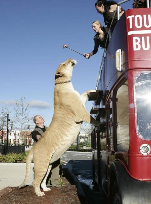


![door-to-hell1[6]](https://jakhongirshaturaev.wordpress.com/wp-content/uploads/2013/08/door-to-hell16.jpg)
![door-to-hell2[2]](https://jakhongirshaturaev.wordpress.com/wp-content/uploads/2013/08/door-to-hell22.jpg)
![door-to-hell3[11]](https://jakhongirshaturaev.wordpress.com/wp-content/uploads/2013/08/door-to-hell311.jpg)
![door-to-hell4[6]](https://jakhongirshaturaev.wordpress.com/wp-content/uploads/2013/08/door-to-hell46.jpg)
![door-to-hell5[2]](https://jakhongirshaturaev.wordpress.com/wp-content/uploads/2013/08/door-to-hell52.jpg)
![door-to-hell9[2]](https://jakhongirshaturaev.wordpress.com/wp-content/uploads/2013/08/door-to-hell92.jpg)
![door-to-hell8[2]](https://jakhongirshaturaev.wordpress.com/wp-content/uploads/2013/08/door-to-hell82.jpg)
![door-to-hell7[2]](https://jakhongirshaturaev.wordpress.com/wp-content/uploads/2013/08/door-to-hell72.jpg)
![door-to-hell6[2]](https://jakhongirshaturaev.wordpress.com/wp-content/uploads/2013/08/door-to-hell62.jpg)


 Borobudur attracted attention in 1885, when Yzerman, the Chairman of the Archaeological Society in Yogyakarta, made a discovery about the hidden foot. Photographs that reveal reliefs on the hidden foot were made in 1890–1891. The discovery led the Dutch East Indies government to take steps to safeguard the monument. In 1900, the government set up a commission consisting of three officials to assess the monument: Brandes, an art historian, Theodoor van Erp, a Dutch army engineer officer, and Van de Kamer, a construction engineer from the Department of Public Works. Borobudur attracted attention in 1885, when Yzerman, the Chairman of the Archaeological Society in Yogyakarta, made a discovery about the hidden foot. Photographs that reveal reliefs on the hidden foot were made in 1890–1891. The discovery led the Dutch East Indies government to take steps to safeguard the monument. In 1900, the government set up a commission consisting of three officials to assess the monument: Brandes, an art historian, Theodoor van Erp, a Dutch army engineer officer, and Van de Kamer, a construction engineer from the Department of Public Works. In 1902, the commission submitted a threefold plan of proposal to the government. First, the immediate dangers should be avoided by resetting the corners, removing stones that endangered the adjacent parts, strengthening the first balustrades and restoring several niches, archways, stupas and the main dome. Second, fencing off the courtyards, providing proper maintenance and improving drainage by restoring floors and spouts. Third, all loose stones should be removed, the monument cleared up to the first balustrades, disfigured stones removed and the main dome restored. The total cost was estimated at that time around 48,800 Dutch guilders.